- All
- Articles
- Blog
- Case Studies
- Featured
- Galleries
- Glossaries
- Products
- Services
- Top 10
- Videos
3D Topographic Map of Tennessee
Step into a world where the geography of Tennessee springs to life in stunning 3D. Traverse the rugged peaks of the Great Smoky Mountains, plunge ...
Snowbasin 3D Maps
Uncover the secrets of Snowbasin Ski Resort with our 3D raised relief maps. Feel the mountain's pulse, explore thrilling runs, and embrace inclusivity. Your alpine ...

Hidden Valley 3D Maps
Hidden Valley 3D Maps bring the resort’s stunning slopes to life, from gentle beginner trails to thrilling advanced runs. Explore every contour and experience the ...
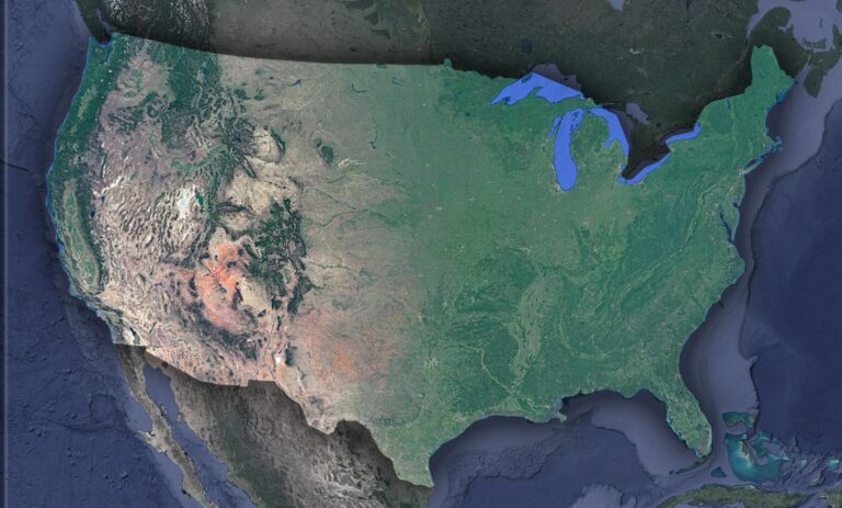
Satellite Map of USA
Unveil the breathtaking tapestry of the USA from space! Satellite imagery brings the nation's sprawling cities, majestic mountains, and vast plains into sharp focus. Embark ...
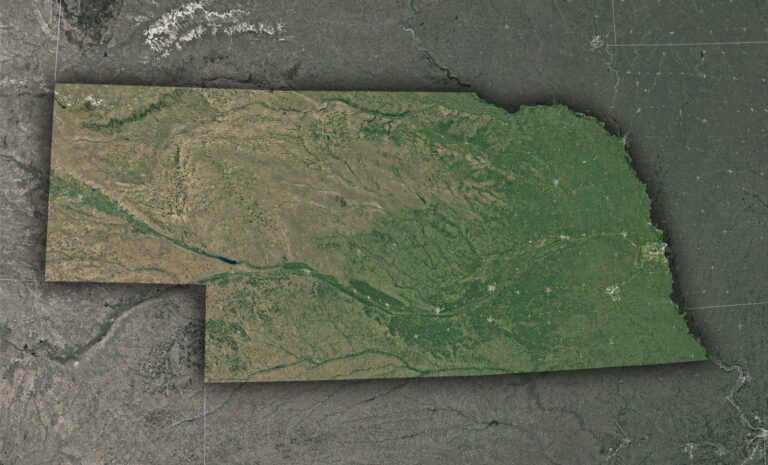
Satellite Map of Nebraska
Dive into Nebraska like never before! From the sprawling Platte River to bustling Omaha, satellite maps bring the Cornhusker State's vast landscapes to life. Experience ...
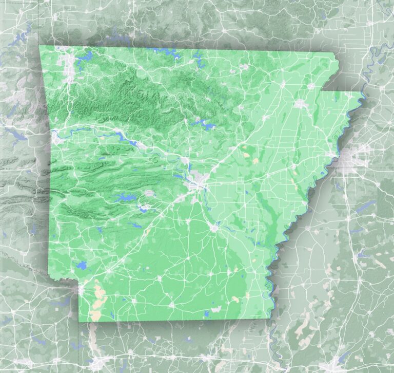
Terrain Map of Arkansas
Journey through Arkansas's captivating terrains, from the mystical Ozark caverns to the gem-rich Gulf Coastal Plain. Each region narrates a unique tale, beckoning explorers and ...
3D Topographic Map of California
Venture into a captivating realm where California's remarkable landscapes come alive in stunning 3D. Traverse the majestic peaks of the Sierra Nevada, explore the fertile ...

Satellite Map of Massachusetts
Unravel Massachusetts from above! Witness the iconic arm of Cape Cod, Boston's sprawling majesty, and the serene Berkshires, all through a satellite's lens. Dive deep ...
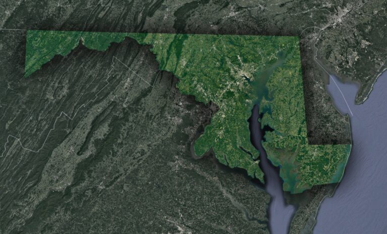
Satellite Map of Maryland
Soar above Maryland, 'America in Miniature,' to uncover its rich tapestry! From the vast Chesapeake Bay to the rolling Appalachians and bustling urban centers, satellite ...
3D Topographic Map of Texas
Prepare for an odyssey like no other, as we journey through Texas's 3D topographic map. Traverse the rugged heights of the Guadalupe Mountains, explore the ...
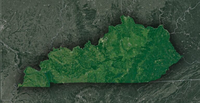
Satellite Map of Kentucky
Journey skyward and witness Kentucky's stunning tapestry! From the lush embrace of the Bluegrass Region to the majestic Appalachians and the secrets of Mammoth Cave, ...
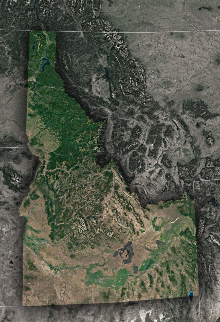
Satellite Map of Idaho
Soar above Idaho and unveil a mosaic of landscapes! From the craggy peaks of the Rockies to the serpentine flow of the Snake River and ...
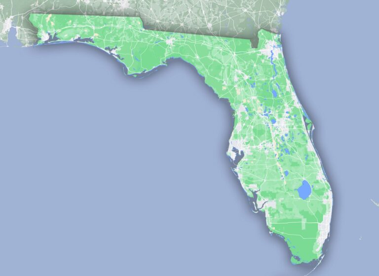
Terrain Map of Florida
Uncover Florida beyond its iconic beaches! Journey through ancient dunes, dive into crystal-clear springs, and roam vast wetlands. From the Everglades' rhythmic 'rivers of grass' ...

Terrain Features on a Map
Dive into the world of maps, where each line and symbol reveals a secret! From majestic mountains to winding rivers, terrain features weave tales of ...
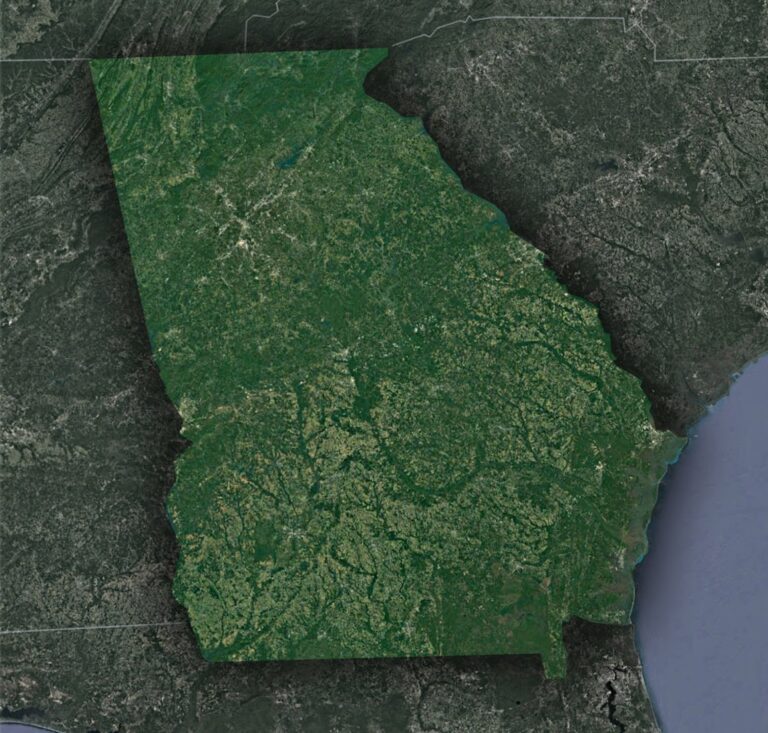
Satellite Map of Georgia
Journey through Georgia from a celestial vantage point! Witness the undulating Blue Ridge Mountains, Atlanta's sprawling urban grid, the intricate dance of coastal wetlands, and ...
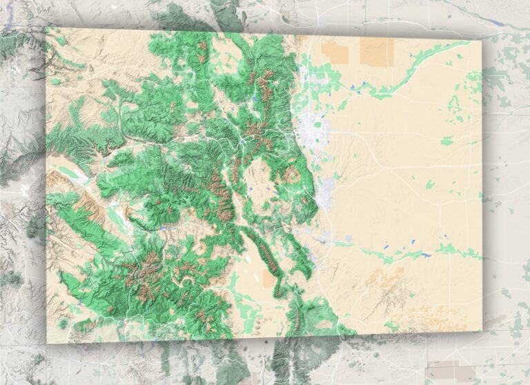
Terrain Map of Colorado
Journey through Colorado's vast landscapes, from the echoing tales of its eastern plains to the majestic Rocky peaks. Delve deep into a geographical odyssey that ...
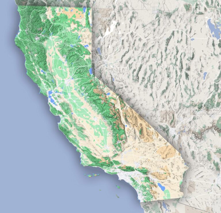
Terrain Map of California
From the dramatic cliffs of Big Sur to the towering peaks of Sierra Nevada, California's terrains are a breathtaking tapestry of nature's wonders. Dive deep ...
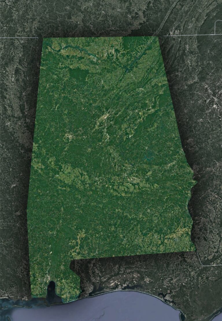
Satellite Map of Alabama
Soar above Alabama's vast tapestry: from the Appalachian foothills and serpentine Tennessee River to the sun-kissed Gulf shores. Through satellite eyes, witness the blend of ...
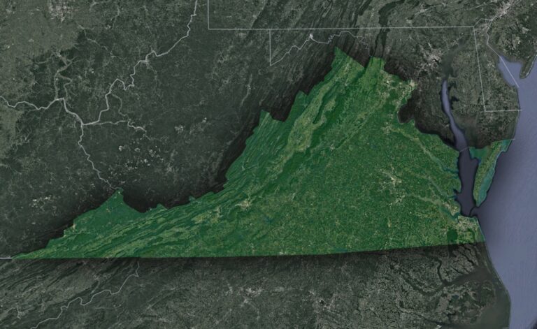
Satellite Map of Virginia
Journey through Virginia's majestic landscapes from a celestial vantage point! Satellite maps unveil the undulating Blue Ridge Mountains, the intricate Tidewater estuaries, and the rich ...
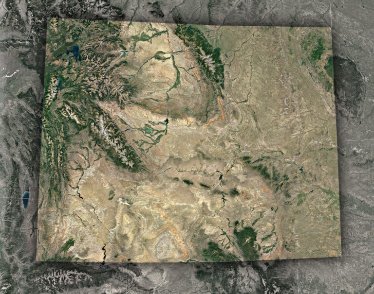
Satellite Map of Wyoming
Embark on an aerial journey over Wyoming! From the rugged peaks of the Rockies to the sprawling plains and iconic Yellowstone, satellite maps unveil Wyoming's ...
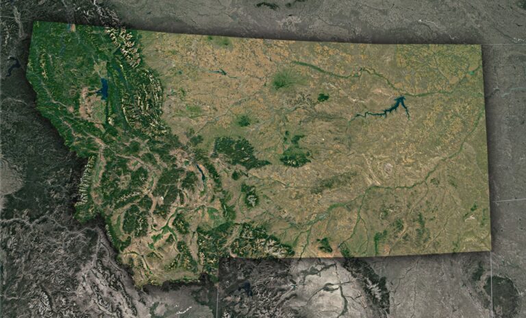
Satellite Map of Montana
Journey skyward over Montana! Satellite maps unveil a breathtaking tableau: from the jagged peaks of the Rockies to the endless Great Plains. Dive deeper to ...
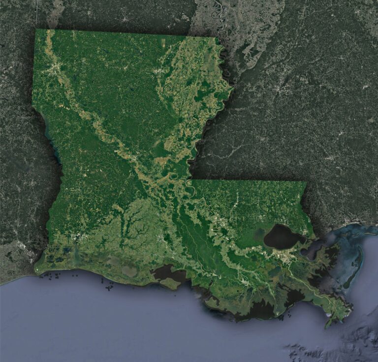
Satellite Map of Louisiana
Dive into the satellite map of Louisiana, where the vast wetlands meet vibrant cities. From space, witness the Bayou State's beauty, resilience, and vulnerabilities, from ...
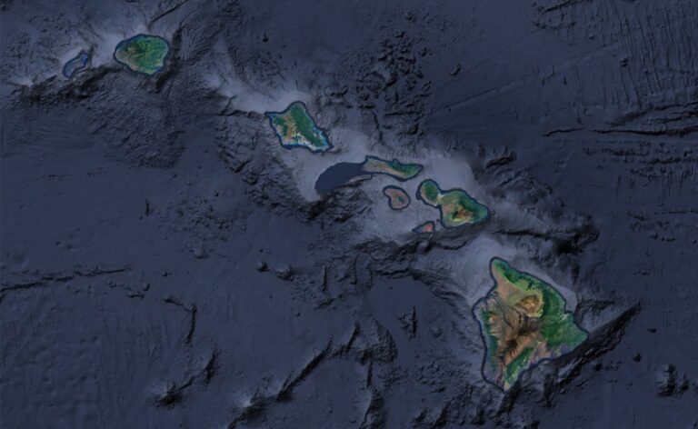
Satellite Map of Hawaii
Soar above Hawaii with satellite mapping! Glide over towering volcanoes, trace vibrant coral reefs, and witness the dance of nature and humanity. From the bustling ...

Satellite Map of Missouri
Ever wondered how Missouri looks from space? Embark on a celestial journey across its rivers, cities, and heartlands. From the mighty Mississippi to the bustling ...
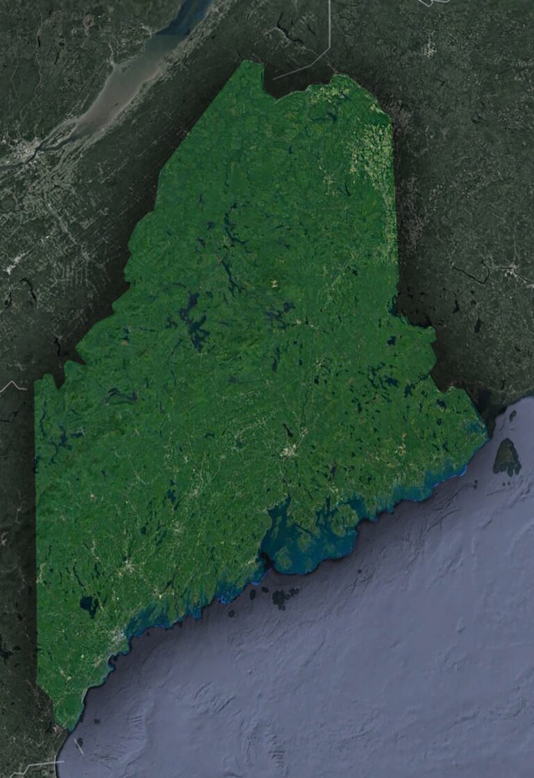
Satellite Map of Maine
Journey above and witness Maine's splendor from the cosmos! From jagged coastlines to the verdant expanse of its forests, satellites unveil a breathtaking tapestry of ...
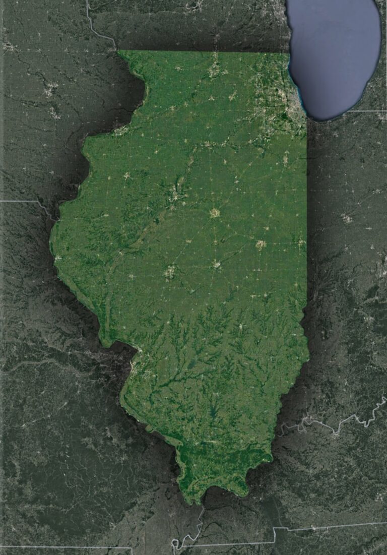
Satellite Map of Illinois
Venture skyward and reimagine Illinois! From the shimmering dance of the Mississippi to Chicago's iconic skyline, satellites unveil the Prairie State's captivating blend of nature ...
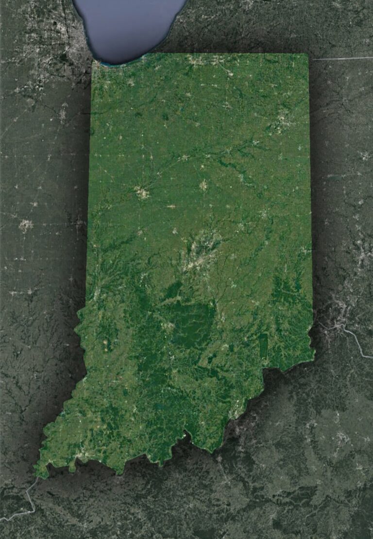
Satellite Map of Indiana
Dive into Indiana's mesmerizing tapestry from the sky! From the shimmering dunes of Lake Michigan to the rhythmic farmlands, experience the Hoosier state's blend of ...

Satellite Map of Wisconsin
Embark on a satellite-guided tour of Wisconsin, America's Dairyland! From the vastness of the Great Lakes to the textured Driftless Area, and the bustling urban ...