- All
- Articles
- Blog
- Case Studies
- Featured
- Galleries
- Glossaries
- Products
- Services
- Top 10
- Videos
3D Topography Models Project Gallery
Browse WhiteClouds custom 3D topographical models, raised relief maps, watershed displays, resort trail maps, visitor center exhibits, and interactive lighted terrain maps.
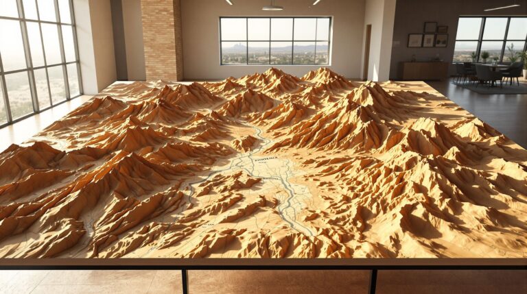
3D Topographic Map of Phoenix, AZ
What does Phoenix really look like beneath the streets and skylines? A 3D topographic map of Phoenix, AZ reveals the hidden depth of the Valley ...
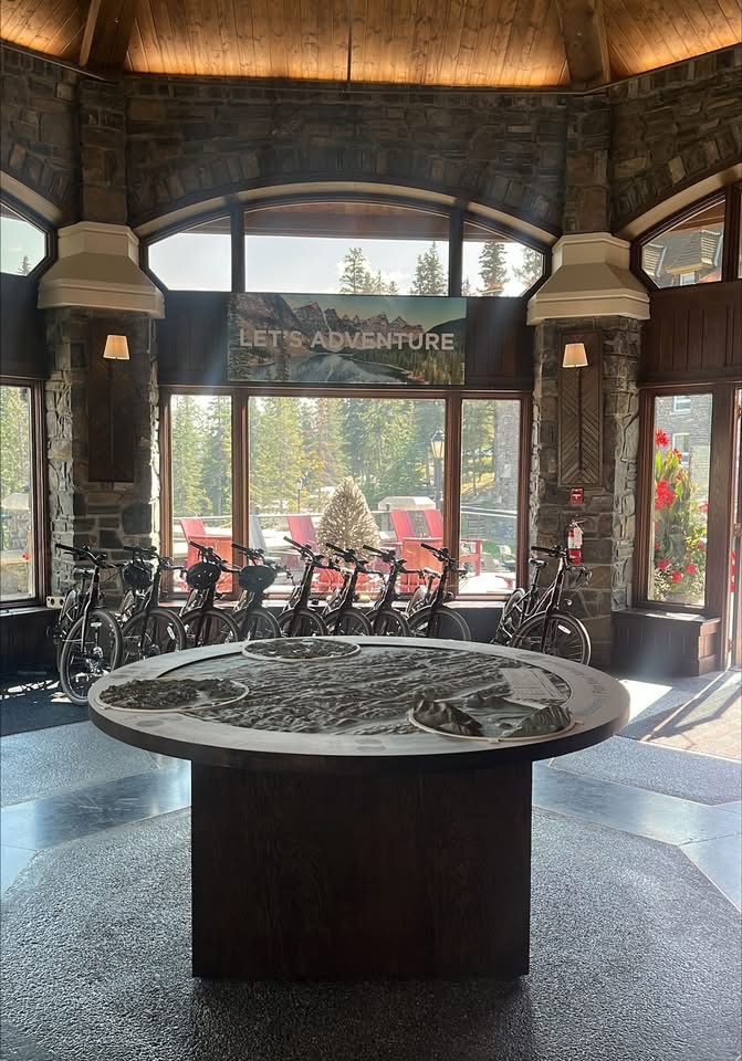
Fairmont Banff Springs 3D Topo Map
Crafted for the Adventure Centre at Fairmont Banff Springs, this 76-inch 3D topographical map transforms Banff National Park into an immersive visual experience. Guests can ...
3D Topographic Map of Boulder, CO
A 3D topographic map of Boulder, CO brings the city’s dramatic terrain—Flatirons, canyons, foothills, and sweeping plains—into a sculptural masterpiece. This article explores Boulder’s landscape, ...
3D Topographic Map of Long Beach, CA
A 3D topographic map of Long Beach, CA transforms the city into a sculptural landscape of coastline curves, inland elevations, port structures, and natural features. ...
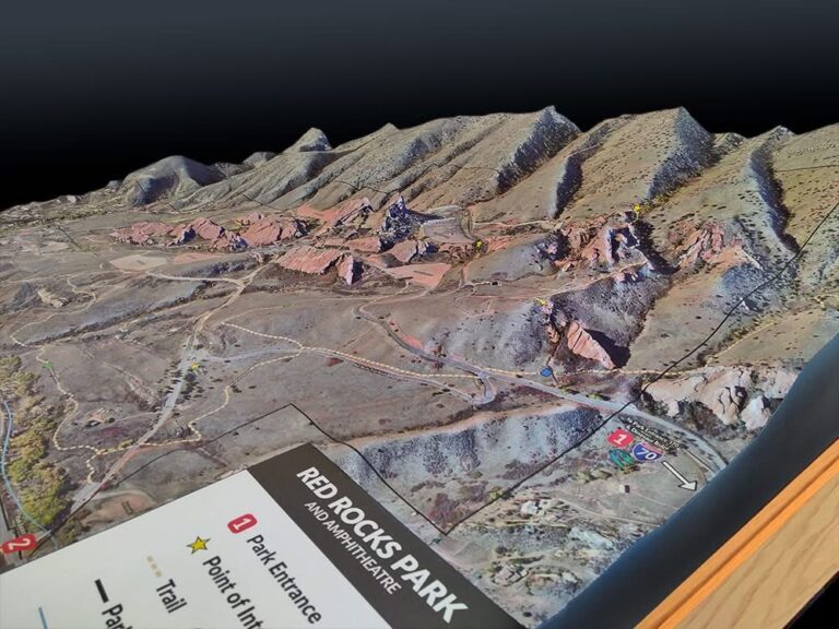
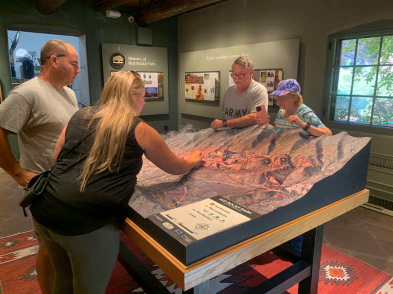
Custom Red Rocks Park Amphitheatre 3D Topographical Map
At the Red Rocks Visitor Center, WhiteClouds unveiled a breathtaking 3D topographical map capturing every ridge, trail, and rock of the legendary amphitheatre. Combining advanced ...
Trail Mapping Meets Retail Design: Why Brands Like Arc’teryx Are Leading the Way
Trail mapping is transforming retail into an immersive experience where geography meets design. Brands like Arc’teryx are leading the movement with 3D topographic installations that ...
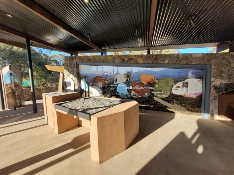
Queensland Immersive Topo Map: A New Way to Explore Girraween
Step into Girraween National Park before you even hit the trail with Queensland’s immersive 3D topo map. Mounted at the Visitor Information Centre, this glossy, ...
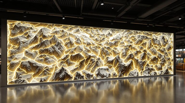
Why Top Brands Are Investing in Giant 3D Topographic Map Installations
Giant 3D topographic map installations are transforming retail, hospitality, and corporate spaces into immersive experiences. From Arc’teryx’s illuminated Vancouver wall to resorts and museums worldwide, ...

Designing High-Impact Topographic Maps for Checkout Counters and In-Store Displays
Topographic maps are transforming checkout counters and in-store displays into powerful storytelling features. From illuminated contours to interactive trail highlights, these designs blend art, engineering, ...
Topographic Wall Maps for Retail Stores: Design Ideas and Real-World Examples
Topographic wall maps are redefining retail spaces by blending art, storytelling, and immersive design. From Arc’teryx’s illuminated Vancouver installation to ski shops and outdoor outfitters ...
Why 3D Trail Maps Are the Future of Outdoor Retail Displays
3D trail maps are reshaping outdoor retail by turning stores into immersive landscapes. These stunning displays blend art, technology, and storytelling, connecting shoppers to the ...

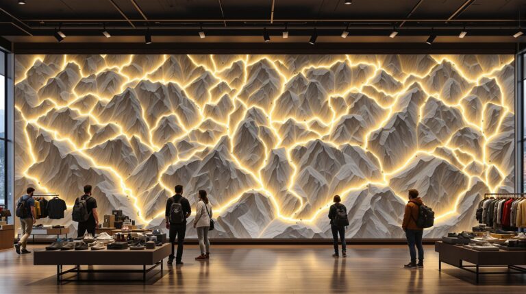
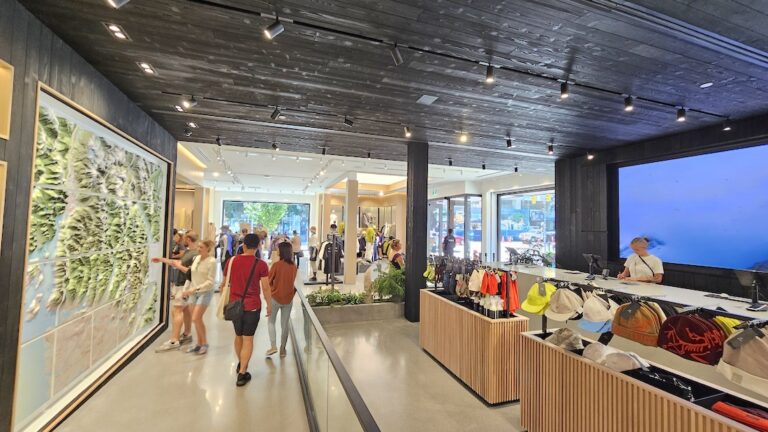
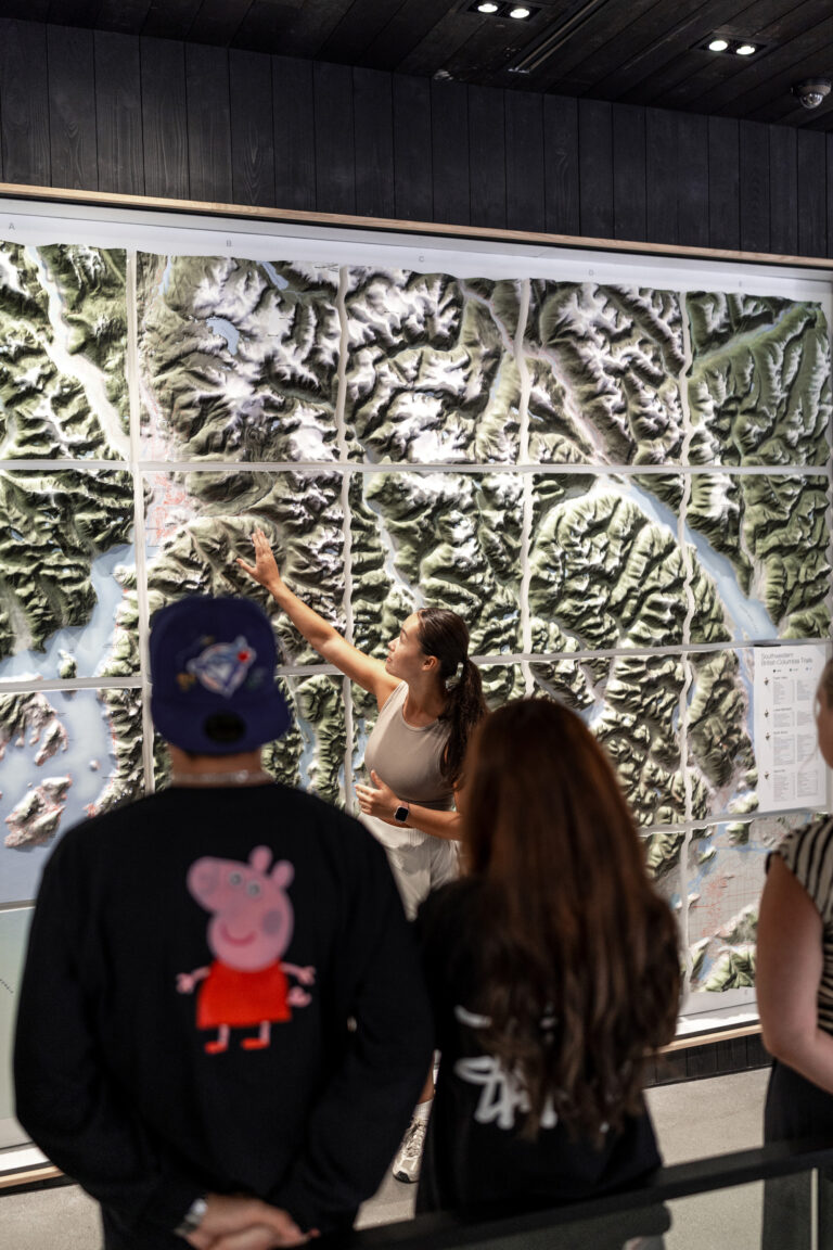
How This 11×9 Foot Illuminated 3D Hiking Trail Map Transformed Arc’teryx’s Store Experience
Arc’teryx’s Vancouver flagship now features a stunning 11x9 foot illuminated 3D hiking trail map. With glowing trailheads activated by visitors, this installation blends art, engineering, ...
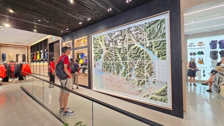
Inside the Epic 3D Topo Wall Map Built for Arc’teryx’s Vancouver Flagship
Arc’teryx’s Vancouver flagship now features a breathtaking 11x9 ft 3D topo wall map of Southwestern BC. With illuminated trailheads activated by visitors, this massive installation ...
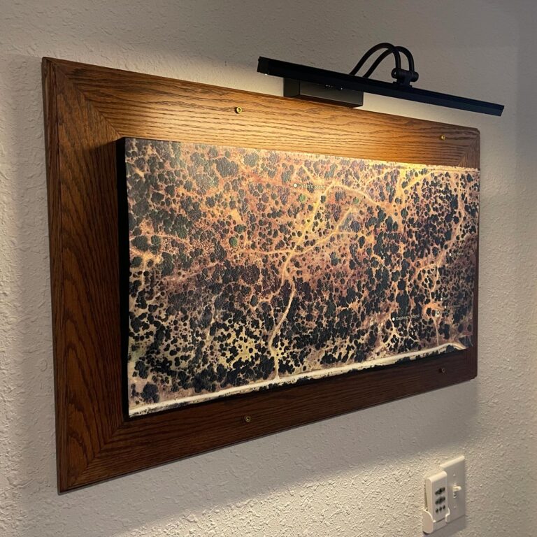
Hairecienda Ranch 3D Map
Discover the process behind the Hairecienda Ranch 3D map, from base map creation to high-resolution vinyl graphics and elevation data. This stunning topographic display brings ...
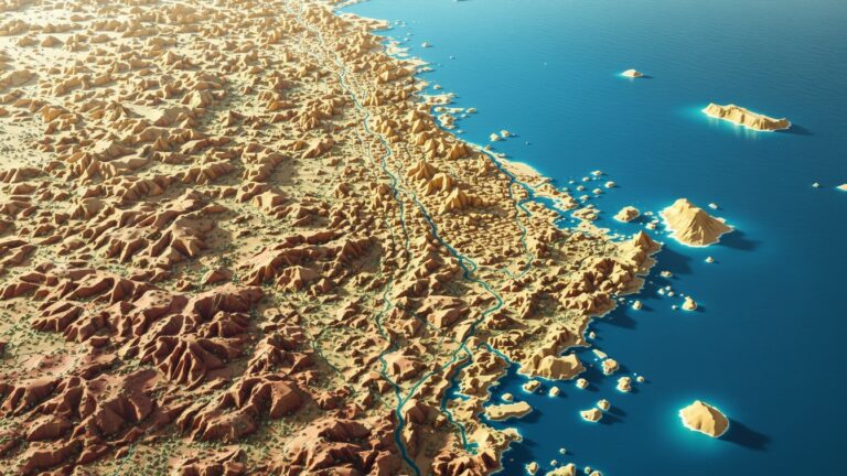
Vatican City Watershed Maps
Vatican City’s water systems, reliant on the Tiber River Basin, are crucial for daily needs. Learn how modern technologies like 3D mapping, GIS, and remote ...
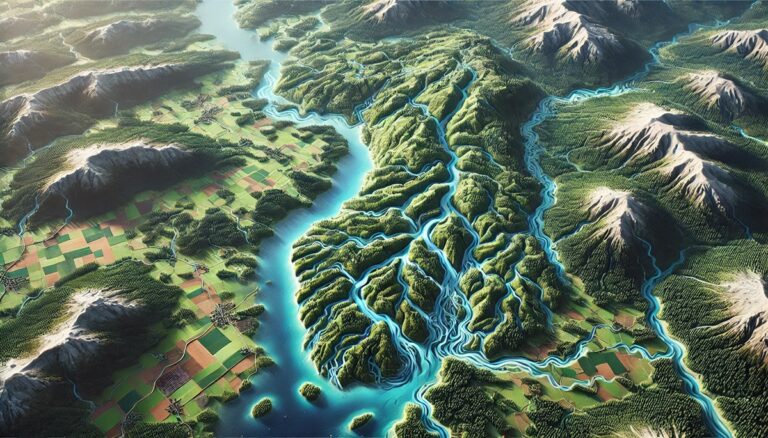
Switzerland Watershed Maps
Switzerland’s watersheds, including the Rhine, Rhône, and Aare River Basins, are vital for agriculture and ecosystems. Learn how modern technologies like 3D mapping, GIS, and ...
Rwanda Watershed Maps
Rwanda’s watersheds, including the Akagera and Nyabarongo River Basins, are vital for agriculture and ecosystems. This blog explores how modern technologies like 3D mapping, GIS, ...

Papua New Guinea Watershed Maps
Papua New Guinea’s watersheds, such as the Sepik and Fly River Basins, are essential for agriculture, ecosystems, and water management. Learn how modern mapping technologies ...

Palau Watershed Maps
Palau’s watersheds, including Wadi Al-Mistal and Wadi Shab, are essential for agriculture, ecosystems, and water management. This blog explores how advanced technologies like 3D mapping, ...

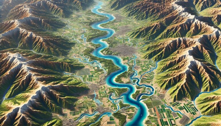
Nepal Watershed Maps
Nepal’s watersheds, including the Koshi, Gandaki, and Karnali river basins, are vital for the country’s ecology and economy. This blog explores the significance of these ...

Maldives Watershed Maps
The Maldives' watersheds are crucial for maintaining freshwater resources in a low-lying nation. This blog examines the importance of watershed maps in managing water resources, ...

Kuwait Watershed Maps
Kuwait’s watersheds are vital for agriculture, energy, and drinking water. This blog explores the challenges they face, including water scarcity and pollution, and how 3D ...
Finland Watershed Maps
Finland’s watershed maps are essential for managing river systems, predicting floods, and ensuring sustainable water use. These maps help allocate water for agriculture, industry, and ...

Cameroon Watershed Maps
Cameroon’s watershed maps are vital tools for managing water resources, preventing floods, and ensuring sustainable water use. These maps guide water distribution for agriculture, industry, ...
Armenia Watershed Maps
Explore Armenia’s watersheds, including the Aras and Kura river basins, which are vital for agriculture, hydropower, and biodiversity. Learn how 3D mapping technologies are enhancing ...

Albania Watershed Maps
Explore Albania's watersheds, which support agriculture, hydropower, and biodiversity. Learn about the country’s diverse river systems, including the Drin, Vjosa, and Seman basins. Discover how ...

Mahaweli River Watershed Map
Explore the Mahaweli River Watershed, a crucial resource for Sri Lanka, supporting agriculture, hydropower, and biodiversity. Learn about its diverse geography, hydrology, and ecosystems, and ...