
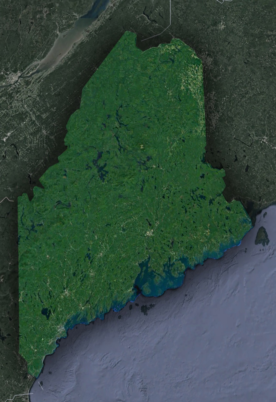
Maine from the Stars: A Satellite’s Perspective on the Pine Tree State
Maine, the northeasternmost state in the U.S., has always been a land of rugged beauty and seafaring heritage. Known for its picturesque coastlines, dense forests, and iconic lighthouses, Maine holds a special charm. But what happens when we see this state from miles above, through the unblinking eyes of satellites?
The Cosmic Gaze
Satellite technology, a space-age marvel, lets us view our planet in ways early explorers could only dream of. From these orbital sentinels, Maine appears not just as a state, but a patchwork quilt of ecosystems, human settlements, and geological wonders.
The Majestic Coastline – Where Land Meets the Atlantic
The Intricacies of a Rocky Embrace: Maine’s breathtaking coastline is where rugged terrain romances the relentless sea. Each nook and cranny, from jagged cliffs to whispering coves and untouched sandy stretches, narrates a saga of timeless allure. As the tide rises and falls, the waves, in their rhythmic dance, carve stories into the very fabric of the state’s edge. This mesmerizing drama, this intricate ballet of nature, is majestically captured from the vantage of space, allowing us to appreciate its sheer vastness and intricate beauty.
Beacons of Hope – Maine’s Lighthouses: Stretching from the historic Portland Head Light to the easternmost sentinel, West Quoddy Head Light, these towering structures stand as vigilant sentinels of the sea. While their detailed magnificence might seem diminutive when glimpsed from satellite perspectives, there’s no denying their immense significance in the tapestry of Maine’s maritime history. These lighthouses, with their guiding beams, have been the silent witnesses to countless voyages and have shaped the very essence of Maine’s nautical legacy.
A Tapestry of Islands: The islands of Maine, prominent among which is the enchanting Mount Desert Island, cradle a world where nature and history meld seamlessly. Home to the famed Acadia National Park, these islands are a treasure trove of biodiversity, indigenous tales, and human endeavors. Observing from above, these landforms appear as emerald gems set against the expansive blue, each with its own tale to narrate.
Verdant Vistas and Towering Peaks
An Evergreen Blanket: Known affectionately as the Pine Tree State, Maine’s extensive forests stretch as far as the eye can see. A vast sea of green, these forests are not just a visual treat but play a pivotal role in the ecological balance of North America. Satellites, with their bird’s-eye view, unveil this thriving green expanse, emphasizing its significance in the grand mosaic of life.
Katahdin – The Pinnacle of Trails: Majestic Katahdin, standing tall as the northernmost point of the Appalachian Trail, is more than just a mountain. It’s a beacon for adventurers, marking both an end and a beginning. A culmination for those who trek the length of the trail and the threshold to the wilderness of Baxter State Park, its silhouette is a proud emblem on the horizon.
Where Nature and Human Endeavors Converge
Portland – A Symphony of Past and Present: As Maine’s largest and most bustling city, Portland seamlessly blends its rich historical legacy with modern vibrancy. Its harbor, once a haven for seafarers, now mirrors the city’s dynamic spirit. Historical landmarks, juxtaposed against urban infrastructure, craft a cityscape that embodies Maine’s journey through time. Seen from the vastness of space, Portland is a shining jewel, reflecting the state’s multifaceted identity.
A Sea of Purple – Maine’s Blueberry Fields: As summer wanes, Maine’s expansive blueberry fields undergo a magical transformation. They burst into a sea of vivid purple, a spectacle that’s nothing short of poetic. This radiant display is not just a visual delight from the heavens but also a testament to the state’s agricultural heritage and its intimate bond with the land.
Nautical Narratives: Maine’s maritime legacy, intricately woven over centuries, is an ode to its bond with the Atlantic. From fishing vessels of yore to modern shipping channels, the sea routes sketch intricate patterns on the ocean canvas. These patterns, evident even from celestial heights, pay homage to the state’s enduring maritime traditions and its undying connection to the waters.
Utility of the Orbital View
Conservation Efforts: Satellite data helps pinpoint areas in need of preservation, ensuring Maine’s landscapes and wildlife thrive.
Climate Impact Study: Rising sea levels, changing forest dynamics, and shifts in marine life patterns become more comprehensible with satellite insights.
Urban Planning : For towns like Bangor and Lewiston, satellite imagery provides a foundation for sustainable development, preserving Maine’s natural charm.
Stargazing, The Other Way Round
Maine’s Dark Sky Parks and Reserves, like the one at Katahdin Woods and Waters National Monument, stand out, even from space. The state’s dedication to preserving the night sky, making it a haven for astronomers and stargazers, shines through.Epilogue: A State Unveiled
Maine has always been a blend of the wild and the welcoming, where moose and fishermen coexist, where dense forests give way to charming towns. Through satellites, we gain a new appreciation for this balance. We see Maine not just as a destination, but as an integral part of Earth’s narrative.As you indulge in a lobster roll, listen to the crashing waves, or hike through the northern woods, remember: high above, satellites are silently gliding, capturing Maine in its purest form. And in their cosmic ballet, they reveal the essence of the Pine Tree State, a place where nature and culture intertwine beautifully.
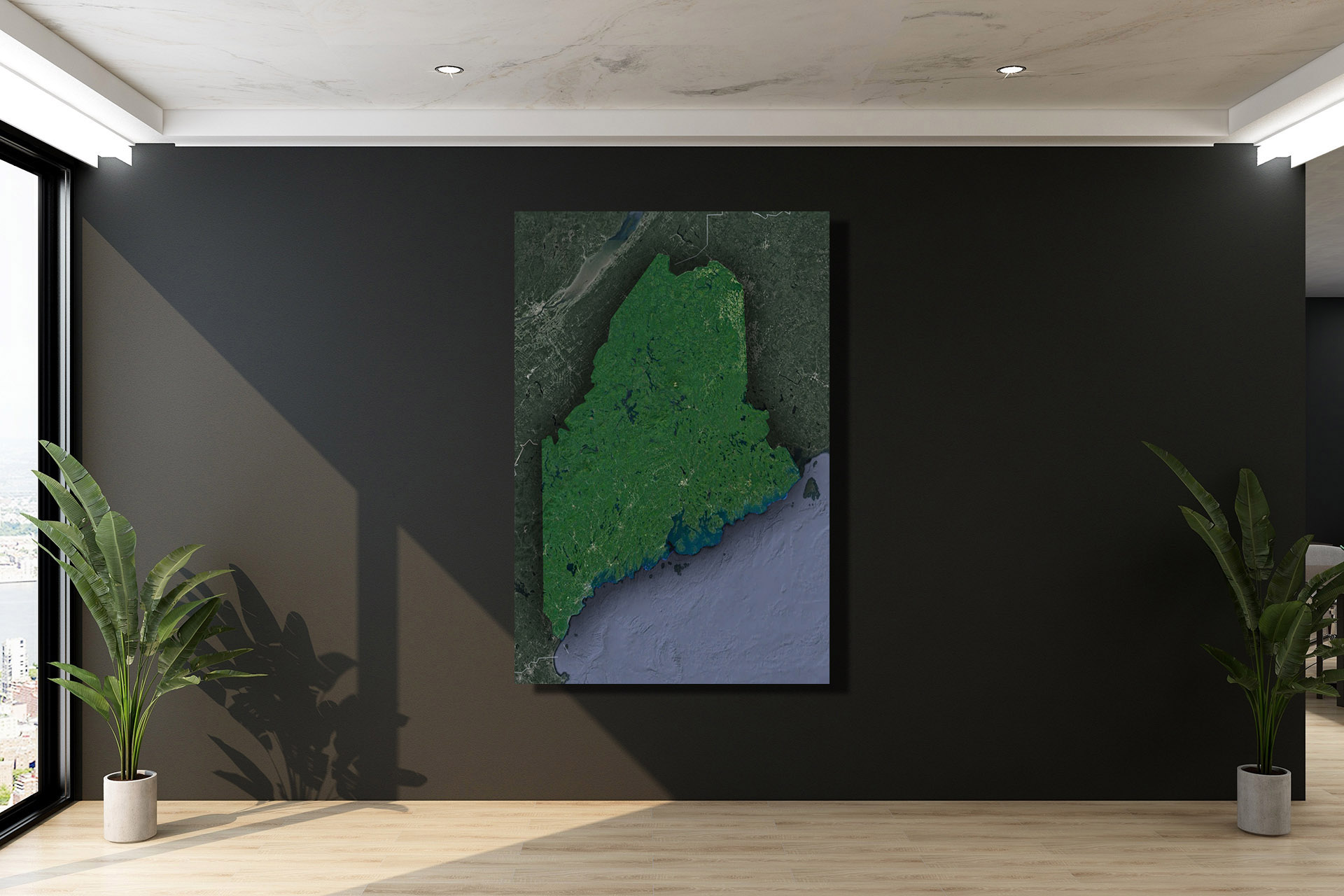
Check out WhiteClouds’ 3D Maps for more information on satellite maps of Maine. 2D Canvas Print Satellite Maps of Maine are also available.
Contact us today to learn more about our 3D services and how we can help you achieve your goals.