
Illinois Unveiled: Satellite Maps Reimagine the Prairie State
Ah, Illinois! A state synonymous with the Windy City’s skyscrapers, vast cornfields, and the Mississippi’s rhythmic flow. But when viewed from hundreds of miles above, an entirely new perspective emerges. Thanks to satellite technology, we can delve deeper into the fabric of the Land of Lincoln. Let’s embark on a sky-high journey through Illinois.
Satellites and the Prairie State
Satellites, those technological marvels in orbit, have transformed our understanding of Earth. From their lofty perch, they’ve provided invaluable insights, especially when it comes to states as geographically diverse as Illinois.
Unraveling Nature’s Intricate Fabric
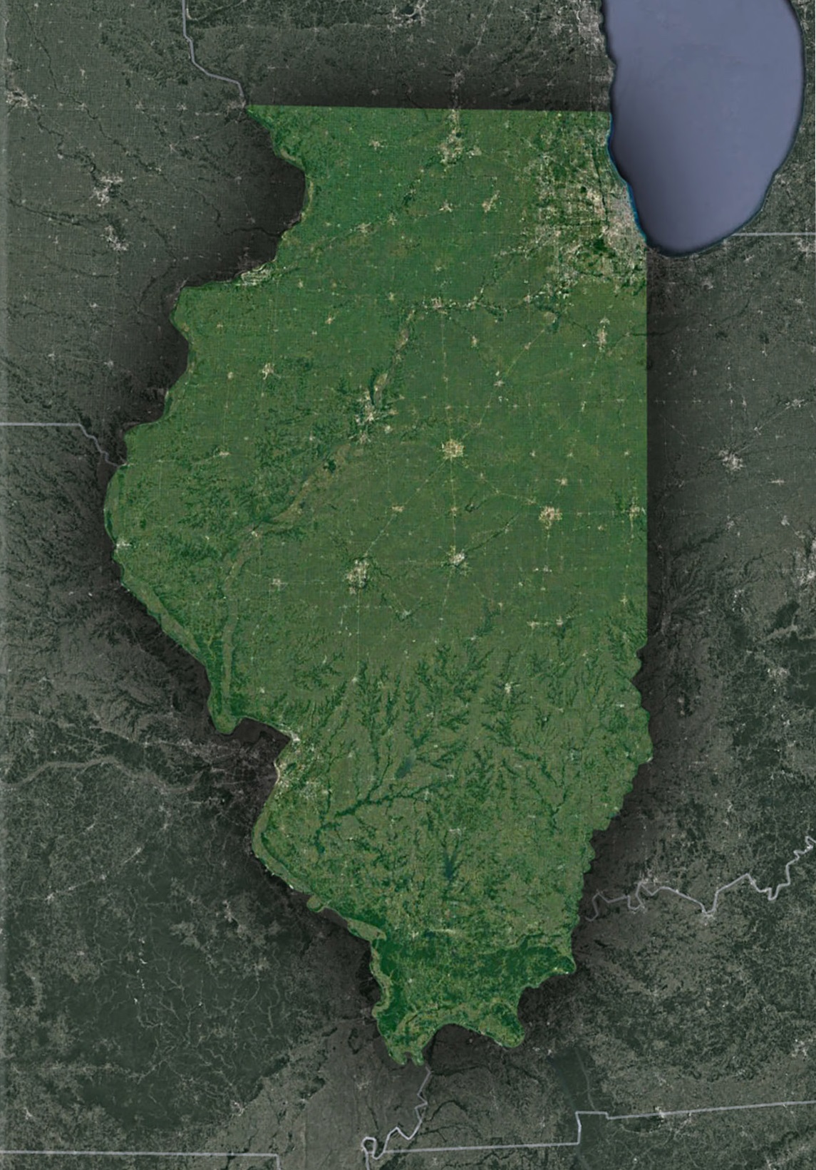
The Mississippi and Illinois Rivers – The Majestic Waterways of the Midwest: Gazing down from the vastness of space, the Mississippi and Illinois Rivers come alive, resembling radiant silver pathways weaving through the landscape. These aren’t just water bodies; they are the very lifeblood of the region. Their confluence at Pere Marquette State Park isn’t merely a geographical intersection. It’s a bustling hub of life where the waters merge, nurturing an incredibly rich wetland ecosystem. The wetlands here, pulsating with life, offer a sanctuary for countless bird species, amphibians, and aquatic life. They serve as breeding grounds, rest stops for migratory birds, and offer a medley of habitats that underscore the importance of waterways in preserving biodiversity. The sight of these rivers, their banks lush with verdant foliage, is a confirmation of the timeless relationship between land and water.
Shawnee National Forest – A Verdant Jewel in Illinois’s Crown: Spanning vast stretches of Southern Illinois, Shawnee National Forest beckons with its whispering trees, imposing bluffs, and mysterious caves that have stood the test of time. This is no ordinary woodland. Shawnee is a sprawling tapestry of life, history, and geological wonders. The dense canopies are home to myriad bird calls, the rustling of unseen creatures, and the soft hum of nature at work. The rugged bluffs, shaped by millennia of erosion, stand as silent witnesses to time’s relentless march, while hidden caves offer sanctuary to creatures and stories of days long past. When satellites beam images of this forested wonder, they capture more than just an expanse of green. They offer a glimpse into a diverse ecosystem, where every square inch teems with life and every season paints a new portrait of nature’s splendor.
The Great Lakes – Beyond Lake Michigan’s Azure Depths: Lake Michigan, one of the magnificent Great Lakes, stretches out like a vast azure canvas. And perched on its shores, the skyline of Chicago rises — a testament to mankind’s architectural prowess. This iconic image, where nature meets urbanization, is a visual symphony of contrasts. The expansive waters of Lake Michigan, sometimes calm and sometimes tempestuous, serve as both a playground and a vital resource for the region. Their shores, whether sandy beaches or rocky outcrops, beckon to both residents and visitors alike. When juxtaposed with the urban sprawl of Chicago, with its towering skyscrapers and bustling streets, the view becomes even more profound. It’s a dance of nature and civilization, a reminder of how humans have built upon and alongside the natural wonders they’ve been bestowed.
The Human Touch
Chicago – The Windy City from Above: Chicago’s geometric cityscape, with its mix of parks, skyscrapers, and intricate roadways, is a testament to human ingenuity. From above, it’s an ever-evolving puzzle, representing growth and innovation.
The Agricultural Backbone: The central regions of Illinois, with their vast fields of corn and soybeans, tell tales of the state’s agrarian roots. These checkered patterns of green and gold are not just farms but the breadbasket of America.
Historic Landmarks – A Satellite’s Perspective: Whether it’s the prehistoric Cahokia Mounds or the modern-day Willis Tower, satellite imagery offers a unique vantage point, connecting history and the present.
The Satellite’s Benevolent Gaze
Enhancing Agriculture: Satellite data aids Illinois’ farmers in monitoring soil health, optimizing irrigation, and predicting yields. Precision agriculture is the future, and it’s taking root in Illinois.
Urban Planning and Infrastructure: For cities like Springfield, Peoria, and Rockford, satellite imagery guides urban development, ensuring sustainable growth while preserving green spaces.
Disaster Management and Prediction: Be it flash floods or snowstorms, real-time satellite feedback can drastically reduce response times and save lives.
The Road Ahead
Conservation Efforts: Using satellite data, Illinois can prioritize areas for conservation, ensuring its wetlands, forests, and prairies remain for future generations.
Renewable Energy Mapping: As Illinois pivots to greener energy sources, satellite maps can pinpoint optimal sites for solar farms and wind turbines.
Transportation and Connectivity: With insights from space, the state can plan efficient transport networks, bridging its urban and rural divide.
Epilogue: A State Redefined
Illinois, often reduced to Chicago’s magnificence or its agrarian charm, is a state of contrasts and synergies. When viewed from space, these intricacies become all the more profound.
From the state’s southern forests to its northern urban centers, from the mighty Mississippi’s westward flow to the Lake Michigan’s eastern embrace, Illinois stands as a testament to nature’s grandeur and human determination.
Next time you enjoy a deep-dish pizza in Chicago, take a hike in Starved Rock State Park, or drive down the historic Route 66, remember that high above, satellites are capturing Illinois’ essence, piecing together a vibrant mosaic that is the Prairie State. Through their lenses, we don’t just see land and water; we see history, evolution, and potential.
Check out WhiteClouds’ 3D Maps for more information on satellite maps of Illinois. 2D Canvas Print Satellite Maps of Illinois are also available.
Contact us today to learn more about our 3D services and how we can help you achieve your goals.