
Unveiling Idaho from Above: Satellite Views of the Gem State
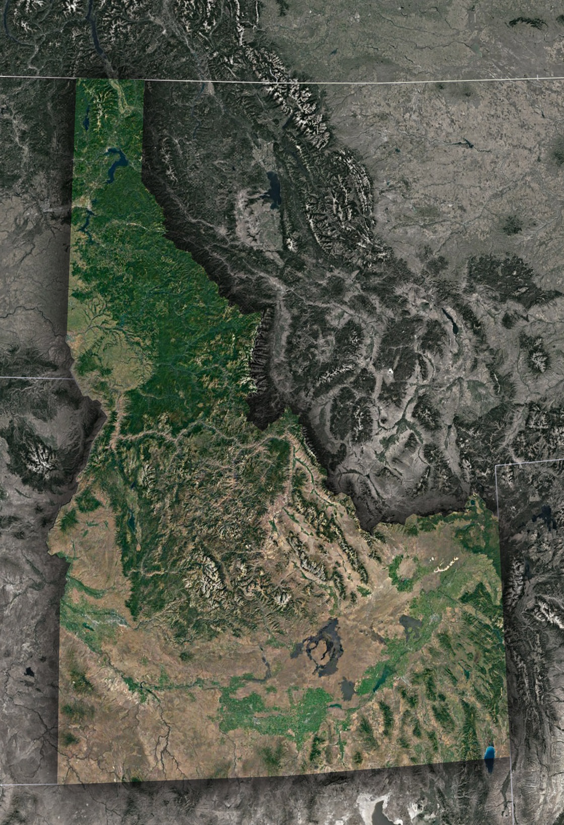
The Great Basin’s Artistry
Stretching into the southern part of Idaho is the Great Basin, a vast expanse that seems to ripple and change colors with the seasons. From a satellite view, this region appears almost like a painter’s palette, with hues of browns, greens, and even vibrant purples. These shades are a testament to the rich minerals present in the soil and the sparse vegetation adapting to the arid conditions.
Snake River’s Serpentine Flow
One of Idaho’s most defining geographical features, the Snake River, carves its way through the state, creating deep canyons and fertile plains in its path. On a satellite map, the river seems to meander whimsically, with every twist and turn showcasing nature’s power and persistence. Adjacent to the river, one can spot the shimmering waters of Lake Coeur d’Alene and Lake Pend Oreille, which further emphasize Idaho’s abundant water resources.
Lava Fields and Craters
Idaho isn’t just about mountains and rivers. The state boasts an intriguing volcanic history, best exemplified by the Craters of the Moon National Monument. From above, this area appears almost alien, with dark lava fields stretching out, interspersed with cinder cones and deep craters. It serves as a stark reminder of the volcanic activity that once dominated this region and shaped much of Idaho’s unique landscape.
Urban Pockets and Agricultural Might
Boise, the state’s capital and its most populous city, stands out prominently on satellite images. The grid-like pattern of streets, patches of green parks, and the encircling roads highlight the balance between urban development and nature. Beyond the cities, the vast agricultural fields become evident. From high above, these fields appear as carefully organized patches, a testament to Idaho’s agricultural heritage and prowess, especially its iconic potato farms.
Dense Wilderness: A Green Expanse
The Frank Church-River of No Return Wilderness is one of the most remote areas in the contiguous United States. From a satellite view, it’s a vast stretch of deep green, with hardly any human intervention visible. This region, with its dense forests and challenging terrains, is a testament to Idaho’s commitment to preserving its natural habitats.
A State of Diversity
Idaho, when viewed from the ground, is a state of scenic drives, hiking trails, and riverside towns. But from space, it’s an intricate patchwork of diverse landscapes, each with its own tale of geological wonder, history, and human endeavor. Whether it’s the rugged peaks of the Rockies, the vastness of the Great Basin, or the meandering path of the Snake River, Idaho emerges as a state of unparalleled beauty and diversity. Through the lens of a satellite, we’re reminded of the delicate balance of nature and the responsibility we bear to preserve and celebrate this gem of the American West.
Check out WhiteClouds’ 3D Maps for more information on satellite maps of Idaho. 2D Canvas Print Satellite Maps of Idaho are also available.
Contact us today to learn more about our 3D services and how we can help you achieve your goals.