
California’s Dynamic Landscape: An In-Depth Exploration of the 3D Topographic Map
California, often referred to as the “Golden State,” is a land of extremes, where diverse landscapes unfold under the sun’s radiant embrace. From the iconic Pacific coastline to the towering Sierra Nevada Mountains and the arid deserts of the south, California’s topography is a confirmation to the Earth’s vast geological diversity. In this comprehensive exploration, we embark on a journey through the 3D topographic map of California, diving deep into its geographical intricacies and unraveling the fascinating stories embedded within its terrain.
Navigating the 3D Topographic Map
Before we dive into the mesmerizing world of California’s topographic map, it’s crucial to understand the fundamentals of 3D topography. These advanced maps offer an immersive representation of the Earth’s surface, portraying elevation, terrain, and natural features in striking detail. The third dimension added to these maps elevates our understanding of California’s landscapes, enabling us to explore the state’s unique geography like never before.
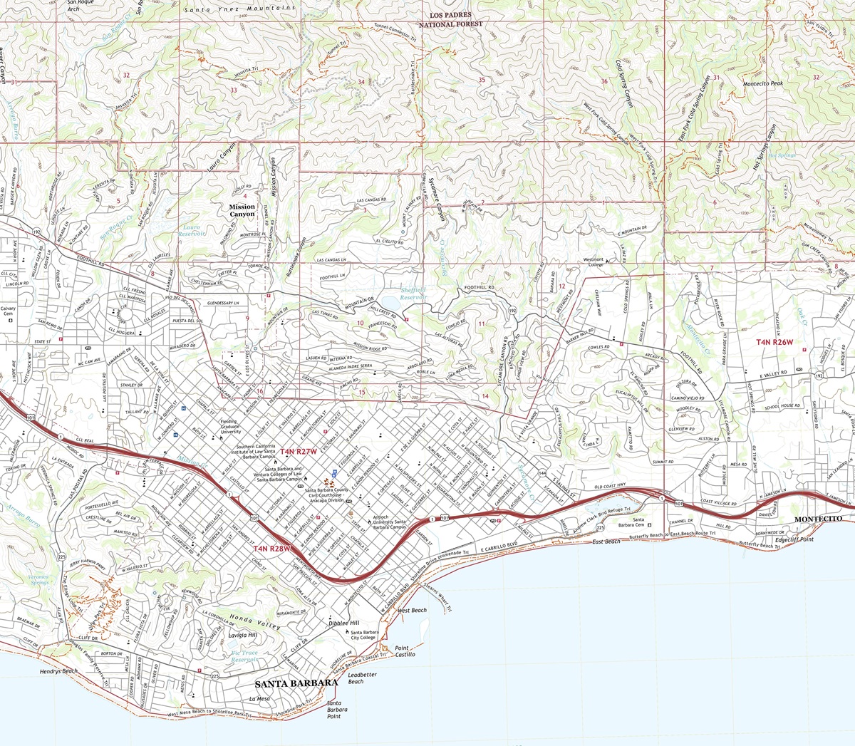 3D Topographic Map of California-Santa Barbara, 1:24,000 quad, 2022, USGS
The Vertical Dimension-Unveiling Elevation: One of the most remarkable features of 3D topographic maps is their ability to depict elevation with unparalleled accuracy. In California, where elevation varies dramatically, this dimension is paramount to comprehending the state’s diverse landscapes. From the lowest desert floors to the towering peaks of the Sierra Nevada, 3D maps vividly illustrate the vertical aspect of California’s topography.
Terrain Visualization-A New Perspective: The power of 3D topography lies in its capacity to bring California’s terrain to life. Every ridge, valley, and canyon is presented with exquisite detail, allowing us to appreciate the subtleties of the state’s geography. This perspective lets us uncover hidden features, discern the effects of erosion, and grasp the interconnectedness of California’s landscapes in ways that conventional maps cannot convey.
 3D Topographic Map
The Sierra Nevada Mountains
Towering Peaks and Rugged Wilderness: Our journey through California’s 3D topographic map commences in the eastern part of the state, where the Sierra Nevada Mountains dominate the landscape. These majestic mountains, crowned by peaks like Mount Whitney, offer a breathtaking vista of rugged terrain, deep valleys, and pristine wilderness.
As we explore the 3D map, the Sierra Nevada Mountains come alive, with elevation gradients illustrated in vivid colors and intricate contours. Mount Whitney, the highest point in the contiguous United States, is elevated to its rightful prominence, beckoning adventurers with its 3D majesty. This immersive experience enables us to virtually traverse these peaks and valleys, offering a glimpse of the Sierra Nevada’s grandeur.
The Pacific Crest Trail-An Epic 3D Journey: The 3D topographic map vividly portrays the Pacific Crest Trail’s winding course through the Sierra Nevada Mountains. Hikers and nature enthusiasts can virtually follow this renowned long-distance trail, immersing themselves in the terrain’s intricacies. The 3D visualization grants us a unique perspective on the trail’s arduous ascents, exhilarating descents, and panoramic vistas that beckon from the peaks.
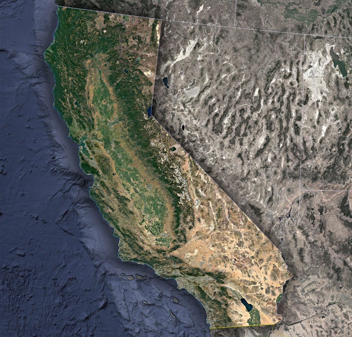 Satellite Map of California
Check out WhiteClouds’ 3D Topographic Maps for more information on a topographic map of California. 2D Canvas Print Satellite Maps of California are also available.

Contact us today to learn more about our 3D services and how we can help you achieve your goals.