Unlocking the Secrets of the Earth: Terrain Features on a Map
In an era dominated by digital touchpoints and virtual landscapes, traditional map reading is an arcane skill that offers an intricate doorway into the heart of our planet. Maps aren’t mere graphical representations; they are intricate tapestries that weave stories of our Earth’s topography. Central to these narratives are terrain features, each with its tale of formation, evolution, and interaction. Let’s navigate these terrains in greater depth.
The Magic of Contour Lines
Contour lines are the topographical fingerprints of the Earth, detailing every rise and dip in the land.
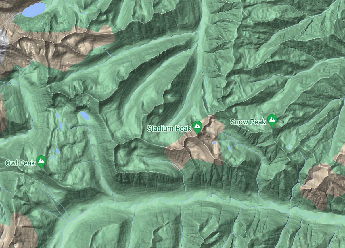
Hills and Depressions: While at first glance concentric circles on a map might look like mere rings, they illustrate a hill’s rise. The tiniest circle, often at the center, denotes the summit. Depressions, or sunken areas, are depicted similarly but come with hachures—short dashes—pointing inwards, a cartographic whisper of a land that dips below its surroundings.
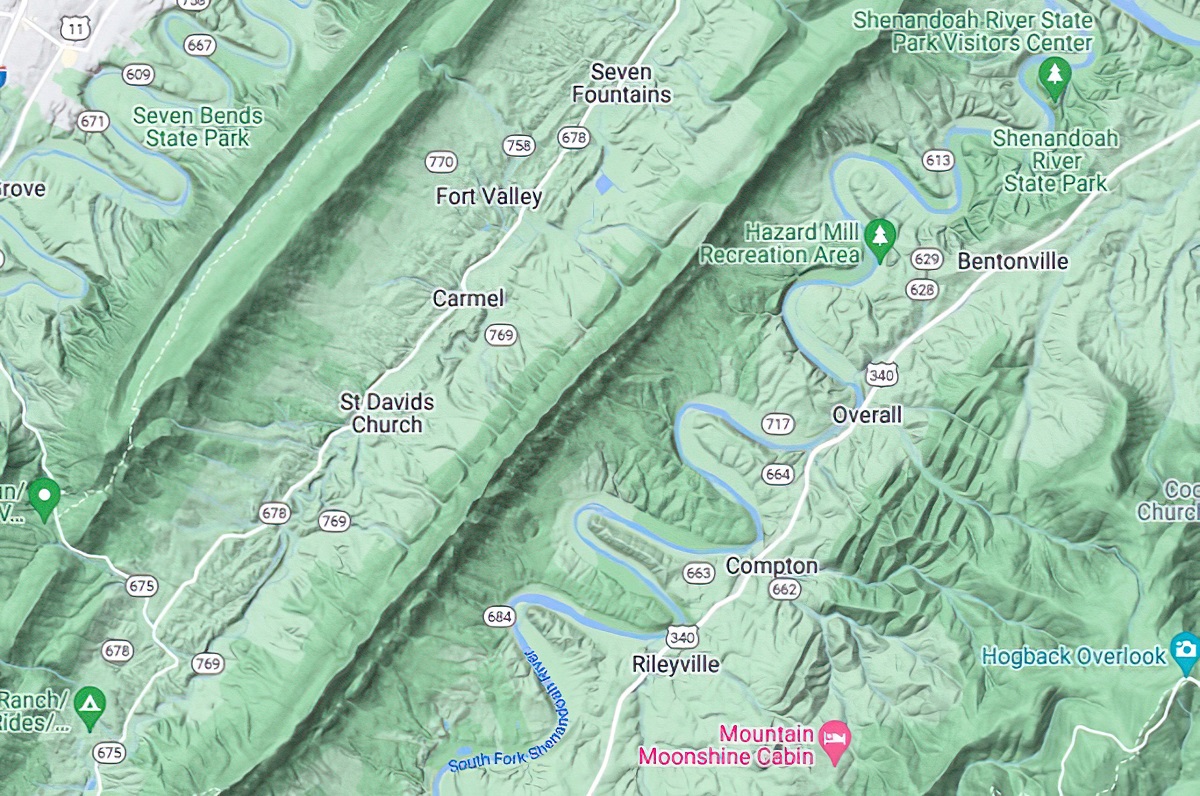
Ridges and Valleys: Stretching these circles turns them into elongated forms, presenting ridges (elevated) and valleys (depressed). The orientation of the “V” in contour lines can indicate water flow direction in valleys, acting as a compass pointing upstream.
Dramatic Drops: Cliffs and Escarpments
The dramatic interruptions in landscapes, cliffs and escarpments, are areas where the earth suddenly surrenders to gravity. On maps, this abrupt change is shown by closely packed contour lines. The rule is simple: the closer they are, the more breathtaking (and potentially dangerous) the drop.
Liquid Lifelines: Water Features
Water bodies don’t just quench our thirst; they’re vital in shaping the topography.
Streams and Rivers: These flowing wonders are typically portrayed as blue lines. But it’s the nearby contour lines, hugging these streams closely or loosely, that tell the story of riverbank steepness and potential speed of water flow.
Lakes and Ponds: More than just blue expanses, the contour lines encircling them offer insights into their depths and the topology of the lakebed. A sudden absence of these lines might indicate a sheer drop or a deep cavernous section within the water body.
Footprints of Humanity
Our species’ endeavor to tame and traverse landscapes is etched onto maps in myriad ways.
Roadways and Rail Lines: Whether it’s the winding mountain paths or straight highways slicing through plains, roads (solid or dashed lines) tell tales of human ingenuity. Rail lines, often parallel lines with cross hashes, reveal routes of industrial connectivity.
Bridges, Dams, and Airfields: Unique symbols, sometimes combined with contour data, highlight these human-made marvels, revealing how we’ve bridged waters, halted them, or taken to the skies.
The Green Chronicles: Vegetation and Land Use
The green patches and symbols aren’t just decorative.
- Forests to Farmlands: Differing shades of green or distinct symbols can indicate thick woodlands, sparse shrubberies, or cultivated stretches. These can provide critical information for hikers about coverage or for ecologists studying land use patterns.
Unique Marks: Peaks, Hollows, and Exploitations
Special terrain features get their unique symbols.
Mountain Peaks: Often marked with an upright triangle and sometimes coupled with an altitude figure, it’s an invitation for mountaineers.
Caves and Quarries: Depicted by distinct symbols like hollow semi-circles or shaded rectangles, they mark Earth’s natural hollows or human-made excavations.
The Grand Cartographic Concert
Maps, in their silent elegance, sing songs of topographical wonders. From the harmonious contours to the abrupt interruptions, every line, shade, and symbol has a story waiting to be discovered. So, the next time you trace a route on a map, remember, you’re not just charting a path—you’re reading Earth’s autobiography. Happy exploring!
Check out WhiteClouds’ 3D Maps for more information on terrain features on a map.