
Indiana From Above: A Satellite’s Tale of Heartland Beauty
Indiana, the “Crossroads of America,” stands as a bridge between the Midwest and the Eastern states. Renowned for its racing tracks and basketball courts, there’s a broader story hidden beneath its surface. With the help of advanced satellite imagery, let’s uncover the intricacies of this Hoosier land.
The Dance of Satellites and Terra Firma
Satellites, our vigilant observers from space, have revolutionized how we perceive our planet. Through their unblinking eyes, the landscapes of Indiana unravel in layers of complexity, painting a portrait of its natural elegance and human endeavors.
Indiana’s Diverse Natural Canvas
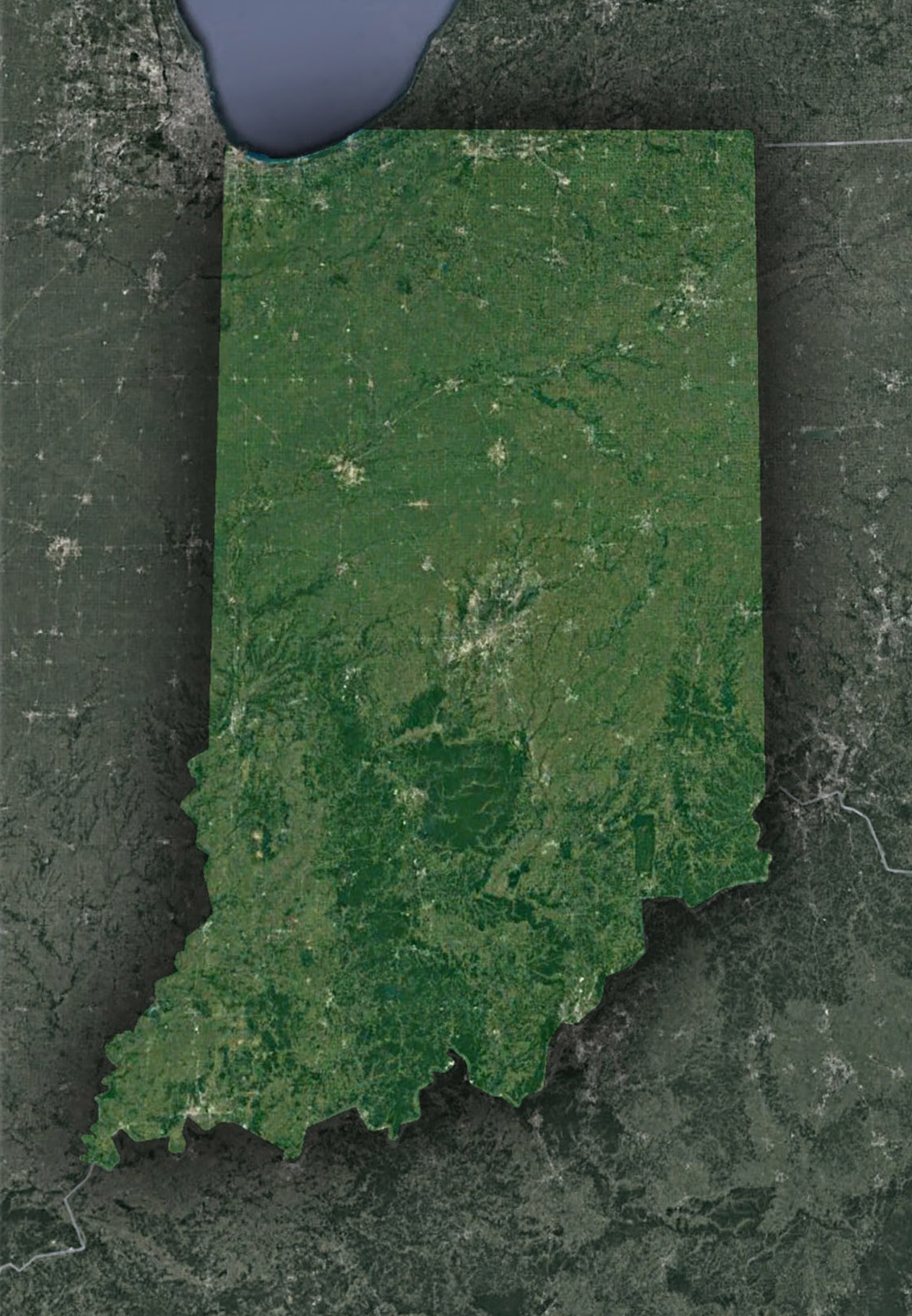
The Pinnacle of the Great Lakes Region – Lake Michigan’s Majestic Fringe: Gazing from the heavens, Indiana’s dunes along Lake Michigan’s shores unveil a spectacle of raw, natural beauty. These undulating sand formations, in stark contrast to the cerulean embrace of the lake, paint a vivid picture of a coastal ecosystem teeming with life and movement. The dunes, sculpted by time and wind, embody the delicate dance of nature’s forces at work.
The Wabash River – Nature’s Artery: Traversing a journey of over 500 miles, the Wabash River winds its way through Indiana, etching deep imprints on the landscape and shaping the very heart of its terrains. As satellites glide overhead, they capture the river’s serpentine silhouette and the life it nurtures. The Wabash, with its adjoining riverbanks, plays host to diverse habitats, making it a linchpin for the state’s settlements and a sanctuary for myriad species.
The Verdant Wilderness – Hoosier National Forest’s Expansive Embrace: In Indiana’s southern stretches, dense forests rise to proclaim their majestic presence. Among them, the Hoosier National Forest stands as a sentinel, its lush green canopy a testament to nature’s bounty. Witnessed from the cosmos, these woodlands transform with the changing seasons, offering a kaleidoscope of colors and textures that reflect the cyclical dance of nature.
Imprints of Humanity on Indiana’s Canvas
- Indianapolis – The Vibrant Heart of Indiana: Indiana’s capital, Indianapolis, is more than just a city; it’s a symphony of urban life and design. Its meticulously planned streets, juxtaposed against serene suburbs and patches of green, narrate stories of architectural foresight and urban evolution. The bird’s eye view provided by satellites paints a tale of a city that has grown exponentially, all while harmonizing with its natural surroundings.
- Agricultural Tapestry – The Geometric Beauty of Farmlands: Stretching across vast swathes of Indiana are intricate patterns of agriculture. Fields of corn and soybean, laid out with geometric precision, form a checkerboard that defines the state’s agrarian landscape. These plots, a testament to Indiana’s agricultural prowess, mirror the state’s dependence on farming as both a livelihood and heritage.
- The Temple of Speed – Indianapolis Motor Speedway’s Grandeur: In the realm of motorsports, few places command as much reverence as the Indianapolis Motor Speedway. This iconic racing circuit, when glimpsed from high above, emerges as an emblem of design excellence. Its sprawling layout and precise contours capture Indiana’s deep-seated passion for speed and automotive competition.
Satellite’s Benevolent Watch
- Monitoring Agricultural Health: With much of Indiana dedicated to farming, satellites assist in understanding soil health, predicting crop yields, and guiding irrigation techniques.
- Urban Development Tracking: Places like Fort Wayne, South Bend, and Evansville can anticipate growth and infrastructural needs using time-lapsed satellite imagery.
- Natural Disasters and Response: Satellites provide real-time feedback during flooding or tornado events, enabling quicker response and effective resource allocation.
Glimpses of Tomorrow
- Sustainable Farming: With satellite help, Indiana can pioneer precision farming, optimizing resource use while maximizing yields.
- Conservation Initiatives: Satellites assist in tracking deforestation rates and suggest areas for reforestation or habitat conservation.
- Energy Landscape Shifts: As Indiana moves towards renewables, satellite data aids in choosing optimal sites for wind and solar installations.
Epilogue: The Symphony of Land and Sky
Indiana might be globally famous for its basketball and racing, but a bird’s-eye view reveals a state with intricate topographies, diverse ecosystems, and a tapestry of human activities blending seamlessly with nature.
From the serenity of the shores of Lake Michigan to the hustle and bustle of Indianapolis, from the timeless forests of the south to the rhythmic patterns of the heartland farms, Indiana stands out as a unique blend of the old and the new.
As you drive through the I-65, attend the famed Indy 500, or take a leisurely walk in Brown County State Park, remember that above you, satellites capture the grandeur and the subtleties of this Hoosier state. They don’t just document landscapes; they narrate Indiana’s ever-evolving story, a tale of resilience, growth, and timeless beauty. Through their eyes, Indiana is not just a place on a map; it’s poetry in motion.
Check out WhiteClouds’ 3D Maps for more information on satellite maps of Indiana. 2D Canvas Print Satellite Maps of Indiana are also available.
Contact us today to learn more about our 3D services and how we can help you achieve your goals.