
Texas Unveiled: An Immersive Odyssey through the 3D Topographic Map
Texas, the Lone Star State, is a land of boundless horizons, where vast plains, rugged mountains, and sun-drenched deserts stretch as far as the eye can see. In this comprehensive exploration, we embark on a captivating journey through the 3D topographic map of Texas, peeling back the layers of its geographical wonders and unraveling the intricate stories etched into its vast terrain.
Navigating the 3D Topographic Map
Before we dive into the diverse landscapes of Texas, it’s essential to understand the fundamentals of 3D topographic maps. These cutting-edge cartographic tools provide an immersive representation of the Earth’s surface, portraying elevation, terrain, and natural features in extraordinary detail. The addition of the third dimension enhances our understanding of Texas’s landscapes, enabling us to explore the state’s unique geography with newfound depth.
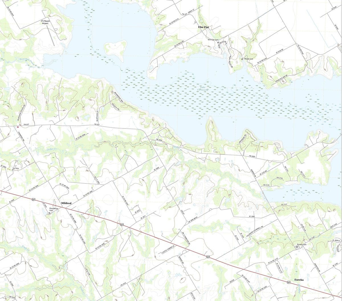 3D Topographic Map of Texas-Powell, 1:24,000 quad, 2022, USGS
Elevation-The Vertical Dimension: One of the most remarkable features of 3D topographic maps is their ability to depict elevation with remarkable precision. In a state as vast as Texas, where elevation varies dramatically, this dimension is crucial to comprehending the diverse landscapes. From the towering peaks of the Guadalupe Mountains to the coastal plains along the Gulf of Mexico, 3D maps vividly illustrate the vertical aspect of Texas’s topography.
Terrain Visualization-A New Perspective: 3D topographic maps offer an immersive experience by bringing Texas’s terrain to life. Every canyon, riverbed, and mountain range is presented with stunning detail, allowing us to appreciate the intricacies of the state’s geography. This unique perspective lets us uncover hidden features, grasp the impact of erosion, and understand the interplay of landforms in ways that traditional maps cannot convey.
 3D Topographic Map
The Guadalupe Mountains
Rugged Peaks and Desert Beauty: Our journey through Texas’s 3D topographic map commences in the western part of the state, where the Guadalupe Mountains rise with timeless majesty. These rugged peaks, crowned by Guadalupe Peak, the highest point in Texas, offer a dramatic vista of arid desert landscapes and captivating wilderness.
As we explore the 3D map, the Guadalupe Mountains come alive with vibrant elevation gradients. Guadalupe Peak, standing tall among the contours, beckons adventurers with its 3D prominence. This immersive experience allows us to virtually traverse these peaks and valleys, offering a glimpse of the Guadalupe Mountains’ grandeur.
The Majesty of Guadalupe Peak Trail: The 3D topographic map vividly portrays Guadalupe Peak Trail, which leads intrepid hikers to the summit of Guadalupe Peak. Hikers and nature enthusiasts can virtually follow this challenging trail, immersing themselves in the terrain’s intricacies. The 3D visualization provides a unique perspective on the trail’s demanding ascents, exhilarating descents, and the panoramic vistas that reward those who reach the peak.
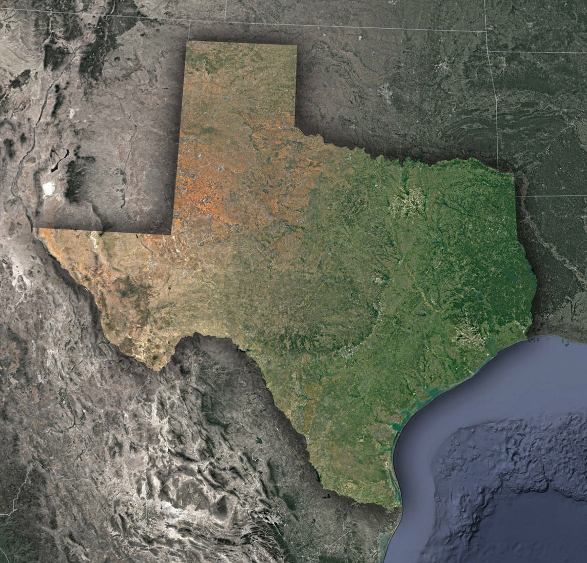 Satellite Map of Texas
The Great Plains
Endless Horizons and Rolling Plains: Transitioning eastward across Texas’s 3D map, we encounter the Great Plains, a vast region characterized by endless horizons, rolling prairies, and fertile farmland. This expansive heartland is depicted in exquisite detail, showcasing the gradual elevation changes and the sweeping plains that stretch to the horizon.
Elevation contours reveal the subtleties of the Great Plains’ topography, highlighting the role of landforms, rivers, and creeks in shaping the region’s diverse landscapes.
The Role of Waterways: Texas’s 3D topographic map accentuates the intricate network of rivers and streams that traverse the Great Plains. These waterways are essential in shaping the region’s terrain, with elevation gradients capturing the dynamic interaction between land and water. Understanding their impact on the Great Plains’ topography is crucial to appreciating the region’s agricultural significance.
The Gulf Coast
Coastal Beauty and Dynamic Shores: Continuing our journey, we arrive at the Gulf Coast, where the 3D topographic map unveils a captivating blend of coastal beauty, dynamic shores, and wetlands. Elevation gradients depict the delicate balance between land and sea, showcasing the barrier islands, bays, and estuaries that define this region.
The Gulf of Mexico’s influence on the Gulf Coast’s topography is unmistakable, with elevation contours revealing the ever-changing interplay of tides, currents, and coastal landforms.
The Chihuahuan Desert
Arid Plains and Desert Pinnacles: Venturing westward on Texas’s 3D topographic map, we enter the Chihuahuan Desert, a region known for its arid plains, distinctive landforms, and stark beauty. The map captures the subtle elevation changes and the vast desert expanses, including iconic features like Big Bend National Park and the Davis Mountains.
Elevation gradients reveal the sculpted canyons, desert mesas, and desert pinnacles that define the Chihuahuan Desert’s unique topography. This immersive experience provides a deeper understanding of the desert’s stark beauty and its significance in Texas’s natural mosaic.
The Geographical Tale of Texas
A Story of Geological Diversity: Throughout our exploration, it becomes evident that Texas’s topography is a testament to its rich geological history. From the towering Guadalupe Mountains to the vast plains of the Great Plains and the dynamic Gulf Coast, the 3D topographic map tells a story of millions of years of geological evolution.
Unique geological features such as the Balcones Fault Zone and the Edwards Plateau are intricately woven into the 3D map’s representation, offering insights into the geological forces that continue to shape Texas’s diverse landscape.
As we conclude our journey through Texas’s 3D topographic map, we depart with a profound appreciation for the state’s diverse and captivating landscapes. From the heights of the Guadalupe Mountains to the vastness of the Great Plains and the beauty of the Gulf Coast, Texas’s topography is a testament to its rich natural heritage.
Understanding Texas’s 3D topographic map isn’t just about navigation; it’s an invitation to immerse yourself in the state’s geological history, ecological diversity, and cultural significance. Whether you are an intrepid explorer, a geography enthusiast, or simply someone eager to delve into the wonders of the natural world, Texas’s 3D topography beckons you to embark on a journey of discovery and wonder, where the landscape springs to life in three dimensions.
Check out WhiteClouds’ 3D Topographic Maps for more information on a topographic map of Texas. 2D Canvas Print Satellite Maps of Texas are also available.
Contact us today to learn more about our 3D services and how we can help you achieve your goals.