Tag: Maps

Vietnam Watershed Maps

Vietnam Watershed Maps

Vietnam’s watersheds, including the Mekong and Red River Basins, are vital for agriculture and ecosystems. Learn how 3D mapping, GIS, and remote sensing technologies help manage these resources. These tools ensure sustainable water use while addressing challenges such as water scarcity, pollution, and climate change. They are essential for safeguarding water systems, improving flood management, and protecting ecosystems for future generations.
Read More »
3D Wall Maps 0

3D Wall Maps

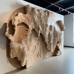
Embark on a visual odyssey with 3D Wall Maps, where geography leaps from the page into stunning three-dimensional reality. Traverse mountains, dive into ocean depths, and roam lush valleys—all within the confines of your home or workspace. Join us in uncovering the craftsmanship, innovation, and transformative power of these maps, as they redefine the way we perceive and interact with our planet.

Read More »
Vail Mountain - Google Earth Style

Vail Mountain 3D Maps

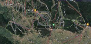
Explore how 3D maps can represent Vail Mountain’s terrain, elevation, lifts, and runs, along with the scale, style, labeling, and source-data decisions involved in planning a physical topographic model.

Read More »
Powder Mountain Map - Google Earth Style

Powder Mountain 3D Maps

Dive into Powder Mountain’s stunning 3D Maps, where peaks and trails come alive in vivid detail. Plan your next epic adventure with precision, from thrilling slopes to serene glades. Elevate your outdoor experience with the power of 3D mapping – Powder Mountain awaits!

Read More »
3D Topographic Map of Tennessee-Locke

3D Topographic Map of Tennessee

Step into a world where the geography of Tennessee springs to life in stunning 3D. Traverse the rugged peaks of the Great Smoky Mountains, plunge into the deep gorges of the Cumberland Plateau, and meander along the fertile plains of the Tennessee Valley. Our journey through Tennessee’s 3D topographic map promises an immersive experience that unlocks the secrets of this diverse and captivating state in a whole new dimension.

Read More »
Snowbasin 3D Map-Google Earth Style

Snowbasin 3D Maps

Uncover the secrets of Snowbasin Ski Resort with our 3D raised relief maps. Feel the mountain’s pulse, explore thrilling runs, and embrace inclusivity. Your alpine adventure in Utah’s Wasatch Mountains begins here!

Read More »
Satellite Map of USA - Contiguous 48

Satellite Map of USA

Unveil the breathtaking tapestry of the USA from space! Satellite imagery brings the nation’s sprawling cities, majestic mountains, and vast plains into sharp focus. Embark on a visual journey that bridges coasts, crosses borders, and captures America’s heart and soul. Discover the USA from a perspective you’ve never imagined!

Read More »
Satellite Map of Nebraska

Satellite Map of Nebraska

Dive into Nebraska like never before! From the sprawling Platte River to bustling Omaha, satellite maps bring the Cornhusker State’s vast landscapes to life. Experience the heartland’s hidden wonders from thousands of miles above. Nebraska’s beauty awaits your aerial exploration!

Read More »
Arkansas Terrain Map

Terrain Map of Arkansas

Journey through Arkansas’s captivating terrains, from the mystical Ozark caverns to the gem-rich Gulf Coastal Plain. Each region narrates a unique tale, beckoning explorers and nature enthusiasts to the heart of the Natural State. Dive in and let Arkansas’s landscapes unveil their secrets!

Read More »
3D Topographic Map of California-San Francisco

3D Topographic Map of California

Venture into a captivating realm where California’s remarkable landscapes come alive in stunning 3D. Traverse the majestic peaks of the Sierra Nevada, explore the fertile expanse of the Central Valley, and wander along the rugged coastlines of the Coastal Ranges. Our immersive journey through California’s 3D topographic map unveils the secrets of the Golden State’s geography in breathtaking depth, offering a unique perspective on its vast and diverse terrain.

Read More »
Satellite Map of Massachusetts

Satellite Map of Massachusetts

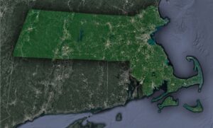
Unravel Massachusetts from above! Witness the iconic arm of Cape Cod, Boston’s sprawling majesty, and the serene Berkshires, all through a satellite’s lens. Dive deep into a state where history and topography dance in mesmerizing patterns, beckoning explorers and history buffs alike. Join us on this aerial journey through the Bay State’s wonders!

Read More »
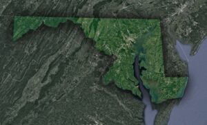
Satellite Map of Maryland

Satellite Map of Maryland

Soar above Maryland, ‘America in Miniature,’ to uncover its rich tapestry! From the vast Chesapeake Bay to the rolling Appalachians and bustling urban centers, satellite views unveil the state’s mesmerizing contrasts. Experience Ocean City’s sandy stretches and the serene wilderness, all through a bird’s-eye perspective. Dive into Maryland’s captivating stories etched across its landscapes!

Read More »
3D Topographic Map of Texas-Powell

3D Topographic Map of Texas

Prepare for an odyssey like no other, as we journey through Texas’s 3D topographic map. Traverse the rugged heights of the Guadalupe Mountains, explore the boundless horizons of the Great Plains, and savor the coastal beauty of the Gulf Coast. Our immersive expedition unveils the secrets of the Lone Star State’s geography, providing a unique perspective on its vast and varied landscapes that will leave you in awe.

Read More »
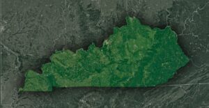
Satellite Map of kentucky

Satellite Map of Kentucky

Journey skyward and witness Kentucky’s stunning tapestry! From the lush embrace of the Bluegrass Region to the majestic Appalachians and the secrets of Mammoth Cave, satellite imagery unveils a state rich in history, culture, and natural marvels. Dive into a celestial exploration of the Bluegrass State like never before!

Read More »
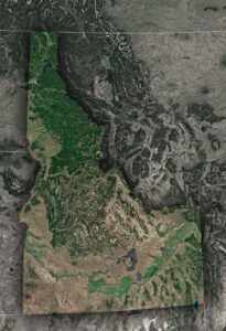
Satellite Map of Idaho

Satellite Map of Idaho

Soar above Idaho and unveil a mosaic of landscapes! From the craggy peaks of the Rockies to the serpentine flow of the Snake River and the alien terrain of Craters of the Moon, the satellite’s eye offers a mesmerizing journey across the Gem State’s geographical wonders and hidden tales.

Read More »

Get a Free Quote