Map Prints and Models
Make a statement with truly unique, accurate 2D or 3D Maps
Why Maps?
Maps can have many purposes: sentimental, educational, or purely just for aesthetics. They have many different styles and many themes which can be molded to suit your purpose. If you like a certain style of map, such as an ocean-faring navigational chart, or prefer the vintage style of historical maps, we can provide your favorite look. You could get a canvas wrap of your favorite location in memory, a place of special interest, or simply to record your adventures. Alternatively, you could use maps for your business, highlighting residential and commercial planning, subsurface earth features, underwater terrain, geographical features, or political boundaries.
Our inventory of ready-made map canvas print imagery is the largest collection on the internet with over 600,000 unique maps and 20 different types. If you don’t see anything to your liking from the Map Canvas Art we have on our eCommerce store, or you have something special in mind in terms of imagery, size or presentation, please contact us for a free quote on a custom 2D print or 3D model project. Click here to see a gallery of some of our custom 3D topography models. We are here to cater to your specific and unique needs.
Types of Maps
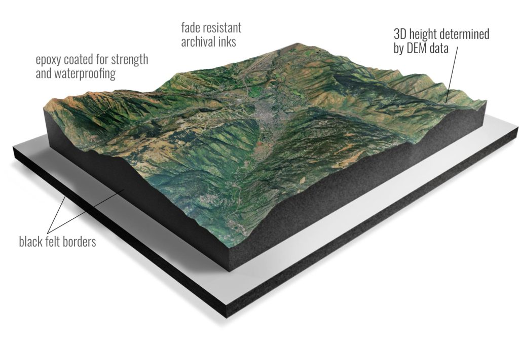
• Extraordinary 3D Accuracy – The visual data for these maps comes from satellites that are photographing the earth by the United States Geological Survey (USGS), Google or NASA. US Topo map data is derived from the geographic information system (GIS) data of The National Map and is continuously updated via National, state, local, and commercial partnerships. The USGS started mapping the country in 1879 and is still the primary civilian mapping agency of the United States. USGS topo maps use the National Map Accuracy Standards which means that 90 percent of the horizontal points tested by field survey teams are accurate to within 40 feet. Most of these topo maps are the 1:24,000-scale topographic maps, also known as 7.5-minute quadrangles. With this scientific data, we use 3D-printers and 3D CNC routers to fabricate the models so there is 100% accurate rendering.
• Fade Resistant Archival Inks – Our materials are gallery quality. We use the latest HP Latex printers and archival ink to produce consistent and quality results. The inks are environment-friendly are reduce fading to preserve as much fine detail as possible over time.
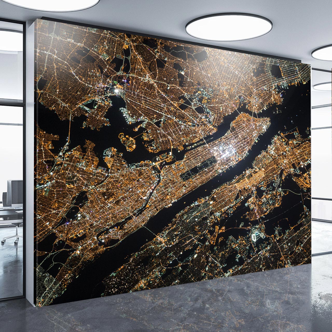
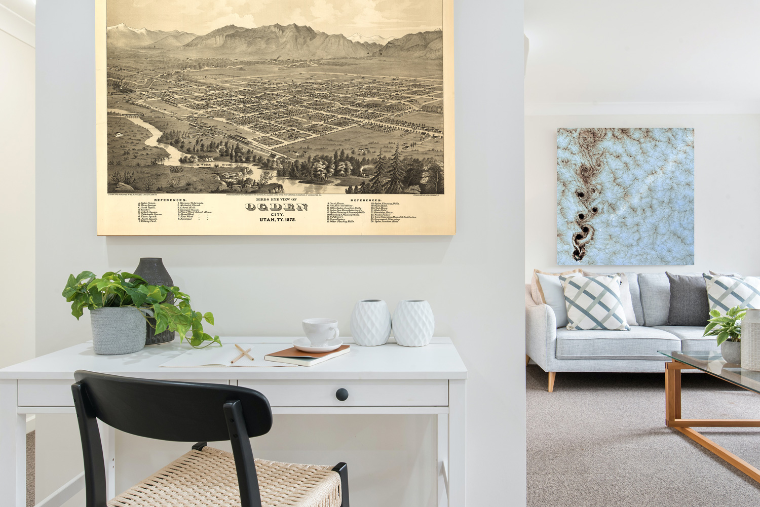
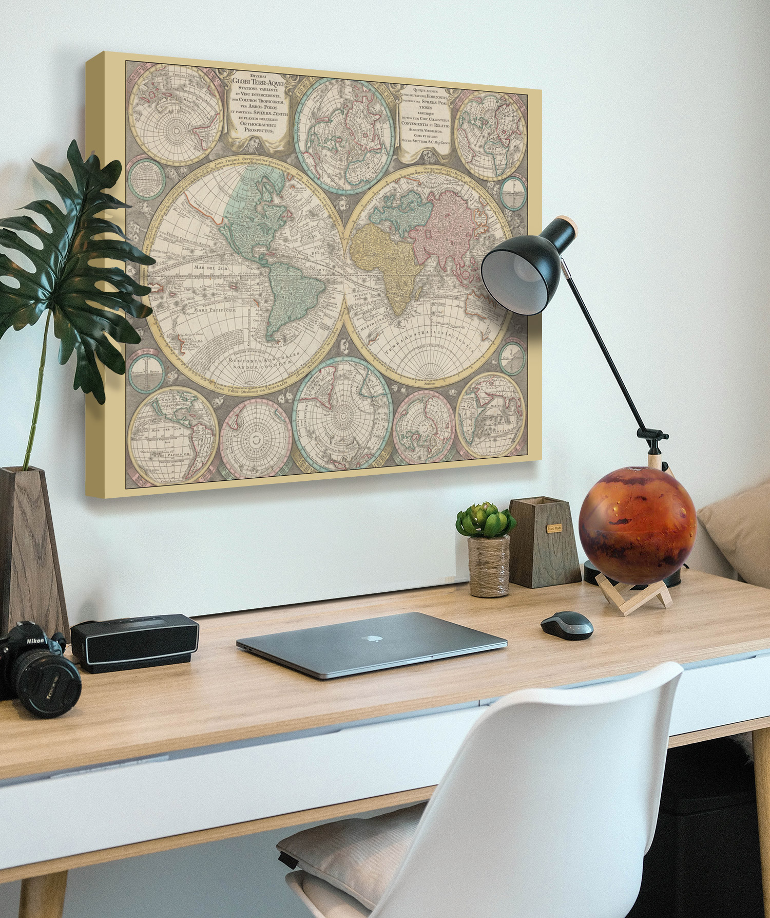
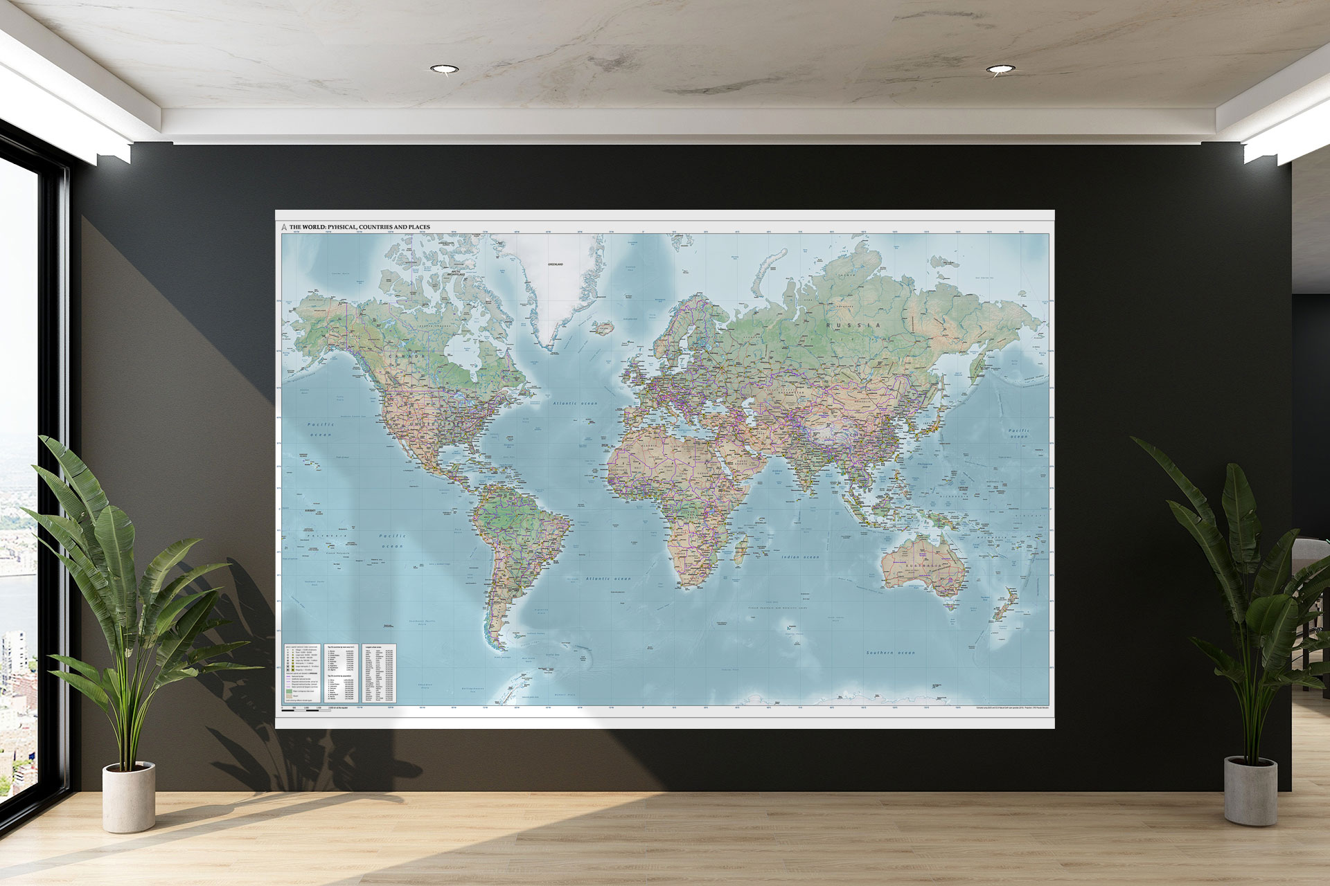
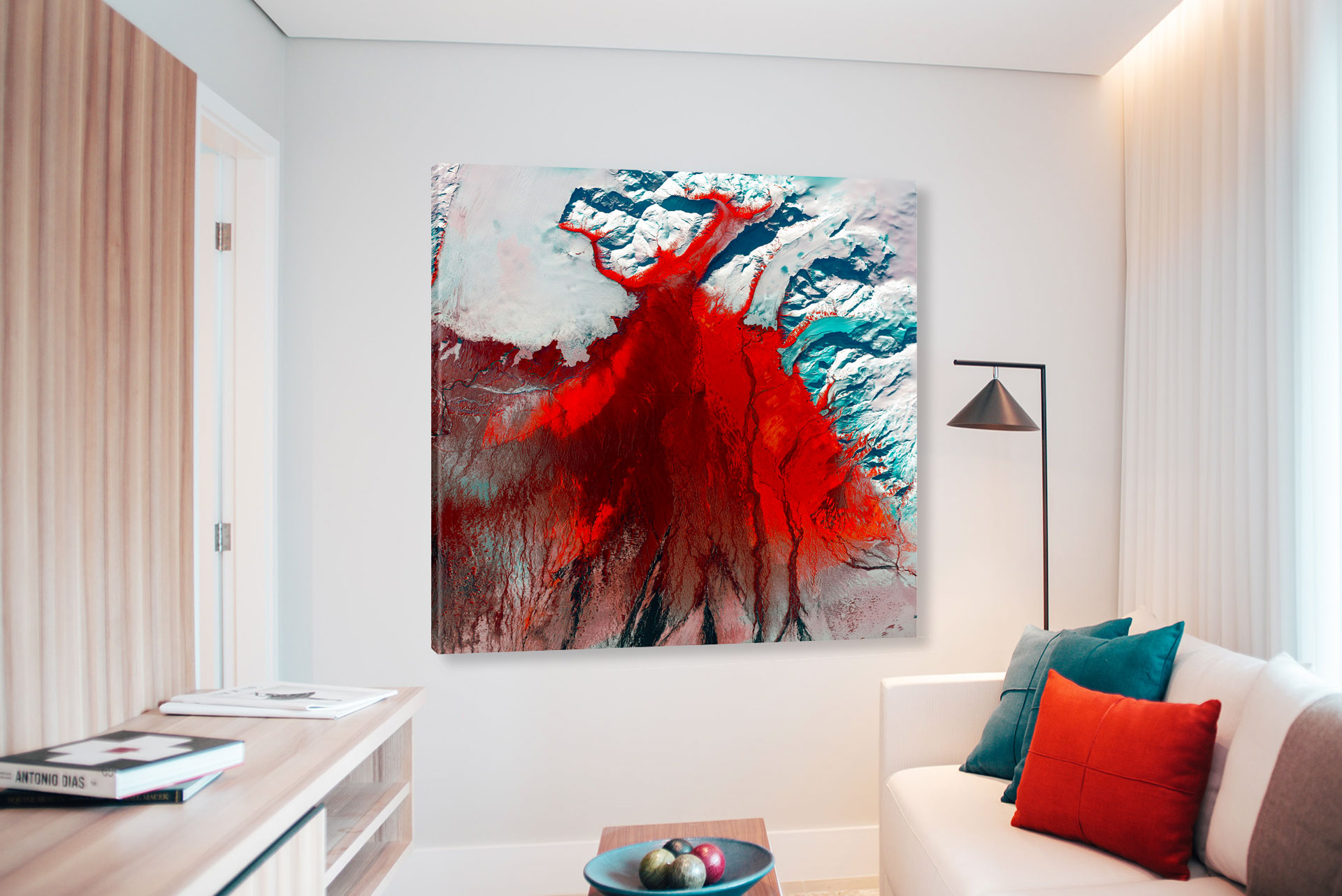
Our 2D maps are highly accurate, detailed, and colored to your desire. With over 20 unique subcategories, they can even take the form of beautiful, hand-crafted maps of historical origin such as railroad, waterway, or war maps. If one sees the historical or scientific maps of a favorite area, one might better appreciate how much a city or location has changed over time. They can also have a much more modern purpose, going over national park terrain, cityscapes, or satellite images. These images can achieve the aesthetic look your space may be missing. Images of the earth from space can almost look like abstract painting from far away, then a closer look reveals the natural beauty of the earth through real images from satellites that may surprise all viewers! Our map decor may have scientific purposes as well, for those meteorologist or geologist buffs who love to see how the surface of the world can change.
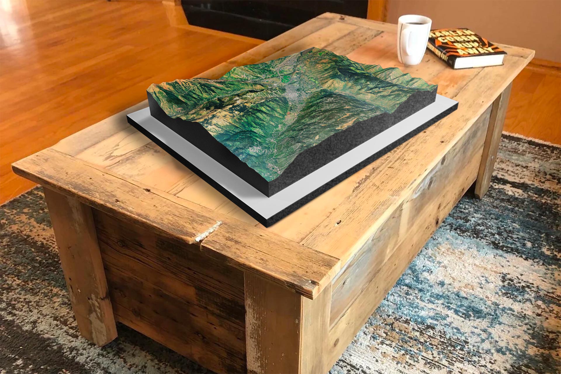
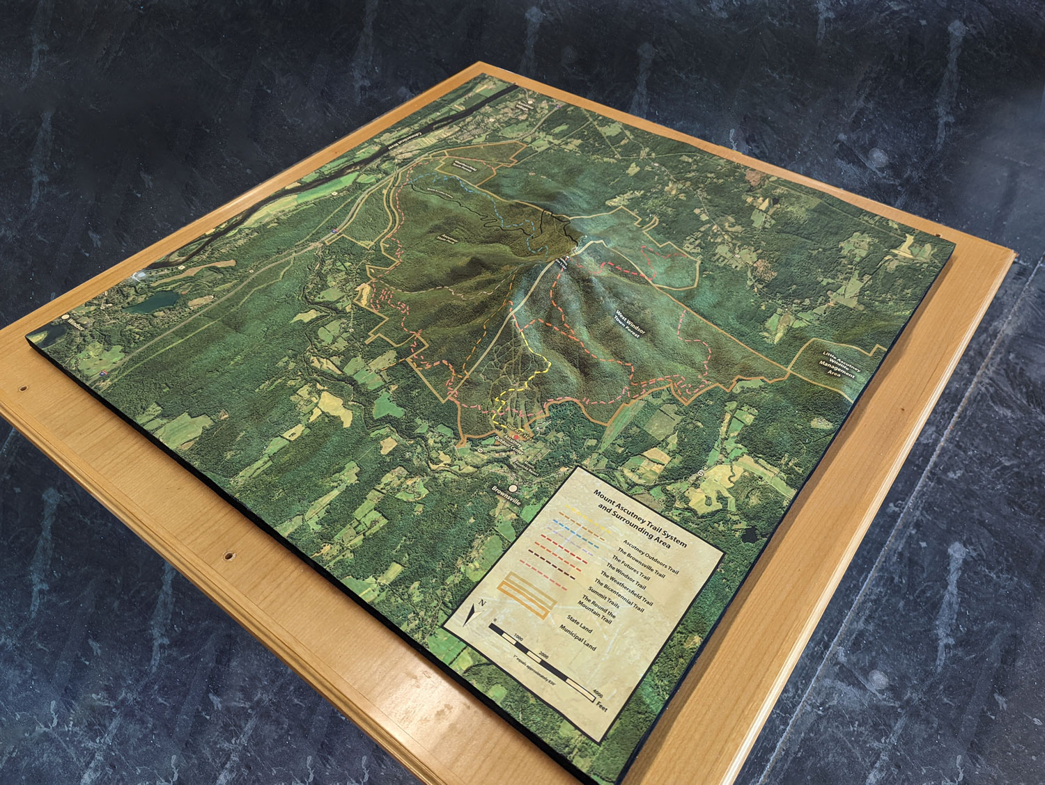
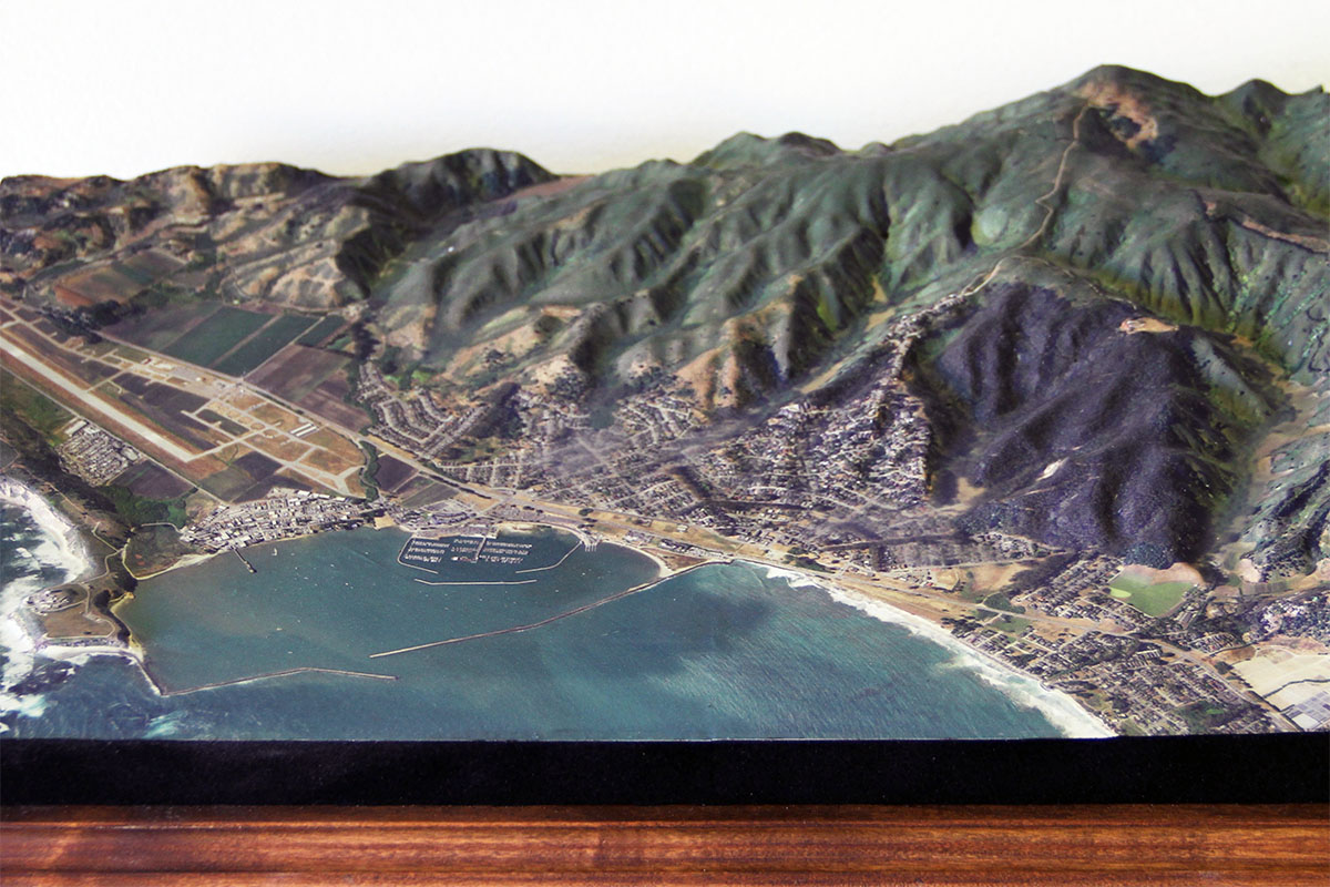
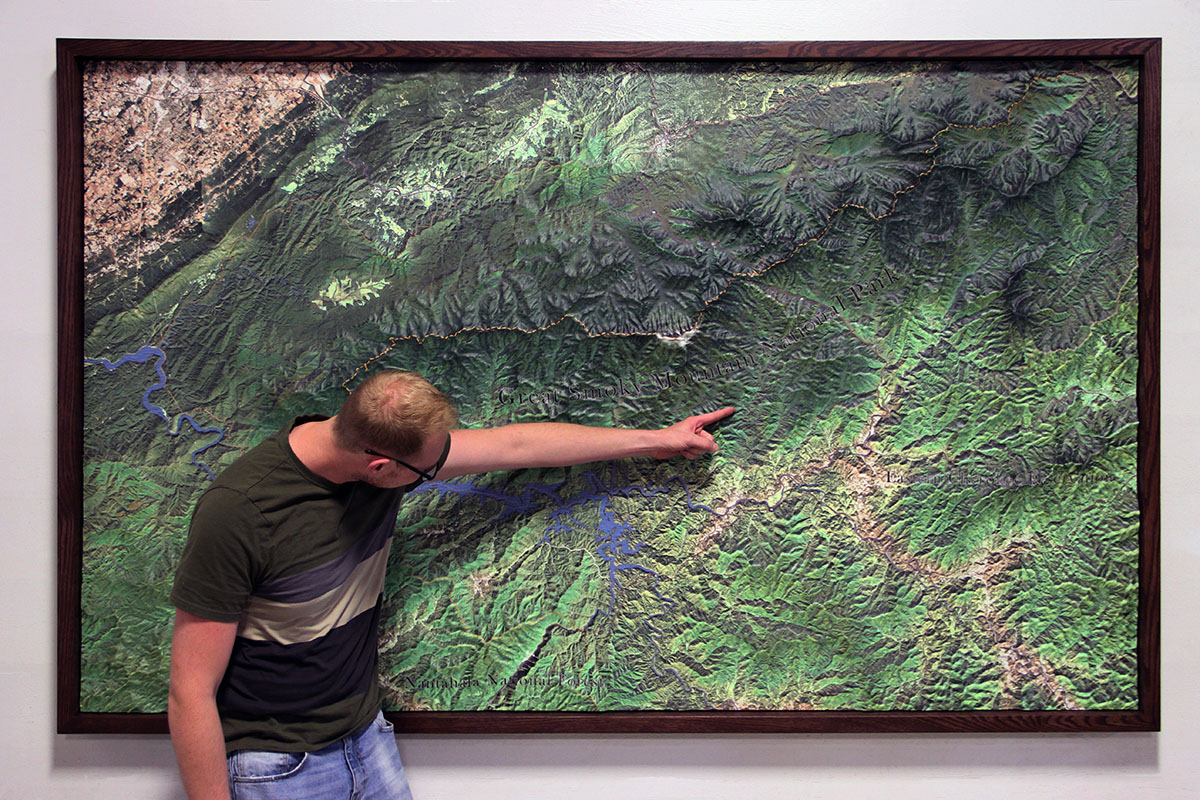
Our high-quality 3D maps and models are on display at museums, national parks, university campuses, sports facilities, hospitals, and research organizations worldwide. Here at WhiteClouds, we have spent years perfecting custom 3D topographical map models of all sizes. They have been used for a variety of purposes across multiple industries, such as the national parks and recreation services, government entities, businesses, and individual consumers. Recognizing their value, we have entered the eCommerce space with ready-made 3D topographical raised-relief maps in order to make them more affordable and widely available. We have 427,142 three-dimensional United States and Mars map products to choose from in 3 styles. They are all three-dimensional, tactile, raised-relief models with a white border base and black felt edges, with the height, always under 2 inches, determined by Digital Elevation Model (DEM) data.
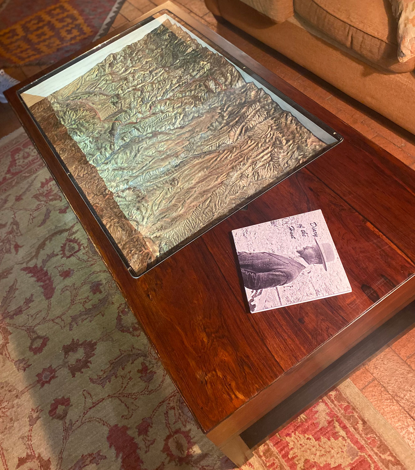
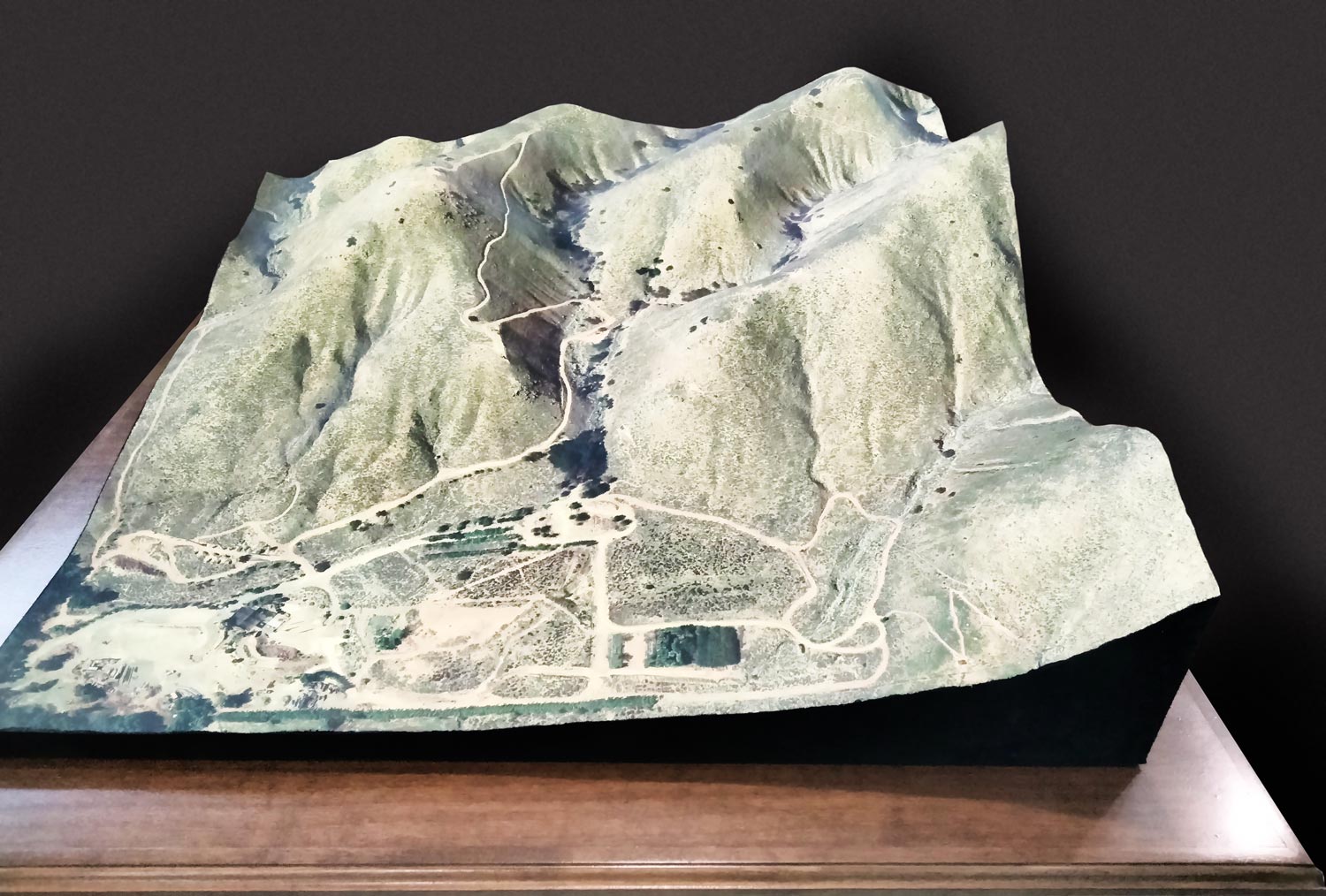
These models are not flat like our 2D canvas prints. These 3D topography raised-relief maps designs are created by combining satellite imagery data from the USGS, Google Earth, Google Maps, NASA, and DEM data. They are produced using 3D Printing technology and CNC routers, making the satellite models as accurate and detailed as possible. The models are then coated with epoxy and sealed to give it a waterproof matte-finish to make them strong and durable.
• 3D Height Determined by DEM data – The height of each model is determined by the 3D DEM data. Today, this DEM data is generated from satellites, airplanes, helicopters, and drones using different technologies such as LIDAR or laser scanning, photogrammetry, IFSAR or radar pulses. Using the DEM data, the actual height of each point in the selected area is then scaled appropriately for determining the scaled height of the model. However, in some cases, we will exaggerate the scale in order to see more depth in maps with low contrast topographies.
• Epoxy Coated for Strength and Waterproofing – Once printed, the model is finished with a double-coated 2-part epoxy hardener. Then, a special sealer providing a weatherproof, stain-resistant matt finish. You could even drive over this with a one-ton truck and it would not be damaged. This core is mounted to a 5/8″ engineered wood composite of Medium Density Fiberboard (MDF) that is wrapped in vinyl for easy cleaning.
• Black felt borders – A black flocking, similar to what you might find in a jewelry case, is applied to all edges to give a high-end museum quality finish.
• Choice of Tabletop or Wall Hanging Model – The model is extremely strong and rigid so if you choose to display it on a table or lean it against a wall, there is no additional cost or hardware. If you would like hardware to hang on a wall, we ofter pre-installed hanger hardware. The type of hanger depends on the size of the art-piece. It may be a sawtooth hanger or a pre-installed cable bracket system for larger 3D raised relief maps.
Our Unique Products...
We have 5 categories of 3D Map ready-made images. If you don’t see anything to your liking, or you have something special in mind in terms of imagery, size or presentation, please contact us for a free quote on a custom project.
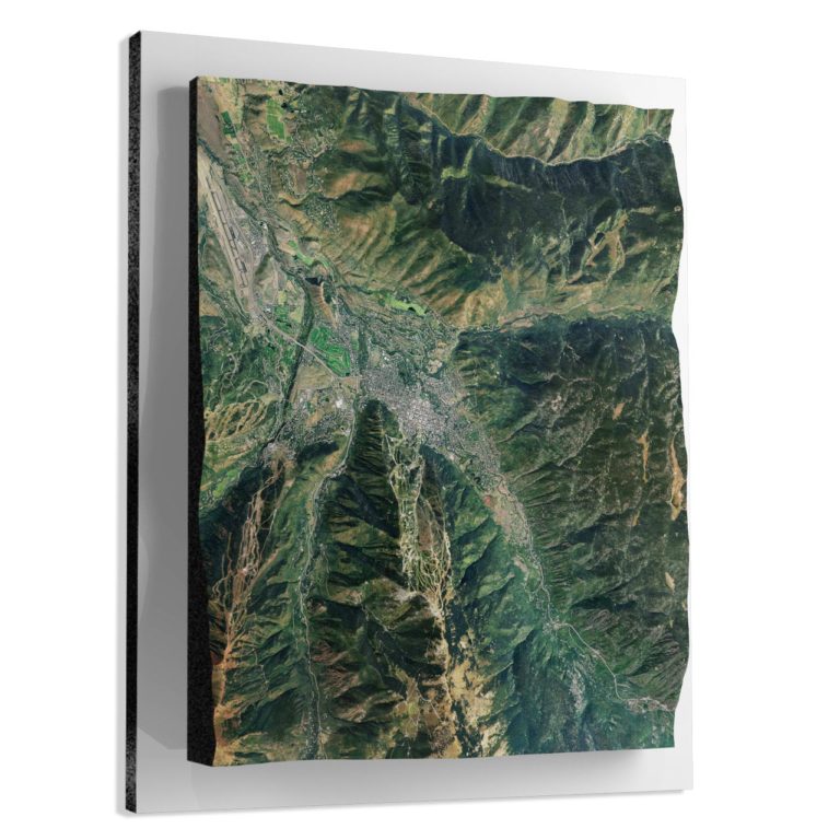
3D Satellite Raised Relief Maps with USGS
We have 65,240 satellite style three-dimensional U.S. maps to choose from. The satellite style shows how a particular site looks in real life photographic realism. The 3D data comes from combining satellite data from Google Earth and bounding box coordinates from USGS, and DEM data.
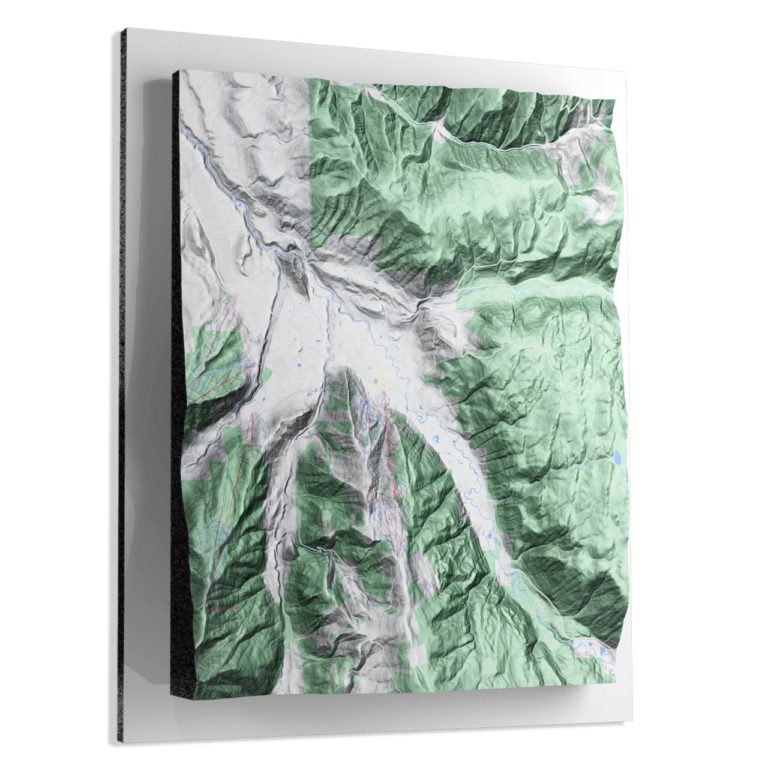
3D Terrain Raised Relief Maps with USGS
We have 65,240 three-dimensional maps in the terrain style to choose from. The terrain style or ‘relief mapping’ is the depiction of the shape of the surface of the Earth on a map. This style does not show photo-realistic colors or textures but is meant to show elevation details such as hills, ridges, vallies, saddles, and depressions along with bodies of water.
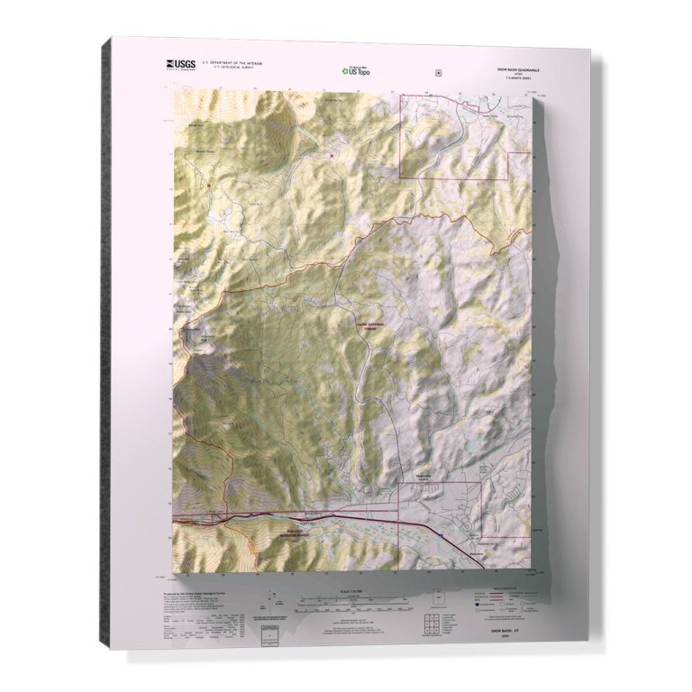
USGS 3D Topographical Raised Relief Maps
We have 65,240 three-dimensional maps to choose from in the USGS topographic map style which shows elevation (contour lines), hydrography, geographic place names, and a variety of cultural features. They do not show photo-realistic colors or textures.
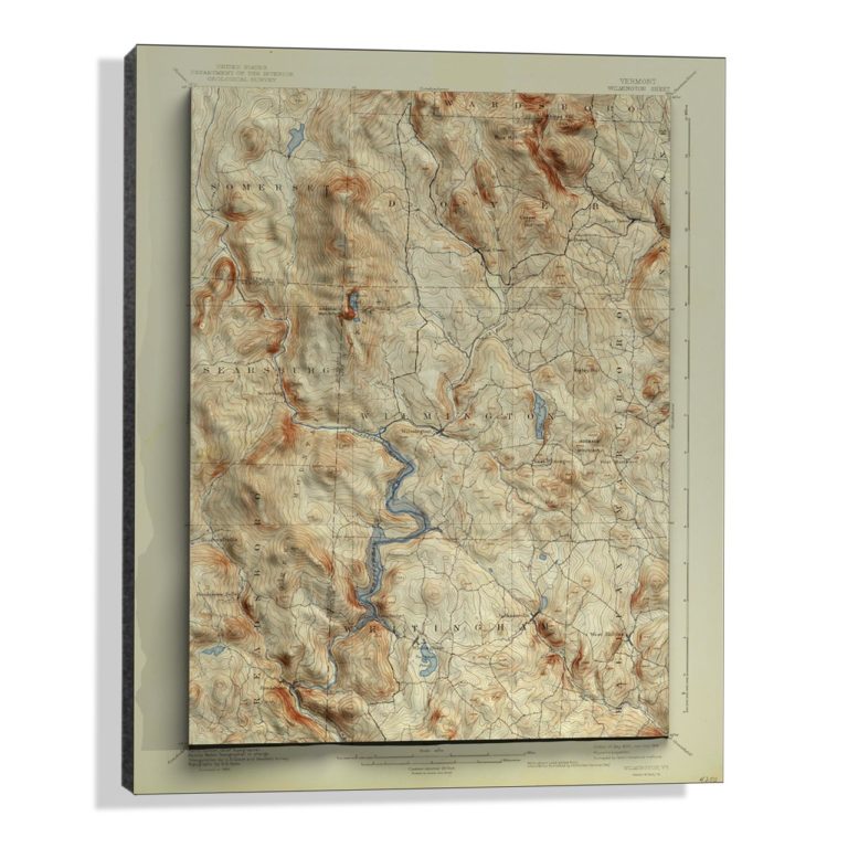
USGS 3D Historical Topographical Raised Relief Maps
We currently have over 350,o00 three-dimensional historical maps to choose from. The imagery and data for these maps was published by the U.S. Geological Survey (USGS) from the start of the topographic mapping program in 1884 until 2006.
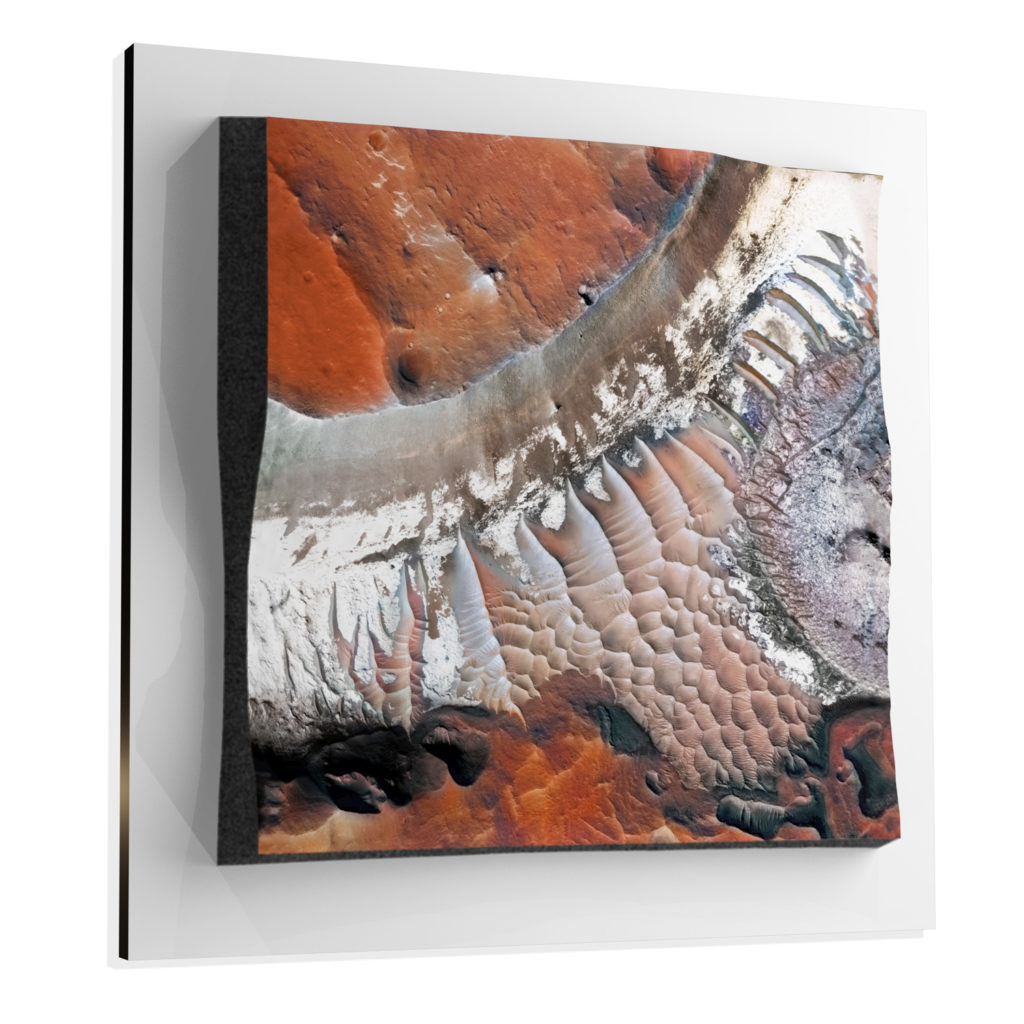
3D Marscapes of Mars
We currently offer 13 unique three-dimensional Mars landscape locations to choose from. These 3D decor pieces are NOT simply flat 2D prints of images. Marscapes are raised surface models of the Martian landscape using data and imagery from NASA and many other scientific resources..
Custom 3D Map Models
If you don’t see anything to your liking from our eCommerce store, or you have something special in mind in terms of imagery, size or presentation, please contact us for a free quote on a custom project or fill out the form below. View a gallery of some of our custom 3D topography models.
Shipping and Delivery
WhiteClouds has delivered models and products large and small around the world. Our Canvas prints are shipped completely FREE to the continental United States. For outside the U.S., there is an additional shipping charge.