What Is a Zoning Map?
A zoning map is the blueprint behind every neighborhood, business district, and skyline. This guide explains what zoning maps are, how they work, and why they matter for homeowners, investors, and cities shaping their future.
A zoning map is the blueprint behind every neighborhood, business district, and skyline. This guide explains what zoning maps are, how they work, and why they matter for homeowners, investors, and cities shaping their future.
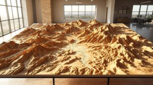
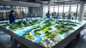
What does Phoenix really look like beneath the streets and skylines? A 3D topographic map of Phoenix, AZ reveals the hidden depth of the Valley of the Sun, from rugged mountain ranges and desert washes to the broad basin that supports one of America’s fastest-growing cities. This immersive perspective transforms flat maps into a living landscape.
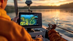
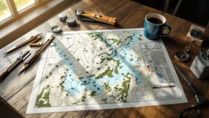
A fishing map unlocks the underwater world—revealing where fish hide, feed, and strike. From sonar imaging to depth contours and fish-rich structures, these maps transform any fishing trip into a smart, strategic adventure. Plan better, catch more, and discover the hidden landscape beneath the surface.
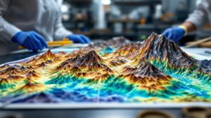
Beneath our feet lies an extraordinary world of rock, history, and unstoppable forces. Geological survey maps reveal that hidden story—showing how landscapes formed, where natural hazards lurk, and how Earth’s ancient past shapes the present. Dive into the colorful science that keeps communities safe and unlocks the marvels concealed underground.
A watershed map tells the story of how water moves—across hills, through soils, into rivers, and out to the sea. From flood planning to wildlife protection, these maps help us understand the invisible networks connecting every raindrop to every river. Dive into how watershed maps shape communities, prevent disasters, and protect our future.
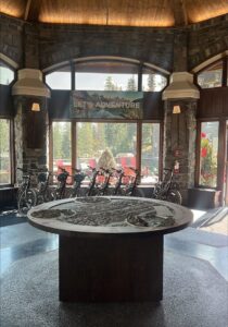
Crafted for the Adventure Centre at Fairmont Banff Springs, this 76-inch 3D topographical map transforms Banff National Park into an immersive visual experience. Guests can explore peaks, valleys, and trails in sculpted detail while planning their next adventure. With a custom pedestal base and museum-quality craftsmanship, it stands as a striking centerpiece that blends beauty, function, and exploration.
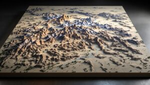
A 3D topographic map of Boulder, CO brings the city’s dramatic terrain—Flatirons, canyons, foothills, and sweeping plains—into a sculptural masterpiece. This article explores Boulder’s landscape, the artistry of relief mapping, and how such a model is fabricated from raw elevation data into a stunning work of geographic art.
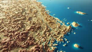
A 3D topographic map of Long Beach, CA transforms the city into a sculptural landscape of coastline curves, inland elevations, port structures, and natural features. This engaging article explores the terrain, the artistry behind 3D maps, and how such a model can be fabricated to bring the city to life.

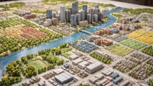
From colorful zoning layers to hidden market patterns, real estate maps reveal far more than streets and parcels — they uncover the stories behind every property. Explore how these maps shape buying, selling, and building decisions in the modern real estate world.
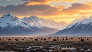
From steaming geysers to endless mountain horizons, Yellowstone National Park is bigger — and wilder — than you ever imagined. Explore its astonishing size, geological wonders, and untamed beauty stretching across three states and millions of acres of pure American wilderness.

How big is California, really? From its snow-capped Sierras to sun-soaked beaches, explore 163,696 square miles of golden landscapes, vast cities, and endless diversity. Journey through a state so immense in beauty, economy, and culture that it feels more like a country than a place on the map.
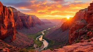
Zion National Park is more than a canyon—it’s a world of towering cliffs, deep valleys, and wild beauty stretching across 229 square miles of Utah wonder. Explore its hidden corners, vertical walls, and endless horizons as we uncover just how big, breathtaking, and boundless Zion truly is.

How big is a homestead, really? From small backyard gardens to sprawling rural retreats, discover what it takes to live sustainably at any scale. Learn how size, soil, and spirit define your path to self-sufficiency—and why a homestead is more about heart than acreage.
A floodplain map reveals where water and land meet—and sometimes clash. More than just shaded zones, it’s a powerful tool that helps predict floods, guide development, and protect lives. Explore how science, data, and design combine to map the hidden paths of water and keep communities resilient against nature’s most unpredictable force.
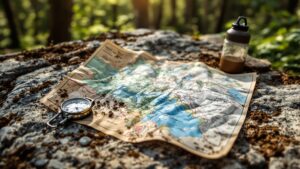
A backpacking map is more than a piece of paper—it’s a gateway to adventure, a survival tool, and a storyteller of the wild. Explore how this essential navigation companion connects exploration, freedom, and discovery, guiding hikers through mountains, forests, and untamed landscapes one contour line at a time.
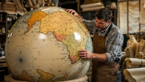
What is a globe, really? More than a map—it’s a miniature Earth, a symbol of exploration, and a timeless work of art. Spin through history, craftsmanship, and imagination as we uncover how globes connect science, adventure, and wonder in one beautiful sphere that brings our world to life.