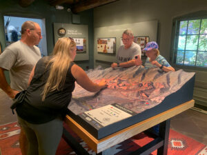
3D Topography Models Project Gallery
Browse WhiteClouds custom 3D topographical models, raised relief maps, watershed displays, resort trail maps, visitor center exhibits, and interactive lighted terrain maps.
Browse WhiteClouds custom 3D topographical models, raised relief maps, watershed displays, resort trail maps, visitor center exhibits, and interactive lighted terrain maps.

Selfie station props transform events into shareable experiences. Discover how these creative setups attract attention, boost engagement, and turn moments into lasting memories.

From sci-fi helmets to massive event displays, 3D printed props are transforming how ideas become reality. Discover how this cutting-edge technology blends precision, creativity, and scale to create stunning, lifelike objects for film, marketing, and beyond.

Custom props are purpose-built creations designed to bring ideas to life, from film sets to live events and branded experiences. Explore how these unique objects combine creativity, scale, and craftsmanship to transform spaces, tell stories, and create unforgettable moments.

Discover the astonishing scale of the world’s largest statue, a nearly 600-foot-tall monument that redefines what human engineering can achieve. From its towering presence above the landscape to the intricate design and symbolism behind it, explore how this colossal structure compares to global icons and why it continues to captivate millions around the world.

From life-sized soldiers to towering monuments that dominate skylines, military statues come in all scales. Discover how size shapes their meaning, impact, and presence—and why even the smallest tribute can feel larger than life.

University props can range from small displays to towering installations over 30 feet tall. Discover how size, purpose, and creativity combine to shape unforgettable campus experiences, from game-day spectacles to iconic landmarks that define university identity.

The Pacific Ocean is so vast it covers more area than all Earth’s land combined. From its staggering width to its deepest trenches, this immense body of water reshapes how we understand scale, exploration, and the natural world. Dive into the numbers, stories, and perspectives that reveal just how truly enormous the Pacific Ocean is.
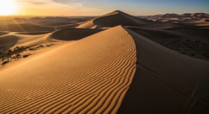
The Gobi Desert isn’t just vast—it’s extraordinary. Spanning over 500,000 square miles, this cold desert stretches across China and Mongolia with rugged terrain, extreme climates, and surprising wildlife. Discover what makes its size so impressive and why the Gobi remains one of the most fascinating and mysterious landscapes on Earth.
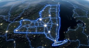
How big is New York State? It’s far more than New York City—spanning mountains, forests, farmland, and Great Lakes shoreline. Discover its true size through miles, regions, and real-world comparisons that reveal just how vast, diverse, and surprisingly expansive the Empire State really is.
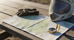
An ATV trail map is your ultimate off-road guide, helping you navigate rugged terrain, plan routes, and ride with confidence. Discover how these maps work, what they include, and why every rider—beginner or expert—needs one for safer, smarter, and more adventurous exploration.

GIS mapping transforms data into powerful visual maps that reveal hidden patterns and insights. Discover how it works and why it’s changing how we understand the world.
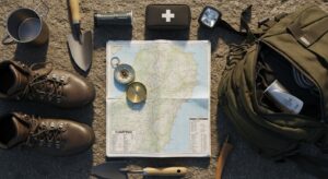
A camping map is more than navigation—it’s your key to exploring the outdoors with confidence. From trails and campsites to terrain and water sources, it helps you plan smarter, stay safe, and discover hidden gems. Whether you’re a beginner or seasoned adventurer, mastering a camping map transforms every trip into a richer, more rewarding experience.
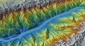
GIS mapping transforms data into powerful visual maps that reveal hidden patterns and insights. Discover how it works and why it’s changing how we understand the world.

A constellation map transforms the night sky into a readable guide, revealing patterns hidden among the stars. From ancient myths to modern astronomy, these maps help you explore, navigate, and truly understand the vast, ever-changing sky above.

What is a wall map? It’s more than décor—it’s a large, visual gateway to the world. From classrooms to living rooms, wall maps combine design, geography, and storytelling to make places easier to understand, explore, and connect with every day.