Tag: Maps

Hebgen Dam Montana 2020-USGS Topographic Map

How to Read a Terrain Map

Get ready to explore the great outdoors with confidence! In this blog post, you’ll learn more about terrain maps, including how to read their legends, interpret contour lines, and identify waterways and man-made features. With some tips and tricks, you’ll be able to orient the map correctly and plan your route like a pro. So why wait? Let’s get started!

Read More »
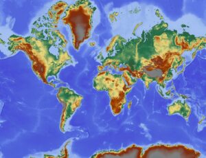
Physical Map - World

Physical Maps

The physical map revealed the earth’s grandeur in breathtaking detail, with its mountains, deserts, and oceans depicted in stunning relief. It was a testament to the power and beauty of nature. Learn more about Physical Maps and explore the wonders of our planet.

Read More »
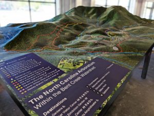
3D Topography of Bentcreek Watershed in North Carolina (mid production)

Terrain Maps

Studying the terrain map, the mountains and valleys came to life. I could almost feel the rush of the rapids and the crunch of the leaves under my feet. Learn more about Terrain Maps and experience the world in a whole new way.

Read More »
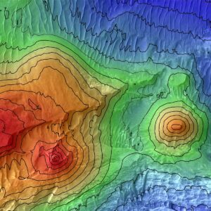
Elevation Maps Lus Chasma

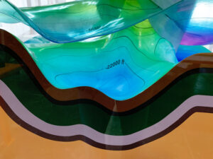
3D Elevation Maps Focus on Color at Different Heights

Learn more about elevation maps and how they are being taken to a whole new level with 3D rendering techniques and a focus on color at different heights. From the snow-capped peaks of the Himalayas to the lush forests of the Amazon, these visually stunning maps offer a deeper understanding of our planet’s geology and natural history.

Read More »
Elevation Maps United States

Elevation Maps

Examining the elevation map, I was transported to the mountaintops and the depths of the valleys. The colors and contours made the landscape come alive. Learn more about Elevation Maps and elevate your sense of adventure.

Read More »
Contour Map-Geologic Salt Blocks/Dome at Cantium

Contour Maps

The contour map revealed the secrets of the land, with every hill and valley depicted in stunning detail. I felt like I was flying over the terrain, taking in its beauty from above. Learn more about Contour Maps and discover the art of landscape reading.

Read More »
Park City Topographic Map 1

Park City 3D Topographical Map

The Park City 3D topographical map is a stunning representation of the local terrain that includes all of the major ski resorts in the area. With its intricate design and detailed features, it’s a valuable resource for anyone interested in winter sports or simply wants to learn more about topographical maps.

Read More »
Hunt for Red October Topography Map

Hunt for Red October and 3D Topographical Maps

Join the exciting hunt for Red October with 3D topographical maps! Learn more about topographical maps and how they’re used in military intelligence, geology, and environmental management. Follow the thrilling moments of analyzing data and predicting submarine movements in this action-packed movie.

Read More »
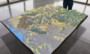
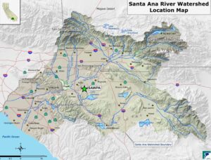
Santa Ana River Watershed Color Inspiration

3D Watershed Maps and Erin Brockovich

In the iconic movie Erin Brockovich, we saw the power of one person’s fight for justice concerning water contamination. But just as important is understanding 3D watershed maps to protect our planet’s health. Learn more about watershed maps and how human activities can impact our water resources to make a difference today.

Read More »
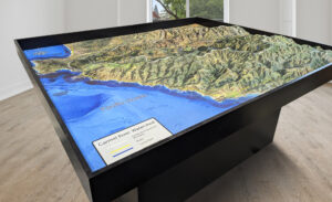
6-foot by 7-foot 3D terrain map of the Carmel River Watershed created for Monterey Peninsula Regional Park District, featuring satellite hybrid imagery, a waterproof surface, and an ADA-accessible pedestal base.

Watershed Maps

The watershed map revealed the intricate network of rivers and streams that nourish the land. It was like witnessing the lifeblood of the earth. Learn more about Watershed Maps and explore the interconnectedness of our planet’s ecosystems.

Read More »
New Orleans Louisiana 2020-USGS Topographic Map

Topographical Maps

With the topographical map in hand, I navigated through the rugged landscape like a seasoned explorer. The contour lines and elevation data provided a thrilling challenge. Learn more about Topographical Maps and elevate your sense of adventure.

Read More »

3D USGS Topographic Maps

Experience the great outdoors in your own home or office with WhiteClouds’ 3D USGS Topographic Maps. Explore the latest topography or journey through time with our historical collection. Learn more about USGS topographic maps and bring the thrill of adventure to your decor.

Read More »
Jaunita Arch Colorado 1960-USGS Topographic Map

USGS Historical Topographic Maps

Pouring over the USGS Historical Topographic Map, I was transported back in time, witnessing the changes that have occurred in the landscape over the years. It was like a journey through history. Learn more about USGS Historical Topographic Maps and discover the evolution of our world.

Read More »

Get a Free Quote