Park City 3D Topographic Map
We Build Custom 3D Topographic Maps
Did you know we make
3D raised-relief maps

and
3D raised-relief maps

3D Topographical maps are a fascinating way to explore and understand the world around us. These maps provide a detailed and accurate view of the Earth’s surface, including its geography, topography, and other natural features. They are an essential tool for hikers, geologists, surveyors, and anyone else who needs to understand the terrain they are navigating.
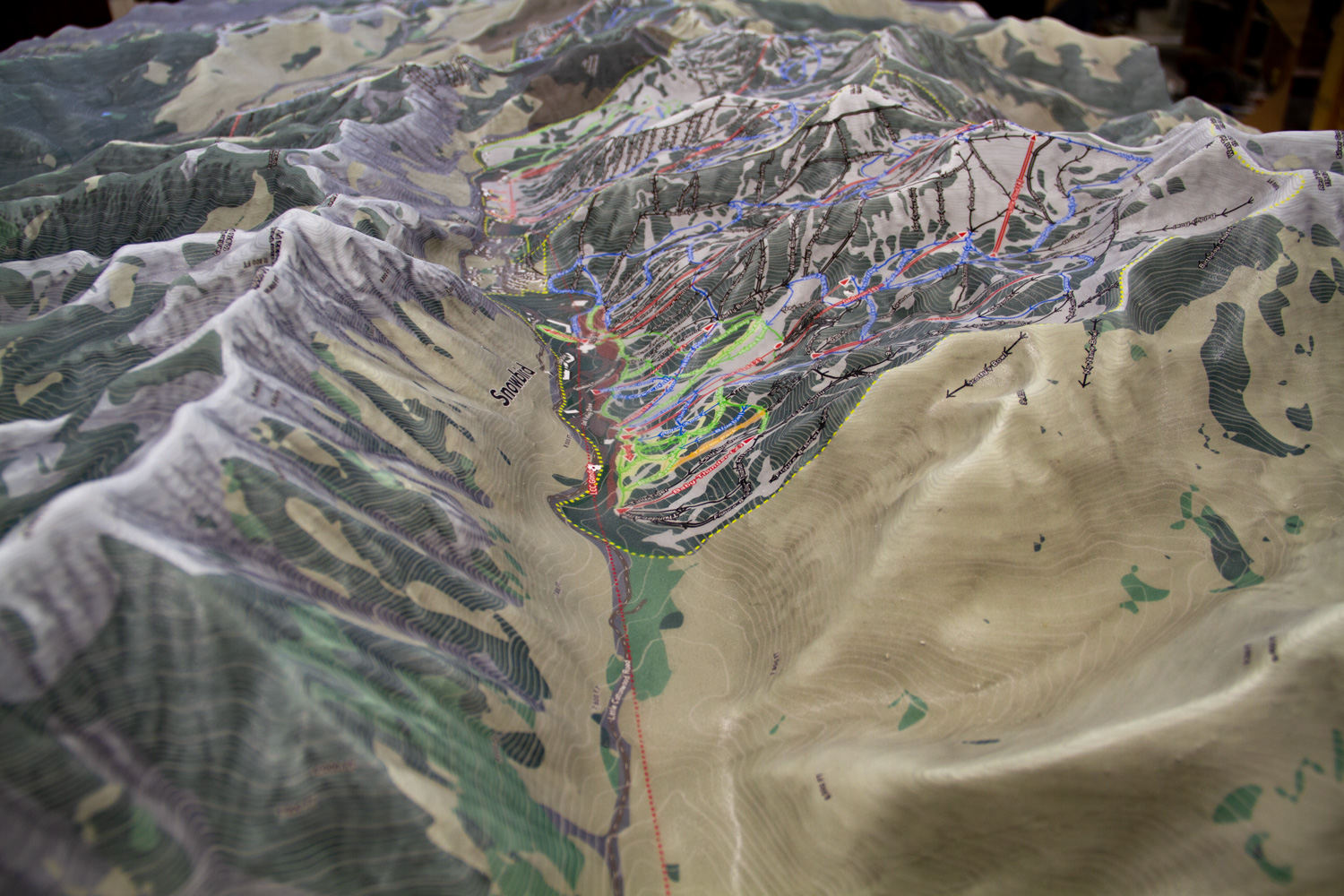
One particularly impressive 3D topographical map is this 7’x7′ map of the Park City area that shows all of the ski resorts in the region. This map is a beautiful and informative representation of the local terrain, providing a detailed view of the mountains, valleys, and other features that make the area such a popular destination for winter sports enthusiasts.
The map shows all of the major ski resorts in the Park City area, including Park City Mountain, Deer Valley, Brighton, Snowbird, and The Canyons. It also highlights the different runs and trails within each resort, as well as the lifts and other amenities that are available. This makes it an invaluable resource for anyone planning a ski trip to the area, as it allows them to get a clear sense of the terrain and plan their route accordingly.
In addition to its practical uses, the Park City 3D topographical map is also a work of art in its own right. The map is beautifully designed and 3D printed, with an overlay on high-quality latex vinyl, with vibrant colors and exquisite detail that make it a pleasure to look at. Whether you’re a seasoned skier or just an admirer of beautiful maps, the Park City 3D topographical map is sure to impress.
To learn more, view Topographic Maps.
Overall, 3D topographical maps are an essential tool for anyone looking to explore the natural world. Whether you’re planning a hike, conducting a survey, or just admiring the beauty of the Earth’s surface, these maps provide an unparalleled level of detail and accuracy that is unmatched by any other type of map. And if you’re lucky enough to get your hands on a large 50 square foot topographical map of the Park City area, you’ll have a stunning and informative representation of one of the world’s premier ski destinations at your fingertips.
Contact us today to learn more about our services and how we can help you achieve your goals.