How to Read a Terrain Map
We Build Custom 2D and 3D Terrain Maps
Did you know we make
3D raised-relief maps

and
3D raised-relief maps

Have you ever found yourself lost in the wilderness, unsure of which direction to take? Or maybe you’re planning a hiking or camping trip and want to ensure you’re fully prepared for the terrain ahead. Whatever your situation may be, learning how to read a terrain map can be a valuable skill that will help you navigate the outdoors with confidence.
In this blog post, we’ll explore the basics of reading a terrain map and provide you with some tips and tricks to help you get started.
Before we dive into the specifics of reading a terrain map, let’s first define what it is. A terrain map, also known as a topographic map, is a two-dimensional representation of a three-dimensional landscape. It shows the physical features of the terrain, including its elevation, contours, and waterways, among other details.
When looking at a terrain map, there are a few key things to keep in mind:
- Understanding the Legend: The legend is the key to understanding the symbols and colors used on the map. It will tell you what each symbol represents, as well as what the different colors indicate. For example, contour lines show elevation, and blue lines indicate bodies of water.
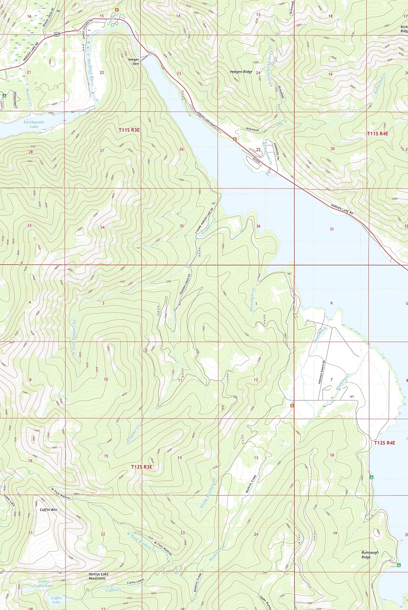
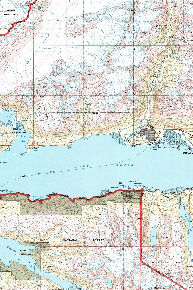
- Interpreting Contour Lines: Contour lines are one of the most important features of a terrain map. They show the elevation of the land, as well as its shape and slope. The closer together the contour lines, the steeper the terrain. When reading contour lines, it’s important to pay attention to the index contour lines, which are darker and usually labeled with their elevation.
- Identifying Waterways: Waterways are another important feature on a terrain map. They include rivers, streams, lakes, and other bodies of water. Blue lines on the map indicate water, while arrows show the direction of flow.
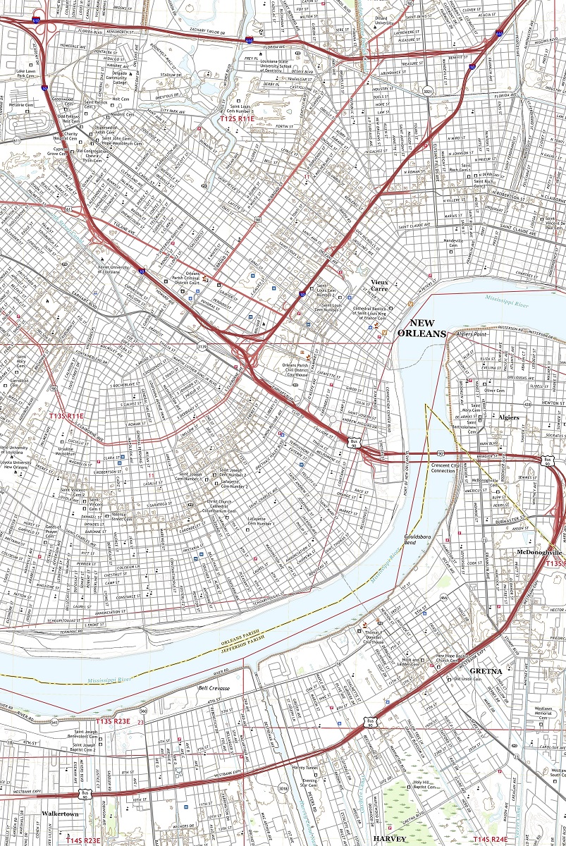
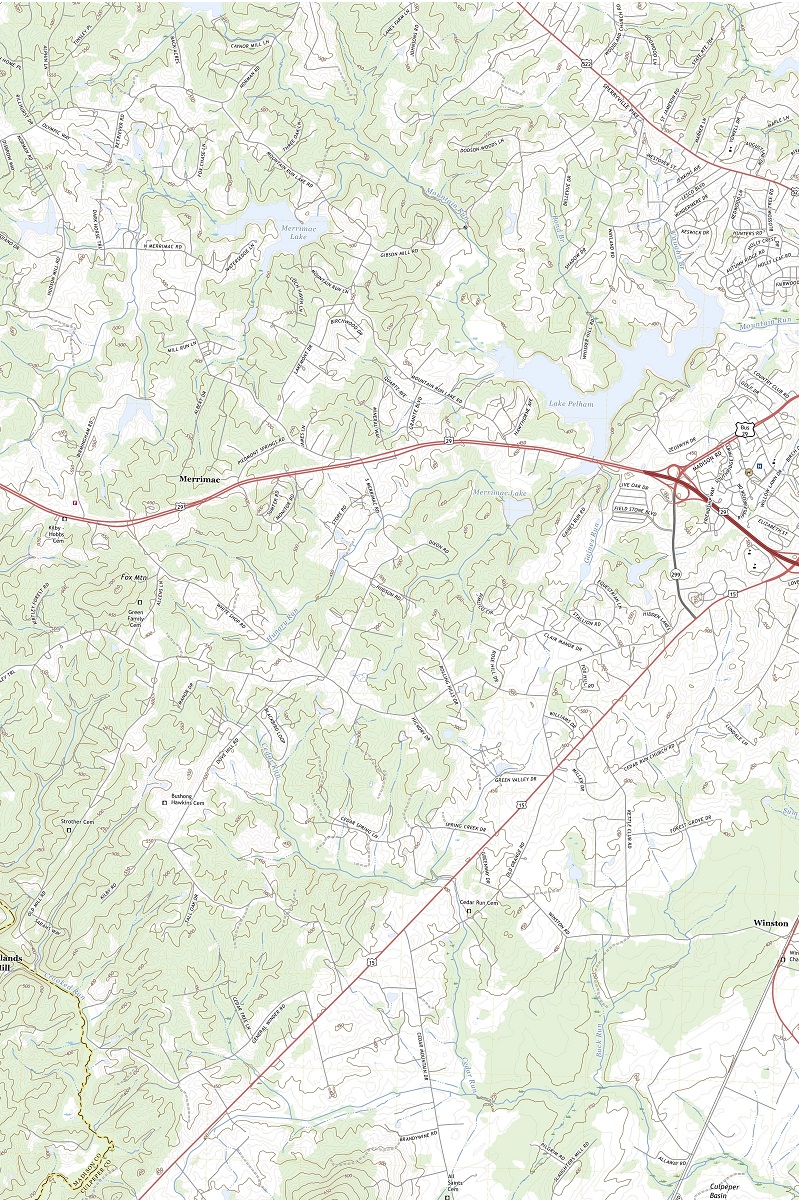
- Noting Man-Made Features: Terrain maps may also include man-made features, such as buildings, roads, and trails. These can be useful for navigation, as well as for planning a route.
Here are some tips and tricks to help you read a terrain map with ease:
- Orient the Map: Before you start reading the map, make sure it’s oriented correctly. The top of the map should be facing north, which will help you orient yourself in relation to the terrain.
- Start with the Big Picture: Begin by looking at the big picture of the terrain. Identify the major features, such as mountain ranges or bodies of water. This will give you a sense of the overall layout of the land.
- Take it Step by Step: Once you’ve identified the major features, start looking at the details. Pay attention to the contour lines and any changes in elevation. Note the location of waterways and man-made features, and use them to plan your route.
- Practice, Practice, Practice: Reading a terrain map takes practice. The more you do it, the easier it will become. Start with a simple map and work your way up to more complex ones as you gain confidence.
To learn more in-depth about both 2D terrain maps and 3D terrain maps, view Terrain Maps or Terrain Maps with a Google Maps Look.
Reading a terrain map can be a valuable skill for anyone who loves the outdoors. By understanding the basics of reading a terrain map and practicing your skills, you’ll be able to navigate the wilderness with confidence and explore new areas with ease. So grab a map, head outside, and start exploring the great outdoors!
Contact us today to learn more about our services and how we can help you achieve your goals.