- All
- Articles
- Blog
- Case Studies
- Featured
- Galleries
- Glossaries
- Products
- Services
- Top 10
- Videos
3D Maps Glossary
Welcome to our glossary on maps! Whether you're a cartographer, geographer, or simply someone who loves exploring the world, this resource is here to help ...
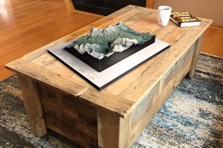
Raised Relief / Topographical 3D Map Models Custom Fabrication Services
We meld top-of-the-line technologies with professional cartography resources to create stunning raised relief terrain maps and models. Our expertise in 3D printing enables us to ...
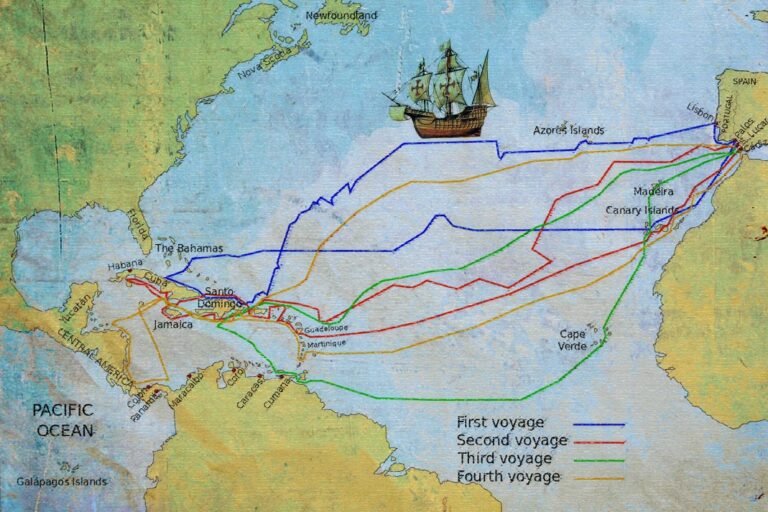
Charting New Waters: The Importance of Nautical Maps
Experience the thrill of navigating the open seas with the help of nautical maps and charts. From Christopher Columbus's exploration of the New World to ...
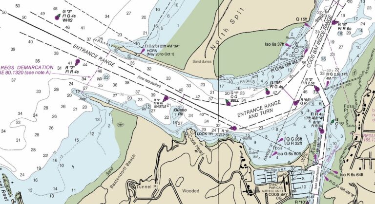
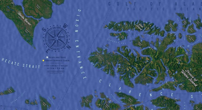
Nautical Maps
Gazing upon the nautical map, the intricacies of the ocean were revealed to me. Every contour, depth, and current was charted with precision. It was ...
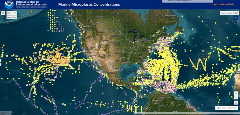
Mapping the Way: How NOAA Maps are Changing the Game
NOAA maps are revolutionizing the way we understand and predict weather and environmental conditions. From meteorologists to policymakers and everyday people, learn more about how ...
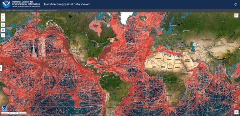
NOAA Maps
The NOAA map revealed the hidden treasures of the ocean - shipwrecks, canyons, and coral reefs. With its advanced technology and data, I felt like ...
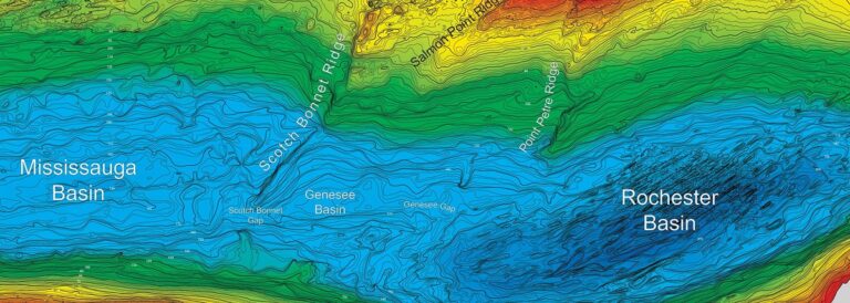
Bathymetric Maps
Delving into the depths of the ocean with the bathymetric map, I discovered a hidden world of canyons, trenches, and undersea volcanoes. It was like ...

The Art of Treasure Trove Mapping with Physical Maps
Unlock the magic of adventure and treasure hunting with physical maps. From "The Goonies" to "The Lord of the Rings," learn more about how physical ...
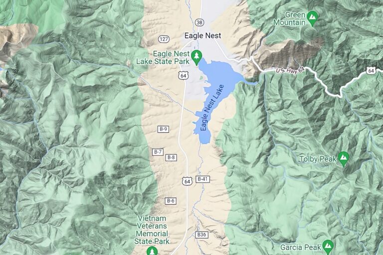
How to Read a Terrain Map
Get ready to explore the great outdoors with confidence! In this blog post, you'll learn more about terrain maps, including how to read their legends, ...
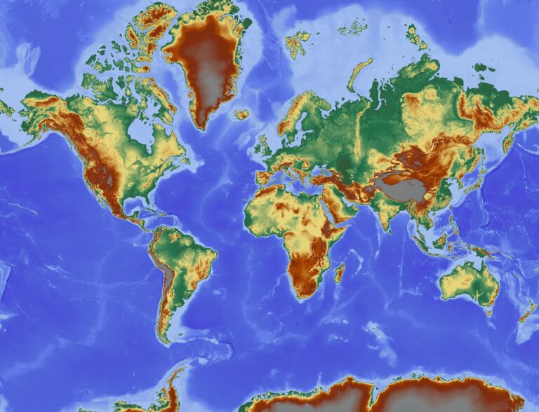
Physical Maps
The physical map revealed the earth's grandeur in breathtaking detail, with its mountains, deserts, and oceans depicted in stunning relief. It was a testament to ...
Terrain Maps
Studying the terrain map, the mountains and valleys came to life. I could almost feel the rush of the rapids and the crunch of the ...
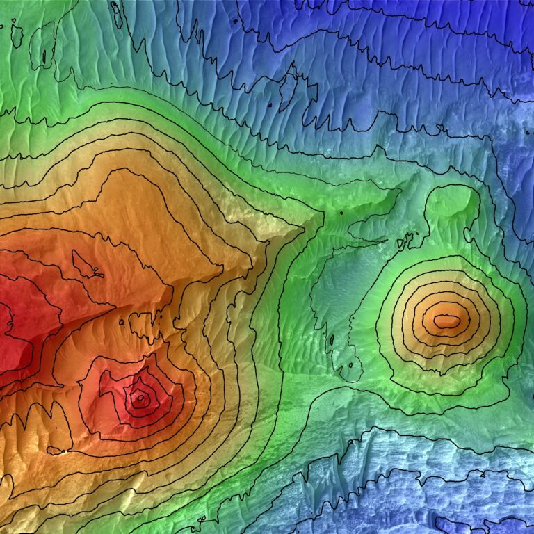
3D Elevation Maps Focus on Color at Different Heights
Learn more about elevation maps and how they are being taken to a whole new level with 3D rendering techniques and a focus on color ...
Elevation Maps
Examining the elevation map, I was transported to the mountaintops and the depths of the valleys. The colors and contours made the landscape come alive. ...

3D Contour Maps in the Movies
Experience the power of 3D contour maps in movies like The Bridge on the River Kwai, Everest, The Revenant, and The Martian. Learn more about ...
Contour Maps
The contour map revealed the secrets of the land, with every hill and valley depicted in stunning detail. I felt like I was flying over ...
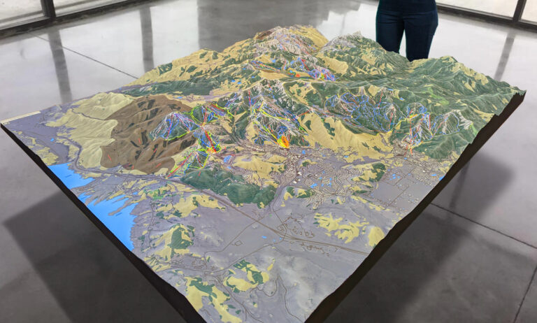
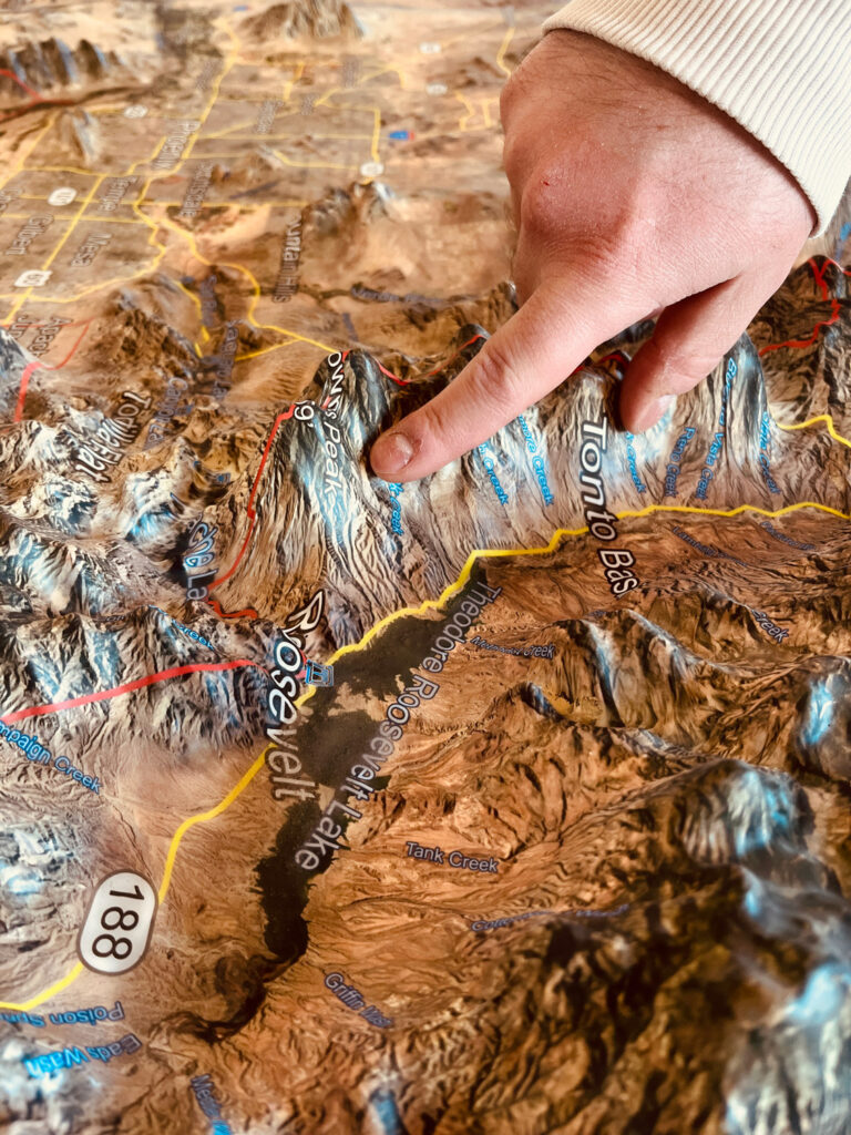
Park City 3D Topographical Map
The Park City 3D topographical map is a stunning representation of the local terrain that includes all of the major ski resorts in the area. ...
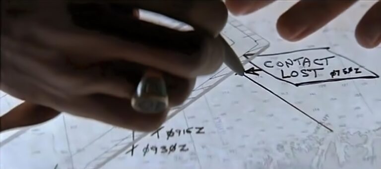
Hunt for Red October and 3D Topographical Maps
Join the exciting hunt for Red October with 3D topographical maps! Learn more about topographical maps and how they're used in military intelligence, geology, and ...
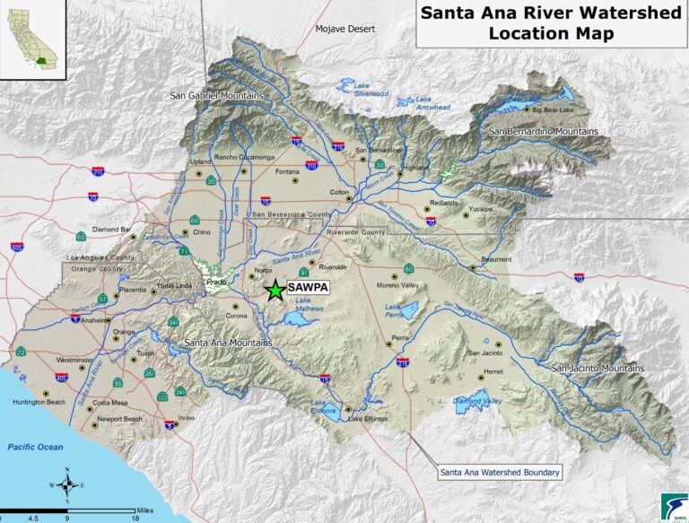
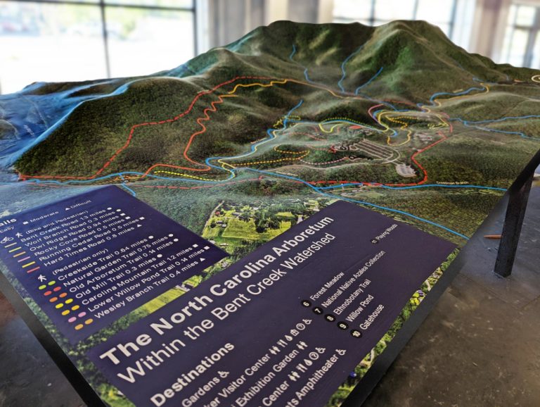
3D Watershed Maps and Erin Brockovich
In the iconic movie Erin Brockovich, we saw the power of one person's fight for justice concerning water contamination. But just as important is understanding ...
Watershed Maps
The watershed map revealed the intricate network of rivers and streams that nourish the land. It was like witnessing the lifeblood of the earth. Learn ...
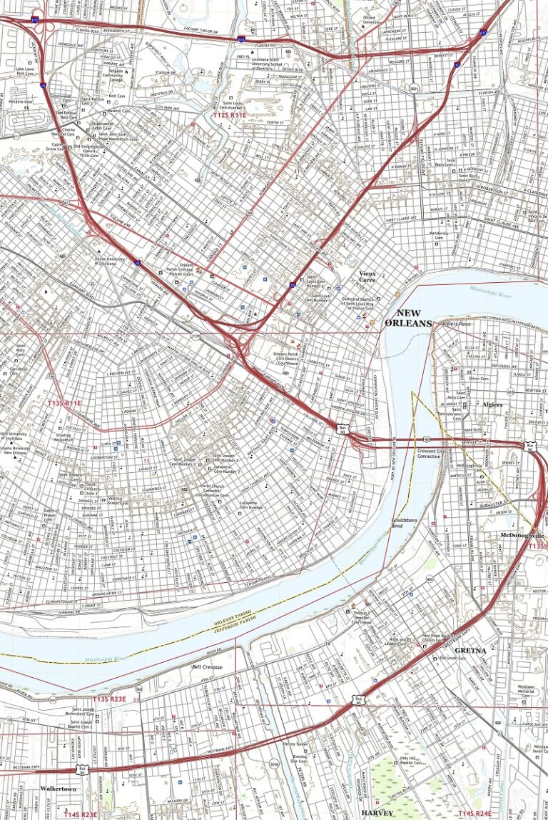
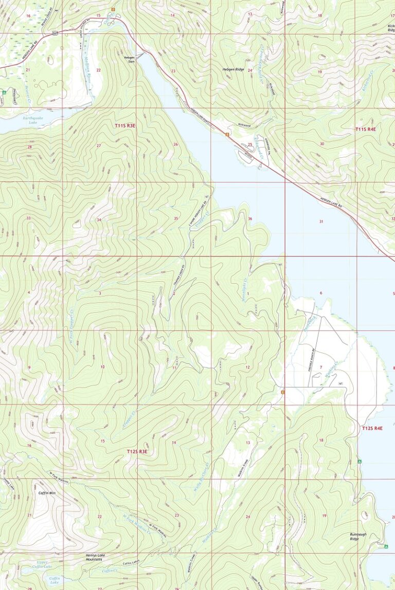
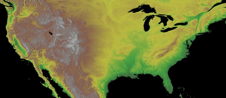
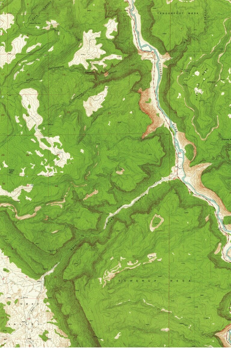
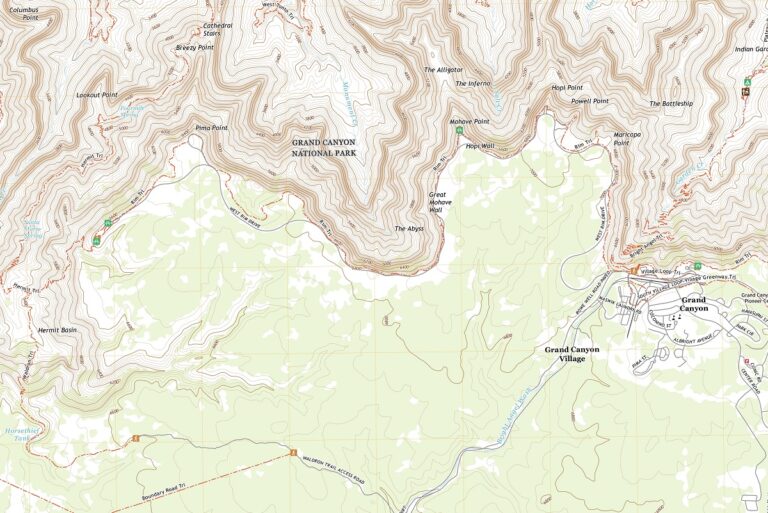
Topographical Maps
With the topographical map in hand, I navigated through the rugged landscape like a seasoned explorer. The contour lines and elevation data provided a thrilling ...
3D USGS Topographic Maps
Experience the great outdoors in your own home or office with WhiteClouds’ 3D USGS Topographic Maps. Explore the latest topography or journey through time with ...
USGS Historical Topographic Maps
Pouring over the USGS Historical Topographic Map, I was transported back in time, witnessing the changes that have occurred in the landscape over the years. ...
USGS Topographic Maps
With the USGS Topographic Map in hand, I felt like a modern-day explorer, navigating through the rugged terrain with ease. The level of detail was ...
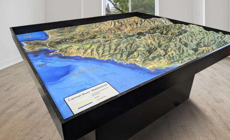
Raised Relief Map of Monterey Peninsula Park
Learn more about raised relief maps and how they can provide a powerful tool for visualizing and understanding landscapes. Check out this stunning 42 square ...
Raised Relief Maps
The raised relief map brought the mountains to life, with their peaks and valleys seemingly jumping off the page. It was a tactile experience like ...
Terrain Maps with Google Maps Look
Explore the world like never before with terrain maps! Discover the thrill of outdoor adventures by learning about the Earth's terrain. Learn more about terrain ...
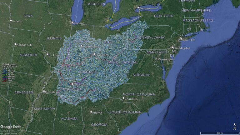
Ohio Watershed Maps
Unearth the secrets of Ohio's intricate watersheds! From the sprawling Ohio River Basin to the majestic Lake Erie Basin, discover the lifelines that sustain the ...
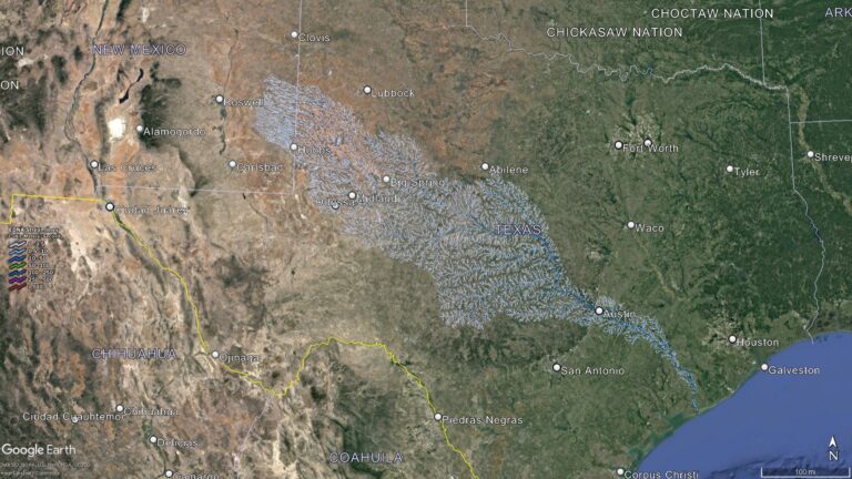
Texas Watershed Maps
Journey through Texas's vast landscapes via its intricate watersheds! From the Rio Grande's mysteries to the Colorado River's vitality, uncover the Lone Star State's water ...