Charting New Waters: The Importance of Nautical Maps
We Build Custom 2D and 3D Nautical Maps
Did you know we make
3D raised-relief maps

and
3D raised-relief maps

Nautical maps and charts have been used by seafarers for centuries to navigate through the unpredictable and often dangerous waters of the world’s oceans. These maps have played a critical role in some of the most famous ocean navigational journeys in history, allowing explorers to chart their courses and avoid hazards along the way.
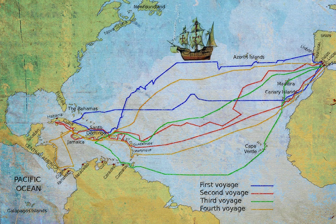
Christopher Columbus’s 1492 voyage across the Atlantic is one of the most well-known explorations in history. To navigate through the unknown waters, Columbus relied heavily on Portolan maps, hand-drawn by Mediterranean sailors. These maps showed the locations of ports, cities, and landmarks along the coastlines, helping Columbus to navigate through the uncharted waters of the Atlantic. While not entirely accurate, these maps were instrumental in Columbus’s discovery of the New World.
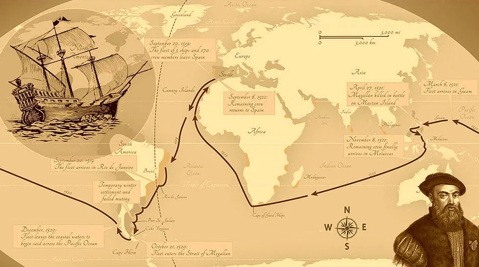
Ferdinand Magellan’s voyage around the world in the 16th century was the first successful circumnavigation of the globe. Magellan and his crew relied heavily on nautical charts and maps to navigate the Pacific Ocean, where they searched for a westward route to the Spice Islands. Like Columbus, Magellan also used the Portolan map to navigate, which showed the locations of ports and landmarks along coastlines. These maps helped Magellan to successfully navigate through the Pacific and become the first to complete a circumnavigation of the globe.
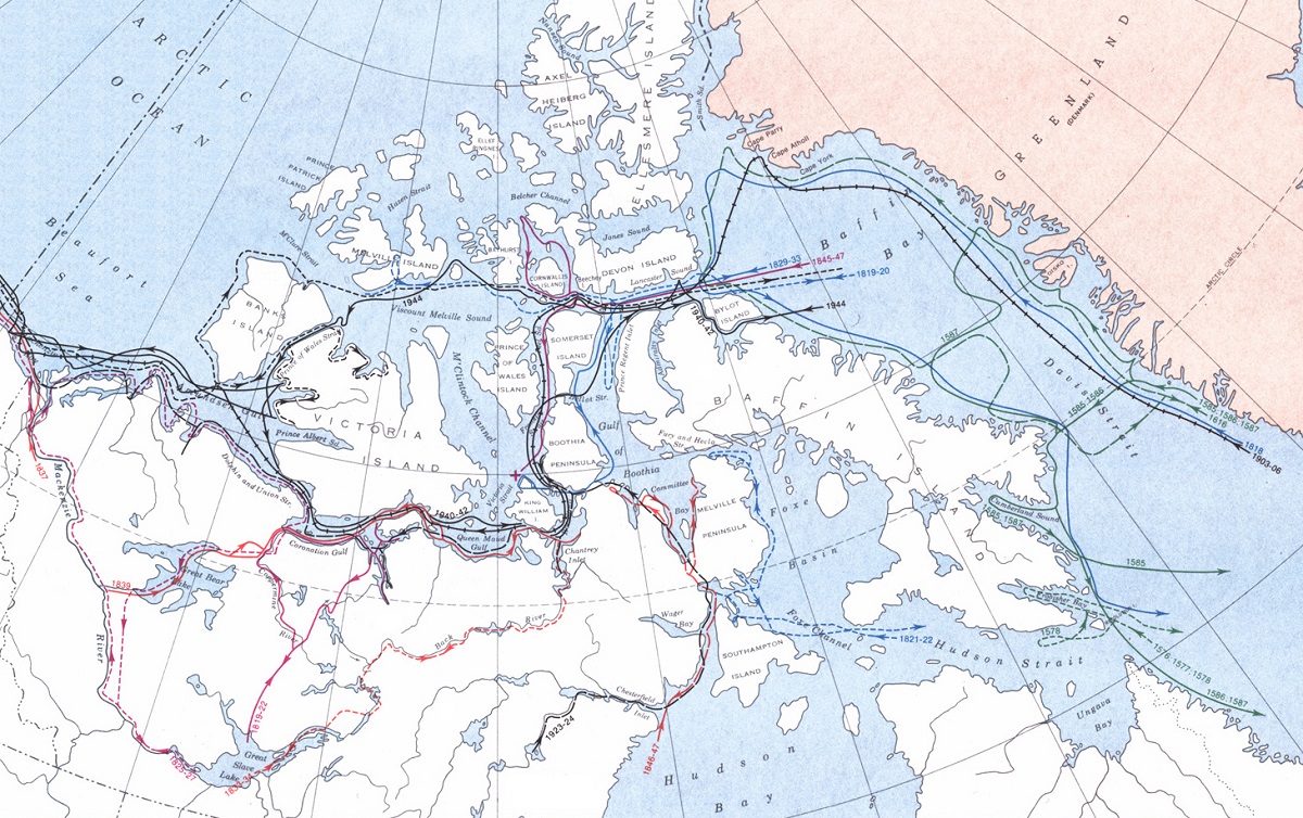
The Northwest Passage is a sea route that connects the Atlantic and Pacific Oceans through the Arctic Ocean. For centuries, explorers tried to find a route through this treacherous waterway, but it wasn’t until the early 20th century that it was successfully navigated. Roald Amundsen’s 1906 expedition was the first to successfully navigate the Northwest Passage, and nautical charts and maps were critical to his success. These maps showed the locations of icebergs, currents, and other hazards, allowing Amundsen to navigate through the dangerous waters of the Arctic and complete the journey.
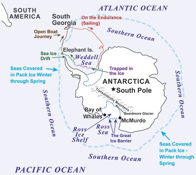
Ernest Shackleton’s early 20th-century attempt to cross the Antarctic continent was one of the most challenging explorations in history. Despite facing harsh weather conditions and equipment failures, Shackleton and his crew were able to use nautical charts and maps to navigate through the icy waters of the Antarctic. These maps showed the locations of ice floes, currents, and other hazards, allowing Shackleton to successfully navigate through some of the most challenging waters in the world.
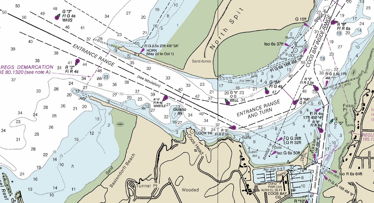
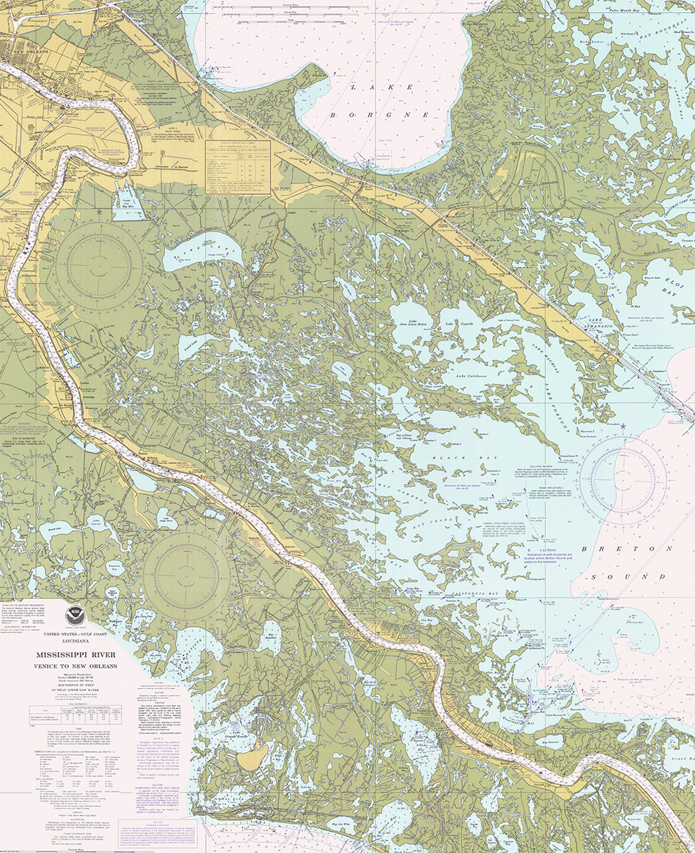
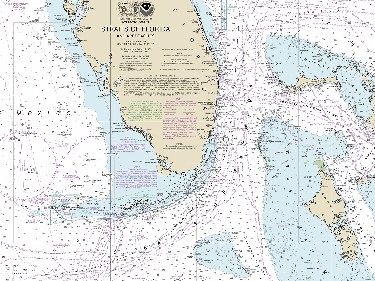
Nautical maps and charts are not only important to famous explorers but also to modern-day sailors. The National Oceanic and Atmospheric Administration (NOAA) provides some of the most detailed and accurate nautical maps available. NOAA’s charts show water depths, shoreline details, and other navigational features that are critical to the safety of commercial and recreational vessels alike. They are essential for safe navigation and protecting life and property at sea.
Moreover, nautical maps and charts are also vital for marine research and conservation efforts. Scientists use these maps to study the ocean floor, ocean currents, and marine life habitats. Accurate nautical charts and maps are also critical for monitoring and managing natural resources such as fish stocks, oil and gas reserves, and mineral deposits.
To learn more in-depth about 2D and 3D nautical maps, view Nautical Maps.
In conclusion, nautical maps and charts have played a critical role in some of the most famous ocean navigational journeys throughout history. From Columbus’s voyage to the New World and Magellan’s circumnavigation of the globe to Amundsen’s navigation of the Northwest Passage.
Contact us today to learn more about our services and how we can help you achieve your goals.