
Texas Watershed Maps
Texas, with its expansive landscapes that range from sun-kissed beaches to arid deserts and rolling plains to dense forests, confirms its geographical diversity. This diversity is mirrored in its water systems, making the Texas watershed maps more than just a tool – they’re a window into the state’s ecological soul. In this in-depth exploration, we’ll traverse the vast terrains of Texas, guided by its watershed maps, uncovering the significance, threats, and conservation efforts centered around its vital water resources.
Understanding the Vital Role of Watersheds
At its essence, a watershed, also commonly known as a drainage basin, is a distinct geographical region responsible for directing all its accumulated rainfall and melted snow towards smaller water bodies such as creeks and streams. These, in turn, flow into larger rivers, eventually making their way to ultimate outflow destinations which could be reservoirs, sprawling bays, or even vast seas. The role of watersheds is paramount in harnessing and managing water resources, a fact that becomes even more pronounced in a state as geographically diverse as Texas. Here, the varying terrains and climates mean that water-related needs and challenges can differ quite starkly from one region to another, underlining the importance of these natural drainage systems.
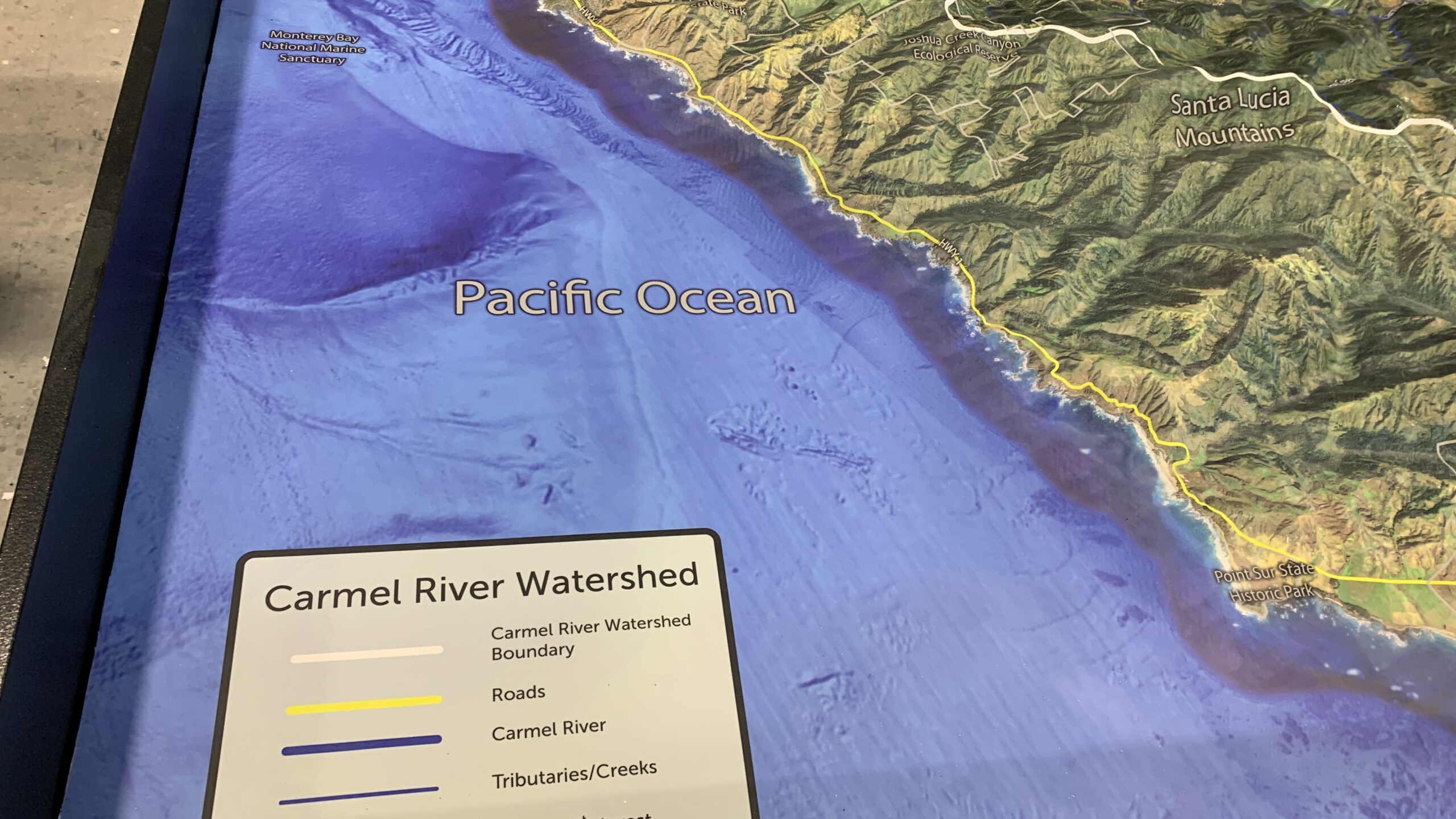
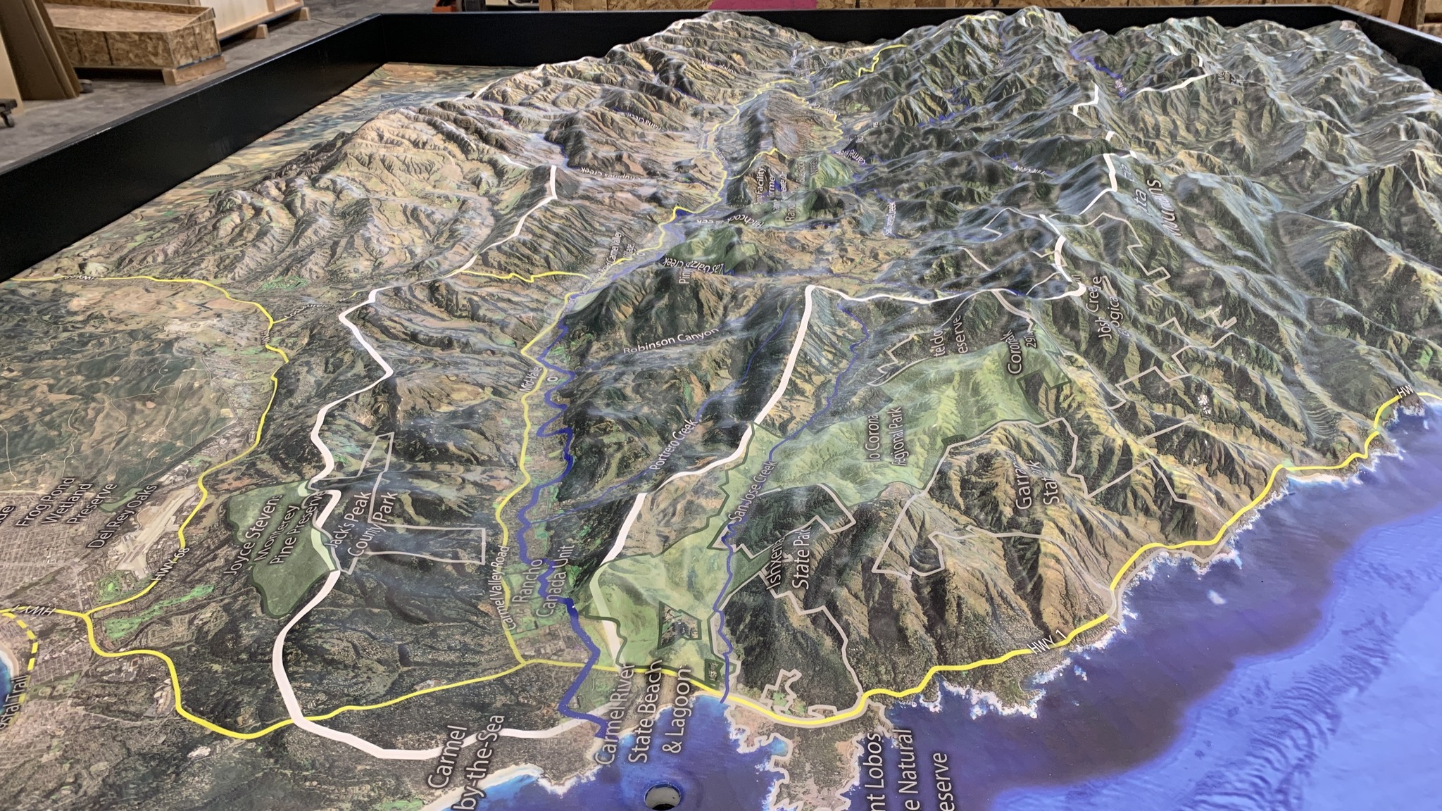
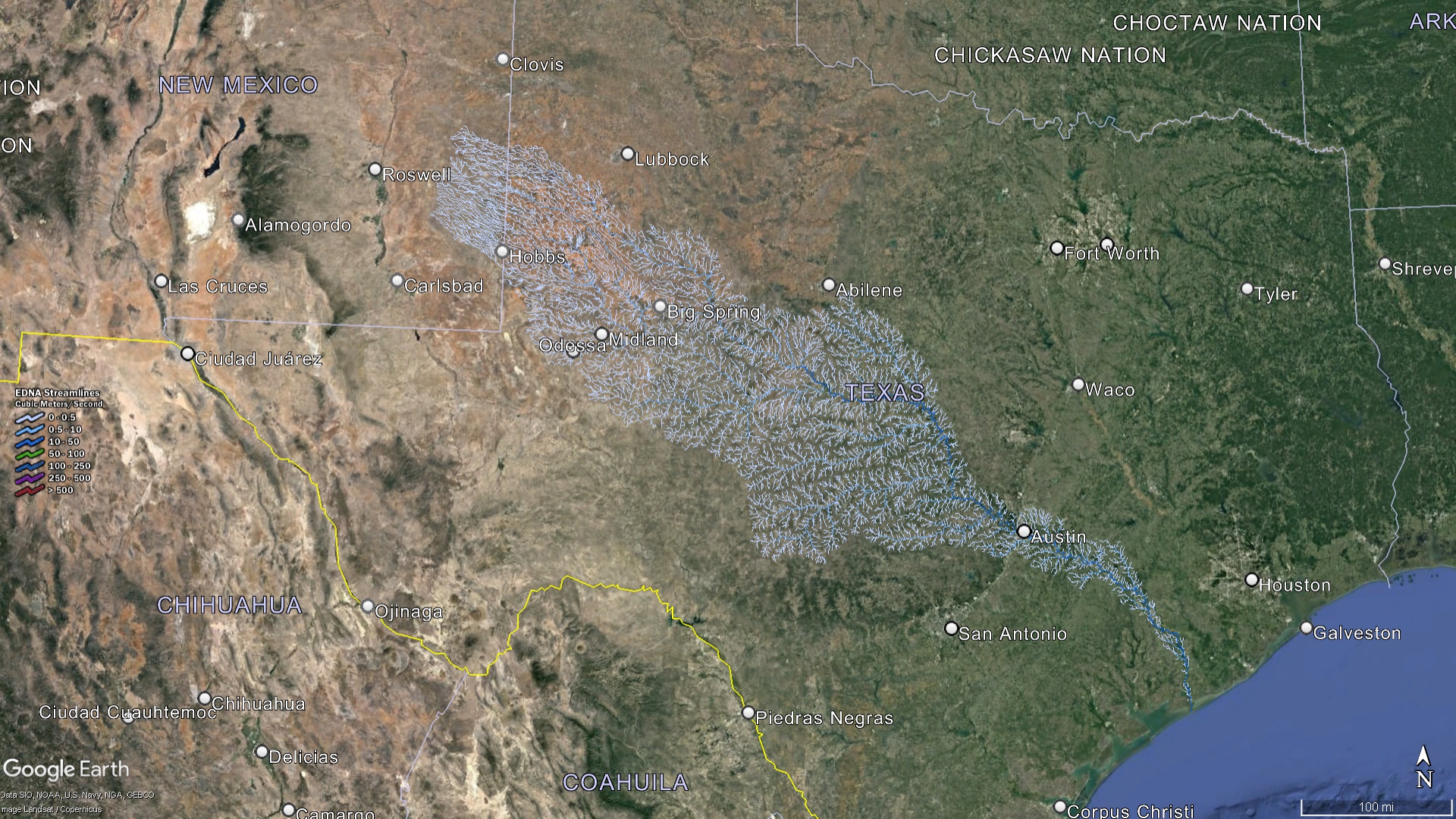 Texas Watershed Streams
Charting the World of Texas Watershed Maps
Offering an intricate bird’s eye view, Texas watershed maps intricately chart out the extensive array of watersheds dotting the state, illuminating their distinct features and the roles they play in Texas’s ecological and human tapestry:
Rio Grande Basin
Beyond its role as a defining natural boundary between Texas and Mexico, the Rio Grande River, along with its many tributaries, oversees the drainage of a substantial portion of West Texas. Its waters ultimately converge into the Gulf of Mexico, making this basin a crucial hub both ecologically and in the larger geopolitical landscape.
Colorado River Basin
Distinct from the famed Colorado River that carved out the Grand Canyon, Texas’s own Colorado River holds the distinction of being the longest river that flows exclusively within the state’s borders. It’s a lifeline for many urban areas, notably the city of Austin.
Guadalupe River Basin
Encompassing the picturesque Texas Hill Country, this basin not only boasts of awe-inspiring landscapes but is also a significant player in the state’s tourism and recreational activities.
Trinity River Basin
With its course running through the bustling metropolises of Dallas and Fort Worth, the Trinity River isn’t just a natural landmark. It’s indispensable for catering to the extensive water requirements of North Texas.
Coastal Basins
Texas’s vast coastline, stretching alongside the Gulf of Mexico, is punctuated with a series of watersheds. These areas are teeming with life, upholding a rich tapestry of biodiversity and forming the backbone of the state’s fisheries industry.
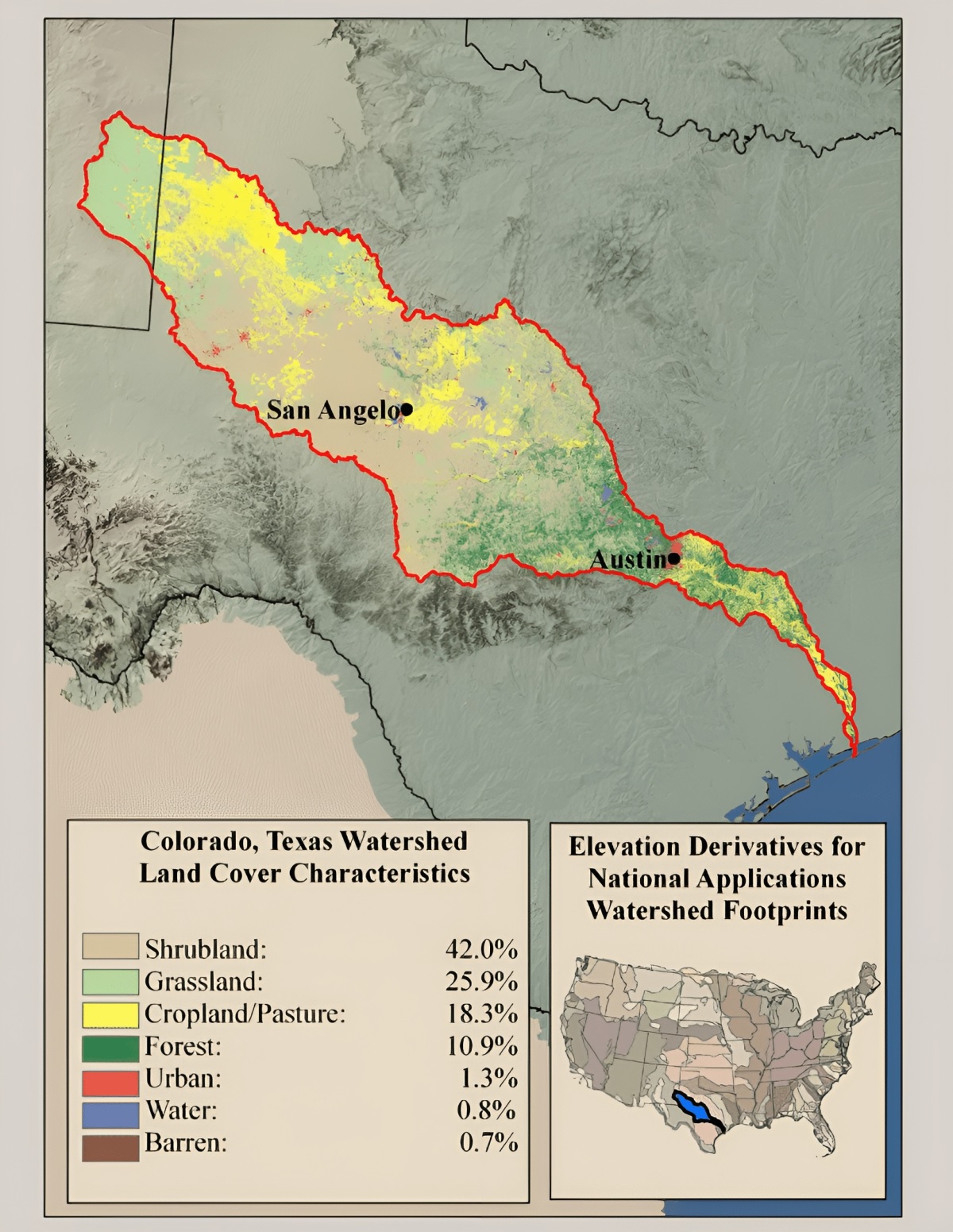
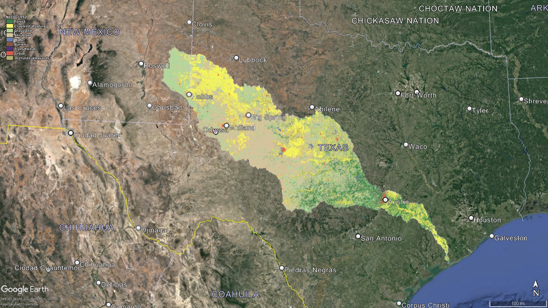 Texas Watershed Land Characteristics
The Indispensable Role of Watersheds in Texas
In the vast expanse of Texas, watersheds serve as more than mere channels for water; they function as essential lifelines, integral to the state’s socio-economic and environmental fabric:
Water Supply: The state’s bustling metropolitan areas, namely Houston, Dallas, Austin, and San Antonio, heavily rely on watersheds to meet their varied needs. Whether it’s providing potable drinking water to millions, irrigating vast agricultural lands, or fulfilling the requirements of diverse industrial operations, watersheds are at the heart of it all.
Economic Backbone: Watersheds play a pivotal role in underpinning several of Texas’s key industries. They support and sustain everything from large-scale agriculture and traditional ranching practices to burgeoning tourism sectors and the vibrant fishing communities along the coastlines.
Biodiversity Hubs: Texas’s watersheds are microcosms of the state’s varied ecosystems. Nestled within their confines, one finds a rich tapestry of life. From fish navigating the rivers to mammals roaming the waterside terrains, the biodiversity these watersheds support is vast and varied.
Centers for Recreation and Tourism: Many of Texas’s rivers, like the picturesque Guadalupe and the lively Comal, are hubs for recreational activities. They draw both locals and tourists alike, offering adventures ranging from tubing expeditions and serene kayaking trips to exhilarating fishing excursions.
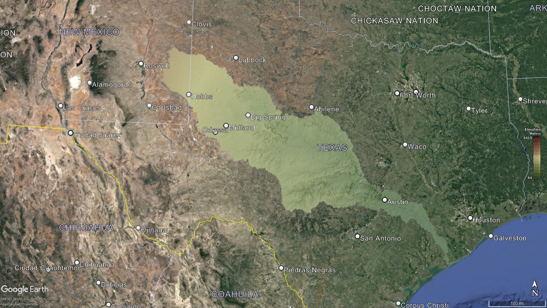 Texas Watershed Elevation
Challenges Confronting Texas’s Watersheds
While these watersheds have been the backbone of Texan life and progress for countless generations, the contemporary era brings with it a slew of challenges:
-
Pollution: The effects of extensive agricultural activities, unchecked industrial waste disposal, and the pressures of urban expansion have coalesced, leading to heightened levels of pollutants in many watersheds. This escalating contamination threatens not just the health of the state’s residents but also the myriad aquatic species that call these watersheds home.
-
Over-extraction: The demands of rapidly expanding urban centers, coupled with industrial growth, often result in water being extracted from watersheds at unsustainable rates. This over-extraction can severely deplete these critical resources, often faster than they can naturally rejuvenate.
-
Climate Change: The specter of climate change looms large, bringing with it the twin threats of droughts and floods. Altered precipitation patterns, coupled with increasing temperatures, pose significant challenges to the state’s watersheds.
-
Changing Land Use Patterns: The march of urbanization, coupled with shifting agricultural practices, can profoundly disrupt the natural dynamics of watersheds. These changes often result in altered water flows, reduced recharge rates, and heightened vulnerability to pollutants.
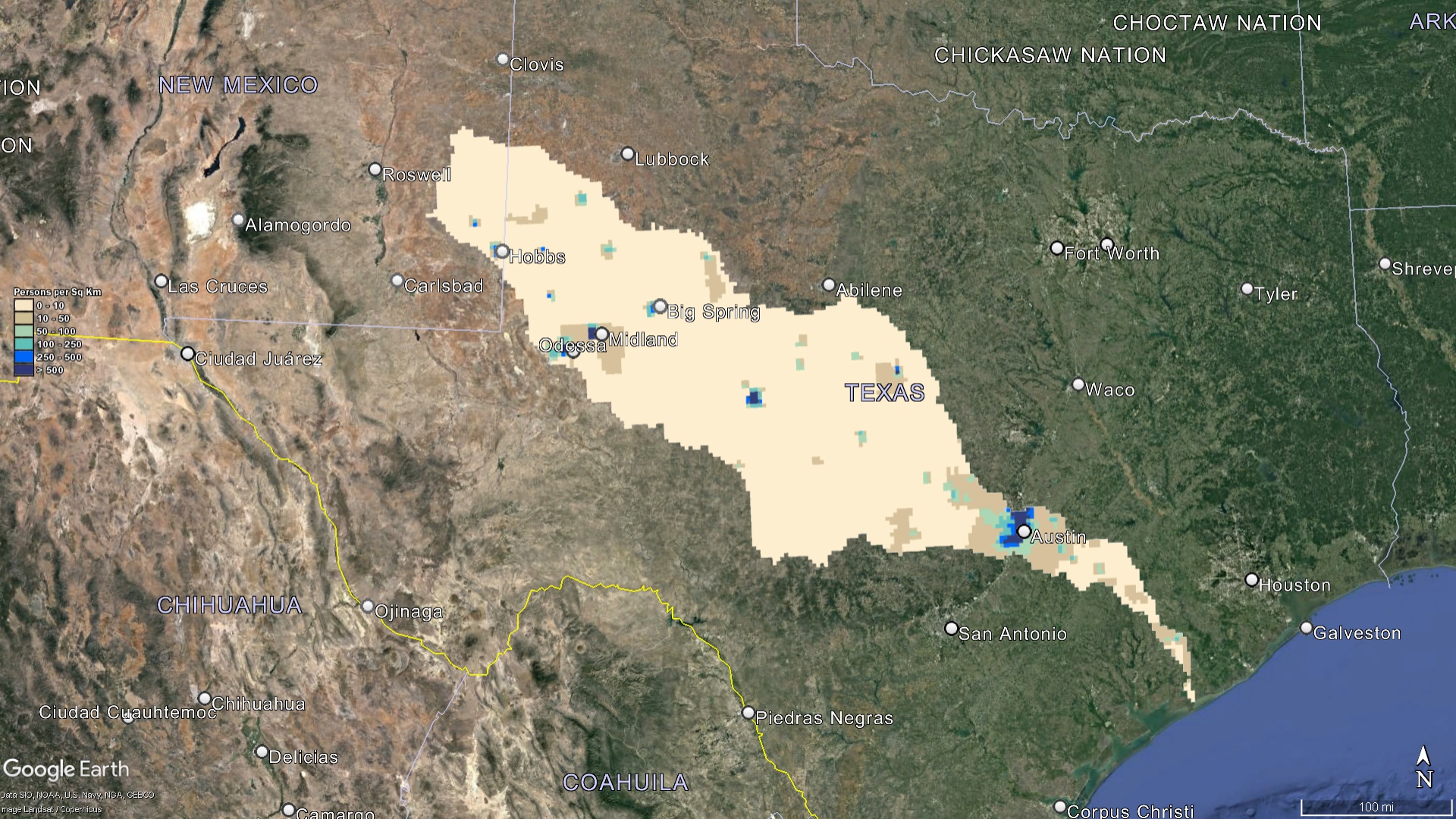 Texas Watershed Population
Galvanized Conservation Efforts for Texas’s Watersheds
Fully cognizant of the critical importance of its watersheds, Texas has embarked on numerous initiatives aimed at their preservation and rejuvenation:
-
Education: A multi-pronged educational approach has been adopted across the state. Schools, local communities, and non-profit organizations are at the forefront, championing the cause of watersheds through awareness programs and interactive sessions.
-
Restoration Endeavors: Numerous projects have been initiated with the singular goal of restoring the health and vitality of Texas’s watersheds. These efforts span habitat rehabilitation, pollution mitigation, and the promotion of sustainable practices in both agriculture and industry.
-
Regulatory Framework: Texas has instituted a robust framework of laws and guidelines, aimed at ensuring the judicious use of water, fostering conservation initiatives, and imposing stringent regulations on potential pollutants.
-
Water Quality Surveillance: Understanding the dynamic nature of watersheds, regular monitoring mechanisms have been put in place. These efforts ensure that any deterioration in water quality, or the emergence of contamination hotspots, is swiftly identified and addressed.
 Texas Watershed Land Percentages
Mapping the Future
Texas watershed maps are not static; they evolve as the state’s needs, challenges, and knowledge grow. These maps serve multiple purposes – from guiding development and land use decisions to aiding conservation strategies and research.
In conclusion, Texas’s watersheds confirm the state’s ecological richness and diversity. Protecting and nurturing these watersheds is not just an environmental imperative but also crucial for the continued prosperity and well-being of all Texans. As we stand at the crossroads of development and conservation, Texas watershed maps offer a guiding light, helping us navigate a path that ensures both progress and preservation. Whether you’re a Texan or an enthusiast of hydrology, understanding the intricacies of Texas’s watersheds offers a deeper appreciation of the Lone Star State’s dynamic landscapes and the life they sustain.
Check out our Watershed Maps for more information on Texas Watershed Maps. You can also learn more at our 3D Maps Learning Center.
Contact us today to learn more about our 3D services and how we can help you achieve your goals.