
Unveiling Arkansas: A Journey through the 3D Topographic Map
Arkansas, the Natural State, is a land of hidden gems, where rugged mountain ranges, meandering rivers, and lush forests paint a picturesque landscape. In this comprehensive exploration, we embark on a captivating journey through the 3D topographic map of Arkansas, peeling back the layers of its geographical wonders and unraveling the intricate stories etched into its terrain.
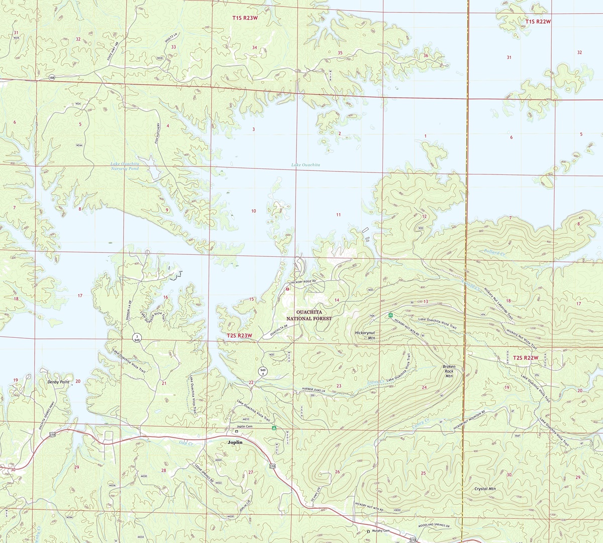 3D Topographic Map of Arkansas-McGraw-Mountain, 1:24,000 quad, 2020, USGS
The World of 3D Topographic Maps
Before we delve into the mesmerizing world of Arkansas’s topographic map, let’s first grasp the essence of 3D topography. These innovative maps provide an immersive representation of the Earth’s surface, offering a lifelike portrayal of elevation, terrain, and natural features. Unlike traditional topographic maps, 3D maps bring Arkansas’s landscapes to life, allowing us to explore the state’s remarkable geography in unprecedented detail.
The Vertical Dimension-Elevation Unveiled: One of the most striking features of 3D topographic maps is their ability to represent elevation with unmatched precision. In Arkansas, where elevation varies from the Ozark Mountains to the lowlands of the Mississippi Delta, this dimension is crucial to understanding the state’s diverse landscapes. From the lofty peaks to the lowest valleys, 3D maps vividly depict the vertical dimension of Arkansas’s topography.
Terrain Visualization-A New Perspective: 3D topographic maps offer an immersive experience by bringing Arkansas’s terrain into focus. Every ridge, valley, and river is presented in stunning detail, allowing us to appreciate the nuances of the state’s geography. With this perspective, we can uncover hidden features, explore the effects of erosion, and grasp the interconnectedness of Arkansas’s landscapes in ways that traditional maps simply cannot capture.
 3D Topographic Map
The Ouachita Mountains
Rugged Peaks and Wilderness Awaits: Our journey through Arkansas’s 3D topographic map commences in the western part of the state, where the Ouachita Mountains rise with timeless majesty. These rugged peaks, including Rich Mountain, offer a dramatic vista of untamed wilderness and captivating natural beauty.
As we explore the 3D map, the Ouachita Mountains come alive, with elevation gradients showcased through rich colors and intricate contours. Rich Mountain, the highest point in the range, stands tall, inviting adventurers with its 3D prominence. This immersive experience allows us to virtually traverse these peaks and valleys, offering a glimpse of the Ouachita Mountains’ grandeur.
The Ouachita National Recreation Trail: The 3D topographic map vividly portrays the Ouachita National Recreation Trail, a renowned long-distance hiking trail that meanders through the heart of the Ouachita Mountains. Hikers and nature enthusiasts can virtually trek along this scenic route, immersing themselves in the terrain’s intricacies. The 3D visualization grants us a unique perspective on the trail’s challenging ascents, exhilarating descents, and panoramic vistas that beckon from the peaks.
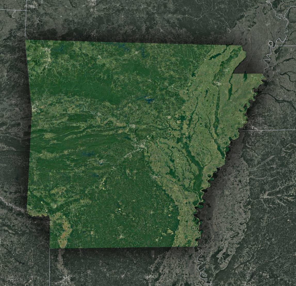 Satellite Map of Arkansas
The Ozark Mountains
Ancient Ranges and Rugged Beauty: Moving northward across Arkansas’s 3D map, we enter the Ozark Mountains, a region characterized by ancient mountain ranges, deep valleys, and lush forests. This geological marvel is brought to life through the 3D representation, showcasing the gradual elevation changes and the hidden treasures of the Ozarks.
The Ozark Mountains’ winding rivers, such as the Buffalo National River, are unveiled in striking detail. Elevation contours illustrate the dramatic bluffs, rugged terrain, and serene beauty that define this region’s topography.
The Buffalo National River-A Scenic Treasure: Arkansas’s 3D topographic map also highlights the Buffalo National River, one of America’s first designated national rivers. The map provides a unique perspective on this scenic treasure, allowing us to explore the river’s course, meandering bends, and the towering bluffs that flank its banks. Understanding the river’s influence on the Ozark Mountains’ topography is essential to appreciating the region’s geological significance.
The Influence of Waterways
River Systems and Hydrological Wonders: Arkansas’s 3D topographic map accentuates the intricate network of rivers and streams that crisscross the state. These waterways are an essential element in shaping the terrain, as their meandering paths are revealed in striking detail. Understanding their impact on Arkansas’s topography is crucial to appreciating the region’s beauty and ecological significance.
The Mississippi Alluvial Plain
Expansive Lowlands and Riverine Ecosystems: Our journey concludes in the eastern part of Arkansas, where the 3D topographic map unveils the Mississippi Alluvial Plain, a region characterized by vast lowlands, fertile soil, and intricate riverine ecosystems.
This portion of the map showcases the flat expanses of the Mississippi floodplain and the intricate web of rivers, bayous, and oxbow lakes that define it. Elevation contours illustrate the dynamic relationship between the land and water, highlighting the role of the Mississippi River and its tributaries in shaping this region’s unique topography.
The Geographical Tapestry of Arkansas
The Dynamic Interplay of Land and Water: Throughout our exploration, it becomes clear that water, in all its forms, plays a central role in shaping Arkansas’s topography. Rivers, streams, and waterfalls are highlighted in the 3D map, offering insight into the state’s hydrological systems and the impact of water on the land.
The geological history of Arkansas is also intricately woven into its 3D topographic map. From the ancient Ouachita Mountains to the timeless beauty of the Ozark Mountains and the dynamic riverine ecosystems of the Mississippi Alluvial Plain, the 3D visualization tells a story of millions of years of geological evolution.
As we conclude our journey through Arkansas’s 3D topographic map, we depart with a profound appreciation for the state’s diverse and captivating landscapes. From the heights of the Ouachita and Ozark Mountains to the expanses of the Mississippi Alluvial Plain, Arkansas’s topography is a confirmation to its rich natural heritage.
Understanding Arkansas’s 3D topographic map isn’t just about navigation; it’s an invitation to immerse yourself in the state’s geological history, ecological diversity, and cultural significance. Whether you are an intrepid adventurer, a geography enthusiast, or simply someone eager to explore the wonders of the natural world, Arkansas’s 3D topography invites you to embark on a journey of discovery and wonder, where the landscape comes alive in three dimensions.
Check out WhiteClouds’ 3D Topographic Maps for more information on a topographic map of Arkansas. 2D Canvas Print Satellite Maps of Arkansas are also available.
Contact us today to learn more about our 3D services and how we can help you achieve your goals.