
Unveiling the Depths: Exploring the Canadian Mining Topographical Model
In the remote reaches of Northern British Columbia lies a confirmation to human ingenuity and geological marvels – the Canadian Mining 3D Topographical Model. Crafted with precision and passion by WhiteClouds, this intricate model offers a window into the dynamic world of block cave mining operations. Join us as we dive into the depths of this remarkable creation, from its fabrication to its role in shaping community dialogue and understanding.

Crafting a Vision: Fabrication of the Canadian Mining Topographical Model
At the intersection of innovation and necessity, the Canadian Mining Topographical Model emerges as a beacon of technological prowess. Fabricated by the skilled artisans at WhiteClouds, this model represents more than just a physical replica; it is a gateway to understanding the complexities of modern mining operations in Northern British Columbia.
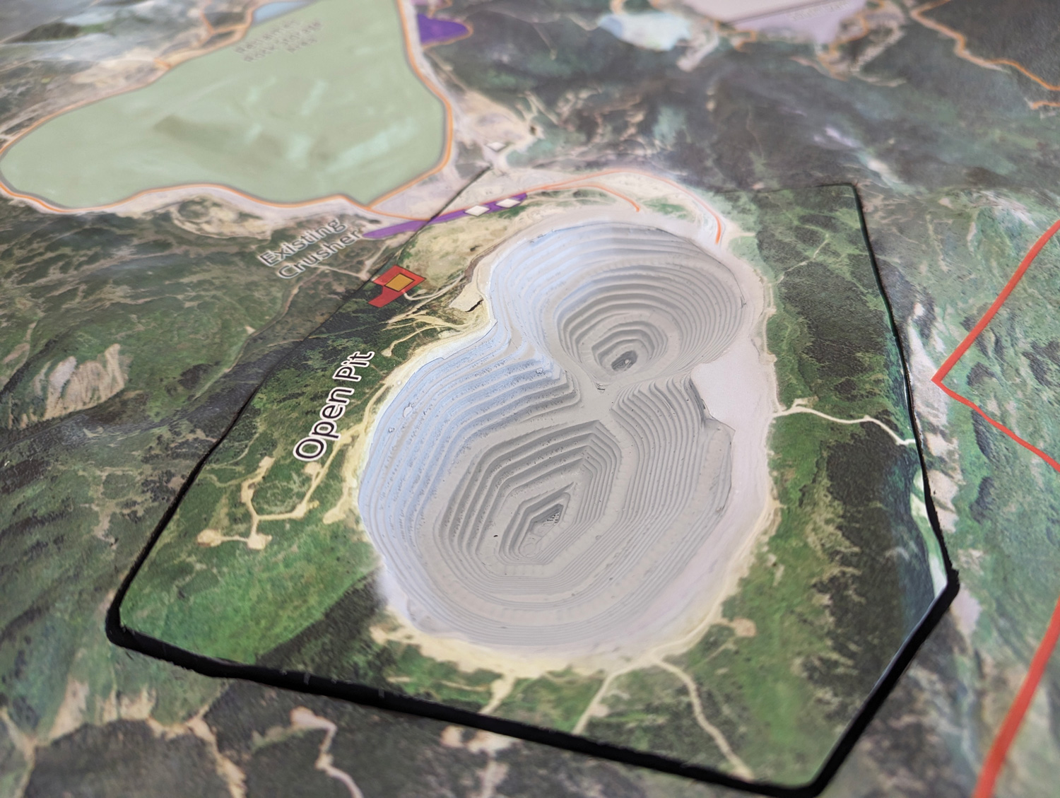
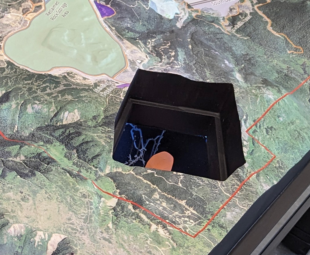
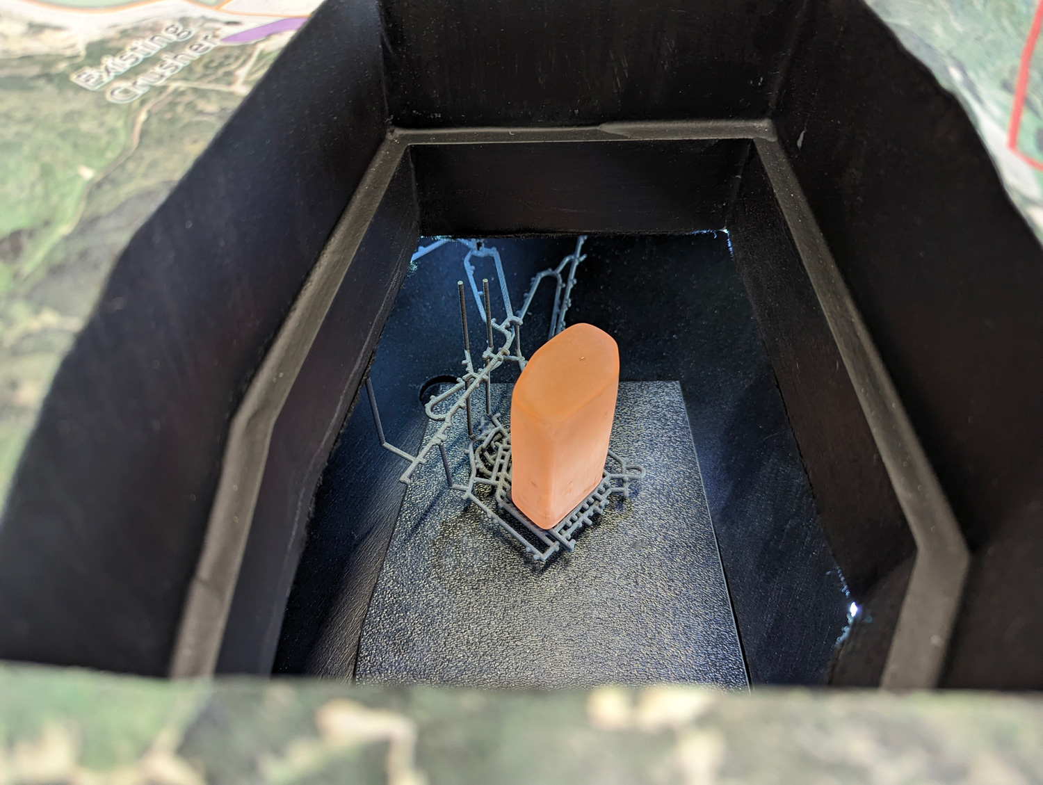
Measuring an impressive 3 feet by 5 feet, the topographical model encompasses the rugged terrain of the region with stunning accuracy. Every contour, every elevation change meticulously recreated to provide a comprehensive overview of the land’s topography. But the true marvel lies beneath the surface, where intricate acrylic tunnels unveil the labyrinthine network of underground block cave mining operations. These are visible with a removable open-pit portion of the map.
Durable, portable, and relatively light, the Canadian Mining Topographical Model is tailor-made for its role in community engagement. Designed to withstand the rigors of remote travel, this model serves as a vital tool in fostering dialogue and understanding among diverse stakeholders. From community meetings to focus groups, its presence sparks curiosity and invites exploration, bridging the gap between industry and community.
As visitors trace the contours of the model, they are transported into the heart of Northern British Columbia’s mining landscape. From the sprawling open-pit copper, gold, and silver mines to the intricate underground tunnels of the block cave operation, every detail is brought to life with unparalleled clarity. It’s not just a representation; it’s an immersive experience, offering a glimpse into the symbiotic relationship between man and nature in the pursuit of precious resources.
In the hands of community leaders and industry experts alike, the Canadian Mining Topographical Model becomes a catalyst for informed decision-making and collaborative action. It fosters empathy, encourages dialogue, and ultimately, lays the foundation for sustainable development in the region.
In Conclusion
The Canadian Mining Topographical Model stands as a confirmation to the power of innovation and collaboration in the realm of resource extraction. Crafted with precision by WhiteClouds, this model offers more than just a glimpse into the complexities of modern mining operations; it serves as a catalyst for dialogue, understanding, and sustainable development in Northern British Columbia. As stakeholders gather around its intricately crafted surface, they embark on a journey of exploration and discovery, forging connections that transcend geography and industry.
Contact us today to learn more about our 3D services and how we can help you achieve your goals.