Tag: Maps

Iran Watershed Maps

Iran Watershed Maps

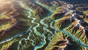
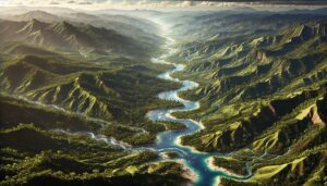
Iran’s watersheds are crucial for agriculture, industry, and ecosystems. This blog examines their significance, the challenges they face, and how 3D watershed maps help manage water resources, reduce pollution, and support conservation efforts. Learn how these mapping technologies aid in sustainable water management, ensuring the resilience of Iran’s vital water systems amid climate change and population pressures.
Read More »
Haiti Watershed Maps

Haiti Watershed Maps

Haiti’s watersheds are crucial for agriculture, ecology, and water supply. This blog examines their significance, challenges, and the role of 3D watershed maps in sustainable management. Learn how these maps help manage water resources, reduce flooding, improve water quality, and support conservation efforts. Discover how modern mapping technologies aid in disaster preparedness, helping Haiti protect its vital water systems for future generations.

Read More »
Israel Watershed Maps

Israel Watershed Maps

Israel’s watersheds are critical for agriculture, industry, and ecosystems. This blog explores their importance, challenges, and how 3D watershed maps contribute to managing water resources, reducing pollution, and supporting conservation efforts. Learn how Israel uses mapping technologies to navigate water scarcity and ensure the sustainability of its vital water systems.

Read More »
Slovakia Watershed Maps

Slovakia Watershed Maps

Slovakia’s watersheds, such as the Danube, Váh, and Hron River Basins, are vital for agriculture and ecosystems. Learn how modern technologies like 3D mapping, GIS, and remote sensing help manage these systems, ensuring sustainable water use and addressing challenges like water scarcity, climate change, and urbanization.

Read More »
Sierra Leone Watershed Maps

Sierra Leone Watershed Maps

Sierra Leone’s watersheds, including the Rokel and Moa River Basins, are crucial for agriculture and ecosystems. This blog explores how modern technologies like 3D mapping, GIS, and remote sensing help manage these vital water systems. These tools are essential for ensuring sustainable water use, addressing challenges such as water scarcity, climate change, and population growth, while protecting Sierra Leone’s ecosystems and water resources.

Read More »
Philippines Watershed Maps

Philippines Watershed Maps

The Philippines’ watersheds, including the Cagayan and Agusan River Basins, are vital for agriculture, ecosystems, and water management. This blog explores how modern technologies like 3D mapping, GIS, and remote sensing help monitor and manage these systems. These tools are essential for ensuring sustainable water use, addressing challenges like climate change, water scarcity, and population growth, while protecting biodiversity and ecosystems.

Read More »
Colombia Watershed Maps

Colombia Watershed Maps

Colombia’s watershed maps are crucial for managing the country’s river systems, predicting floods, and ensuring sustainable water use. These maps help allocate water for agriculture, industry, and communities while addressing the challenges of climate change. By monitoring water availability and quality, they guide conservation efforts and ensure that Colombia’s water resources remain viable for future generations, supporting both ecosystems and the economy.

Read More »
Guyana Watershed Maps

Guyana Watershed Maps

Guyana’s watersheds are vital for its ecosystems, agriculture, and economy. This blog explores the importance of these water systems, the challenges they face, and how 3D watershed maps aid in sustainable water management. Discover how advanced mapping technologies help manage water resources, address issues like deforestation and pollution, and support conservation efforts, ensuring the health of Guyana’s watersheds for future generations.

Read More »
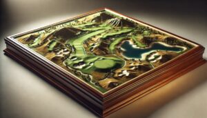
Lake McDonald USGS 3D topographical map

Lake McDonald 3D Topographical Map

Lake McDonald’s breathtaking beauty comes to life with a 3D topographical map, showcasing its crystal-clear waters, towering mountains, and deep glacial-carved valleys. Perfect for hikers, boaters, and nature lovers, this map offers a stunning, detailed view of the lake’s terrain, making it an essential tool for exploring Glacier National Park like never before.

Read More »
Turkmenistan Watershed Maps

Turkmenistan Watershed Maps

Turkmenistan’s watersheds, including the Amu Darya, Murghab, and Karakum River Basins, are vital for agriculture and ecosystems. Learn how modern technologies like 3D mapping, GIS, and remote sensing help manage these systems, ensuring sustainable water use and addressing challenges like water scarcity, climate change, and population growth.

Read More »
Russia Watershed Maps

Russia Watershed Maps

Russia’s watersheds, such as the Volga and Ob River Basins, are crucial for agriculture, ecosystems, and water management. Learn how modern technologies like 3D mapping, GIS, and remote sensing help manage these systems, ensuring sustainable water use and addressing challenges like climate change, water scarcity, and growing population demands.

Read More »
Montenegro Watershed Maps

Montenegro Watershed Maps

Montenegro’s watersheds play a crucial role in the country’s ecology and economy, supporting biodiversity and agriculture. This blog explores their significance and how 3D mapping technologies help manage these vital resources. By combining satellite imagery, remote sensing, and LiDAR, detailed watershed maps are created to monitor changes in water flow and land use, helping ensure sustainable development and environmental conservation for the future.

Read More »
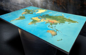
Custom 60-inch by 38-inch 3D map of the United States featuring custom graphics that highlight major highways.

3D Map of the United States

Discover the U.S. in stunning detail with 3D maps! These immersive maps bring mountains, cities, and landscapes to life, offering a unique way to explore iconic landmarks, plan adventures, and understand geography. Whether for education, urban planning, or outdoor recreation, 3D maps are revolutionizing how we interact with the diverse terrain of the United States. Explore like never before!

Read More »

Get a Free Quote