
Exploring the U.S. with 3D Maps: A Revolutionary Perspective on the American Landscape
The United States is a vast and diverse country, with geographical features ranging from towering mountain ranges to expansive flatlands, bustling cities to desolate deserts, and miles of coastline hugging the Atlantic and Pacific oceans. Traditional 2D maps have served us well for centuries, helping us navigate, explore, and understand the world around us. However, they often fall short when it comes to visualizing the full complexity of a landscape. That’s where the revolutionary power of 3D maps comes into play. A 3D map of the United States offers a dynamic and immersive way to experience the country’s topography, landmarks, and cities like never before.
With the rise of advanced mapping technologies, 3D maps provide a far more comprehensive view of the U.S., allowing us to see the intricate details of mountains, valleys, rivers, urban sprawls, and coastal regions. From recreational use to educational purposes, urban planning, environmental monitoring, and beyond, the creation and use of 3D maps have far-reaching implications for how we explore and interact with the landscape of the United States.
In this blog, we’ll take a deep dive into the world of 3D maps of the United States, exploring how these maps are made, their various applications, and the ways they are transforming our understanding of geography.
The Power of 3D Maps: Why They Matter for the U.S.
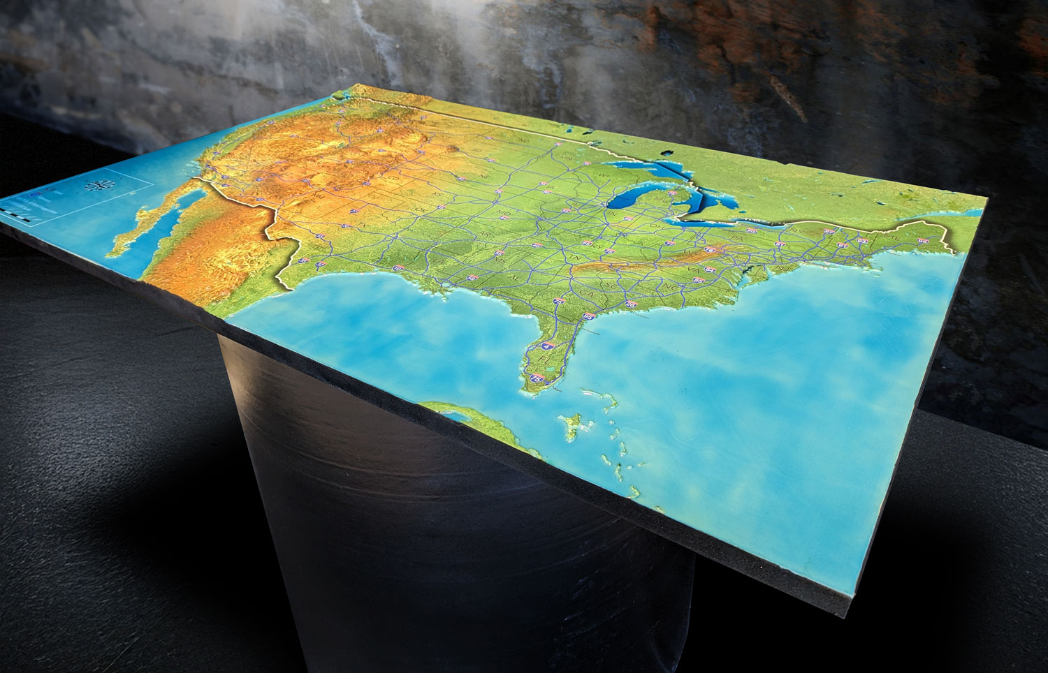
While traditional maps offer a bird’s-eye view of the landscape, they are limited in their ability to convey the complexities of topography, elevation, and terrain. A 3D map, on the other hand, provides a full, three-dimensional representation of the landscape, enabling viewers to explore vertical relief—from towering peaks to plunging valleys—in a way that’s impossible on a flat map.
For the U.S., a country with dramatically varied geography, 3D maps offer critical advantages:
Realistic visualization of terrain: From the towering Rockies to the rolling hills of Appalachia, 3D maps provide an accurate sense of the physical landscape. Whether you’re exploring the craggy peaks of the Sierra Nevadas or the deep canyons of the Southwest, these maps make it easier to grasp the true shape of the land.
Urban planning and infrastructure: In densely populated urban areas like New York City or San Francisco, 3D maps allow planners and developers to visualize how buildings interact with their surroundings, see the effects of proposed developments on their environments, and understand traffic flow in greater detail.
Educational tools: 3D maps are excellent for teaching geography, geology, and environmental science. They give students a clearer understanding of the natural processes that shape the landscape and how human activity interacts with the environment.
Travel and tourism: For adventurers and outdoor enthusiasts, 3D maps make it easier to plan trips, providing critical information about elevation changes, trail difficulty, and distances. They offer hikers, skiers, and mountaineers a more detailed view of national parks and recreational areas across the U.S.
How 3D Maps of the United States Are Created
The process of creating a 3D map of the U.S. involves the collection of detailed geospatial data, sophisticated computer modeling, and the application of cutting-edge technologies like LiDAR, satellite imagery, and 3D rendering software. Here’s an in-depth look at how these maps are fabricated:
Collecting Elevation Data with LiDAR
LiDAR (Light Detection and Ranging) is one of the key technologies behind 3D maps. LiDAR uses laser pulses to measure the distance between a sensor and the ground, providing highly accurate elevation data. Mounted on aircraft, drones, or satellites, LiDAR sensors fly over the landscape, sending out millions of laser pulses that bounce back once they hit the Earth’s surface. The time it takes for the lasers to return is used to calculate the exact elevation of every point on the ground.
For mapping the U.S., LiDAR data is collected from various government and private sources. The U.S. Geological Survey (USGS), for instance, has an extensive database of LiDAR data that covers vast portions of the country. This data is crucial for creating accurate representations of both urban and rural areas.
Digital Elevation Models (DEMs): Building the Skeleton
Once the LiDAR data is collected, it’s processed into a Digital Elevation Model (DEM). A DEM is essentially a grid where each cell contains an elevation value. This grid forms the “skeleton” of the 3D map, allowing cartographers to model the landscape’s vertical relief in great detail. DEMs are particularly useful for understanding topography, as they capture every mountain, valley, river, and ridge across the terrain.
For the United States, DEMs can be created at various resolutions depending on the purpose of the map. For example, a high-resolution DEM may be used to map a small area in great detail, such as the Grand Canyon or Yosemite National Park, while a lower-resolution DEM might be used for national-scale maps.
Applying Textures with Satellite Imagery
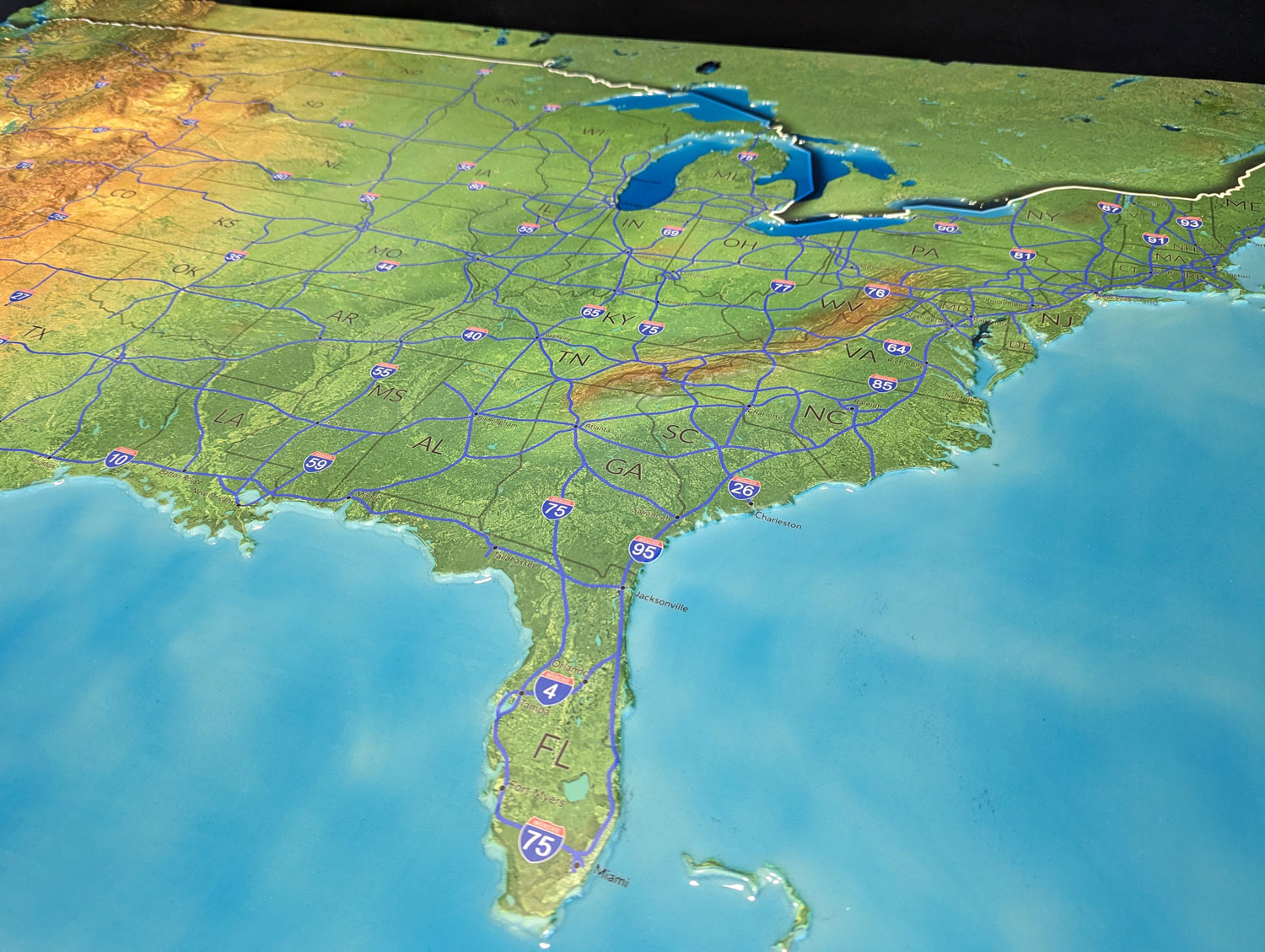
To make the 3D map visually realistic, textures and colors are applied using satellite imagery. Satellite images provide detailed views of the landscape, showing natural features like forests, deserts, lakes, and rivers, as well as man-made structures such as cities, roads, and bridges. High-resolution imagery allows for an accurate and immersive visual representation of the landscape.
This imagery is draped over the 3D terrain model, providing the map with rich detail and visual context. For instance, satellite imagery might show the lush green forests of the Pacific Northwest, the red-rock canyons of Utah, or the sprawling urban landscape of Los Angeles. This combination of elevation data and imagery creates a highly realistic map that’s both functional and visually stunning.
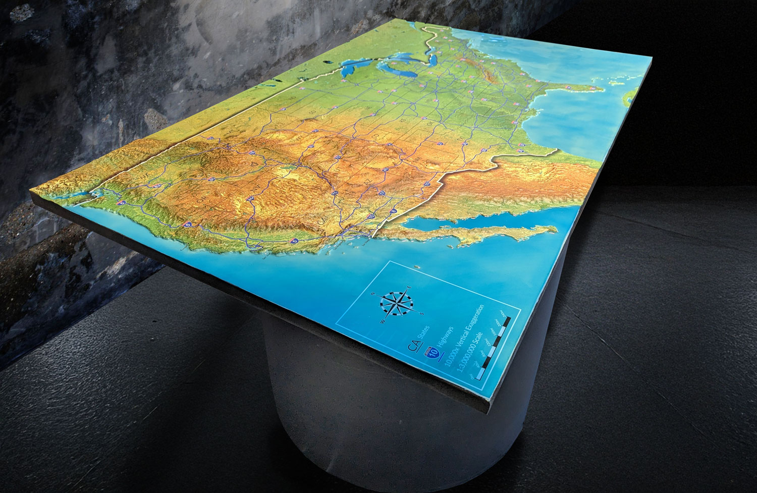
Enhancing the Map with Additional Data Layers
To make 3D maps even more useful, additional data layers can be added. These layers might include information on land use, transportation networks, climate zones, or political boundaries. In urban areas, 3D maps may also include models of buildings, bridges, and other infrastructure, showing how these structures interact with the surrounding landscape.
For example, a 3D map of Washington, D.C. might include not only the natural terrain but also detailed models of iconic landmarks like the U.S. Capitol, the Washington Monument, and the Lincoln Memorial. Meanwhile, a 3D map of the Rocky Mountains might include data on trails, campgrounds, and ski areas, making it easier for outdoor enthusiasts to navigate the region.
Creating Interactive and Digital Formats
Once the map is complete, it can be presented in a variety of formats. Interactive digital maps are the most common, allowing users to zoom in and out, rotate the view, and explore the landscape from different angles. These maps are accessible through websites, apps, and even virtual reality platforms, offering a hands-on way to explore the geography of the United States.
Physical 3D models can also be created using 3D printing technology, often for use in educational exhibits or architectural models. These tangible representations of the landscape give users a tactile experience, allowing them to interact with the map in a way that’s not possible with traditional paper maps.
Applications of 3D Maps of the U.S.: Changing How We Explore the Nation
The versatility of 3D maps makes them valuable tools across many different fields. Here are some of the ways that 3D maps of the United States are being used to solve problems, advance research, and improve decision-making:
Urban Planning and Development
In cities like San Francisco, where the landscape is characterized by steep hills and tight spaces, 3D maps are essential for urban planning. Planners use 3D maps to visualize new developments and infrastructure projects, ensuring that they fit within the city’s complex topography. For instance, they can simulate how a new building will affect its surroundings, whether it will block views, or how it might alter wind patterns.
3D maps also allow for more effective transportation planning, helping cities design transit systems that work with the landscape rather than against it. In mountainous areas like Denver or Salt Lake City, understanding elevation changes is critical for designing roadways, bridges, and tunnels.
Environmental Conservation
3D maps are a critical tool in environmental conservation efforts. They provide researchers and policymakers with the data needed to monitor and protect ecosystems across the U.S. For example, 3D maps can help scientists track deforestation in the Appalachian Mountains, monitor glacier retreat in Alaska, or measure soil erosion in agricultural regions.
In coastal areas, 3D maps are used to model sea level rise and flood risks. As climate change continues to impact the U.S., 3D maps can show how rising waters may affect cities like Miami or New York, helping governments prepare for and mitigate the potential damage.
Education and Learning
For educators and students, 3D maps are an incredibly engaging way to learn about geography, geology, and history. These maps offer a more interactive and immersive learning experience than traditional maps, allowing students to explore the landscape in greater detail.
For example, a 3D map of the Mississippi River can show how the river has shaped the surrounding landscape over time, influencing settlement patterns, trade routes, and economic development. In geology classes, 3D maps of volcanic regions like Hawaii or the Cascade Range provide a clearer understanding of how volcanic activity has shaped the land.
Recreation and Tourism
3D maps are also widely used in the recreation and tourism industry, particularly for outdoor activities like hiking, skiing, and mountaineering. By offering a detailed view of trails, elevations, and natural landmarks, 3D maps help adventurers plan their trips more effectively and stay safe while exploring the great outdoors.
For example, hikers in Yellowstone National Park can use a 3D map to plan their route, determine how steep the terrain will be, and locate scenic overlooks or camping areas. Skiers in resorts like Aspen or Park City can use 3D maps to assess the difficulty of various runs, check snow conditions, and locate lifts.
Real-Time Navigation
Many modern navigation apps, like Google Maps and Apple Maps, have started incorporating 3D elements to enhance the user experience. By providing drivers with a three-dimensional view of urban areas, these apps make it easier to navigate complex intersections, understand lane configurations, and visualize upcoming turns.
As technology continues to advance, we can expect to see even more real-time data integration in 3D maps. This could include live traffic updates, weather conditions, and construction alerts, helping users make informed decisions as they navigate the landscape.
Iconic Landscapes of the U.S. Through 3D Maps: A Virtual Tour
Using 3D maps, we can explore some of the most iconic and breathtaking landscapes of the United States in stunning detail. Here’s a virtual tour of a few key landmarks:
The Grand Canyon
A 3D map of the Grand Canyon reveals the dramatic depth and complexity of this iconic natural wonder. With its steep cliffs, winding river, and intricate rock formations, the Grand Canyon is a perfect example of how 3D maps can capture the vertical relief of the landscape. Visitors can use these maps to explore hiking trails, locate viewing points, and understand the canyon’s unique geology.
The Rocky Mountains
The Rocky Mountains stretch across much of the western United States, and their towering peaks and deep valleys are beautifully rendered in 3D maps. Whether you’re planning a ski trip to Colorado or a summer hike in Montana, a 3D map provides a clear view of the mountain ranges, allowing adventurers to plan their routes and assess the difficulty of the terrain.
The Great Plains
While the Great Plains may seem flat compared to mountainous regions, a 3D map reveals the subtle changes in elevation that define this vast expanse. From the rolling hills of the Dakotas to the agricultural heartland of Kansas, 3D maps offer a unique perspective on how the landscape has been shaped by natural forces and human activity.
The Appalachian Trail
The Appalachian Trail is one of the most famous long-distance hiking trails in the world, stretching over 2,000 miles from Georgia to Maine. A 3D map of the trail shows the rugged terrain of the Appalachian Mountains, allowing hikers to visualize the elevation changes and terrain they’ll encounter along the way.
Coastal Cities
For urban explorers, 3D maps offer a fascinating view of America’s coastal cities. In places like San Francisco or New York City, these maps show how the built environment interacts with the natural landscape, highlighting the iconic skylines, bridges, and waterfronts that define these cities.
The Future of 3D Maps: What’s Next for Mapping Technology?
As mapping technology continues to evolve, the future of 3D maps of the United States looks incredibly promising. Here are some exciting trends we can expect to see in the coming years:
Augmented Reality (AR): Imagine being able to point your smartphone at a landscape and instantly see a 3D map overlaid on the real-world view. AR technology is already being used in navigation apps, and its potential for 3D maps is huge.
Virtual Reality (VR): With VR headsets becoming more accessible, we may soon be able to explore 3D maps in fully immersive environments. This could allow users to take virtual tours of national parks, cities, and other landmarks without ever leaving their homes.
Real-Time Data Integration: Future 3D maps will likely include even more real-time data, allowing users to see live updates on weather, traffic, and other conditions that affect their travel plans.
Increased Accuracy and Detail: As LiDAR and satellite technology continue to improve, the accuracy and detail of 3D maps will only get better, providing an even more precise view of the landscape.
Conclusion: The Power of 3D Maps in Exploring the United States
A 3D map of the United States offers more than just a way to navigate the country—it’s a powerful tool for understanding the complexities of the landscape, from towering mountains to sprawling cities. Whether used for urban planning, environmental conservation, education, or recreation, these maps provide an immersive and detailed view of the nation’s geography.
As technology continues to advance, 3D maps will play an even larger role in how we explore, understand, and interact with the United States. With their ability to visualize both natural and human-made landscapes, 3D maps are revolutionizing the way we see the world around us. Whether you’re a student, a traveler, or a professional, these maps offer an exciting new way to engage with the landscape of the U.S. and beyond.