Tag: Maps

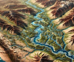
Colorado River Watershed Map

Colorado Raised Relief Map

Dive into the breathtaking landscapes of Colorado with a raised relief map! This tactile 3D masterpiece brings the Rockies, valleys, and plains to life, offering a unique blend of artistry and practicality. Perfect for explorers, educators, and decor enthusiasts, these maps capture the state’s stunning topography in vivid detail. Feel every peak and valley—Colorado’s beauty, right at your fingertips!
Read More »
Malta Watershed Maps

Malta Watershed Maps

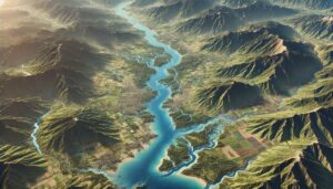
Malta’s watersheds are vital for the island’s agriculture, tourism, and ecosystems. This blog explores their significance, challenges, and how 3D watershed maps help manage water resources, reduce pollution, and support conservation efforts. Learn how mapping technologies help Malta navigate water scarcity, climate change, and resource management challenges for a sustainable future.

Read More »
Zimbabwe Watershed Maps

Zimbabwe Watershed Maps

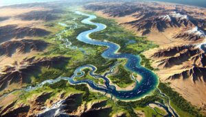
Zimbabwe’s watersheds, including the Zambezi and Limpopo River Basins, are vital for agriculture and ecosystems. Learn how 3D mapping, GIS, and remote sensing technologies help manage these essential water systems. These tools address challenges like water scarcity, pollution, and climate change, ensuring sustainable water use, improving flood management, and safeguarding ecosystems, ultimately supporting the country’s water security for future generations.

Read More »
Uzbekistan Watershed Maps

Uzbekistan Watershed Maps

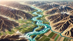
Uzbekistan’s watersheds, including the Amu Darya and Syr Darya Basins, are vital for agriculture and ecosystems. Learn how modern technologies like 3D mapping, GIS, and remote sensing help manage these systems, ensuring sustainable water use and addressing challenges like water scarcity, climate change, and population growth.

Read More »
United Kingdom Watershed Maps

United Kingdom Watershed Maps

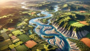
The UK’s watersheds, including the Thames, Severn, and Tyne River Basins, are essential for agriculture and ecosystems. Learn how modern technologies like 3D mapping, GIS, and remote sensing help manage these systems, ensuring sustainable water use and addressing challenges like water scarcity, climate change, and population growth.

Read More »
Tanzania Watershed Maps

Tanzania Watershed Maps

Tanzania’s watersheds, including the Rufiji, Pangani, and Wami River Basins, are vital for agriculture and ecosystems. Learn how modern technologies like 3D mapping, GIS, and remote sensing help manage these systems, ensuring sustainable water use and addressing challenges like water scarcity, climate change, and population growth.

Read More »
Dominican Republic Watershed Maps

Dominican Republic Watershed Maps

Dominican Republic’s watershed maps are essential for managing river systems, predicting floods, and ensuring sustainable water use. These maps help allocate water for agriculture, industry, and communities while addressing climate change challenges. By monitoring river flow, groundwater levels, and water quality, they support flood prevention, efficient water distribution, and ecosystem protection, ensuring that the country’s water resources are preserved for future generations.

Read More »
Bhutan Watershed Maps

Bhutan Watershed Maps

Watershed maps are crucial for managing Bhutan’s rivers, hydropower, and agriculture. These maps help predict water availability, mitigate flood risks, and guide sustainable development while adapting to climate change challenges.

Read More »
Victoria Nile Watershed Map

Victoria Nile Watershed Map

Explore the Victoria Nile Watershed, a critical resource for East Africa, supporting agriculture, hydropower, and biodiversity. Learn about its geography, hydrology, and rich ecosystems. Advanced 3D mapping technologies are playing a key role in monitoring changes, simulating future risks, and supporting sustainable water management and ecosystem conservation. These tools are essential for ensuring the river’s health and its ability to provide vital resources for future generations.

Read More »
Orinoco River Watershed Map

Orinoco River Watershed Map

Explore the Orinoco River Watershed, one of South America’s most biodiverse regions, through a dynamic 3D map. Discover how advanced mapping technologies help manage this vital ecosystem, safeguard water resources, and support conservation efforts. Dive into the heart of the Orinoco and learn how it shapes both nature and the livelihoods of millions.

Read More »
Madagascar Watershed Maps

Madagascar Watershed Maps

Madagascar’s watersheds are crucial for agriculture, hydropower, and ecosystems. This blog explores their significance, challenges, and how 3D watershed maps help manage water resources, reduce pollution, and support conservation efforts. Learn how mapping technologies help Madagascar navigate water scarcity, climate change, and resource management challenges for a sustainable future.

Read More »
Virginia Watershed Maps

Virginia Watershed Maps

Dive into the Arctic and Sub-Arctic Basins Watershed, a region of extreme landscapes and unique ecosystems. Discover how 3D mapping technology is transforming our understanding of water flow, environmental changes, and climate impacts, offering vital insights into protecting these fragile regions for future generations.

Read More »
Austria Watershed Maps

Austria Watershed Maps

Austria’s watersheds, shaped by its Alps and Danube River, play a vital role in sustaining ecosystems, agriculture, and human populations. Advanced 3D mapping technologies offer detailed insights into these systems, providing valuable data for managing water resources and predicting natural events. This blog explores Austria’s watersheds, the technology behind mapping, and how these maps can help protect the environment.

Read More »
Ecuador Watershed Maps

Ecuador Watershed Maps

Ecuador’s watershed maps are essential for managing river systems, predicting floods, and ensuring sustainable water use. These maps guide water allocation for agriculture, industry, and communities while addressing climate change challenges. By monitoring river flow, groundwater levels, and water quality, they support flood prevention, efficient water distribution, and ecosystem protection, ensuring Ecuador’s water resources are preserved for future generations.

Read More »

Get a Free Quote