Tag: Maps

Washington D.C. Topo Map

Washington D.C. Topo Map

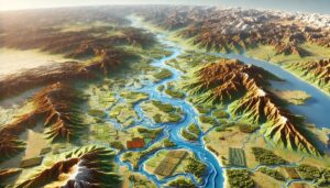
Discover Washington D.C.’s unique geography with detailed topo maps that capture its rolling hills, iconic landmarks, and rivers. Learn how 2D and 3D maps are expertly crafted to highlight the interplay of natural beauty and urban design. Perfect for planners, historians, and adventurers, these maps offer a deeper understanding of the nation’s capital and its fascinating blend of history and topography.

Read More »

Savannah River Watershed Map

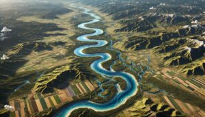
Discover the Savannah River Watershed, a vital system supporting ecosystems, agriculture, and communities in the Southeast. Explore its intricate waterways, rich biodiversity, and economic importance. Learn how stunning 3D maps bring its geography to life, addressing challenges like climate change and habitat loss while preserving its natural beauty and significance for future generations.

Read More »
Po River Watershed Map

Po River Watershed Map

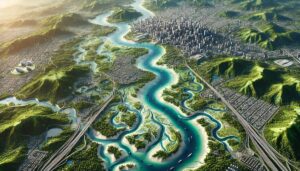
Discover the Po River Watershed, Italy’s longest and most vital river. Explore how 3D mapping technologies track its flow, support biodiversity, and aid sustainable management. Learn about the river’s dynamic ecosystems, its role in agriculture, and the challenges it faces from climate change and pollution, all while ensuring its continued ability to sustain the region’s economy and environment.

Read More »
Lamoille River Watershed Map

Lamoille River Watershed Map

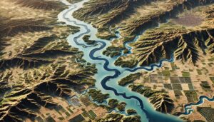
Discover the Lamoille River Watershed Map, a vital tool for understanding the river’s ecology, hydrology, and human impact. Explore its diverse landscapes, seasonal flow, and conservation needs, all brought to life with cutting-edge 3D mapping technology. This resource guides sustainable water management and helps preserve the health of the Lamoille River for future generations.

Read More »
Slovenia Watershed Maps

Slovenia Watershed Maps

Slovenia’s watersheds, including the Soča, Sava, and Drava River Basins, are vital for agriculture and ecosystems. Learn how modern technologies like 3D mapping, GIS, and remote sensing help manage these systems, ensuring sustainable water use and addressing challenges like water scarcity, climate change, and urban growth.

Read More »
North Carolina Topo Map

North Carolina Topo Map

Discover North Carolina’s stunning geography with topographic maps revealing the Blue Ridge Mountains, rolling Piedmont hills, and serene Coastal Plain. From the dynamic Outer Banks to the state’s winding rivers, 2D and 3D maps bring the Tar Heel State to life, offering adventurers and conservationists a deeper connection to its diverse and breathtaking landscapes.

Read More »
Palestine Watershed Maps

Palestine Watershed Maps

Palestine’s watersheds, including the Jordan River Basin, are vital for agriculture, ecosystems, and water management. This blog explores how modern technologies like 3D mapping, GIS, and remote sensing help monitor and manage these critical water systems. These tools are essential for ensuring sustainable water use, addressing challenges such as water scarcity, climate change, and growing population demands, while protecting vital ecosystems for future generations.

Read More »
Indiana Topo Map

Indiana Topo Map

Discover Indiana’s rich landscapes with topographic maps revealing the towering dunes of Lake Michigan, rolling southern hills, and intricate cave systems. From the Wabash River Valley to the flat plains of the heartland, 2D and 3D maps bring Indiana’s terrain to life, offering adventurers, conservationists, and educators a deeper connection to the Hoosier State’s natural beauty and geographical wonders.

Read More »
Loire River Watershed Map

Loire River Watershed Map

Explore the Loire River Watershed, a vital French waterway supporting agriculture and biodiversity. Discover how 3D mapping technologies track water flow, support conservation, and guide sustainable water management. Learn about the river’s ecosystems, seasonal fluctuations, and challenges from climate change and human activity, all while ensuring its continued role in sustaining the region’s environment and economy.

Read More »
Columbia Topo Map

Columbia Topo Map

Discover Columbia’s dynamic landscapes with topo maps that unveil rolling hills, vast rivers, and vibrant urban areas. Learn how these maps are meticulously crafted in 2D and 3D, blending technology and artistry. Perfect for adventurers, planners, and conservationists, Columbia topo maps provide a detailed window into the region’s geography, fostering exploration and a deeper connection to its natural and cultural heritage.

Read More »
Austin Topo Map

Austin Topo Map

Discover Austin’s rolling hills, vibrant green spaces, and winding waterways with detailed topo maps. Learn how 2D and 3D maps are expertly crafted to capture every contour of this dynamic city. Perfect for adventurers, planners, and conservationists, these maps reveal Austin’s unique blend of natural beauty and urban innovation, offering a deeper connection to the heart of Texas.

Read More »
Yellow River (Huang He) Watershed Map

Yellow River (Huang He) Watershed Map

Discover the Yellow River (Huang He) Watershed, a vital lifeline for northern China. Learn how 3D mapping technologies track water flow, support conservation, and manage resources. Explore the river’s seasonal dynamics, its rich ecosystems, and how advanced tools are helping address challenges like pollution and climate change, ensuring the sustainable future of this crucial water system.

Read More »
Don River Watershed Map

Don River Watershed Map

Explore the Don River Watershed, a vital waterway in southern Russia. Learn how advanced 3D mapping technologies track its flow, support ecosystems, and guide sustainable water management. Discover how the river sustains agriculture, industry, and biodiversity while facing challenges from climate change and human activity, all while ensuring the health of the watershed for future generations.

Read More »
Illinois Topo Map

Illinois Topo Map

Discover Illinois’s hidden topographical treasures with detailed maps revealing the rolling Shawnee Hills, sprawling rivers, and urban landscapes of Chicago. From the rugged Driftless Area to the flat yet fertile Central Plains, 2D and 3D topographic maps bring the Prairie State’s diverse terrain to life, offering adventurers and educators a deeper connection to its natural beauty and geographical wonders.

Read More »
Singapore Watershed Maps

Singapore Watershed Maps

Singapore’s watersheds, including the Singapore and Kallang River Basins, are vital for agriculture and ecosystems. Learn how modern technologies like 3D mapping, GIS, and remote sensing help manage these systems, ensuring sustainable water use and addressing challenges like water scarcity, climate change, and urban growth.

Read More »
Italy Topo Map

Italy Topo Map

Discover Italy’s breathtaking terrain with topographic maps showcasing the soaring Alps, rolling Tuscan hills, dramatic Amalfi Coast, and historic Po Valley. From Sicily’s volcanic peaks to the Apennines’ rugged beauty, 2D and 3D maps bring Italy’s diverse landscapes to life, guiding explorers, conservationists, and historians through its natural and cultural wonders.

Read More »

Get a Free Quote