Tag: Maps

Burkina Faso Watershed Maps

Burkina Faso Watershed Maps

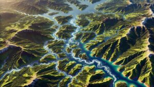
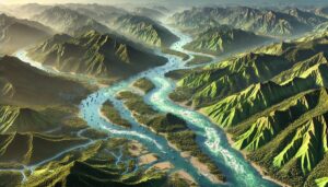
Watershed maps are essential for managing water resources in Burkina Faso, helping to predict floods, monitor water availability, and guide sustainable use for agriculture, industry, and communities. These maps provide critical data on river systems and groundwater, supporting water distribution and flood prevention. They are also key in adapting to the challenges posed by climate change and ensuring the country’s water security.
Read More »
Brazil Watershed Maps

Brazil Watershed Maps

Brazil’s watershed maps are essential for managing water resources, preventing floods, and ensuring sustainable water use. These maps guide water management, flood prevention, and ecological protection in the face of climate change and rapid development.

Read More »
India Watershed Maps

India Watershed Maps

Excerpt: India’s watersheds are crucial for agriculture, hydropower, and ecosystems. This blog explores their significance, challenges like water scarcity and pollution, and the role of 3D watershed maps in sustainable water management. Learn how these maps help manage water resources, predict floods, and support conservation efforts, ensuring India’s watersheds remain resilient and capable of supporting the country’s growing needs amid climate change and rapid urbanization.

Read More »
Burundi Watershed Maps

Burundi Watershed Maps

Watershed maps in Burundi are crucial for managing water resources, preventing floods, and ensuring sustainability. These maps help track river systems, predict seasonal water availability, and guide the equitable distribution of water for agriculture, industry, and communities. By supporting flood prevention, water conservation, and climate adaptation strategies, these maps play a vital role in maintaining water security and ecological health in the country.

Read More »
Poland Watershed Maps

Poland Watershed Maps

Poland’s watersheds, such as the Vistula and Oder River Basins, are essential for agriculture, ecosystems, and water management. Learn how modern technologies like 3D mapping, GIS, and remote sensing help monitor and manage these systems, ensuring sustainable water use and addressing challenges like climate change, water scarcity, and growing population demands.

Read More »
Belgium Watershed Maps

Belgium Watershed Maps

Belgium’s watershed maps help manage water resources and prevent flooding, guiding sustainable water use for agriculture, industry, and ecosystems. These maps play a key role in tackling the challenges of climate change and protecting the country’s rivers and wetlands.

Read More »
Wailuku River Watershed Map

Wailuku River Watershed Map

Explore the Wailuku River Watershed, a vital ecosystem in Maui. Learn how 3D mapping technology helps manage water resources, protect wildlife, and support conservation. Discover the river’s ecological significance and the challenges it faces from climate change and human development.

Read More »
Brunei Watershed Maps

Brunei Watershed Maps

Brunei’s watershed maps help manage the country’s water resources, prevent floods, and ensure sustainable water use. These maps are essential for flood prediction, ecosystem conservation, and adapting to climate change.

Read More »
Grenada Watershed Maps

Grenada Watershed Maps

Grenada’s watersheds, crucial for both its environment and economy, are essential for water flow, agriculture, and biodiversity. This blog examines the island’s unique water systems, the role of 3D mapping in management, and the conservation efforts necessary to preserve these vital resources. Discover how Grenada is working to ensure the sustainability of its watersheds for future generations.

Read More »
Saint Lucia Watershed Maps

Saint Lucia Watershed Maps

Saint Lucia’s watersheds, such as the Roseau and Nevis River Basins, are vital for agriculture, ecosystems, and water management. Learn how modern technologies like 3D mapping, GIS, and remote sensing help manage these systems, ensuring sustainable water use and addressing challenges like water scarcity, climate change, and population growth.

Read More »
Mali Watershed Maps

Mali Watershed Maps

Mali’s watersheds play a critical role in agriculture, hydropower, and ecosystems. This blog explores their significance, challenges, and how 3D watershed maps help manage water resources, reduce pollution, and support conservation efforts. Learn how mapping technologies help Mali navigate water scarcity, climate change, and resource management challenges for a sustainable future.

Read More »
Gambia Watershed Maps

Gambia Watershed Maps

Gambia’s watershed maps are crucial for managing river systems, predicting floods, and ensuring sustainable water use. These maps help allocate water for agriculture, industry, and communities while addressing climate change challenges. By monitoring river flow, groundwater levels, and water quality, they support flood prevention, efficient water distribution, and ecosystem protection, ensuring that Gambia’s water resources are preserved for future generations.

Read More »
Guinea-Bissau Watershed Maps

Guinea-Bissau Watershed Maps

Guinea-Bissau’s watersheds are vital for its environment and economy, supporting agriculture, biodiversity, and water supply. This blog examines the challenges, the role of 3D watershed maps, and conservation efforts needed to protect these critical resources for the future. Discover how mapping and sustainable practices can safeguard Guinea-Bissau’s watersheds in the face of pollution, deforestation, and climate change.

Read More »
United Arab Emirates Watershed Maps

United Arab Emirates Watershed Maps

The UAE’s watersheds, including groundwater systems and wadis, are vital for freshwater supply. Learn how modern technologies like 3D mapping, GIS, and remote sensing help manage these limited resources. These tools are crucial for ensuring sustainable water use, addressing challenges like water scarcity, climate change, and rapid urbanization, and enhancing the country’s ability to adapt to future water demands in its arid landscape.

Read More »
Kazakhstan Watershed Maps

Kazakhstan Watershed Maps

Kazakhstan’s watersheds are vital for agriculture, energy, and ecosystems. This blog examines their significance, the challenges they face, and how 3D watershed maps help manage water resources, reduce pollution, and support conservation efforts. Learn how these mapping technologies assist in managing water availability, flood risk, and pollution to protect Kazakhstan’s vital water systems.

Read More »
Cyprus Watershed Maps

Cyprus Watershed Maps

Cyprus’s watershed maps are crucial for managing river systems, predicting floods, and ensuring sustainable water use. These maps guide water allocation for agriculture, industry, and communities while addressing climate change challenges. By monitoring water availability, river flow, and groundwater levels, they support effective water management strategies, flood prevention, and ecosystem conservation, ensuring Cyprus’s water resources are preserved for future generations.

Read More »

Get a Free Quote