
What Is a Selfie Station Prop?
Selfie station props transform events into shareable experiences. Discover how these creative setups attract attention, boost engagement, and turn moments into lasting memories.
Selfie station props transform events into shareable experiences. Discover how these creative setups attract attention, boost engagement, and turn moments into lasting memories.

From sci-fi helmets to massive event displays, 3D printed props are transforming how ideas become reality. Discover how this cutting-edge technology blends precision, creativity, and scale to create stunning, lifelike objects for film, marketing, and beyond.

Custom props are purpose-built creations designed to bring ideas to life, from film sets to live events and branded experiences. Explore how these unique objects combine creativity, scale, and craftsmanship to transform spaces, tell stories, and create unforgettable moments.
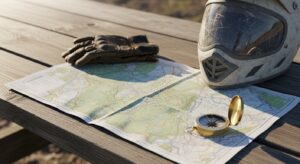
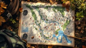
An ATV trail map is your ultimate off-road guide, helping you navigate rugged terrain, plan routes, and ride with confidence. Discover how these maps work, what they include, and why every rider—beginner or expert—needs one for safer, smarter, and more adventurous exploration.

GIS mapping transforms data into powerful visual maps that reveal hidden patterns and insights. Discover how it works and why it’s changing how we understand the world.
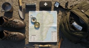
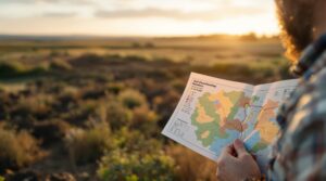
A camping map is more than navigation—it’s your key to exploring the outdoors with confidence. From trails and campsites to terrain and water sources, it helps you plan smarter, stay safe, and discover hidden gems. Whether you’re a beginner or seasoned adventurer, mastering a camping map transforms every trip into a richer, more rewarding experience.
GIS mapping transforms data into powerful visual maps that reveal hidden patterns and insights. Discover how it works and why it’s changing how we understand the world.

A constellation map transforms the night sky into a readable guide, revealing patterns hidden among the stars. From ancient myths to modern astronomy, these maps help you explore, navigate, and truly understand the vast, ever-changing sky above.

What is a wall map? It’s more than décor—it’s a large, visual gateway to the world. From classrooms to living rooms, wall maps combine design, geography, and storytelling to make places easier to understand, explore, and connect with every day.

Wood statues transform simple blocks of timber into powerful works of art. From ancient spiritual carvings to modern sculptures, these creations combine natural beauty, craftsmanship, and storytelling. Discover how wood statues are made, the traditions behind them, and why this timeless art form continues to inspire artists and collectors around the world.

Jade statues are more than beautiful sculptures—they are masterpieces carved from one of the world’s most revered stones. From ancient emperors to modern collectors, jade has symbolized power, harmony, and artistry for thousands of years. Explore the history, meaning, and craftsmanship behind these timeless works of art.

A soils map reveals the hidden blueprint beneath your feet. Discover how soil data shapes farming, construction, conservation, and land investment decisions.
A soils map reveals the hidden blueprint beneath your feet. Discover how soil data shapes farming, construction, conservation, and land investment decisions.
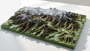
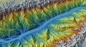
What is a 3D terrain map? It’s geography brought to life. From towering mountains to winding valleys, discover how modern elevation data transforms flat maps into immersive, three-dimensional landscapes used in real estate, gaming, education, and environmental planning.

What is a cadastral map? It’s the detailed blueprint behind property ownership, defining boundaries, parcel sizes, and legal land records. From city skyscrapers to rural farmland, cadastral maps power real estate transactions, guide urban planning, and protect property rights—quietly shaping how land is bought, sold, taxed, and developed around the world.
A legend on a map is the quiet powerhouse behind every successful journey. It decodes symbols, colors, and lines, transforming abstract visuals into clear, actionable meaning. Whether you are navigating city streets, hiking mountain trails, or exploring data-rich digital maps, the legend is what turns confusion into confidence and information into understanding.