
What Is a Camping Map? Your Guide to Navigating the Great Outdoors
There’s a unique thrill that comes with stepping into the outdoors. The air feels different, the noise of everyday life fades, and the world opens up in ways that feel both freeing and unfamiliar. Whether you’re heading into a dense forest, setting up beside a quiet lake, or venturing into rugged mountain terrain, one tool quietly shapes your entire experience: the camping map. At first glance, a camping map might seem like a simple guide showing trails and campsites. But in reality, it is so much more. It’s a navigator, a planner, a safety net, and a storyteller all rolled into one. It tells you where you are, where you’re going, and what you might discover along the way. In an age where GPS and smartphones dominate navigation, the camping map remains a trusted companion for outdoor enthusiasts. It offers reliability when technology fails, depth when digital tools oversimplify, and a sense of connection that no screen can replicate. So, what exactly is a camping map? Let’s explore how it works, why it matters, and how it can transform your outdoor adventures.
Defining a Camping Map
A camping map is a specialized type of map designed specifically for outdoor recreation, with a focus on camping areas, natural features, and navigation routes. Unlike general road maps or city maps, camping maps are built to guide you through less-developed landscapes where infrastructure is limited and conditions can change quickly.
These maps typically highlight campgrounds, trails, water sources, elevation changes, terrain types, and points of interest such as scenic overlooks or ranger stations. They are created with outdoor users in mind, meaning they prioritize clarity, durability, and detail relevant to nature-based travel.
A camping map isn’t just about getting from point A to point B. It’s about understanding the environment you’re entering. It helps you anticipate challenges, discover opportunities, and make informed decisions about where to go and how to get there.
The Evolution of Camping Maps
Long before modern printing techniques and digital tools, early explorers relied on hand-drawn maps to navigate unfamiliar terrain. These maps were often incomplete or inaccurate, but they laid the foundation for the detailed cartography we use today.
As camping and outdoor recreation grew in popularity, especially in places like the United States, the need for more accurate and accessible maps became clear. Government agencies and organizations such as the National Park Service and the U.S. Forest Service began producing standardized maps that combined scientific accuracy with user-friendly design.
These maps evolved to include topographic data, trail systems, and designated camping areas. Over time, advancements in satellite imagery and geographic information systems (GIS) further improved their precision.
Today, camping maps exist in both physical and digital formats. While apps and GPS devices offer convenience, traditional paper maps remain essential due to their reliability and independence from battery life or signal strength.
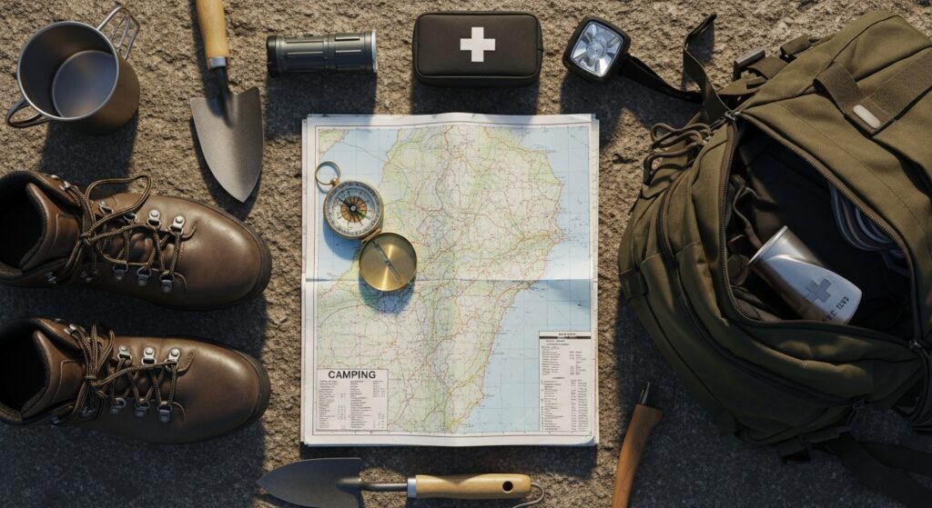
Key Features of a Camping Map
A well-designed camping map is packed with information, but it presents that information in a way that is easy to interpret, even in the field.
One of the most important elements is topography. Contour lines show elevation changes, helping you understand the steepness of terrain and plan your route accordingly. This is especially important in mountainous or uneven landscapes, where elevation can significantly impact travel time and difficulty.
Trails are another central feature. Camping maps clearly mark hiking paths, biking routes, and sometimes even off-road vehicle trails. These paths are often labeled with distances and difficulty levels, allowing you to choose routes that match your experience and fitness level.
Water sources such as rivers, lakes, and streams are typically highlighted. Access to water is crucial for camping, both for hydration and for practical needs like cooking and cleaning.
Campsites themselves are usually marked with symbols, indicating whether they are developed campgrounds, backcountry sites, or dispersed camping areas. Additional details may include amenities like restrooms, fire pits, or picnic tables.
Landmarks and points of interest add another layer of value. These might include scenic viewpoints, historical sites, or unique natural features that enhance your experience.
Types of Camping Maps
Not all camping maps are the same. Different types serve different purposes, depending on the environment and the needs of the user.
Topographic maps are among the most detailed and widely used. They provide a three-dimensional understanding of the landscape through contour lines and elevation data. These maps are ideal for hikers and backpackers who need to navigate complex terrain.
Recreation maps focus more on user experience. They highlight trails, campgrounds, and attractions, often using simplified visuals that are easy to read. These are commonly found in national parks and tourist areas.
Forest and wilderness maps are designed for more remote environments. They include information about land boundaries, access points, and regulations, making them essential for backcountry camping.
Digital camping maps, available through mobile apps and GPS devices, offer interactive features such as real-time location tracking and route planning. While convenient, they should be used alongside physical maps rather than as a replacement.
Why Camping Maps Still Matter in the Digital Age
With smartphones and GPS devices readily available, it might seem like traditional camping maps are becoming obsolete. However, the opposite is true.
Technology can fail. Batteries die, signals disappear, and devices break. A paper camping map, on the other hand, requires no power and is always accessible.
Beyond reliability, camping maps offer a broader perspective. Digital screens often limit your view to a small area, while a physical map allows you to see the entire landscape at once. This helps you understand how different features connect and make better decisions about your route.
There’s also a psychological element. Using a camping map encourages a deeper engagement with your surroundings. It slows you down, makes you more observant, and enhances your sense of adventure.
How to Read a Camping Map
Learning to read a camping map is an essential skill for any outdoor enthusiast. While it may seem intimidating at first, it becomes intuitive with practice.
Start with the legend. This section explains the symbols used on the map, from campsites to trail markers. Understanding these symbols is key to interpreting the map accurately.
Next, pay attention to the scale. This tells you how distances on the map relate to real-world distances. It helps you estimate how far you’ll be traveling and how long it might take.
Contour lines are perhaps the most challenging aspect for beginners. These lines represent elevation, with closer lines indicating steeper terrain. By studying them, you can visualize hills, valleys, and slopes.
Orientation is also crucial. Always align your map with the surrounding landscape, using a compass if necessary. This ensures that you’re reading the map correctly and moving in the right direction.
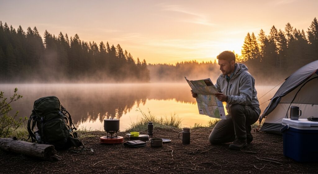
Planning a Trip with a Camping Map
A camping map is one of the most valuable tools for trip planning. Before you even step outside, it allows you to visualize your journey and prepare for what lies ahead.
You can identify potential campsites, evaluate trail options, and locate water sources. You can also assess terrain difficulty and plan alternative routes in case conditions change.
Weather considerations can also be factored in. For example, knowing the elevation of your campsite can help you anticipate temperature differences, while understanding the terrain can inform decisions about shelter and gear.
By using a camping map during the planning phase, you reduce uncertainty and increase your chances of a safe and enjoyable trip.
Safety and Navigation in the Wild
Safety is one of the most important reasons to use a camping map. In unfamiliar environments, getting lost can quickly turn into a serious situation.
A camping map helps you stay oriented and avoid dangerous areas. It allows you to track your progress, recognize landmarks, and make informed decisions if you need to change your route.
In emergency situations, a map can be a lifesaver. It can help you identify the quickest path to safety, locate nearby resources, or communicate your location to others.
Even experienced campers rely on maps as a backup to technology. It’s a simple but powerful tool that can make all the difference.
The Emotional Connection to Maps
Beyond their practical uses, camping maps carry a unique emotional value. They represent exploration, discovery, and the unknown.
There’s something deeply satisfying about unfolding a map and tracing your route with your finger. It connects you to a long tradition of exploration, from early adventurers to modern-day travelers.
Camping maps also become keepsakes. They hold memories of trips taken, challenges overcome, and moments experienced in nature. Over time, they transform from tools into personal artifacts.
The Future of Camping Maps
As technology continues to evolve, camping maps are becoming more advanced and accessible. Digital platforms are integrating real-time data, interactive features, and community-driven updates.
At the same time, there is a growing appreciation for traditional maps. Many outdoor enthusiasts are rediscovering their value and incorporating them into their adventures alongside digital tools.
The future of camping maps is likely to be a blend of both worlds. Digital innovation will enhance functionality, while physical maps will continue to provide reliability and depth.
Your Essential Outdoor Companion
A camping map is far more than a navigation tool. It’s a guide, a planner, a safety resource, and a connection to the natural world.
Whether you’re a seasoned adventurer or a first-time camper, understanding how to use a camping map can transform your experience. It empowers you to explore with confidence, make informed decisions, and fully appreciate the landscapes you encounter.
In a world that often feels fast-paced and disconnected, a camping map invites you to slow down, look closer, and rediscover the joy of exploration.


