
What Is a Soils Map? The Hidden Blueprint Beneath Your Feet
Walk across a field, a suburban backyard, or a stretch of desert highway, and it all might look the same at first glance. Dirt is dirt, right? Not even close. Beneath the surface lies a complex, living system shaped by climate, geology, time, and biology. A soils map is the key that unlocks that underground story. If you have ever wondered how farmers know what crops to plant, how builders decide whether land can support a home, or how environmental planners protect wetlands and forests, the answer often begins with one essential tool: a soils map. In this in-depth guide, we will explore what a soils map is, how it is created, why it matters, and how it influences everything from agriculture and real estate to conservation and climate resilience.
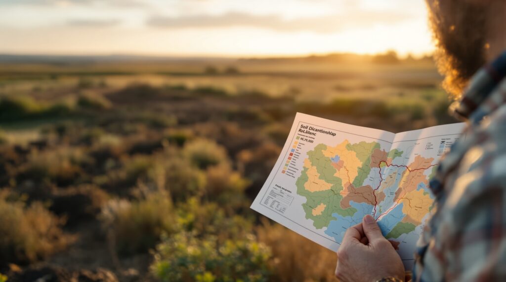
What Is a Soils Map?
A soils map is a detailed geographic representation of the different soil types within a specific area. It shows how soil properties vary across landscapes and identifies distinct soil units based on characteristics such as texture, structure, drainage, depth, fertility, and composition.
Unlike a simple dirt chart, a soils map is a scientific document rooted in fieldwork, laboratory analysis, and geographic information systems. It divides land into mapped units, each representing a specific soil series or soil association. These units describe the soil’s behavior and potential uses.
In the United States, most official soils maps are developed and maintained by the United States Department of Agriculture through its Natural Resources Conservation Service. These maps form the backbone of land planning decisions across rural and urban environments. At its core, a soils map answers one powerful question: What is the ground truly capable of?
Soil Is More Than Dirt
Before understanding soils maps, it helps to understand soil itself. Soil is a dynamic mixture of minerals, organic matter, water, air, and living organisms. It forms slowly over thousands to millions of years as rock breaks down and interacts with climate, vegetation, and microorganisms.
Soil scientists typically classify soil into layers called horizons. These horizons stack vertically to create a soil profile, often including:
- A surface organic-rich layer
- A topsoil layer where roots grow
- A subsoil layer with accumulated minerals
- A deeper parent material layer
A soils map translates these vertical profiles into a horizontal story. Instead of digging everywhere, scientists identify patterns and map similar soil types across entire landscapes. The result is a detailed guide to what lies beneath fields, forests, cities, and coastlines.
A Brief History of Soil Mapping
Soil mapping became increasingly important in the late 19th and early 20th centuries as agriculture expanded and governments realized that land productivity depended heavily on soil characteristics. In the United States, formal soil surveys began in 1899. Over time, the methodology became more sophisticated, combining field observation, aerial photography, satellite imagery, and digital mapping technologies.
Globally, organizations like the Food and Agriculture Organization have helped coordinate international soil classification systems and global soil mapping efforts. Today, soil mapping is both a field science and a data science, blending boots-on-the-ground analysis with advanced GIS modeling.
How Is a Soils Map Created?
Creating a soils map is a meticulous process that involves several key stages.
First comes fieldwork. Soil scientists walk the land, dig test pits, and examine soil profiles. They analyze texture by feel, observe color patterns, measure depth, and record drainage characteristics. Each observation contributes to identifying a specific soil series.
Next comes laboratory analysis. Samples are tested for pH levels, nutrient content, organic matter, and mineral composition. These data refine classifications and help determine agricultural suitability and engineering behavior.
Then comes classification. Soils are categorized according to standardized systems such as Soil Taxonomy in the United States. Each mapped unit represents a defined soil type with predictable characteristics.
Finally, cartographers and GIS specialists translate field data into digital and printed maps. Modern soils maps are often interactive and accessible online, allowing users to zoom in on specific parcels and retrieve detailed soil descriptions.
The final product is far more than a colorful chart. It is a technical blueprint of the land.
What Information Does a Soils Map Show?
A soils map typically includes:
- Soil types and boundaries
- Drainage classifications
- Slope gradients
- Erosion risk
- Flooding potential
- Soil depth and texture
- Suitability ratings for crops, buildings, septic systems, and roads
Each soil unit is paired with a detailed description in a soil survey report. These descriptions explain how the soil behaves under different conditions.
For example, a sandy loam might drain quickly and support certain crops well, while a clay-rich soil may retain water but pose foundation challenges for buildings. This information transforms guesswork into informed decision-making.
Why Soils Maps Matter in Agriculture
For farmers, soil is everything. It determines crop selection, irrigation strategy, fertilization plans, and yield potential. A soils map reveals whether land is ideal for corn, wheat, orchards, pasture, or specialty crops. It identifies areas prone to erosion or compaction and highlights fields that may require drainage improvements.
Precision agriculture has elevated soil mapping even further. Farmers now combine traditional soils maps with GPS data and satellite imagery to tailor planting and nutrient management to micro-variations within a single field. Without soils maps, modern agriculture would be significantly less efficient and more environmentally risky.
Soils Maps and Real Estate Development
In real estate and land development, soils maps are foundational tools.
Before construction begins, developers consult soils maps to evaluate load-bearing capacity, shrink-swell potential, and drainage characteristics. Certain clay soils expand when wet and contract when dry, creating structural stress on foundations.
Soils maps also identify flood-prone areas and wetlands, influencing zoning decisions and environmental compliance.
If you are buying land for a home, ranch, or commercial building, reviewing the soils map can reveal hidden challenges or opportunities long before breaking ground.
Environmental Planning and Conservation
Soils maps are essential for environmental protection. They help identify habitats suitable for wetlands, forests, and grasslands. They guide reforestation efforts and restoration projects.
Because soil influences water movement, soils maps are critical for watershed management. Areas with highly permeable soils may recharge groundwater effectively, while compacted soils may increase surface runoff and flooding risk.
In climate resilience planning, soils maps help identify areas vulnerable to drought, erosion, or land degradation. Healthy soils store carbon, regulate water cycles, and support biodiversity. Mapping them supports long-term sustainability.
Soils Maps in Urban Settings
You might assume soils maps matter only in rural areas, but cities rely on them too. Urban planners use soils data to assess stormwater infiltration, green infrastructure potential, and landscaping viability. When designing parks, community gardens, or urban farms, soils maps provide insights into contamination risk and fertility levels.
Infrastructure projects, including roads, pipelines, and utilities, also depend on understanding soil stability and drainage patterns. Even in dense metropolitan areas, the soil beneath streets and sidewalks tells a critical story.
Digital Soils Maps and GIS Technology
Modern soils mapping is increasingly digital. Geographic Information Systems allow users to layer soils data with topography, land use, zoning, and climate data. Interactive platforms enable property owners, farmers, engineers, and researchers to access parcel-level information instantly.
In the United States, the Web Soil Survey platform managed by the Natural Resources Conservation Service provides free public access to detailed soils data. Users can draw custom boundaries and download reports tailored to specific land areas. Digital access has democratized soil knowledge, putting powerful land intelligence tools in the hands of everyday users.
Limitations of Soils Maps
While soils maps are incredibly valuable, they are not perfect.
Soil boundaries are generalized representations. Real landscapes transition gradually rather than abruptly. Small-scale variations may not appear on broader maps.
Additionally, soil conditions can change over time due to construction, erosion, compaction, or contamination.
Soils maps should therefore be viewed as guides rather than guarantees. For high-stakes projects, on-site soil testing remains essential.
How to Read a Soils Map
At first glance, a soils map may look like a patchwork quilt of colored shapes. Each shape corresponds to a soil map unit symbol. These symbols connect to detailed descriptions in the soil survey report.
- Understanding a soils map involves interpreting both spatial patterns and written data. Key aspects to review include:
- Soil texture, which affects drainage and fertility.
- Slope percentage, which influences erosion risk.
- Depth to restrictive layers, such as bedrock.
- Hydrologic soil group, which indicates runoff potential.
- Suitability ratings for specific land uses.
Learning to read a soils map is like learning to read a blueprint. Once you understand the symbols and classifications, the landscape becomes transparent.
Global Soil Mapping and Climate Impact
Soil mapping has expanded beyond national surveys to global initiatives. Climate change has intensified the importance of understanding soil carbon storage and degradation risks. Global soil maps help researchers track desertification, deforestation impacts, and agricultural sustainability.
Because soil stores more carbon than the atmosphere and vegetation combined, mapping soil properties is crucial for climate modeling and mitigation strategies The ground beneath us is not passive. It plays an active role in planetary health.
The Future of Soils Mapping
Emerging technologies are reshaping soil mapping. Remote sensing, machine learning, and predictive modeling are increasing resolution and accuracy.
Drones equipped with multispectral sensors can detect subtle variations in vegetation that correlate with soil differences. Artificial intelligence models can predict soil properties in unmapped regions based on environmental data.
The future of soils maps lies in real-time data integration and high-resolution mapping that adapts to environmental changes.
As our need for sustainable land use intensifies, soils maps will become even more critical.
Why Every Landowner Should Care
If you own property, manage farmland, invest in real estate, or work in environmental planning, understanding soils maps gives you an advantage.
- It reveals what your land can support.
- It identifies risks before they become expensive problems.
- It empowers smarter, more sustainable decisions.
A soils map is not just a scientific document. It is a strategic tool.
The Hidden Story Beneath Every Landscape
So what is a soils map? It is a scientific portrait of the ground beneath your feet. It is a guide to agriculture, construction, conservation, and climate resilience. It is the intersection of geology, biology, and geography. Next time you walk across a field or stand in your backyard, imagine the invisible map beneath you. Imagine the centuries of formation, the layers of minerals and organic matter, the movement of water and roots. The landscape is speaking. A soils map simply translates its language.


