
What Is a 3D Terrain Map? Seeing the Earth Rise Off the Page
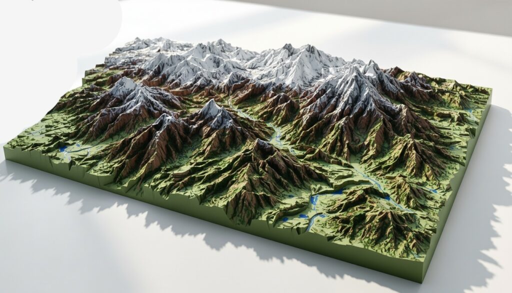
A 3D terrain map is exactly what it sounds like: a map that brings the surface of the Earth to life in three dimensions. Instead of flat lines and shaded contours, it reveals mountains that rise, valleys that sink, ridges that ripple, and coastlines that curve in sculpted relief. It transforms geography from something you read into something you see and almost feel. For centuries, maps were confined to paper. They relied on symbols, contour lines, and color gradients to suggest elevation. While effective, those flat representations required imagination. A 3D terrain map removes that barrier. It visually models elevation, slope, and landform structure so clearly that you can instantly understand how a landscape flows. From digital globe platforms to physical raised-relief models, 3D terrain maps are now everywhere. They’re used in classrooms, national parks, real estate development, architecture, gaming, military planning, and outdoor adventure. They answer one simple but powerful question: what does this place actually look like?
From Contour Lines to Sculpted Landscapes
Traditional topographic maps use contour lines to represent elevation. Each line connects points at the same height above sea level. The closer the lines, the steeper the terrain. This method works beautifully for trained readers, but it demands interpretation.
A 3D terrain map converts that data into a visual model. Elevation becomes shape. Height becomes volume. Instead of imagining how steep a mountain is, you see it. Instead of interpreting how deep a canyon runs, you perceive its depth.
The transition from flat to dimensional mapping has roots in centuries-old cartography. Early relief maps were carved from wood or molded from plaster. Today, digital mapping tools use satellite data, laser scanning, and advanced rendering engines to create hyper-accurate three-dimensional representations of Earth’s surface. What was once handcrafted is now generated from millions—or billions—of data points.
The Science Behind a 3D Terrain Map
At its core, a 3D terrain map is built from elevation data. This data is typically stored in what’s known as a Digital Elevation Model (DEM). A DEM contains elevation values for a grid of points across a landscape. Each point has a precise height measurement.
Modern DEMs are often created using satellite imagery and LiDAR (Light Detection and Ranging). LiDAR works by emitting laser pulses toward the ground from aircraft or drones and measuring how long they take to bounce back. This produces incredibly detailed elevation models, capturing features as small as individual trees or buildings.
Once elevation data is collected, specialized software translates those height values into a three-dimensional surface. Texture maps, satellite imagery overlays, and shading effects are added to enhance realism. The result is a 3D terrain map that can be rotated, zoomed, and explored from any angle.
The entire planet has now been mapped this way. Mountain ranges, deserts, glaciers, river systems—each can be viewed in dynamic three-dimensional form.
Physical vs. Digital 3D Terrain Maps
There are two primary forms of 3D terrain maps: physical and digital. Physical 3D terrain maps, often called raised-relief maps, are tangible models. They are made from materials like molded plastic, resin, wood, or 3D-printed composites. National parks frequently display these models in visitor centers so guests can understand trail systems and mountain elevations at a glance. In classrooms, students can run their hands over mountain ranges and feel the steepness of valleys.
Digital 3D terrain maps exist on screens. They appear in mapping platforms, GIS software, and interactive applications. Digital versions allow real-time manipulation. You can tilt the view, simulate sunlight angles, measure distances, and analyze slopes. Architects use them for site planning. Urban developers evaluate flood risk. Hikers preview trail difficulty. Even video game designers rely on terrain mapping to create realistic landscapes.
While physical maps provide tactile learning and visual clarity, digital terrain maps offer flexibility and depth of analysis. Together, they’ve reshaped how we understand geography.
How 3D Terrain Maps Are Used Today
The practical applications of 3D terrain maps stretch far beyond curiosity.
- Urban planning depends heavily on terrain modeling. Cities must consider slope, drainage, elevation, and flood plains before building infrastructure. A 3D terrain map allows planners to visualize how water will flow during heavy rain, where landslides might occur, and which areas are best suited for development.
- Environmental scientists use 3D terrain maps to study erosion patterns, watershed systems, and climate change impacts. When glaciers melt, terrain maps reveal how coastlines may shift. When forests are cleared, slope analysis helps predict soil loss.
- The military uses terrain maps for strategic planning. Elevation can determine visibility, accessibility, and defensive advantage. Real estate professionals analyze terrain to understand lot grading, viewshed potential, and build feasibility.
- Outdoor enthusiasts rely on 3D terrain visualization to plan adventures. A steep ridge looks very different in three dimensions compared to flat contour lines. Mountaineers can better assess ascent routes, and mountain bikers can preview technical descents.
- Even the entertainment industry uses 3D terrain modeling. Film studios and game developers create immersive worlds using terrain data. Fantasy landscapes often begin as modified versions of real topographic models.
The Educational Power of 3D Terrain Maps
One of the most transformative impacts of 3D terrain maps is in education. Geography once required imagination. Students stared at maps and memorized contour intervals. Today, they can rotate a 3D model of a mountain range and instantly understand how elevation changes shape ecosystems.
Consider the dramatic relief of the Himalayas. On a flat map, they appear as a shaded band across Asia. In three dimensions, they tower above surrounding plains. The connection between tectonic forces and towering peaks becomes obvious.
Rivers, too, are easier to understand in 3D. Instead of a blue line winding across a page, students can see how water follows gravity, carving valleys and feeding deltas. Concepts like watershed boundaries and drainage basins become intuitive. By removing abstraction, 3D terrain maps deepen comprehension. They make Earth science tangible.
The Technology That Makes It Possible
The rise of 3D terrain mapping is inseparable from advancements in satellite imaging and computing power.
Satellites orbiting Earth continuously collect high-resolution imagery and elevation data. Agencies like NASA and other international space organizations have contributed to global terrain mapping initiatives, producing comprehensive elevation datasets.
Powerful GIS (Geographic Information Systems) software processes these enormous data files. Advanced rendering engines transform raw elevation grids into smooth, realistic surfaces. Real-time graphics processing units (GPUs) allow terrain to be displayed interactively without lag.
Cloud computing has further expanded access. Instead of storing massive elevation datasets locally, users can stream terrain data on demand. This makes high-quality 3D mapping available to everyday users—not just specialists.
The combination of satellite data, LiDAR scanning, and high-performance computing has democratized three-dimensional geography.

3D Terrain Maps in Real Estate and Development
In real estate, terrain matters. Elevation affects drainage, foundation requirements, views, accessibility, and long-term property value.
A 3D terrain map provides instant clarity. Developers can see whether a parcel slopes gently or sharply. Architects can design homes that align with the natural topography instead of fighting against it. Engineers can assess grading costs before breaking ground.
In mountainous regions, terrain modeling is especially critical. A property perched on a ridge may offer panoramic views but require complex structural supports. A lot nestled in a valley may face flood risks.
Buyers benefit as well. Instead of relying solely on photographs, they can explore the land in three dimensions, understanding how a property sits within its broader landscape.
Gaming and Virtual Worlds
Many modern video games feature breathtaking landscapes—towering cliffs, rolling hills, winding rivers. Behind those visuals often lies real-world terrain data.
Game developers use digital elevation models to generate believable environments. Even fictional worlds frequently begin as modified terrain datasets. The realism of slopes and drainage patterns makes virtual exploration feel authentic.
Open-world games rely on terrain modeling to create immersive experiences. Players can climb mountains, traverse valleys, and navigate complex landscapes—all built from the same principles that guide real-world 3D terrain mapping.
Why 3D Terrain Maps Feel So Intuitive
Humans perceive the world in three dimensions. Our brains are wired to interpret depth, shadow, and spatial relationships. Flat maps require cognitive translation. Three-dimensional maps align directly with how we naturally see.
Shadows enhance realism by simulating sunlight angles. Vertical exaggeration—sometimes applied to emphasize elevation differences—makes subtle terrain features more visible. Perspective views replicate what you might see from an airplane or mountain summit. This intuitive clarity explains why 3D terrain maps are so engaging. They don’t just present information; they immerse you in it.
The Future of 3D Terrain Mapping
As technology advances, 3D terrain maps are becoming more detailed and more interactive.
Drone-based LiDAR scanning now produces ultra-high-resolution terrain models for specific sites. Virtual reality applications allow users to “walk” through digital landscapes. Augmented reality tools project terrain models onto physical surfaces, blending digital geography with real space.
Real-time environmental modeling may soon integrate live data—showing how rainfall changes runoff patterns or how wildfires spread across terrain. These innovations will deepen our understanding of Earth’s dynamic systems.
Artificial intelligence is also accelerating terrain analysis. Algorithms can automatically detect landslide risks, flood zones, or erosion patterns within 3D models. The map is no longer static. It is becoming a living, analytical environment.
3D Terrain Maps and Climate Awareness
As climate change reshapes coastlines and mountain ecosystems, terrain mapping plays a critical role in forecasting and adaptation.
Sea-level rise simulations depend on accurate elevation models. Even small changes in elevation can determine whether coastal communities face flooding. 3D terrain maps help visualize those potential impacts clearly.
In wildfire-prone regions, slope steepness influences fire behavior. Emergency planners rely on terrain models to predict fire spread and plan evacuation routes.
By revealing how landforms interact with environmental forces, 3D terrain maps support smarter, more resilient decision-making.
From Exploration to Understanding
A 3D terrain map is more than a technological achievement. It is a new way of seeing. It transforms the Earth from a flat abstraction into a sculpted reality. It bridges science and art. It empowers planners, educators, adventurers, and designers. It makes complex spatial information intuitive and accessible.
Whether displayed as a raised-relief model in a museum or rendered on a smartphone screen, a 3D terrain map invites exploration. You can trace mountain ridges with your eyes, follow rivers to their mouths, and understand how landscapes rise and fall. In a world increasingly shaped by geography—from climate change to urban growth—seeing the land clearly has never been more important.
Why 3D Terrain Maps Matter
So what is a 3D terrain map? It is a three-dimensional representation of Earth’s surface built from precise elevation data. It reveals the true shape of landscapes—mountains, valleys, plains, and coastlines—in a way flat maps cannot. But beyond its definition, it represents something bigger. It reflects humanity’s desire to understand the world in deeper detail. It combines technology, science, and visualization to transform raw data into insight. As mapping continues to evolve, 3D terrain maps will only grow more powerful. They will help us design smarter cities, protect vulnerable ecosystems, and explore both real and virtual worlds with clarity. When you look at a 3D terrain map, you are not just seeing land. You are seeing structure, motion, possibility, and the story of Earth itself rising from the surface.


