Tag: Maps

Rhine River Watershed Map

Rhine River Watershed Map

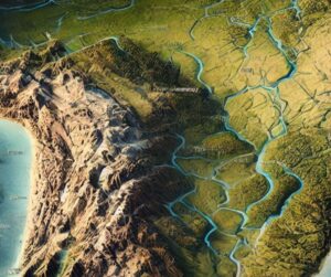
Discover the Rhine River Watershed, a vital water system shaping Europe’s culture and economy. Learn how 3D mapping technologies help monitor water flow, track seasonal changes, and protect ecosystems. Explore the river’s rich biodiversity, seasonal variations, and how advanced mapping tools support sustainable water management, conservation, and climate adaptation efforts in this dynamic and essential region.

Read More »
Rufiji River Watershed Map

Rufiji River Watershed Map

Explore the Rufiji River Watershed, a vital water system in Tanzania. Discover its dynamic geography, diverse ecosystems, and how cutting-edge 3D mapping technology is transforming sustainable management, conservation, and development efforts, ensuring a balanced future for this crucial river basin.

Read More »
New Jersey Topo Map

New Jersey Topo Map

Discover New Jersey’s diverse geography with topographic maps revealing the Highlands’ rugged ridges, the serene Pine Barrens, and the dynamic Atlantic Coast. From the dramatic Delaware Water Gap to bustling urban landscapes, 2D and 3D maps bring the Garden State’s terrain to life, offering adventurers and conservationists a deeper connection to its natural beauty and unique features.

Read More »
Juruá River Watershed Map

Juruá River Watershed Map

Discover the Juruá River Watershed, a vital Amazonian water system rich in biodiversity. Explore its dynamic geography, ecosystems, and how cutting-edge 3D mapping technology is transforming sustainable management and conservation efforts, ensuring the health and future of this crucial river basin.

Read More »
Seine River Watershed Map

Seine River Watershed Map

Discover the Seine River Watershed, a vital lifeline to Northern France. Learn how advanced 3D mapping technologies help monitor water flow, track seasonal changes, and protect ecosystems. Explore its rich cultural history, dynamic ecosystems, and the challenges of managing this crucial resource amidst climate change, pollution, and urban development.

Read More »
Israel Topo Map

Israel Topo Map

Discover Israel’s stunning terrain with topographic maps revealing the arid Negev Desert, dramatic Dead Sea, lush Galilee, and historic Judean Hills. From rolling coastal plains to ancient archaeological sites, 2D and 3D maps bring the Holy Land to life, offering adventurers and historians a deeper connection to its diverse and captivating landscapes.

Read More »
Shatt al-Arab Watershed Map

Shatt al-Arab Watershed Map

Discover the Shatt al-Arab Watershed, a vital river system at the heart of the Middle East. Learn how 3D mapping technologies are helping manage its water flow, track seasonal changes, and protect ecosystems. Explore its rich biodiversity, cultural significance, and the challenges it faces from climate change and human activity, while uncovering how advanced mapping is supporting sustainable water management.

Read More »
Tajikistan Watershed Maps

Tajikistan Watershed Maps

Tajikistan’s watersheds, including the Vakhsh, Zeravshan, and Panj River Basins, are essential for agriculture and ecosystems. Learn how modern technologies like 3D mapping, GIS, and remote sensing help manage these systems, ensuring sustainable water use and addressing challenges like water scarcity, climate change, and population growth.

Read More »
Chao Phraya River Watershed Map

Chao Phraya River Watershed Map

Discover the Chao Phraya River Watershed, Thailand’s lifeline. Learn how advanced 3D mapping technologies help manage its waters, track seasonal changes, and support conservation efforts. Explore its dynamic river systems, rich ecosystems, and the challenges of climate change, while uncovering how this vital resource shapes agriculture, urban development, and the region’s future.

Read More »
Trombetas River Watershed Map

Trombetas River Watershed Map

Dive into the Trombetas River Watershed, a vital part of the Amazon ecosystem. Explore its dynamic geography, rich biodiversity, and how cutting-edge 3D mapping technology is transforming sustainable management and conservation efforts, ensuring the river’s health and resources for future generations.

Read More »
Matanuska River Watershed Map

Matanuska River Watershed Map

Discover the Matanuska River Watershed Map, a window into Alaska’s dynamic ecosystem. Uncover its river systems, diverse habitats, and human connections, all brought to life with cutting-edge 3D mapping technology. Explore how this tool guides conservation, sustainable water management, and the future of the Matanuska River, ensuring its health and vitality for generations to come.

Read More »
Florida Topo Map

Florida Topo Map

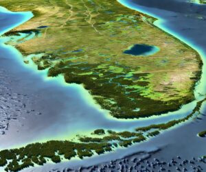
Discover Florida’s stunning landscapes with topographic maps that reveal the Everglades’ wetlands, rolling Panhandle hills, and dynamic coastlines. From exploring freshwater springs to navigating sandy beaches, 2D and 3D maps bring the Sunshine State’s diverse terrain to life. Perfect for adventurers, conservationists, and educators, these maps offer a deeper connection to Florida’s unique geography and natural beauty.

Read More »
Israel Topo Map

Israel Raised Relief Map

Experience Israel’s stunning geography with raised relief maps that bring its mountains, valleys, and historical landmarks to life. Perfect for educators, travelers, and history enthusiasts, these tactile masterpieces offer a unique way to explore the land’s diverse terrain. Discover the artistry behind their creation and connect with the stories embedded in Israel’s remarkable landscapes.

Read More »
South America Topo Map

South America Topo Map

Discover South America’s breathtaking terrain with topographic maps showcasing the towering Andes, lush Amazon Basin, and dramatic Patagonia. From the arid Atacama Desert to sprawling wetlands like the Pantanal, 2D and 3D maps bring the continent’s diverse landscapes to life, guiding adventurers and conservationists through its natural wonders.

Read More »
Xingu River Watershed Map

Xingu River Watershed Map

Explore the Xingu River Watershed, a crucial Amazonian water system rich in biodiversity. Discover its dynamic geography, vital ecosystems, and how cutting-edge 3D mapping technology is revolutionizing its sustainable management and conservation efforts, ensuring the health of this essential river basin for future generations.

Read More »
Columbia River Watershed Map 2

Columbia River Watershed Map

Discover the Columbia River Watershed, a vast system spanning the Pacific Northwest. Explore its ecosystems, hydropower significance, and challenges like flooding and climate change. Learn about the artistry and technology behind 3D map fabrication, bringing its intricate waterways and landscapes to life. Uncover the vital role this watershed plays in sustaining communities, economies, and biodiversity across the region.

Read More »

Get a Free Quote