Tag: Maps

Manua Loa Volcano-Day

Top 10 Largest Volcanoes in the World

Discover the world’s top 10 largest volcanoes, from Mauna Loa’s vast shield to Kilimanjaro’s towering peak. Explore their massive sizes, rich histories, and fascinating stories of power and beauty that shape our planet. Journey into the heart of these natural giants and uncover the awe-inspiring forces of Earth’s fiery past and present!

Read More »
Augusta National Golf Club 2

Top 10 Golf Courses in the United States

Discover the ultimate golfing experience with our top 10 U.S. golf courses, featuring Augusta’s iconic greens, Pebble Beach’s stunning coastline, and Bandon Dunes’ windswept links. Dive into rich histories, legendary moments, and breathtaking landscapes that make these courses a golfer’s dream. Whether it’s the challenge of Shinnecock or the beauty of Cypress Point, these destinations are where legends play.

Read More »
Thailand Watershed Maps

Thailand Watershed Maps

Thailand’s watersheds, including the Chao Phraya, Mekong, and Mae Klong River Basins, are crucial for agriculture and ecosystems. Learn how modern technologies like 3D mapping, GIS, and remote sensing help manage these systems, ensuring sustainable water use and addressing challenges like water scarcity, climate change, and population growth.

Read More »
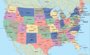
Political Map-United States

What Is a Political Map? Understanding Its Purpose and Importance

Political maps reveal the world’s borders, countries, and capitals, showcasing how humans organize and divide the Earth. They’re essential tools for education, travel, and understanding global politics. From ancient hand-drawn maps to modern digital designs, political maps tell the story of our ever-changing world, helping us navigate, learn, and connect with the places and people around us.

Read More »
Mount Everest

Top 10 Largest Mountains in the World

Explore the awe-inspiring heights and captivating stories of the world’s 10 largest mountains. From Everest’s legendary summits to K2’s savage beauty, uncover breathtaking landscapes, daring adventures, and the rich histories that make these peaks the ultimate test of resilience and wonder. Journey into the heart of Earth’s towering giants!

Read More »
Cartography Map Mountains

What Is Cartography? Exploring the Craft of Mapmaking

Cartography combines science, art, and storytelling to create maps that guide, inspire, and inform. From ancient clay tablets to modern GPS, maps reveal our world in fascinating ways. Dive into the history, techniques, and future of mapmaking, and discover how cartographers transform data into tools that connect us to our planet and beyond!

Read More »
Sahara Desert

Top 10 Largest Deserts on Earth

Journey through the world’s largest deserts, from Antarctica’s icy expanse to the Sahara’s golden sands. Explore their immense sizes, rich histories, unique ecosystems, and fascinating stories of survival and exploration. These vast, arid landscapes showcase the beauty and resilience of nature, offering a glimpse into Earth’s most extreme and captivating environments. Adventure awaits in these extraordinary deserts!

Read More »
Andes Mountain Range

Top 10 Longest Mountain Ranges in the World

Embark on a journey across the world’s longest mountain ranges! From the towering Andes to the ancient Appalachians, discover epic landscapes, fascinating histories, and awe-inspiring peaks. Explore rugged terrains, cultural legends, and geological wonders that define these majestic ranges, each with a unique story that captivates adventurers, historians, and nature enthusiasts alike. Let these monumental mountains inspire your next adventure!

Read More »
Vermejo Park Ranch

Top 10 Largest Ranches in the United States

Explore the vast expanse of the top 10 largest ranches in the U.S.! From sprawling cattle operations to historic landscapes, these ranches epitomize the rugged beauty and rich heritage of American ranching. Dive into their fascinating histories, sheer scale, and contributions to the culture and economy, showcasing the enduring spirit of the Old West across millions of acres.

Read More »
Panama Watershed Maps

Panama Watershed Maps

Panama’s watersheds, such as the Panama Canal and Chagres River Basins, are vital for agriculture, industry, and ecosystems. Learn how 3D mapping, GIS, and remote sensing help monitor and manage these systems, ensuring sustainable water use and addressing challenges like climate change, water scarcity, and growing demand for resources.

Read More »
Malawi Watershed Maps

Malawi Watershed Maps

Malawi’s watersheds play a crucial role in agriculture, energy, and ecosystems. This blog explores their importance, challenges, and how 3D watershed maps contribute to managing water resources, reducing pollution, and supporting conservation efforts. Learn how mapping technologies help Malawi navigate water scarcity, climate change, and resource management challenges for a sustainable future.

Read More »
Indonesia Watershed Maps

Indonesia Watershed Maps

Indonesia’s watersheds are crucial for agriculture, hydropower, and ecosystems. This blog explores their significance, the challenges they face, and how 3D watershed maps aid in managing water resources, supporting conservation, and adapting to climate change. Learn how mapping technologies help protect Indonesia’s water systems for the future.

Read More »
Netherlands Watershed Maps

Netherlands Watershed Maps

The Netherlands’ watersheds, such as the Rhine and Meuse river basins, are critical for agriculture, biodiversity, and water management. This blog explores how advanced technologies like 3D mapping, GIS, and remote sensing are used to manage these systems. By monitoring water flow, quality, and the effects of climate change, these tools help ensure sustainable water use and protect ecosystems for future generations in the Netherlands.

Read More »
Tunisia Watershed Maps

Tunisia Watershed Maps

Tunisia’s watersheds, including the Medjerda, Oued Miliane, and Oued Zarga River Basins, are essential for agriculture and ecosystems. Learn how modern technologies like 3D mapping, GIS, and remote sensing help manage these systems, ensuring sustainable water use and addressing challenges like water scarcity, climate change, and population growth.

Read More »
Djibouti Watershed Maps

Djibouti Watershed Maps

Djibouti’s watershed maps are crucial for managing water resources, predicting floods, and ensuring sustainable water use. These maps help allocate water for agriculture, industry, and communities while addressing challenges like climate change and water scarcity. By monitoring river flow, groundwater levels, and rainfall, they support flood prevention, efficient water distribution, and ecosystem protection, ensuring long-term water security for the country.

Read More »

Get a Free Quote