What Is a Soils Map?
A soils map reveals the hidden blueprint beneath your feet. Discover how soil data shapes farming, construction, conservation, and land investment decisions.
A soils map reveals the hidden blueprint beneath your feet. Discover how soil data shapes farming, construction, conservation, and land investment decisions.
What is a 3D terrain map? It’s geography brought to life. From towering mountains to winding valleys, discover how modern elevation data transforms flat maps into immersive, three-dimensional landscapes used in real estate, gaming, education, and environmental planning.

What is a cadastral map? It’s the detailed blueprint behind property ownership, defining boundaries, parcel sizes, and legal land records. From city skyscrapers to rural farmland, cadastral maps power real estate transactions, guide urban planning, and protect property rights—quietly shaping how land is bought, sold, taxed, and developed around the world.
A legend on a map is the quiet powerhouse behind every successful journey. It decodes symbols, colors, and lines, transforming abstract visuals into clear, actionable meaning. Whether you are navigating city streets, hiking mountain trails, or exploring data-rich digital maps, the legend is what turns confusion into confidence and information into understanding.
A custom topographic map transforms elevation data into a personalized view of the land. From hiking routes to 3D relief wall art, explore how tailored contour maps reveal the true shape of mountains, valleys, and coastlines with precision and beauty.

A children’s atlas is more than a book of maps—it’s a gateway to adventure. With colorful illustrations, simple geography, and global stories, it invites young readers to explore the world from their own home. Each page sparks curiosity, builds understanding, and helps children see how big, diverse, and connected our planet truly is.
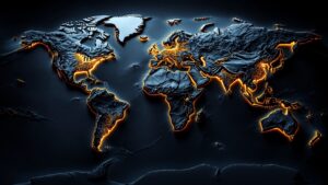
A world relief map transforms Earth from flat paper into a living landscape. With raised mountains, deep oceans, and sculpted continents, it reveals how our planet truly looks and feels—turning geography into an experience you can see, touch, and explore.

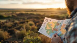
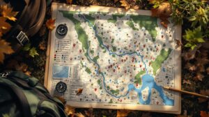
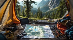
A hunting map is more than lines and colors—it’s a secret language of the land. It reveals where animals travel, where you can hunt legally, and how to move with confidence. From ridgelines to hidden valleys, a hunting map transforms wilderness into strategy, guiding every step of your journey before you ever set foot in the field.
A contour map uses flowing lines to reveal the hidden shape of the land. Each line marks equal elevation, showing how terrain rises, falls, and flows. Learn how contour maps work, how to read them, and why they remain essential tools for navigation, science, and understanding the Earth’s surface.
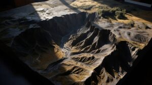
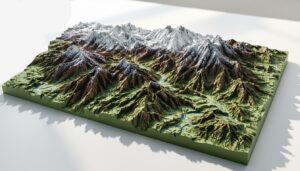
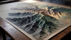
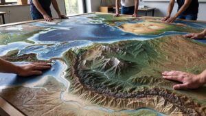
A terrain model turns the Earth’s surface into a three-dimensional landscape you can see and understand instantly. From mountains and valleys to rivers and coastlines, these models reveal how land is shaped and why it matters. Discover how terrain models are made, used, and why they remain essential tools for learning and planning.
A raised relief map turns flat geography into a three-dimensional landscape you can see and feel. From towering mountains to winding valleys, these maps bring Earth’s surface to life. Discover how raised relief maps work, how they’re made, and why they remain one of the most powerful ways to understand our planet.
A backcountry topo map is your guide where roads vanish and terrain rules. Learn how contour lines reveal elevation, routes, and hidden hazards—and why these maps remain essential for wilderness navigation and exploration.

A contour model transforms flat elevation data into a living 3D landscape. Discover how these layered models reveal hills, valleys, and terrain logic, and why they’re essential in architecture, planning, education, and environmental design.

A property map is more than lines on paper—it’s a visual guide to land ownership, boundaries, and hidden rules that shape how property is used. Discover how property maps work, why they matter, and how they influence real estate, planning, and everyday decisions.
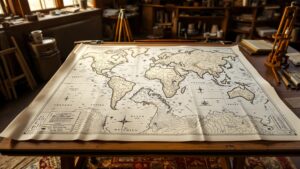
A cartographic map is more than a picture of land. It is a carefully designed blend of science, art, and storytelling that turns geography into meaning. Discover how cartographic maps shape navigation, education, history, and how we understand the world around us.

A nautical chart is far more than a map of the sea. It reveals hidden depths, underwater hazards, tides, and navigation routes that keep vessels safe. Explore how nautical charts work, why they matter, and how they’ve guided sailors for centuries across the world’s most unpredictable waters.