
Exploring the Land in Contours, Ridges, and Real-World Detail
A custom topographic map is more than a navigational tool. It is a sculpted portrait of the Earth, designed around a specific place, purpose, and perspective. While standard topographic maps show elevation, terrain, and geographic features in a consistent format, a custom topographic map takes that foundational data and reshapes it—highlighting the details that matter most to the person using it. Whether you’re a hiker planning a backcountry expedition, a landowner studying acreage boundaries, an architect analyzing site elevation, or someone commissioning a framed relief map of a meaningful landscape, a custom topographic map transforms raw geographic data into something precise, personal, and powerful. To understand what makes it special, we first need to understand what topography itself really means.
Understanding Topography: The Shape of the Land
Topography refers to the physical features of a landscape—its hills, valleys, ridges, slopes, depressions, rivers, and plains. It describes the shape of the land in three dimensions. Traditional topographic maps use contour lines to represent elevation. Each line connects points of equal height above sea level. When contour lines are spaced far apart, the terrain is relatively flat. When they are tightly packed, the slope is steep.
For more than a century, organizations like the United States Geological Survey have produced topographic maps for navigation, surveying, engineering, and scientific research. These maps became foundational tools for explorers, military planners, environmental scientists, and outdoor enthusiasts. But standard maps follow strict formatting. They are uniform. They are generalized. A custom topographic map, on the other hand, is tailored.
What Makes a Topographic Map “Custom”?
A custom topographic map is built around specific criteria chosen by the user. Instead of presenting a broad, standardized view, it zooms in on a selected region and emphasizes details relevant to a particular goal.
Customization can include scale adjustments, color palettes, labeling preferences, contour interval spacing, boundary overlays, satellite imagery integration, or 3D relief rendering. A mountain climber might want tight contour intervals to assess steep ascents. A real estate developer may prefer parcel boundaries and elevation shading. A conservationist may need watershed overlays.
The customization transforms the map from a generic reference into a targeted analytical tool—or even a personalized piece of art.
How Custom Topographic Maps Are Created
Modern custom topographic maps rely on advanced geographic data and mapping technology. Elevation data often comes from satellite-based measurements, aerial LiDAR scans, or digital elevation models. Agencies like NASA and international space programs contribute high-resolution terrain data that allows cartographers to model landscapes with remarkable accuracy.
Software platforms process this data and convert it into contour lines, hill shading, and color gradients. Designers then adjust layers based on user preferences. Rivers can be emphasized. Trails can be highlighted. Grid systems can be simplified or expanded.
In some cases, the digital map becomes the foundation for a physical 3D relief map created through laser cutting, CNC carving, or 3D printing.
The result is not just information. It is a visual experience of terrain.
The Difference Between Standard and Custom Maps
Standard topographic maps are designed for consistency. They often cover large regions, use fixed scales, and adhere to strict cartographic conventions. This makes them reliable and universal.
Custom maps, however, prioritize relevance. If someone needs to analyze a 15-mile hiking corridor, they do not need an entire state map. If a rancher wants to study drainage patterns on private land, they do not need urban grid references.
Customization reduces clutter. It refines focus. It enhances usability. It also allows aesthetic personalization. Some custom maps feature minimalist black-and-white contour lines. Others use vibrant gradient shading to dramatize elevation changes. Some incorporate metallic finishes, layered wood designs, or framed presentation formats for display.
Function meets form.
Who Uses Custom Topographic Maps?
Custom topographic maps serve a wide range of users, each with different objectives. Outdoor adventurers rely on them to plan routes, assess terrain difficulty, and identify water sources. Search-and-rescue teams use them to evaluate elevation hazards and coordinate operations.
Architects and engineers analyze slope stability and land contours before designing buildings or infrastructure. Landscape designers study elevation changes to plan drainage and garden layouts.
Hunters and anglers use topographic maps to identify ridgelines, valleys, and water systems. Property developers examine them to understand grading requirements.
Even interior decorators and gift buyers commission custom topographic maps as artistic centerpieces—capturing a favorite mountain range, national park, or hometown in striking relief.
Customization expands the audience beyond professionals into everyday enthusiasts.
Custom Topographic Maps in the Digital Age
Digital mapping technology has transformed accessibility. What once required specialized cartography expertise can now be customized online.
Interactive mapping platforms allow users to define map boundaries, adjust contour intervals, select color themes, and preview results instantly. Satellite overlays can be toggled on or off. Terrain shading can be intensified for dramatic effect.
Advancements in data visualization mean that users can view landscapes from multiple angles. Three-dimensional flyovers, slope gradient heat maps, and watershed modeling are now widely available.
The technology has democratized topographic customization. You no longer need a government office or surveying firm to produce a detailed terrain map.
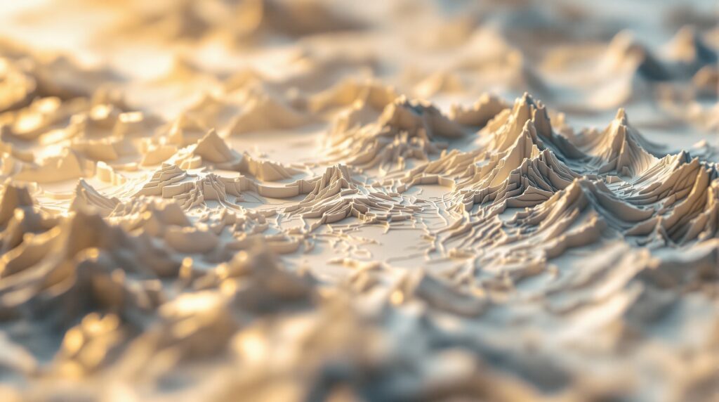
3D Relief Maps: Bringing Elevation to Life
One of the most exciting forms of custom topographic mapping is the three-dimensional relief map. Unlike flat contour representations, relief maps physically model elevation changes.
Layers of wood, resin, or printed material are stacked and carved to match contour lines. The result is tactile. You can run your hand across ridges and valleys.
For educational settings, relief maps help students visualize how mountains rise and rivers carve landscapes. For homeowners, they provide a stunning decorative piece that also conveys geographic depth.
A 3D custom topographic map turns abstract elevation numbers into something you can see and feel.
Applications in Real Estate and Land Development
Topography directly affects property value and development potential. Steep slopes may limit construction. Low-lying areas may pose flooding risks. Natural drainage patterns influence landscaping design.
Custom topographic maps allow developers and buyers to examine elevation features before making decisions. Overlaying parcel boundaries with contour data reveals how much grading might be required.
In areas near mountain ranges or coastal cliffs, elevation information becomes even more critical. Accurate mapping supports informed investment.
The Role of Custom Maps in Outdoor Exploration
For hikers and mountaineers, terrain is everything. A custom topographic map can focus on a specific trail system, highlight elevation gain, and display nearby water sources. Contour spacing tells a story of effort. Closely packed lines warn of steep climbs. Wide spacing signals gentler terrain.
Serious expedition planners may integrate waypoints, campsites, and emergency routes into their custom map. In wilderness navigation, clarity and relevance can make a real difference.
Artistic and Sentimental Value
Beyond utility, custom topographic maps often carry emotional meaning. Imagine a framed relief map of the mountain range where you proposed. Or a contour rendering of the coastline where you grew up. Or a detailed elevation map of a national park you visit every summer. Because landscapes are tied to memory, custom topographic maps become personal artifacts. They freeze geography in a meaningful frame. Some designers experiment with layered wood textures, minimalist monochrome palettes, or metallic finishes to elevate the aesthetic impact. The land becomes art.
Accuracy and Data Sources
Accuracy is essential in custom mapping. Elevation data typically comes from digital elevation models generated through satellite radar measurements, aerial photogrammetry, or LiDAR scanning.
Government agencies, scientific institutions, and international mapping programs continuously refine this data. High-resolution terrain models can capture variations within meters or even centimeters.
However, resolution depends on the source. Rural and mountainous areas may have more detailed elevation data than dense urban regions. Understanding data origin helps determine how precise a custom map can be.
Environmental and Conservation Uses
Custom topographic maps play an important role in environmental planning.
- Watershed analysis relies on elevation modeling to predict how water flows through terrain. Conservation groups use topographic overlays to identify erosion risks and habitat zones.
- In wildfire management, terrain slope affects fire spread. Elevation influences wind patterns and vegetation density.
A custom map tailored to ecological analysis can support smarter land stewardship.
How to Choose the Right Custom Topographic Map
Choosing a custom map depends on purpose.
If navigation is the goal, prioritize clarity and contour precision. If display is the focus, consider material quality and color design. If analysis is required, ensure high-resolution elevation data.
Consider scale carefully. A map that covers too wide an area may lose detail. Too narrow, and it may omit context.
Customization means flexibility—but it also requires thoughtful decisions.
The Future of Custom Topographic Mapping
Technology continues to evolve. Augmented reality may soon allow users to project 3D terrain maps onto physical spaces. Interactive holographic terrain displays are already under development. Real-time elevation modeling integrated with satellite imagery could offer dynamic updates.
As geospatial data becomes more precise and accessible, custom topographic maps will grow more immersive and more accurate. What began as contour lines on paper is becoming a living visualization of the Earth’s surface.
Why Custom Topographic Maps Matter
A custom topographic map is more than a geographic reference. It is a tool for planning, a medium for analysis, a piece of art, and a record of landscape. It distills millions of elevation data points into a form that humans can interpret. It reveals the invisible slopes beneath forests. It explains how rivers find their way downhill. It shows how mountains rise from plains. Most importantly, it connects people to place.
When you understand the terrain of a landscape—its ridges, valleys, and contours—you see it differently. You notice patterns. You appreciate scale. You anticipate movement. A custom topographic map makes that understanding personal. It answers a simple question—what does this land really look like?—in extraordinary detail. And in doing so, it transforms geography into something tangible, analytical, and beautiful.


