Mountains and maps share an intimate connection, a relationship rooted in the spirit of exploration and the promise of discovery. Mountains rise from the Earth’s crust like ancient guardians, their jagged peaks reaching into the heavens, defying time and gravity. Maps, on the other hand, are humanity’s attempt to tame them—lines inked with precision on paper, tracing contours and summits that seem to touch the infinite. Together, they invite dreamers and adventurers to journey into the unknown, where blank spaces on old maps once held whispers of monsters or lost kingdoms hidden in remote valleys. The allure of a mountain on a map is not just in its elevation or its name; it is in the stories it promises—a trail to be followed, a summit to be conquered, or a secret to be uncovered. Maps flatten their majesty, reducing their vast wilderness to symbols and gradients, yet within those measured curves lies the pull of adventure, where each ridge and contour line hints at treacherous passes, roaring rivers, and the thrill of reaching the top. Mountains and maps alike challenge the soul, daring us to climb higher, to push further, and to chart not just the land but also the limits of human resilience and imagination.

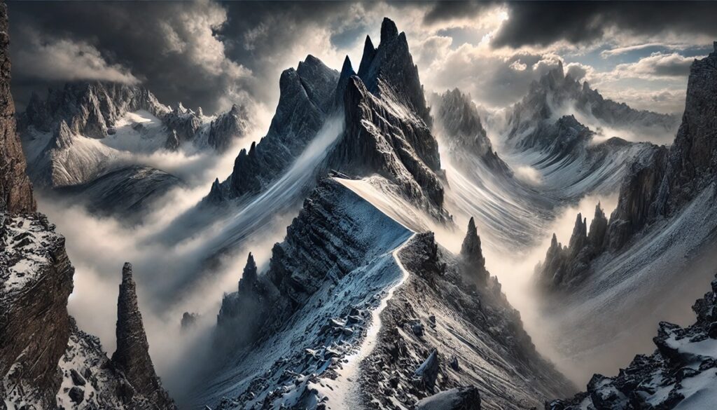
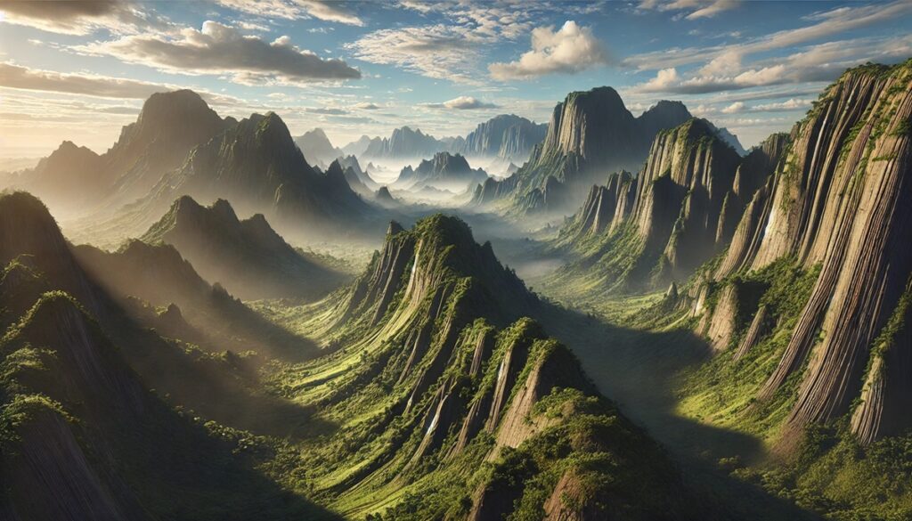
Mountains tell the story of Earth’s geological past, forged by powerful tectonic forces over millions of years. While some ranges have aged into subdued hills, others are youthful, jagged, and still growing as tectonic plates collide and shift. This list explores the top 10 youngest mountain ranges across the globe, ranked by their massive size. Each range represents a dynamic story of creation, beauty, and human interaction, brimming with fascinating geological facts and folklore. Let’s explore these majestic giants that remind us of Earth’s ever-changing surface.
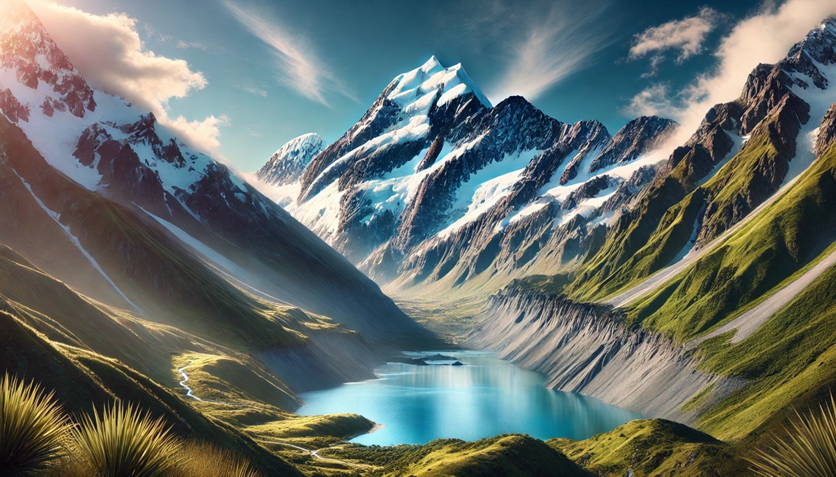
#1: Southern Alps – 350 miles
New Zealand’s Southern Alps stretch 350 miles across the South Island, forming a dramatic spine of peaks and glaciers. This range, which began rising about 5 million years ago, is one of the youngest on the planet. Aoraki/Mount Cook, the tallest peak, reaches 12,218 feet and holds deep cultural significance for the indigenous Māori people.
The Southern Alps were formed by the collision of the Pacific and Indo-Australian tectonic plates, a process still shaping the landscape today. Towering mountains, alpine lakes, and fjords make this range a magnet for adventurers and photographers. Aoraki/Mount Cook is particularly legendary, both for its beauty and its challenges; Sir Edmund Hillary, the first to summit Mount Everest, honed his climbing skills here.
The Māori people tell a story of Aoraki, a son of the heavens, who turned to stone after his canoe struck land. Today, the mountains are a playground for outdoor enthusiasts, offering hiking, skiing, and glacier trekking. Despite their youth, the Southern Alps are already iconic, representing the wild and untamed spirit of New Zealand’s South Island.
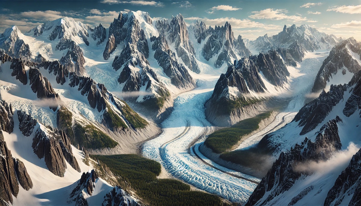
#2: Alaska Range – 600 miles
The Alaska Range, stretching 600 miles across southern Alaska, is one of the youngest and most dramatic mountain ranges in North America. Born approximately 6 million years ago, it remains geologically active, with ongoing uplift caused by tectonic movement. Denali, the tallest peak in North America, rises to an awe-inspiring 20,310 feet, dominating the Alaskan wilderness.
The Alaska Range is famous for its rugged beauty and harsh climate, where temperatures can plummet to -75°F. Indigenous Alaskan tribes, such as the Athabaskan people, consider Denali a sacred mountain, naming it “The High One.” Early explorers, including climbers like Hudson Stuck, braved its treacherous slopes, setting records that continue to inspire mountaineers. Denali National Park, encompassing much of the range, attracts adventurers who trek its icy peaks, glacial valleys, and vast tundra.
The Alaska Range is also a hub of wildlife, with grizzly bears, caribou, and wolves thriving in its wild expanse. Glaciers like the Kahiltna and Ruth carve through the mountains, creating dramatic landscapes. Its youthful peaks remain sharp and towering, making the Alaska Range an enduring symbol of North America’s untamed beauty.
#3: Caucasus – 700 miles
The Caucasus Mountains, a 700-mile range spanning Europe and Asia, were formed about 25 million years ago during tectonic activity between the Arabian and Eurasian plates. Mount Elbrus, at 18,510 feet, is the tallest peak in Europe and an extinct volcano.
The Caucasus have long been a region of cultural diversity, serving as a bridge between civilizations. The mountains are steeped in mythology, including the tale of Prometheus, who was bound to Mount Kazbek as punishment for stealing fire from the gods. Historically, the Caucasus were a natural barrier between powerful empires like Persia and Russia, making the region fiercely contested.
This range is geologically active, with earthquakes and volcanic remnants still shaping the land. The Caucasus boasts rich biodiversity, from ancient forests to rare animals like the Caucasian leopard. Its combination of natural beauty and cultural heritage makes the Caucasus a hidden gem in the world of mountains.
#4: Tien Shan – 1,500 miles
The Tien Shan, or “Celestial Mountains,” spans 1,500 miles across Central Asia, primarily through Kyrgyzstan, Kazakhstan, and China. Formed approximately 25 million years ago, this range remains strikingly young in geological terms. Its highest peak, Jengish Chokusu, stands at 24,406 feet, piercing the sky with jagged, snow-capped summits.
The Tien Shan has long captured the imagination of travelers and explorers. Marco Polo famously described its grandeur during his travels along the Silk Road, which passed through the range’s lower valleys. Its peaks served as both a physical and symbolic boundary between cultures, marking the trade routes that connected East and West. The mountains are laced with glaciers, including the massive Inylchek Glacier, one of the largest outside the polar regions.
Legends swirl around the Tien Shan’s mystical beauty. Local tales speak of hidden valleys where immortality can be found, guarded by spirits of the mountains. Despite its harsh, remote conditions, the Tien Shan is home to diverse wildlife, including the elusive snow leopard and golden eagles. As one of the least explored ranges, its pristine landscapes offer a glimpse into untouched wilderness, making the Tien Shan a geological and cultural wonder.
#5: Alps – 750 miles
The Alps, stretching 750 miles across central Europe, are a stunning range that emerged around 30 million years ago due to the collision between the African and Eurasian plates. This young and dynamic range cuts across countries like France, Switzerland, Italy, Austria, and Germany. Mont Blanc, at 15,774 feet, reigns as the highest peak and has drawn adventurers for centuries.
With their rugged peaks, pristine valleys, and iconic glaciers, the Alps have been a cradle of exploration, tourism, and folklore. The mountains are dotted with charming villages that host travelers year-round, whether for skiing in Chamonix or hiking trails like the Tour du Mont Blanc. Stories abound about the Alps being home to mythical creatures like the barbegazi, small bearded men who live in snowy caves.
Glaciers, though receding due to climate change, remain a hallmark of the Alps, feeding rivers like the Rhine and the Danube. This range is geologically active, with occasional earthquakes and evidence of slow tectonic uplift. As a European jewel, the Alps have inspired artists, poets, and adventurers for generations.
#6: Andes – 4,300 miles
The Andes, stretching an astounding 4,300 miles along the western edge of South America, are the longest continental mountain range in the world. They began forming about 45 million years ago when the Nazca Plate subducted beneath the South American Plate. These mountains traverse seven countries, including Chile, Argentina, and Peru, and are famed for their high-altitude plateaus, such as the Altiplano. Aconcagua, the tallest peak, towers at 22,841 feet and draws climbers from around the globe.
The Andes are an epicenter of cultural history, once home to the mighty Inca Empire. The ancient city of Machu Picchu, perched high in the mountains, continues to awe visitors with its engineering and mystery. Legends abound about Incan messengers, or chasquis, who could traverse the steep slopes with incredible speed. Volcanoes like Cotopaxi and Chimborazo reveal the mountains’ volcanic origins, as the Andes are part of the Pacific Ring of Fire.
The Andes are also a hub of biodiversity. The range houses unique animals like llamas, condors, and spectacled bears. Its ecosystem supports countless rivers, including the Amazon, which begins in the Andes’ snow-capped peaks. While still geologically young, the Andes’ vast size and cultural influence make them one of Earth’s most iconic mountain ranges.
#7: Carpathians – 900 miles
The Carpathian Mountains stretch 900 miles across Eastern Europe, covering parts of Romania, Ukraine, Slovakia, and Poland. Formed about 30 million years ago, they are a relatively young range, shaped by tectonic movements of the Eurasian Plate. The highest peak, Gerlachovský štít, rises to 8,711 feet, making the Carpathians smaller in height but no less significant in beauty and history.
The Carpathians are steeped in mystery and folklore, particularly in Transylvania, where tales of vampires and werewolves abound. The forests of the Carpathians are some of the last remaining old-growth woodlands in Europe, teeming with brown bears, lynxes, and wolves. Castles and medieval villages dot the landscape, blending natural beauty with a rich cultural heritage.
Geologically, the Carpathians are still experiencing slow uplift, creating their rolling peaks and deep valleys. The mountains are known for their karst formations, with vast caves and underground rivers drawing spelunkers and explorers. This range offers a glimpse into Europe’s wild past, where untamed nature and ancient stories collide.
#8: Rockies – 3,000 miles
The Rocky Mountains, or “Rockies,” stretch 3,000 miles through Canada and the United States, forming a jagged backbone of North America. Formed about 70 million years ago during the Laramide orogeny, the Rockies remain relatively young with sharp peaks and high elevations. Mount Elbert, the tallest peak, rises to 14,440 feet in Colorado.
These mountains were a significant barrier to early westward expansion in the United States. Native American tribes like the Blackfeet and Shoshone inhabited the Rockies, weaving rich folklore about spirits living in the peaks. Early explorers like Lewis and Clark marveled at their beauty but found crossing them treacherous. Today, the Rockies are a playground for outdoor enthusiasts, offering world-class skiing, hiking, and wildlife.
The Rockies are a biodiversity hotspot, home to elk, bears, and mountain goats. Rivers such as the Colorado and Missouri originate here, carving dramatic canyons over millennia. Despite their ancient origins, the Rockies’ youthful peaks, alpine lakes, and glacial valleys make them an enduring marvel of nature.
#9: Himalayas – 1,500 miles
The Himalayas, spanning 1,500 miles across Asia, are not just Earth’s tallest mountains but also among the youngest. Formed about 50 million years ago, the range was created by the collision of the Indian and Eurasian tectonic plates, which continues to push the mountains higher every year. Mount Everest, standing at 29,032 feet, is the crown jewel of the Himalayas. The range stretches across five countries: India, Nepal, Bhutan, China, and Pakistan, making it an essential part of many cultures and histories. Interestingly, the Himalayas are home to over 50 peaks that soar above 23,000 feet.
The Himalayas hold profound cultural and spiritual significance, particularly in Hinduism and Buddhism. Mount Kailash, a sacred peak, is said to be the abode of Lord Shiva. Legend tells of travelers who ventured to the mountains seeking enlightenment, often encountering mystical experiences. In modern times, the Himalayas are a haven for climbers and adventurers, though summiting the peaks is perilous. Sir Edmund Hillary and Tenzing Norgay made history in 1953 when they became the first to conquer Everest.
Geologically speaking, the Himalayas remain in their prime, still rising by about half an inch annually. This range’s young age contributes to its sharp peaks, deep valleys, and unstable slopes. The Ganges River, originating here, provides life to millions downstream. With glaciers, roaring rivers, and unmatched biodiversity, the Himalayas stand as a breathtaking symbol of Earth’s power.
#10: Appalachians – 1,500 miles
The Appalachian Mountains, stretching 1,500 miles from Alabama to Canada, may seem older in appearance, but parts of this iconic range are still geologically young. Though the Appalachians’ origins date back over 480 million years, renewed tectonic activity and erosion have shaped its modern features in the last few million years. Mount Mitchell, at 6,684 feet, is the highest peak in the range.
The Appalachians were a formidable barrier for early American settlers moving westward. Stories of rugged pioneers and resourceful mountain folk define its history, with legends of hidden gold and ghostly apparitions haunting its valleys. The Appalachian Trail, stretching over 2,000 miles, is a confirmation to human endurance and nature’s beauty.
The range is ecologically significant, with some of the oldest deciduous forests in North America. Rich in minerals, coal mining once dominated the Appalachian economy, leaving behind a complex legacy of prosperity and environmental challenges. Despite its rolling hills and rounded peaks, the Appalachians remain vibrant, both culturally and geologically, proving that even ancient ranges can still evolve.