
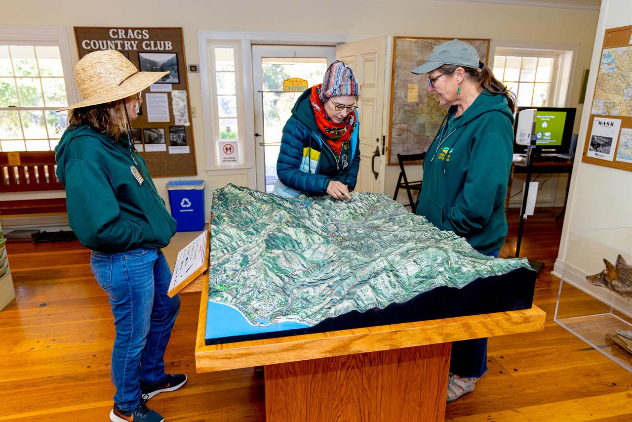
Museum & Visitor Center 3D Map Displays
Custom raised relief maps for museums, national parks, state parks, historical sites, science centers, and public exhibits.
View more examples →
WhiteClouds designs and fabricates custom 3D topographical models, raised relief maps, terrain model displays, watershed models, resort maps, visitor-center exhibits, property maps, and large-format 3D map installations built around your exact location, audience, and purpose.
From museum exhibits and national park visitor centers to ski resorts, universities, real estate developments, military training environments, corporate lobbies, and decorative wall maps, we create physical 3D maps that make terrain easier to understand, easier to explain, and more memorable to experience.
Custom 3D maps built for interpretation, planning, education, presentation, and display.
Explore project types ↓
WhiteClouds creates custom 3D topographical models for education, interpretation, planning, wayfinding, visitor engagement, sales presentations, training, and premium display environments.
Raised relief maps help visitors understand landscapes, routes, watersheds, parks, geology, and historical context before they explore the full exhibit.
Physical terrain models make land, buildings, roads, access, grading, and future development easier to review, discuss, and present.
Add lighting, controls, projection mapping, removable elements, or route illumination to turn a map into a teaching or presentation tool.
Models can be built with cabinetry, acrylic covers, ADA-friendly bases, wall mounts, rolling displays, or protective exhibit enclosures.
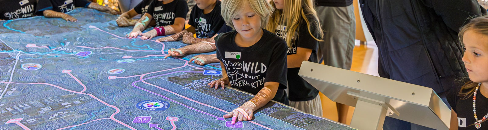
WhiteClouds has produced custom 3D topographical models and raised relief maps for national brands, museums, visitor centers, parks, resorts, universities, conservation groups, historic sites, private landowners, and public-facing exhibits.
A custom 3D map can be educational, decorative, functional, interactive, or all of the above. Browse topographical models by audience, environment, feature, and map type to see how raised terrain can support planning, storytelling, orientation, interpretation, training, and display.
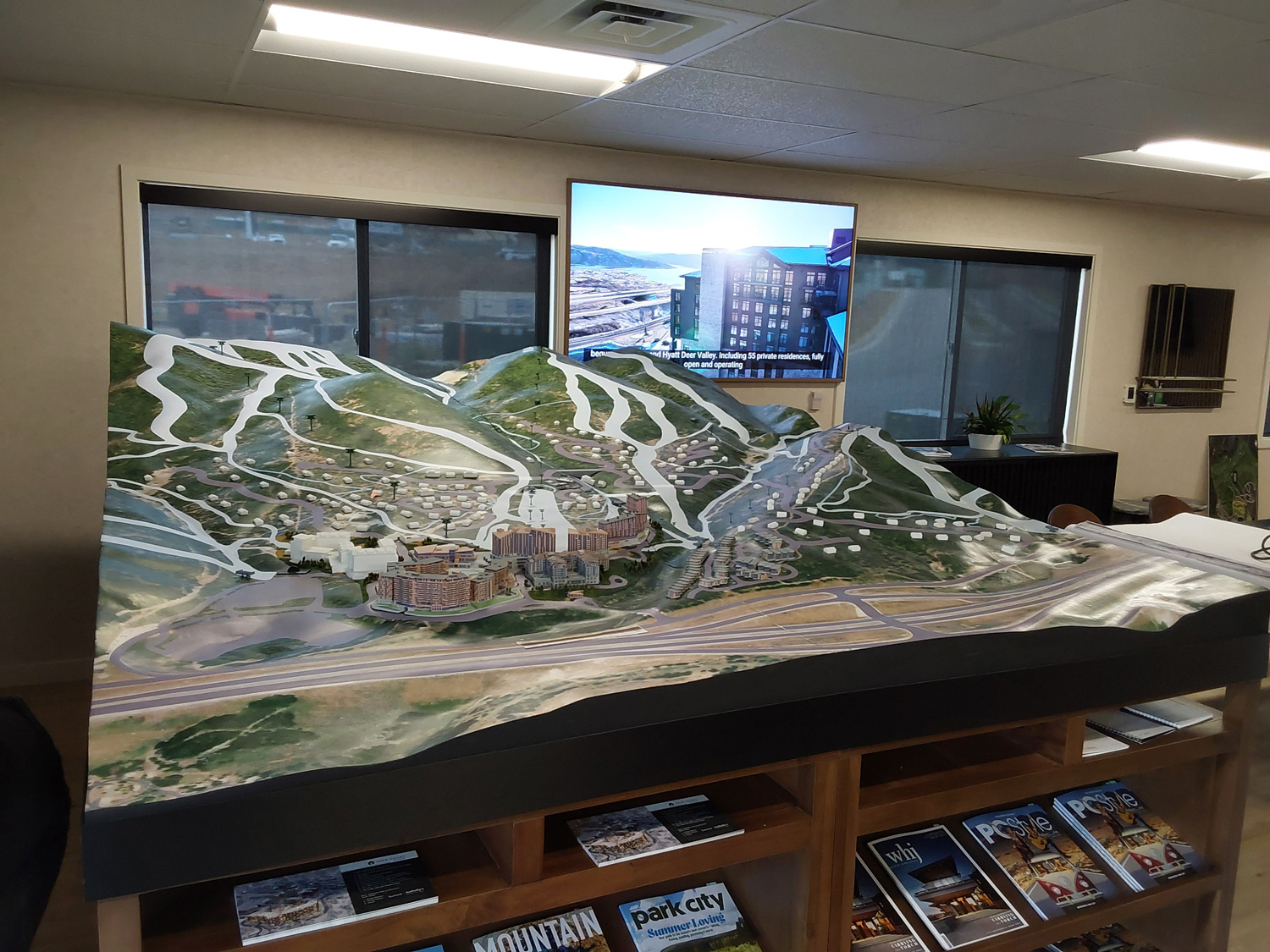
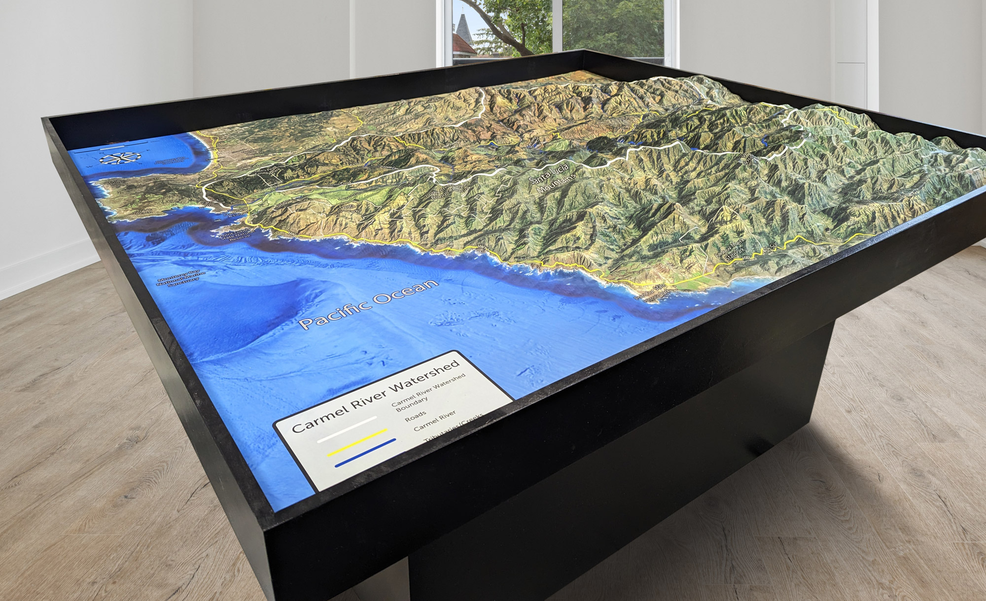

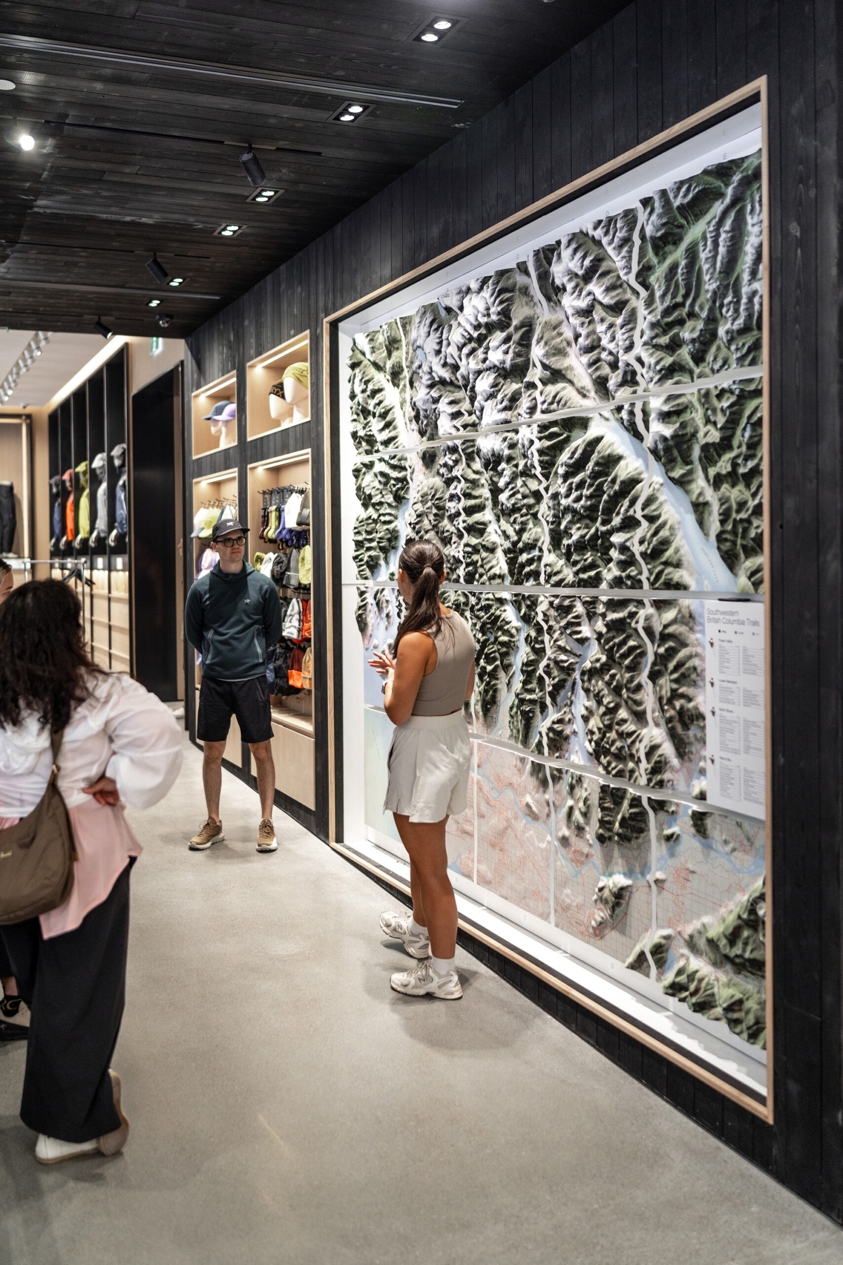
WhiteClouds creates custom 3D topographical models that combine accurate terrain, durable fabrication, detailed map graphics, and display-ready finishing for museums, visitor centers, resorts, campuses, property developments, and public exhibits.
Built for long-term exhibit use in visitor centers, museums, lobbies, sales centers, and permanent displays.
Add trails, roads, rivers, labels, boundaries, buildings, contour data, satellite imagery, or branded graphics.
Choose from wall-mounted, tabletop, pedestal, cabinet, freestanding, shadowbox, or outdoor-ready presentation options.
Integrate LED routes, animated water flow, push-button controls, projection mapping, removable markers, or other interactive features.
Use coatings, acrylic covers, durable substrates, and sealed surfaces to help protect the model in public-facing environments.
Support is available for scale, map data, design files, graphics, custom bases, crating, shipping, and installation planning.
Many raised relief maps are made as standard wall decor or printed consumer products. WhiteClouds focuses on custom projects where the map has a specific purpose: educating visitors, helping teams plan, explaining landforms, showing ownership boundaries, presenting a development, demonstrating water flow, guiding guests, or creating a memorable display.
A project can be built around almost any defined geographic area, property, campus, region, watershed, trail system, coastline, mountain range, island, or custom boundary.
The same terrain can be built as a wall-mounted map, tabletop model, museum exhibit, planning display, outdoor installation, or premium lobby feature.
A few examples of the feedback WhiteClouds receives when the finished work is installed and in use.
“I would not be surprised if this map will be more meaningful to the people who see it than maybe any other that you guys have done. People around here are going to LOVE it because most people here live and make a living in all the little nooks and crannies of the waters of SE Alaska. Our staff will be able to point to where the fish people are eating that day came from, where the wood in our tables came from, and where the historical photos on our walls were taken.”
“My experience working with White Clouds and watching their step-by-step development of the actual map and table were eye-opening. Their shop is set up for such large scale works that this project was probably breeze, but they treated it with care. I love that the finished product is both tactile and durable so people can trace their fingers along the mountain trails as they plan their hikes. We have ordered a second for a state park visitor center!”
“... we were all really blown away by how good it looked. Your support throughout the entire process has also been greatly appreciated too.”
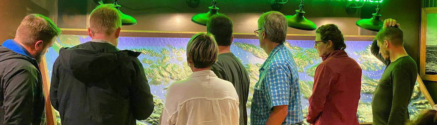
The best custom terrain models do more than look impressive. They make geography easier to discuss, teach, sell, interpret, plan, and remember.
Raised relief maps help visitors understand landscapes, travel routes, geology, settlement patterns, parks, battlefields, watersheds, and regional history before they explore the full exhibit.
Custom 3D maps can show mountain ranges, valleys, trails, roads, campgrounds, lakes, rivers, overlooks, visitor facilities, and terrain features in a way flat signage often cannot.
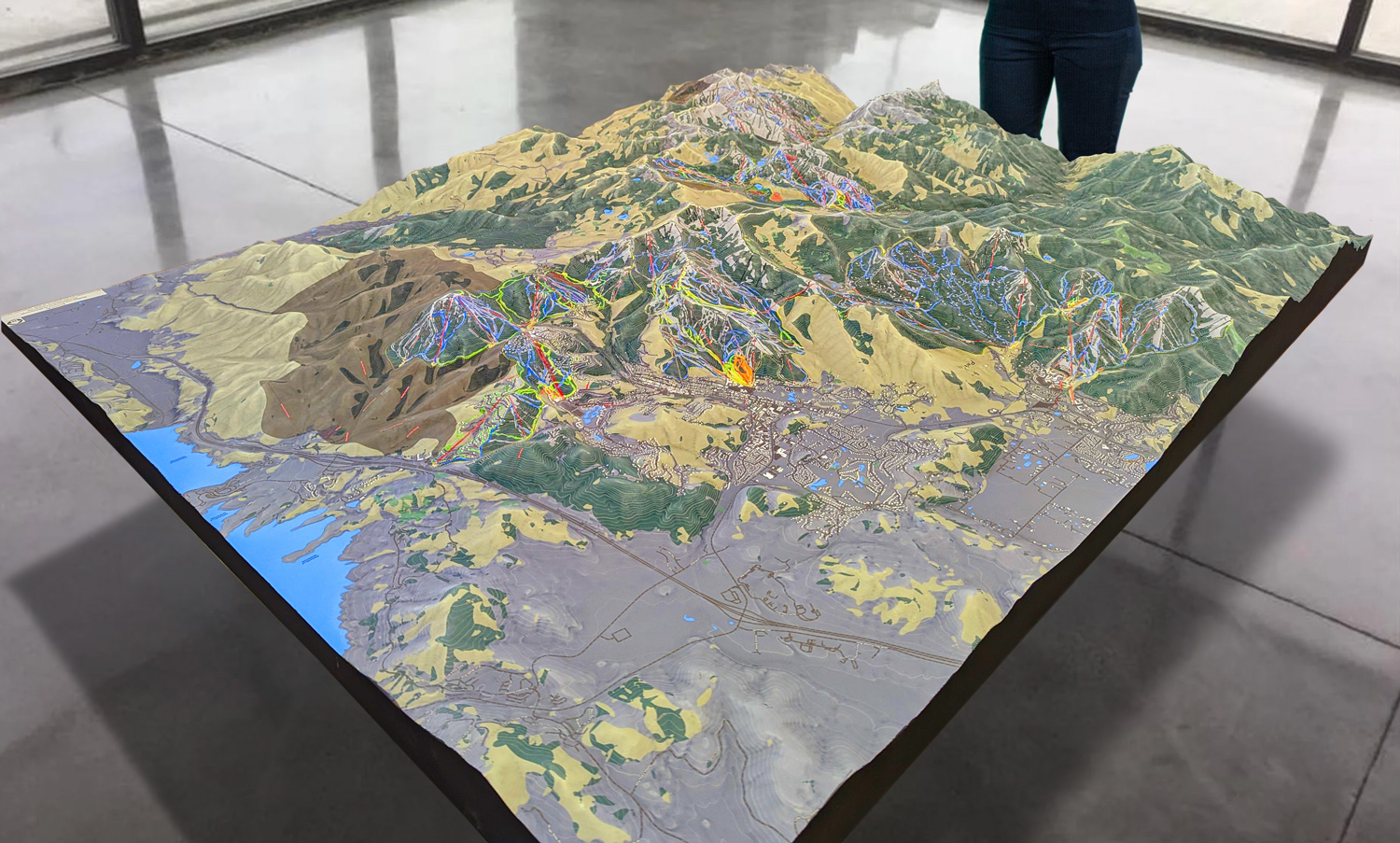
Topographical resort maps can highlight ski runs, lifts, lodges, village areas, hiking routes, terrain zones, elevations, and branded guest experiences.
Physical terrain models make land easier to evaluate during development discussions, investor presentations, public meetings, master planning, entitlement reviews, and sales conversations.
Custom terrain models can support training, orientation, strategic planning, route planning, public communication, and situations where physical terrain context matters.
Topographical models support geography, geology, earth science, environmental education, campus planning, donor displays, science buildings, and hands-on learning.
Watershed models can show drainage, water flow, elevation, land use, restoration concepts, flood paths, rivers, lakes, and environmental relationships in a tactile way.
Custom map displays can turn a meaningful region, property, mountain range, coastline, campus, or destination into a premium visual statement for lobbies, offices, hospitality spaces, and private interiors.
For repeatable products, regional raised relief maps can be developed for gift shops, visitor centers, resort stores, outdoor retailers, and destination-based merchandise programs.
Every project starts with the place you want to represent and the story the map needs to tell. Some models need accurate planning information. Others need a dramatic visual impression. Many need both.
When a flat map is not enough, lighting and interactivity can turn a 3D terrain model into a teaching tool, presentation display, wayfinding aid, or exhibit centerpiece.
Interactive 3D maps are especially useful for museums, visitor centers, watershed education, campus maps, real estate planning, military training, utilities, infrastructure presentations, and large public-facing exhibits.
Some projects need more than raised terrain. WhiteClouds can combine topographical maps with architectural models, miniature landscapes, transparent layers, removable sections, labeled elements, roads, water, vegetation, buildings, and custom diorama model features.
WhiteClouds matches the fabrication method to the project. A wall-mounted decorative map, a museum exhibit, a tabletop property model, a retail product run, and an outdoor interpretive display may all require different materials and production methods.
The Making of large 3D Printed Raised Relief Maps. These raised relief maps are customized with size, shape, and design elements including cabinetry.
A detailed closeup of our Park City, Utah topographical model, showing the surrounding ski resorts, mountain terrain, and raised relief details.
A detailed closeup of our Great Smoky Mountains National Park topographical model, showing the raised terrain, mountain ridges, valleys, and natural landscape features.
Custom topographical models can be built for a private office, a retail display, a museum gallery, a planning room, a visitor center, a corporate lobby, or an entire wall. Large maps can also be fabricated in sections to make shipping, handling, and installation more practical.
Framed raised relief maps, lobby displays, and large-format terrain wall installations.
Planning models, exhibit tables, property displays, campus maps, and protected dioramas.
Pedestals, rolling bases, lightboxes, cabinetry, ADA-friendly stands, and storage-integrated displays.
Acrylic covers, tempered glass, French cleats, structural mounting, and protective enclosures.
Every project is custom, so pricing depends on the model’s size, level of detail, fabrication method, finish quality, graphics, special features, and display requirements.
A custom topographical model moves more smoothly when the location, audience, scale, display environment, and level of detail are discussed early.
We start with the location or boundary area, intended use, approximate size, audience, installation environment, timeline, and any must-have labels, features, or visual references.
The team reviews available terrain data, map imagery, CAD files, GIS layers, site plans, or reference materials. From there, we define the map style, vertical exaggeration, graphic overlays, labels, colors, and display format.
A digital proof or design preview is prepared so the terrain, map graphics, scale, labels, special features, and overall presentation can be reviewed before physical fabrication begins.
The model is produced using the best-fit fabrication method, which may include 3D printing, CNC carving, thermoforming, molding, casting, resin work, HD foam, high-resolution graphics, painting, and protective coatings.
If the project includes lighting, controls, cabinetry, acrylic covers, wall mounting, drainage features, or special display hardware, those components are integrated and tested before shipment.
The finished map is packed for safe transit. WhiteClouds can provide handling and mounting guidance so your facilities team, exhibit partner, installer, or local contractor understands the intended setup.
Almost any region can be considered if suitable terrain data, map references, imagery, or site information is available. Projects can include parks, campuses, ski resorts, watersheds, cities, islands, coastlines, mountain ranges, private properties, trails, mines, developments, or custom-defined boundaries.
A location or boundary is the best starting point. Helpful information includes the intended size, display location, audience, preferred map style, features to show, timeline, and any files you already have, such as GIS data, CAD files, DEM files, LiDAR data, site plans, maps, sketches, or reference images.
Accuracy depends on the quality of the available data, the selected scale, vertical exaggeration, and the level of graphic detail required. WhiteClouds can use available terrain data and source materials to create models that are visually accurate, presentation-ready, and appropriate for the project’s purpose.
Yes. Vertical exaggeration is often used to make terrain easier to see, especially when the finished map covers a large area or includes subtle elevation changes. The right amount depends on the landscape, scale, and viewing distance.
Yes. Custom overlays can include trails, roads, lift lines, buildings, rivers, lakes, campgrounds, property boundaries, ownership areas, points of interest, legends, labels, logos, routes, utilities, and other information.
Yes. Options may include LED lighting, illuminated buildings, route lighting, button controls, kiosk controls, projection mapping, under-map lighting, removable pieces, magnetic elements, QR codes, and other interactive features.
Many topographical models are designed for indoor use, but outdoor or semi-outdoor displays can be built with appropriate materials, coatings, bases, and enclosures. Outdoor requirements should be discussed early because sunlight, moisture, temperature, handling, and maintenance affect the build approach.
WhiteClouds can build small desktop maps, framed wall maps, tabletop models, large exhibit displays, and multi-panel wall-scale installations. Very large maps can be sectioned for shipping, handling, and on-site assembly.
Yes. Multiple copies can be produced when the design is repeatable. Depending on quantity, size, and required detail, methods such as casting, thermoforming, or repeatable digital fabrication may be appropriate.
Timeline depends on size, complexity, data preparation, graphics, fabrication method, finishing, lighting, bases, and approvals. Simple projects may move quickly, while large museum, visitor center, outdoor, or interactive displays require more planning and production time.
Explore related map formats, source data, and terrain visualization options often used in custom 3D topographical models and raised relief map projects.
Share the area you want to model, the approximate size, how the map will be used, and any features you want to include. WhiteClouds can help refine the map style, terrain detail, display format, materials, and next steps.