Navigating the Waters: The Amazing World of Watershed Models!
Welcome, eco-enthusiasts and curious minds! Today, we’re diving deep into the fascinating world of watershed models. These aren’t your ordinary models; they’re complex, dynamic systems that scientists and environmentalists use to predict floods, manage our precious water resources, and study the impact of pollution on our rivers and lakes. So, buckle up as we embark on this wet and wild journey to uncover the secrets of watershed models and how they’re helping us safeguard the planet’s most vital resource: water.

Watershed Wonders – An Introduction
First off, what exactly is a watershed? Imagine it as nature’s own water collection system. Every drop of rain that falls on land, every snowflake that melts, has to go somewhere, right? That “somewhere” is often a river, lake, or the ocean, and the area that channels all this water into our streams and rivers is what we call a watershed.
Watersheds are essential to our ecosystems, communities, and economies. They provide us with fresh water for drinking, irrigation for our crops, habitats for countless species, and so much more. But managing them can be tricky business, especially with the challenges of climate change, pollution, and urban development. That’s where our heroes, the watershed models, come into play.
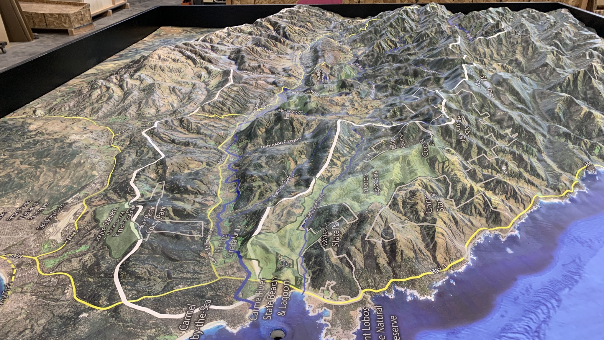
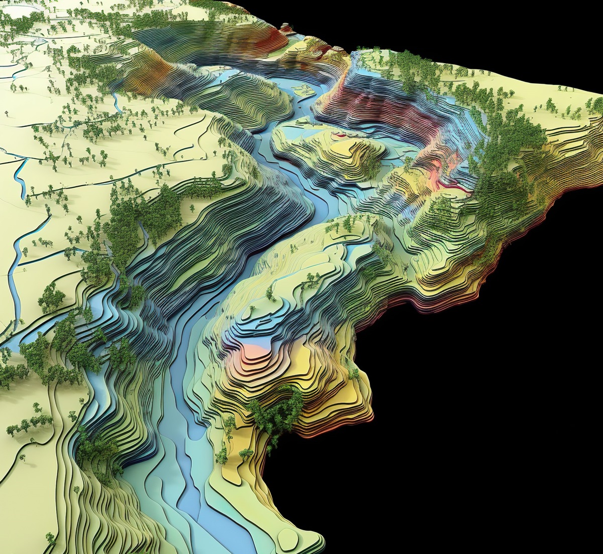
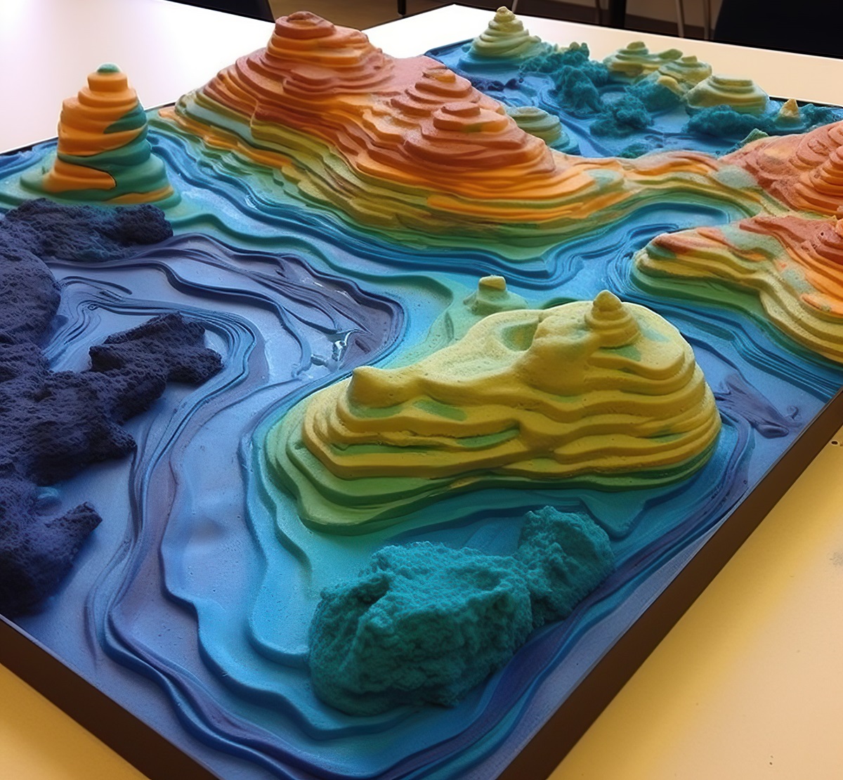
The Art and Science of Physical Watershed Models
Stepping into a room with a physical watershed model is like observing a miniature world come to life. These models are meticulously crafted, often to scale, to represent the physical features of a watershed, from its highest peaks down to its lowest valleys.
Creating these models is a fascinating blend of art and science. Engineers and environmental scientists work together, using materials like plastic, resin, or even sand, to sculpt the landscape. Then, they add water to simulate rainfall, rivers, and streams. This hands-on approach allows them to study how water flows through the watershed, how it responds to changes in the environment, and the effects of human intervention, such as building dams or clearing forests.

Digital Watersheds – Simulating Nature with Technology
While physical models offer a tangible view of water flow, digital watershed models take things to the next level. Using complex algorithms and vast amounts of environmental data, these computer simulations can predict how watersheds will react under various conditions.
Digital models are incredibly versatile. They can simulate decades of water cycles in minutes, predict the impact of a new housing development on local water quality, or help plan the restoration of wetlands to improve ecosystem health. With advancements in technology, these models are becoming ever more accurate, providing invaluable insights for water resource management and environmental protection.
Real-World Heroes: Watershed Models at Work
Watershed models are not just theoretical constructs; they have real, tangible impacts on our world. Take, for example, the management of the Mississippi River Basin. Here, watershed models have been instrumental in predicting and mitigating the effects of seasonal flooding, protecting millions of lives and properties. These models help engineers design levees and floodways to manage the river’s flow, reducing the risk of disaster.
Another inspiring story comes from the Chesapeake Bay watershed. Scientists have used digital models to understand how nutrient runoff from agriculture affects water quality. These insights have guided policies to reduce pollution, leading to significant improvements in the bay’s health, benefiting both people and wildlife.
The Future Flow – Innovations in Watershed Modeling
The future of watershed modeling is bright, with new technologies promising even greater insights and capabilities. Artificial Intelligence (AI) and Machine Learning (ML) are game changers, enabling models to learn from vast datasets, predict outcomes more accurately, and even suggest the most effective interventions for water conservation and pollution control.
Emerging technologies like satellite remote sensing provide real-time data on watershed conditions, enhancing model accuracy. Virtual reality (VR) offers another exciting development, allowing scientists and policymakers to explore watershed models in an immersive 3D environment, making complex data more accessible and understandable.
Getting Involved – Citizen Science and Watershed Conservation
Watershed conservation is a communal effort, and there’s a growing movement for citizen science where volunteers contribute valuable data to watershed models. Through initiatives like water quality testing and habitat assessment, ordinary people are making extraordinary contributions to our understanding of watersheds.
Many communities organize watershed cleanup events, where volunteers remove trash and invasive species from local streams and rivers. Participating in these activities not only helps protect your local watershed but also connects you to a larger community of conservationists.
Water Wise – Tips for Everyday Watershed Stewardship
Every one of us lives in a watershed, and our daily actions can impact its health. Simple steps like reducing pesticide use in our gardens, conserving water at home, and supporting sustainable agriculture can make a big difference. Educating ourselves and others about the importance of watersheds and the challenges they face is also crucial.
Advocating for policies that protect water quality and watershed health is another powerful way to contribute. Whether by supporting green infrastructure projects in urban areas or conservation efforts in natural settings, our collective voices can lead to positive change.
As we conclude our exploration of the world of watershed models, it’s clear that these tools are not just about understanding water flow; they’re about connecting us to our environment and empowering us to protect our most precious resource. From the artistry of physical models to the sophistication of digital simulations, watershed models are key to navigating the challenges of water management and conservation.
Through real-world applications, technological innovations, and community involvement, we can all play a part in safeguarding our watersheds for future generations. So, let’s take inspiration from these models and work together towards a sustainable, water-wise world.
Contact us today to learn more about our 3D services and how we can help you achieve your goals.