Florida Maps
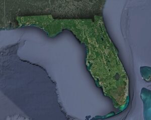
Take a journey through the Sunshine State with our collection of Florida maps. Explore its cities, coastlines, and natural wonders in detail, and discover hidden gems you never knew existed.
Take a journey through the Sunshine State with our collection of Florida maps. Explore its cities, coastlines, and natural wonders in detail, and discover hidden gems you never knew existed.
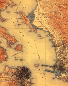
Take a journey through time with our top 10 USGS historical maps! From stunning topography to intricate cartography, each map tells a unique story of America’s past. Learn more about USGS historical maps and the fascinating details they hold.

Orthophoto maps bring the world to life, offering stunningly detailed aerial views of cities, landscapes, and terrain. From soaring skyscrapers to rolling hills, these maps provide a bird’s eye perspective that will take your breath away.
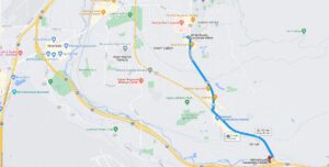
With vicinity maps, the world is at your fingertips. Explore new destinations, navigate unfamiliar terrain, and discover hidden gems. Let these maps guide you on your next adventure, and you’ll never be lost again.
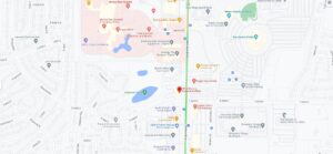
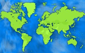
Location maps are like a window to the world, allowing us to explore and navigate our surroundings with ease. From ancient maps etched in stone to digital maps at our fingertips, they’ve been an essential tool for humans throughout history.
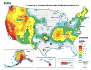
With seismic maps, the earth’s secrets are unveiled. Explore hidden tectonic plates, ancient fault lines, and anticipate natural disasters before they strike. Journey into the depths of our planet and discover its mysteries.
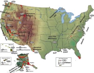
Tectonic maps reveal the drama of our planet’s past. From the collision of continents to the birth of mountain ranges, explore the dynamic forces that have shaped our world. Embark on a journey through time and space with tectonic maps.
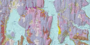
Geomorphic maps bring the Earth’s surface to life, revealing mountains, valleys, rivers, and more in intricate detail. With these maps, we can explore the planet’s physical features and gain a deeper understanding of its natural wonders.
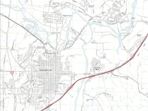
With planimetric maps, the world becomes a two-dimensional masterpiece. Streets, buildings, and waterways come alive, and navigating becomes a breeze. These maps are the perfect tool for exploring and planning, unlocking the secrets of the world around us.
Cartogram maps are like visual puzzles, distorting geography to show patterns in non-spatial data. From election results to economic data, these maps offer a unique perspective on the world around us.
Cartometric maps are like a magic trick, maintaining the area of geographic features on the Earth’s surface while preserving their relative positions. From climate change to land use planning, these equal-area maps offer a unique perspective on the world around us.
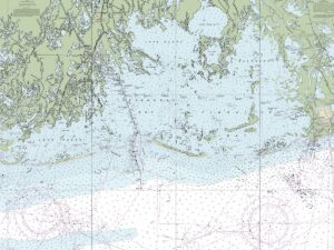
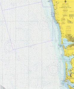
A nautical chart is like a map of the ocean, guiding sailors through the unknown with intricate details of currents, depths, and hazards. With a history dating back to ancient times, nautical charts have evolved to become an essential tool for safe and efficient navigation at sea.
Dive into the vast beauty of the United States’ largest lakes! From the expansive Great Lakes to the shimmering Lake Okeechobee, discover the top 10 grandest bodies of water that adorn America.

Get ready to discover the future of mapping with WhiteClouds 3D Maps Learning Center. Our cutting-edge technology and expert resources will take you on a journey of exploration and understanding like never before. Join us today and lead the way in charting the course ahead!
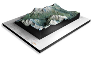
Our National Parks 3D Maps series is the new dimension of adventure you’ve been waiting for. Explore America’s most beloved national parks from a perspective that was previously only available to the most intrepid explorers.

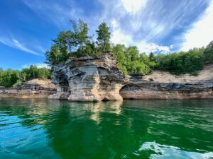
Embark on a journey to the top 10 national parks in the US and let nature take your breath away. From majestic mountains to awe-inspiring canyons, experience the magic of these natural wonders that are truly worth the visit.