

Step back in time and experience the captivating beauty of America’s past with our top 10 USGS historical maps. These maps are more than just pieces of paper; they are windows into a world that once was, showcasing the intricate details of a country on the cusp of change. From coast to coast, these maps reveal the rich history and evolution of America’s geography.
As you explore our top 10 USGS historical maps, you will discover the fascinating stories behind each one. From the gold rush of California to the oil fields of Texas, these maps capture the essence of America’s unique character and spirit. With their detailed illustrations and impressive topography, these maps give you a glimpse into a world that has long since vanished.
So come with us on a journey through America’s past, and learn more about the USGS historical maps that have helped shape our understanding of this great nation. Whether you are a history buff or simply curious about the world around you, these maps are sure to leave you inspired and amazed.
#1: Central Park, New York 1897
Central Park, located in Manhattan, New York City, is a massive public park established in 1858 to provide an urban refuge from the bustling city around it. It was designed by Frederick Law Olmsted and Calvert Vaux, with construction continuing for several decades. The park is renowned for its beautiful landscapes, lakes, and iconic landmarks, such as the Central Park Zoo, the Central Park Conservatory Garden, and the Bethesda Fountain.
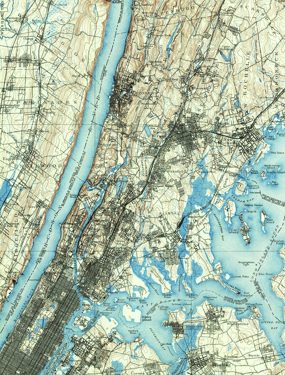
In 1897, Central Park was undergoing a significant redesign led by the Olmsted Brothers landscape architecture firm. This included the creation of new features such as the Great Lawn, the Ravine, and the Bethesda Terrace and Fountain. The redesign also involved extensive changes to the park’s infrastructure, such as new roads, paths, and drainage systems, all aimed at making the park more accessible and enhancing its natural beauty.
The USGS historical map of Central Park, created in the same year, provides a glimpse into the park’s design and development over time. The map shows the location of various landmarks, lakes, and natural features, including the Reservoir, the Ramble and Lake, and the Great Lawn. Its intricate details include the location of individual trees and shrubs, adding to the map’s accuracy and precision. The USGS map was created as part of a larger effort by the government to create accurate topographic maps of the entire country.
Central Park, New York USGS Historical Maps (1897)
Central Park, New York (Harlem, New York 1897) 2D Map: Canvas Print Maps
Central Park, New York (Harlem, New York 1897) 3D Map: Raised Relief Maps
Central Park, New York (Harlem, New York 1897) High Resolution PDF: Hi-Res PDF Map
Learn more about USGS Historical Maps
#2: San Francisco, California (1899)
San Francisco is a vibrant and bustling city located in the northern part of California, on a peninsula surrounded by the Pacific Ocean and San Francisco Bay. It is one of the most culturally diverse cities in the United States, with a population of over 880,000 people. San Francisco has a long and storied history, from the Native American tribes who originally inhabited the area to the Spanish explorers who first settled there in the late 18th century.
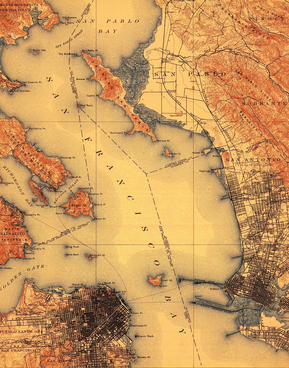
The city truly began to boom during the California Gold Rush in 1849, when thousands of people flocked to San Francisco in search of gold. This influx of people transformed the city almost overnight, turning it into a bustling metropolis with a diverse population from around the world. The city continued to grow and develop throughout the 19th and early 20th centuries, with the construction of iconic landmarks such as the Golden Gate Bridge and Alcatraz Island.
In 1899, the USGS produced a topographic map of the San Francisco quadrangle. This map is significant as it provides a detailed view of the city during a period of rapid growth and development. At the time, San Francisco was undergoing significant changes to its infrastructure, including the construction of new roads, buildings, and transportation systems. The USGS map is a valuable resource for historians and urban planners, as it allows us to see how the city was laid out and how it evolved over time. Additionally, the map provides a unique glimpse into the natural features of the area, including the hilly terrain that is now so closely associated with the city.
San Francisco, California USGS Historical Maps (1899)
San Francisco, California (1897) 2D Map: Canvas Print Maps
San Francisco, California (1897) 3D Map: Raised Relief Maps
San Francisco, California (1897) High Resolution PDF: Hi-Res PDF Map
Learn more about USGS Historical Maps
#3: Mount Shasta, California (1954)
Mount Shasta is a majestic stratovolcano located in the Cascade Range of northern California. Standing at 14,179 feet (4,322 meters), it is the second-highest peak in the Cascades and the fifth highest in California. Mount Shasta is considered to be a potentially active volcano, having erupted several times in the past, the most recent being in 1786. Despite the potential danger, the mountain draws visitors from all over the world for its stunning natural beauty and outdoor recreational activities, such as hiking, skiing, and mountaineering.
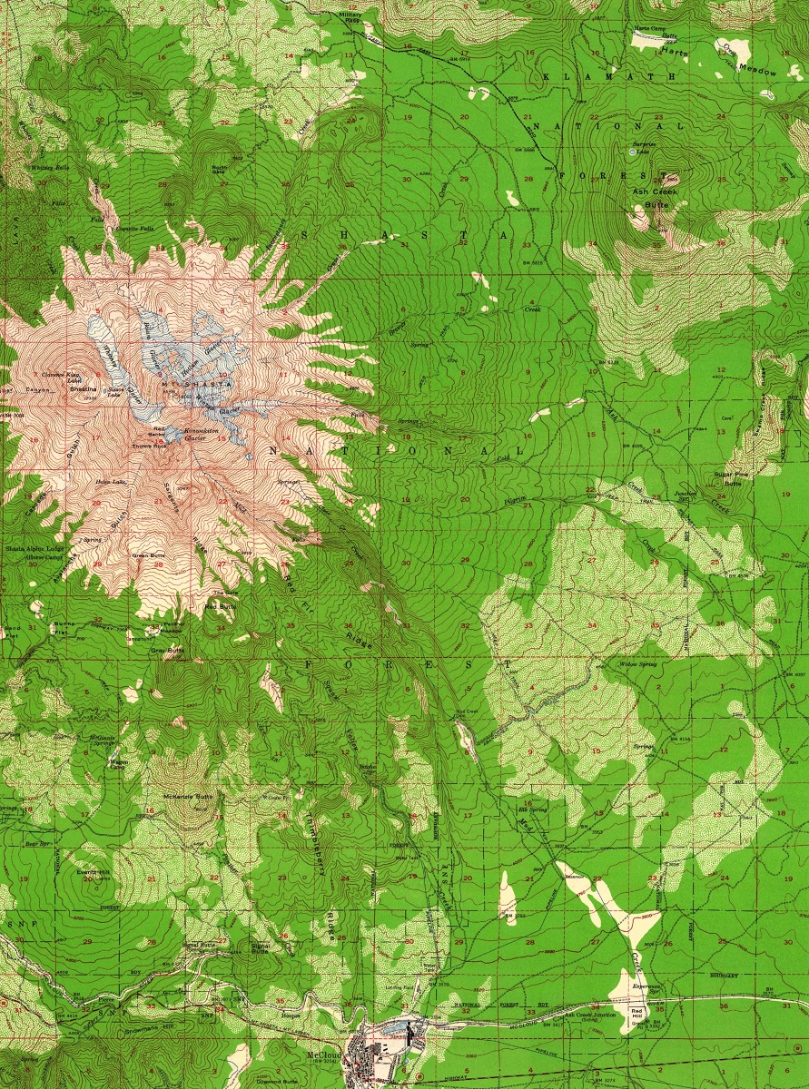
The USGS produced a topographic map of the Mount Shasta quadrangle in 1954, which is significant for a few reasons. First, it provides valuable information about the mountain’s geography and topography, including its glaciers, lakes, and rivers. Second, the map is useful for studying the mountain’s geological history and understanding its potential for future eruptions. Lastly, the map serves as a snapshot of the area before significant changes occurred due to human activity, such as the development of ski resorts and other infrastructure in the surrounding areas.
In addition to its geological significance, Mount Shasta is also culturally and spiritually significant to many Indigenous communities in the area, including the Wintu, Karuk, and Modoc peoples. The mountain has long been considered a sacred site and a place of spiritual power, with various legends and myths associated with it. Today, Mount Shasta continues to inspire awe and wonder in visitors and locals alike, with its towering presence and breathtaking vistas.
Mount Shasta, California USGS Historical Maps (1954)
Mount Shasta, California (Shasta, California 1954) 2D Map: Canvas Print Maps
Mount Shasta, California (Shasta, California 1954) 3D Map: Raised Relief Maps
Mount Shasta, California (Shasta, California 1954) High Resolution PDF: Hi-Res PDF Map
Learn more about USGS Historical Maps
#4: Cape Cod, Massachusetts (1887)
Cape Cod, a picturesque peninsula in southeastern Massachusetts, has long been a popular destination for tourists seeking a mix of history, natural beauty, and charming seaside towns. The area is renowned for its idyllic beaches, scenic harbors, and iconic lighthouses that dot the coastline. Cape Cod has a rich maritime history, with fishing and whaling playing a significant role in the region’s development.
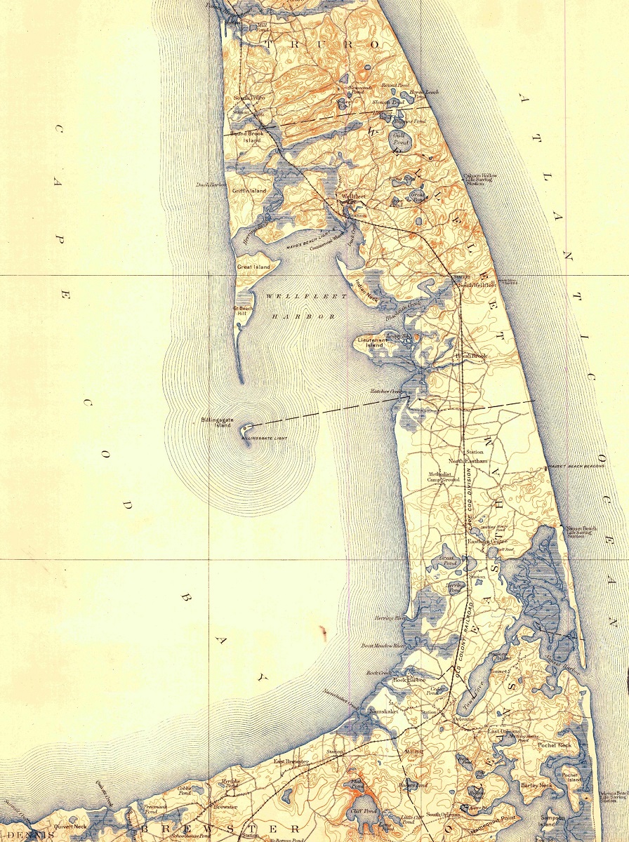
The USGS historical map of the Cape Cod quadrangle created in 1887 provides a valuable snapshot of the area’s geography and infrastructure during the late 19th century. At the time, Cape Cod was experiencing significant economic growth, with the expansion of the fishing industry and the development of tourism. The map shows the location of many historic sites and landmarks, including the many lighthouses that were crucial for maritime navigation. The map also highlights the extensive road network and transportation infrastructure that facilitated the region’s economic growth.
This historical map of Cape Cod serves as a valuable reference for researchers and historians, providing a window into the past and enabling us to see how the area has evolved over time. By comparing the map to more recent maps, we can gain insight into the changes that have taken place in the region, such as the growth of towns and the decline of certain industries. The USGS historical map of Cape Cod is not only a fascinating artifact of the region’s history but also an important tool for understanding its present and future.
Cape Code, Massachusetts USGS Historical Maps (1887)
Cape Code, Massachusetts (Wellfleet, Massachusetts 1887) 2D Map: Canvas Print Maps
Cape Code, Massachusetts (Wellfleet, Massachusetts 1887) 3D Map: Raised Relief Maps
Cape Code, Massachusetts (Wellfleet, Massachusetts 1887) High Resolution PDF: Hi-Res PDF Map
Learn more about USGS Historical Maps
#5: Washington DC (1900)
Washington DC, the capital of the United States, has a rich history and significance as the center of the US government. It was founded in 1790 and named after the first US President, George Washington. The city has played a crucial role in the development of the country, from the Civil War to the Civil Rights Movement. Today, it is home to numerous government buildings, historic sites, and cultural institutions, making it a popular destination for tourists and a center of political activity.
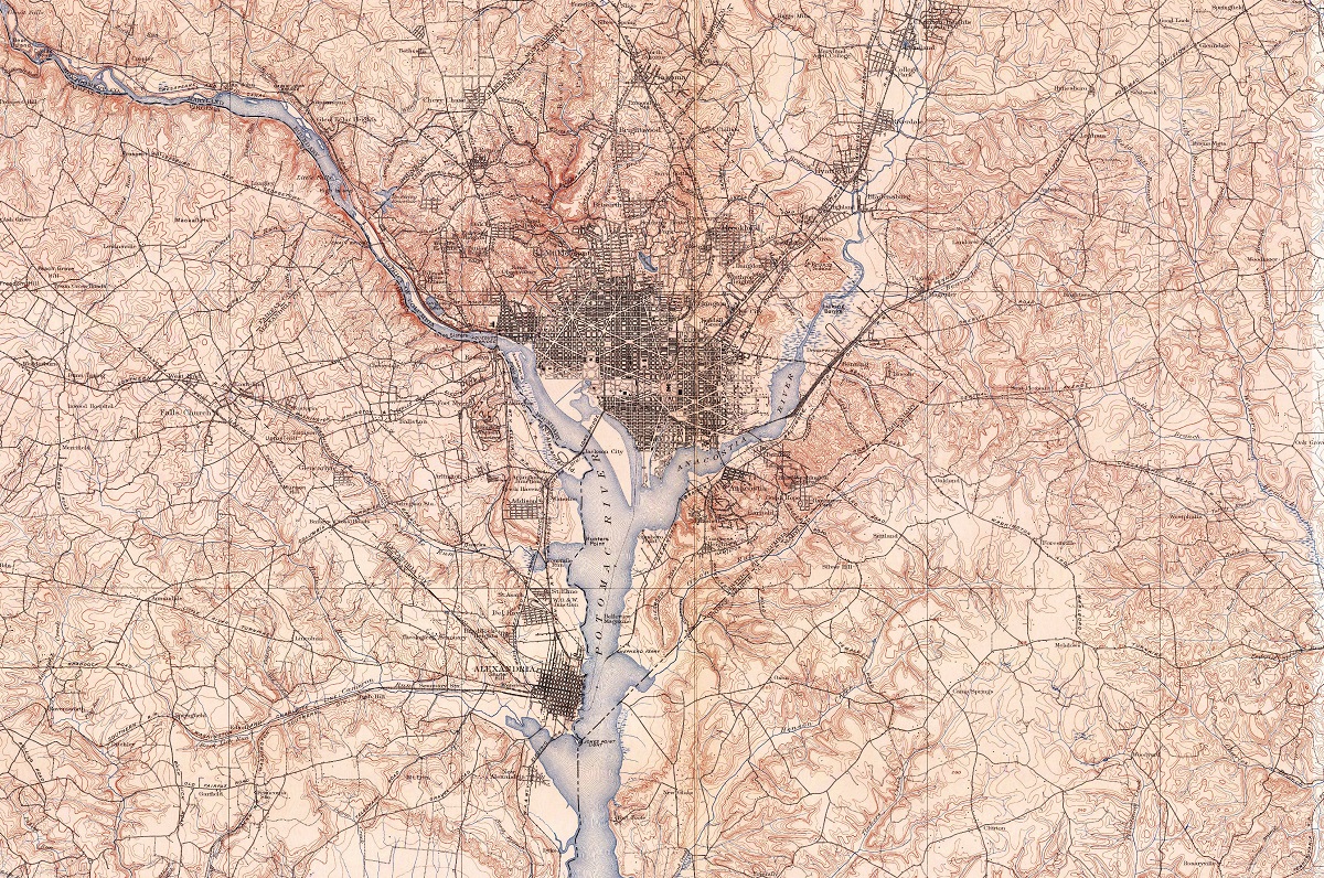
In 1900, Washington DC was undergoing significant changes as it continued to expand and develop as a city. The USGS topographic map of the Washington quadrangle produced that year is a valuable resource for understanding the city’s layout and infrastructure during this period. The map shows the location of important landmarks and buildings such as the Capitol, the White House, and the Smithsonian museums, as well as the city’s parks, roads, and transportation systems. It also highlights the city’s topography, including the Potomac River and the hills and valleys that make up the surrounding landscape.
The USGS map of Washington DC in 1900 provides insight into the city’s growth and development during this time, which was marked by a series of major events such as the Spanish-American War and the construction of the Washington Monument. It is a valuable resource for historians and researchers studying the history of the city and its role in shaping the nation. Today, Washington DC continues to evolve and change, but its rich history and significance as the capital of the United States remain.
Washington DC USGS Historical Maps (1900)
Washington DC (Washington, Maryland 1900) 2D Map: Canvas Print Maps
Washington DC (Washington, Maryland 1900) 3D Map: Raised Relief Maps
Washington DC (Washington, Maryland 1900) High Resolution PDF: Hi-Res PDF Map
Learn more about USGS Historical Maps
#6: Los Angeles, California (1894)
Los Angeles, California is a sprawling metropolis located in the southern part of the state, and is the second most populous city in the United States. The city has a rich history that dates back to 1781 when it was founded as a small pueblo. However, it was during the late 19th century and early 20th century that Los Angeles underwent significant growth and development. This period saw the discovery of oil, the arrival of the film industry, and the construction of the Los Angeles Aqueduct, which brought water from the Owens Valley to the city.
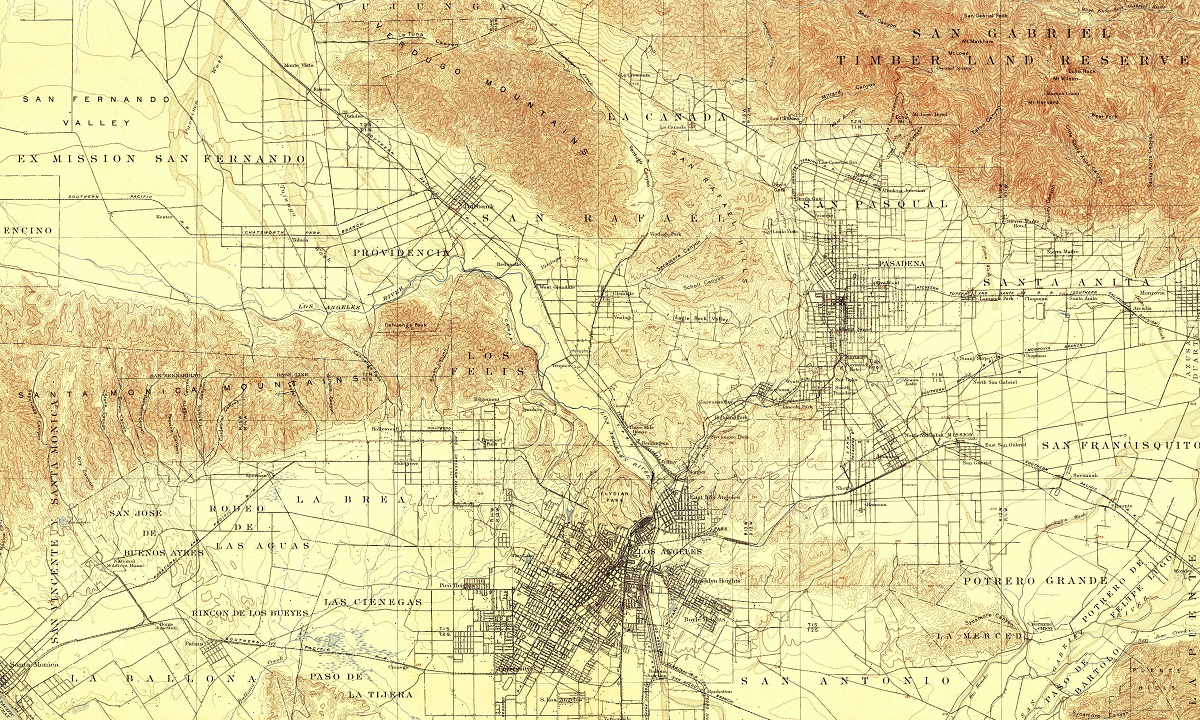
The Los Angeles quadrangle topographic map produced by the USGS in 1894 is a valuable historical document that provides insight into the city’s urbanization and infrastructure during this period of rapid growth. The map shows the layout of the city, including the location of roads, railroads, and neighborhoods. It also highlights the region’s topography, including the Santa Monica Mountains and the Los Angeles River. The map provides valuable historical information on the city’s development and urbanization in the late 19th century, and is an important resource for historians, geographers, and urban planners alike.
Los Angeles, New York USGS Historical Maps (1894)
Los Angeles, New York (Los Angeles, New York 1894) 2D Map: Canvas Print Maps
Los Angeles, New York (Los Angeles, New York 1894) 3D Map: Raised Relief Maps
Los Angeles, New York (Los Angeles, New York 1894) High Resolution PDF: Hi-Res PDF Map
Learn more about USGS Historical Maps
#7: Yosemite National Park, California (1900)
Yosemite National Park, situated in the Sierra Nevada Mountains in central California, is a world-renowned destination for outdoor enthusiasts and nature lovers alike. The park boasts breathtaking views of towering granite cliffs, cascading waterfalls, and pristine wilderness. Among its most recognizable landmarks are Half Dome and El Capitan, which attract climbers from around the globe.
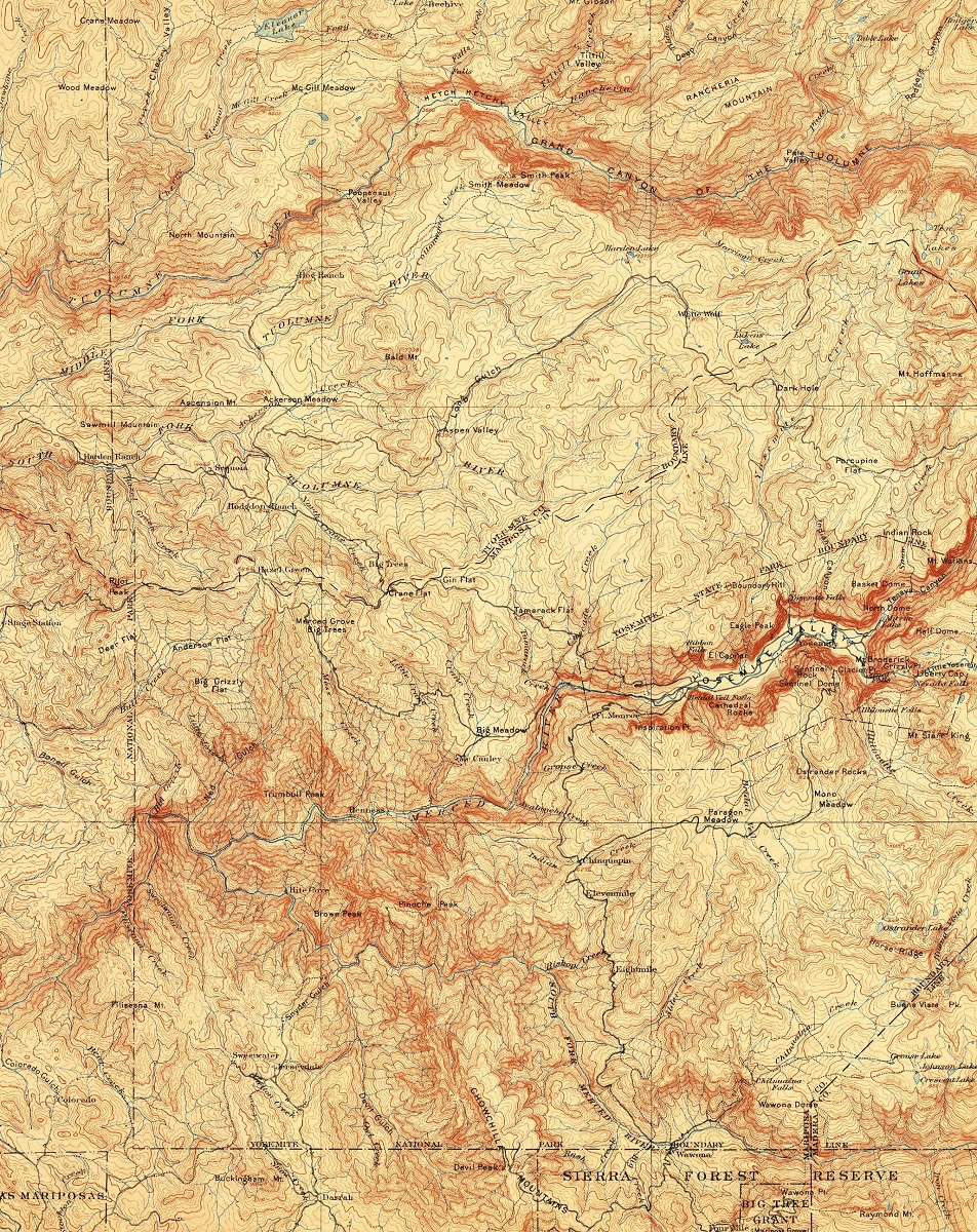
In 1900, the USGS produced a topographic map of Yosemite National Park that played a crucial role in its preservation as a protected area. This map provided intricate details about the park’s natural features, including its rivers, lakes, and mountain ranges, making it easier for people to explore and appreciate the area’s natural beauty. Additionally, the map helped to identify particularly scenic spots and led to the creation of designated hiking trails and campsites, further enhancing visitors’ experiences.
Yosemite National Park, California (1900)
Yosemite National Park, California (Yosimite, California 1900) 2D Map: Canvas Print Maps
Yosemite National Park, California (Yosimite, California 1900) 3D Map: Raised Relief Maps
Yosemite National Park, California (Yosimite, California 1900) High Resolution PDF: Hi-Res PDF Map
Learn more about USGS Historical Maps
#8: Chicago, Illinois (1901)
Chicago, Illinois, is a bustling metropolis located in the heart of the Midwest. The city has a rich history and has played an important role in the development of the United States. In 1901, the USGS produced a topographic map of Chicago as part of a larger effort to map the entire country. This map is significant because it provides valuable historical information about the city’s urbanization and infrastructure during the early 20th century.
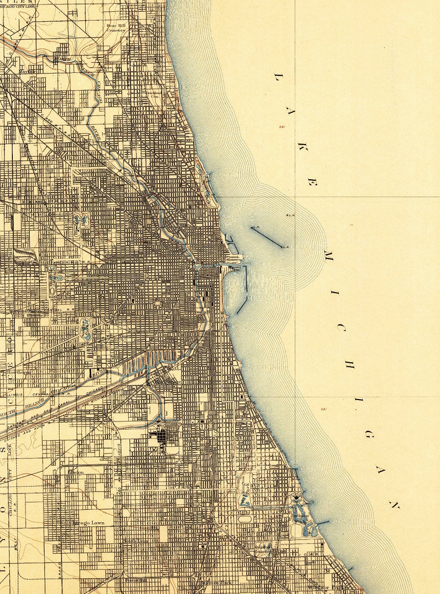
The Chicago topographic map from 1901 shows the city during a period of rapid growth and development. At the time, Chicago was an industrial powerhouse and one of the largest cities in the United States. The map provides detailed information about the city’s layout, including its streets, buildings, and parks. It also shows the location of the city’s major industries, including steel mills, stockyards, and rail yards, which were vital to the city’s economy.
Chicago, Illinois USGS Historical Maps (1901)
Chicago, Illinois (Chicago, Illinois, 1901) 2D Map: Canvas Print Maps
Chicago, Illinois (Chicago, Illinois, 1901) 3D Map: Raised Relief Maps
Chicago, Illinois (Chicago, Illinois, 1901) High Resolution PDF: Hi-Res PDF Map
Learn more about USGS Historical Maps
#9: Glacier National Park, Montana (1901)
Glacier National Park, located in the northern part of Montana, is a majestic wilderness area known for its stunning mountain landscapes, crystal-clear lakes, and awe-inspiring glaciers. Established in 1910, the park covers over 1 million acres and is home to a diverse range of plant and animal species.
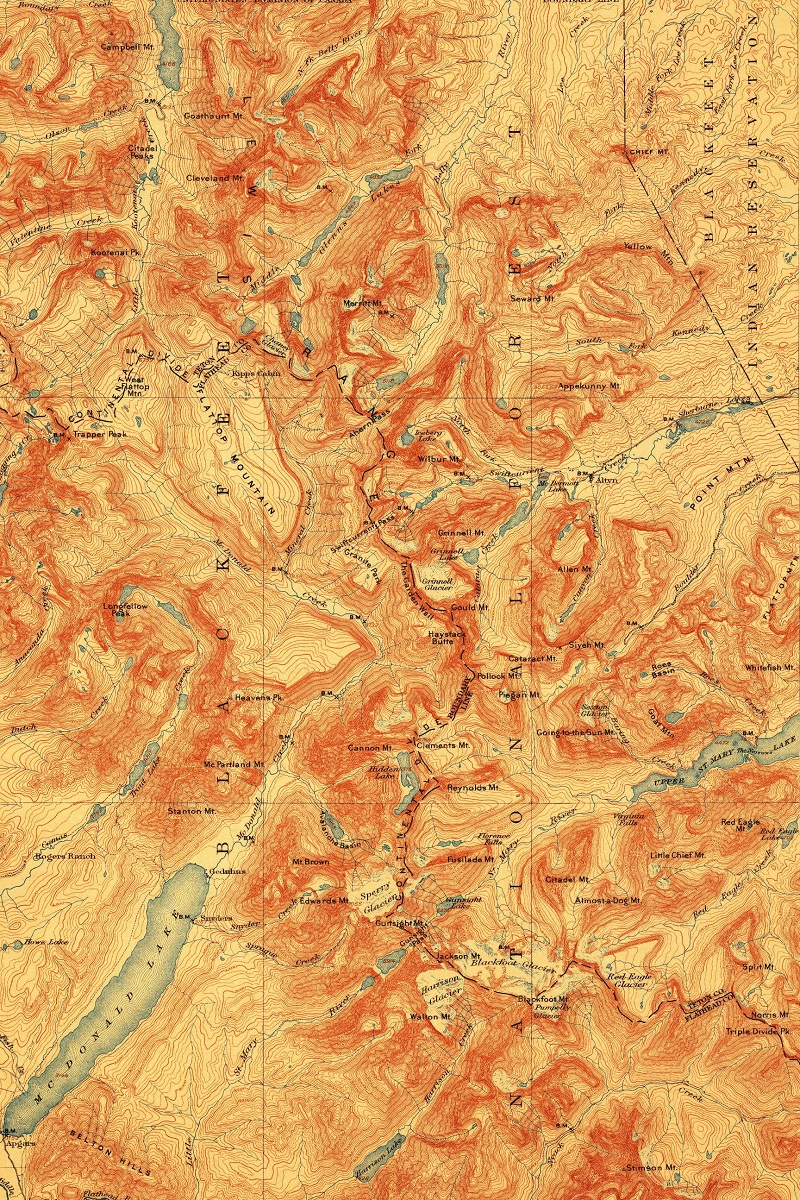
The USGS played an instrumental role in the establishment of the park by producing a topographic map of the area in 1901. This map provided detailed information about the park’s geography, including its mountain ranges, rivers, and valleys. It also helped to identify the most scenic areas of the park, which would later become popular tourist destinations.
The map was particularly significant for its detailed documentation of the park’s glaciers, which were a major focus of early conservation efforts. By providing accurate measurements of the park’s glaciers, the map helped to raise awareness of the park’s unique natural features and the need to protect them.
Today, the USGS continues to produce topographic maps of the park to help visitors navigate its rugged terrain and appreciate its natural beauty. These maps provide a valuable tool for both conservationists and outdoor enthusiasts, allowing them to better understand and appreciate the park’s unique features.
Glacier National Park USGS Historical Maps (1901)
Glacier National Park 2D NPS Map: Canvas Print Maps
Glacier National Park 3D NPS Maps: Raised Relief Maps
Glacier National Park (Chief Mountain, Montana 1901) 2D Map: Canvas Print Maps
Glacier National Park (Chief Mountain, Montana 1901) 3D Map: Raised Relief Maps
Glacier National Park (Chief Mountain, Montana 1901) High Resolution PDF: Hi-Res PDF Map
Learn more about USGS Historical Maps
#10: San Mateo, California (1915)
San Mateo is a charming city located on the San Francisco Peninsula in California. Situated just south of San Francisco, it has become an increasingly popular destination for tech companies and residents of the Bay Area alike. Its strategic location provides easy access to Silicon Valley and San Francisco, making it an ideal spot for commuters.
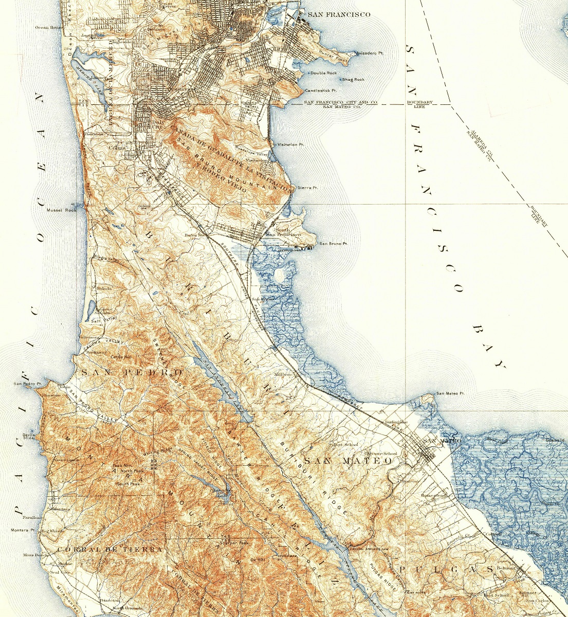
In 1915, the USGS produced a topographic map of San Mateo County that marked an important milestone in the area’s development. The map showed the progress of urbanization in San Mateo, highlighting the growth of residential and commercial areas. It also depicted the expansion of the Southern Pacific Railroad, which played a critical role in the city’s growth and development.
Overall, the 1915 topographic map of San Mateo County was a valuable resource for the city’s growth and development. It provided a detailed record of the city’s features and helped to identify areas that were particularly suitable for development. Today, San Mateo remains a vibrant and thriving city, known for its dynamic community, beautiful scenery, and exciting opportunities.
San Mateo, California USGS Historical Maps (1915)
San Mateo, California (San Mateo, California, 1915) 2D Map: Canvas Print Maps
San Mateo, California (San Mateo, California, 1915) 3D Map: Raised Relief Maps
San Mateo, California (San Mateo, California, 1915) High Resolution PDF: Hi-Res PDF Map
Learn more about USGS Historical Maps