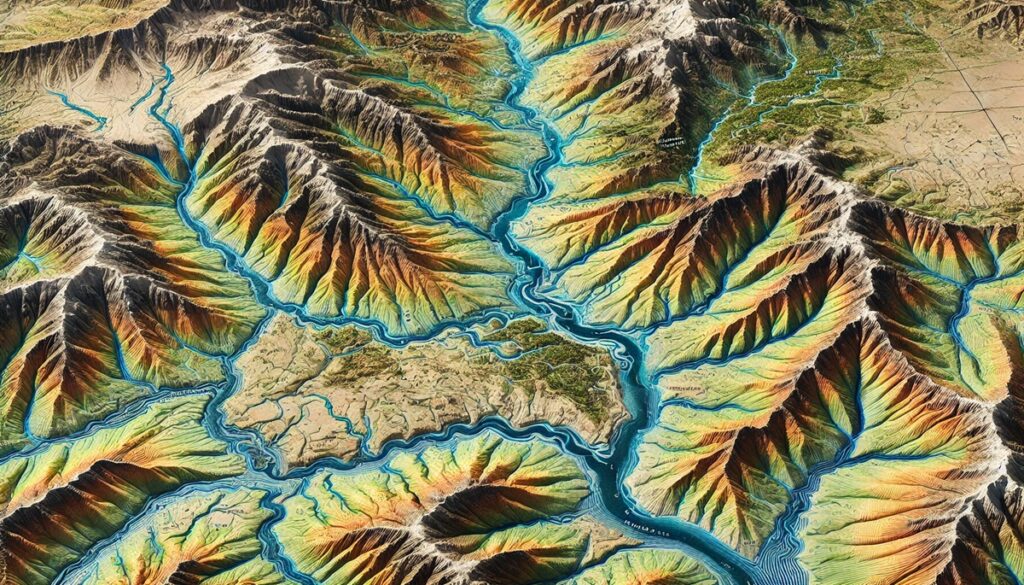
Watersheds are nature’s intricate systems, shaping landscapes and guiding the flow of water across vast territories. A watershed, often referred to as a drainage basin, is an area of land where all the water drains into a common outlet, like a river, lake, or ocean. Maps of these watersheds bring this natural flow to life, capturing the delicate interplay between geography, water, and life. They reveal the journey of water from mountain peaks, through valleys, across plains, and into the sea, showing how rivers snake through land, splitting into tributaries, and nourishing ecosystems along the way. Watershed maps are powerful tools, offering a visual representation of these complex systems that influence everything from water supply and agriculture to wildlife and climate. These maps don’t just show the location of rivers and lakes; they capture the essence of a landscape, showing elevations, flood zones, and how human development interacts with the environment. They serve as a reminder of the natural forces that connect us all, demonstrating how water moves across boundaries, sustaining life on its journey. Whether simple topographical maps, floodplain illustrations, or advanced GIS representations, watershed maps allow us to see the world from a different perspective, offering insights into the resources that shape ecosystems and the communities that depend on them. Through these maps, we gain a deeper understanding of the world’s interconnectedness, seeing how every drop of water plays a role in sustaining the environment and shaping the history of humankind.

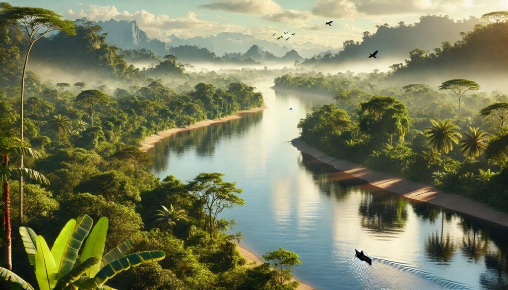
South America is home to some of the largest, most dynamic watersheds on the planet, each with its own unique characteristics and ecological importance. These vast river systems are crucial for sustaining ecosystems, providing water for human consumption, agriculture, and industrial activities. These watersheds also serve as central corridors for transportation, trade, and the growth of human civilizations. Below is a list of the top 10 largest watersheds in South America, ranked by size, and highlighting the significance of each basin.
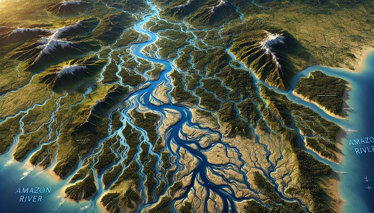
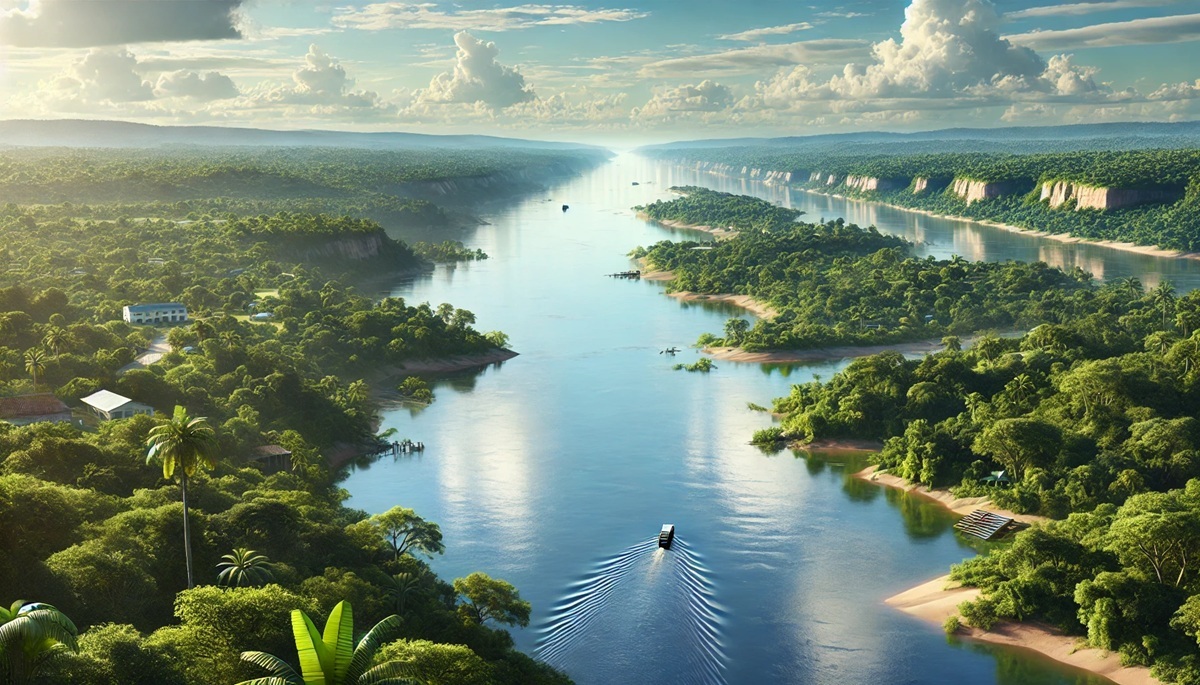
#1: Amazon River Basin, 2,720,000 Square Miles
The Amazon River Basin, covering 2,720,000 square miles, is by far the largest watershed in South America and one of the largest in the world. It spans across nine countries: Brazil, Peru, Colombia, Ecuador, Venezuela, Guyana, Suriname, French Guiana, and Bolivia. The Amazon River itself is the lifeblood of the basin, with more than 1,100 tributaries feeding into it. The basin is famous for its staggering biodiversity, holding around one-tenth of all species in the world. Its rainforests are often referred to as the “lungs of the Earth” due to their role in producing oxygen and absorbing carbon dioxide. Historically, the basin has supported numerous indigenous tribes and has been a vital part of the region’s culture and economy. Today, the Amazon faces significant threats from deforestation, climate change, and illegal logging, sparking ongoing conservation efforts aimed at preserving its unique ecosystems. The basin is critical for global climate regulation and provides important resources for surrounding communities.
#2: Paraná River Basin, 1,240,000 Square Miles
The Paraná River Basin, spanning 1,240,000 square miles, is a vital water source for Brazil, Argentina, and Paraguay. The Paraná River is the second-longest river in South America, and it serves as a critical route for trade and transport. The basin is home to a number of hydroelectric power stations, including the massive Itaipu Dam, which is shared between Brazil and Paraguay and is one of the largest producers of hydroelectric power in the world. The Paraná Basin is also rich in biodiversity, supporting wetlands like the Pantanal, which is one of the world’s largest tropical wetlands. Historically, the basin has played an essential role in the development of the region’s economy, particularly in agriculture and industry. However, like many other river systems, the Paraná Basin faces challenges from pollution, dam construction, and the impacts of climate change. The basin is an important source of water for millions of people and has a critical role in sustaining the agricultural industry in the region.
#3: São Francisco River Basin, 634,000 Square Miles
The São Francisco River Basin covers 634,000 square miles and is one of the most important watersheds in Brazil. The São Francisco River is a lifeline for the semi-arid regions of northeast Brazil, providing water for millions of people in an otherwise arid landscape. The river has been crucial for irrigation, agriculture, and hydroelectric power generation. The basin is also home to a rich variety of wildlife, including the endangered São Francisco river dolphin. The river is culturally significant, as it has served as a major trade route since colonial times. The São Francisco River has been part of numerous irrigation projects, including the massive transposition project that diverts its water to other parts of the country. Despite its importance, the river faces threats from pollution, over-extraction of water, and deforestation in its basin. Preservation of this watershed is crucial to ensuring the continued health of the region’s ecosystems and the livelihoods of its inhabitants.
#4: Orinoco River Basin, 880,000 Square Miles
The Orinoco River Basin spans 880,000 square miles and is one of the major watersheds in northern South America. Located primarily in Venezuela, with parts extending into Colombia, the Orinoco River is one of the longest rivers on the continent, flowing into the Atlantic Ocean. The Orinoco Basin is known for its extraordinary biodiversity, with its wetlands, savannas, and forests providing a unique habitat for many species, including jaguars, caimans, and over 1,400 species of birds. Historically, the Orinoco River was a key trade route for indigenous peoples and European settlers. The basin is also crucial for the oil industry, as Venezuela’s vast oil reserves are located within the watershed. However, the basin faces environmental challenges from oil spills, deforestation, and the effects of climate change. The Orinoco River remains a vital water source for millions of people, but its ecosystems are increasingly under threat.
#5: Magdalena River Basin, 276,000 Square Miles
The Magdalena River Basin covers 276,000 square miles in Colombia, and the Magdalena River is the country’s longest and most important river. The river runs northward from the Andes, flowing through central and northern Colombia before emptying into the Caribbean Sea. The basin is essential for transportation, as the river has long been a key route for trade and commerce, particularly for goods like coffee and coal. The Magdalena River also provides irrigation for agriculture in the region, which is one of Colombia’s primary industries. The basin is home to rich biodiversity, with numerous species of fish, birds, and mammals. However, the river and its ecosystems face threats from pollution, deforestation, and dam construction, which have disrupted natural habitats and water flow. Conservation efforts are underway to protect the river and its surrounding ecosystems, ensuring that the Magdalena Basin continues to provide vital resources for the region.
#6: Tocantins-Araguaia River Basin, 674,000 Square Miles
The Tocantins-Araguaia River Basin spans 674,000 square miles in Brazil, draining much of the central and northern regions of the country. The Tocantins and Araguaia rivers are the main rivers of the basin, which is an important water source for agriculture, energy production, and transportation. The basin is characterized by a mix of forests, wetlands, and savannas, providing a home for diverse wildlife, including jaguars, capybaras, and various species of birds. The Tocantins-Araguaia Basin has also been a critical site for Brazil’s hydroelectric industry, with several dams located along the rivers, generating electricity for millions. Despite the economic benefits, the basin faces environmental threats from deforestation, water pollution, and climate change, which are putting pressure on the region’s natural resources and wildlife.
#7: Xingu River Basin, 250,000 Square Miles
The Xingu River Basin, covering 250,000 square miles, is located in Brazil and is a vital part of the Amazon River Basin. The Xingu River runs through the heart of Brazil’s Amazon rainforest, feeding into the main Amazon River. The basin is home to diverse ecosystems, including tropical rainforests, wetlands, and savannas, and is inhabited by several indigenous communities who rely on the river for fishing and transportation. The Xingu River Basin is important for its biodiversity, with numerous species of fish, birds, and mammals, many of which are found nowhere else on Earth. The basin is also known for its cultural significance, with indigenous peoples living along the river for thousands of years. The Xingu River is under threat from deforestation, mining, and large-scale infrastructure projects, which are disrupting local ecosystems and indigenous communities. The Xingu River remains a focal point for conservation efforts, with initiatives aimed at protecting its waters and the people who depend on them.
#8: Paraná-Paraguay River Basin, 810,000 Square Miles
The Paraná-Paraguay River Basin spans 810,000 square miles and is one of the largest and most important river systems in South America. The basin includes the Paraná and Paraguay rivers, which flow through Brazil, Argentina, Paraguay, and Bolivia. The Paraná-Paraguay Basin is vital for agriculture, providing water for irrigation, and for transportation, serving as a major trade route for goods such as grain, petroleum, and coal. The basin is also a major source of hydroelectric power, with numerous dams built along the rivers. The region is known for its wetlands, including the Pantanal, which is one of the world’s largest tropical wetlands. The basin supports a wide variety of wildlife, including jaguars, capybaras, and several species of birds. However, the Paraná-Paraguay Basin is facing increasing challenges from dam construction, pollution, and habitat destruction, which threaten its ecosystems and biodiversity.
#9: São Francisco River Basin, 634,000 Square Miles
The São Francisco River Basin covers 634,000 square miles and is one of the most important watersheds in Brazil. The river has long been a source of water for millions of people, particularly in the semi-arid regions of northeast Brazil. The river supports agriculture, power generation, and is a critical lifeline for local communities. However, the basin faces significant threats from over-extraction, pollution, and climate change.
#10: Magdalena River Basin, 276,000 Square Miles
The Magdalena River Basin spans 276,000 square miles in Colombia and is critical for the country’s agricultural and transportation sectors. The river provides water for irrigation, trade, and is a vital part of the national economy. Despite challenges like pollution and dam construction, the Magdalena Basin remains a symbol of Colombia’s connection to its natural heritage and resources.
These ten watersheds not only play an essential role in South America’s ecology and economy but also represent the deep connection between the continent’s rivers and its people. From the vast Amazon to the lesser-known Magdalena, these river systems highlight the interdependence between natural resources, wildlife, and human activity, showcasing the importance of preserving these vital ecosystems for future generations.