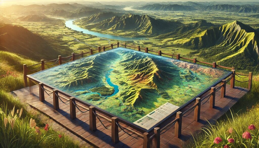
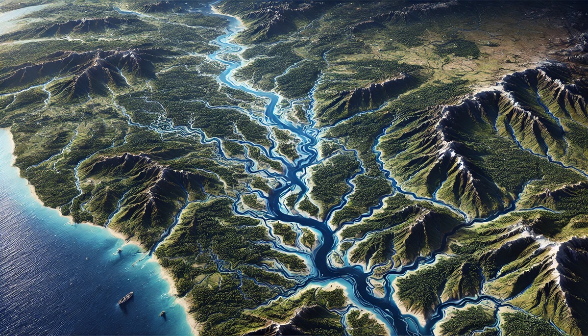
Watersheds are nature’s intricate networks, capturing the flow of water as it journeys through rivers, streams, and lakes, eventually finding its way to oceans or other water bodies. These vast and interconnected areas are vital to ecosystems, agriculture, and human life, making the role of maps in understanding them absolutely essential. Maps of watersheds allow us to visualize the ways water shapes the landscape, guiding the way we manage water resources, flood risks, and environmental protection. From the smallest local watersheds to the largest river basins, these maps provide not just a geographical perspective, but a deeper understanding of how water moves, interacts, and nourishes life. They show us the boundaries of river systems, the elevation changes that direct water flow, and the areas most vulnerable to flooding. Watershed maps are used by ecologists to study ecosystems, by farmers to manage irrigation, and by urban planners to ensure that cities don’t disrupt the natural flow of water. The accuracy and detail in these maps have evolved with advances in technology, from the earliest hand-drawn sketches to modern satellite imagery and GIS data that allow for real-time monitoring of water resources. These maps help us predict how water will behave in the future, aiding in flood mitigation efforts, environmental conservation, and climate change adaptation. Ultimately, they are essential tools for anyone interested in understanding the complex relationship between water and the environment, showing how a simple river can affect an entire landscape and how every drop of water counts in sustaining life on Earth.

A watershed is an area of land where all the water that falls within it drains into a common outlet such as a river, lake, or ocean. These natural features play a critical role in maintaining ecological balance, as they support biodiversity, agriculture, and human settlements. The largest watersheds in the world are vast, often covering millions of acres, and can span across multiple countries and ecosystems. Each of these watersheds has its own unique geography, history, and cultural significance. Below is a list of the top 10 largest watersheds, ranked by their size, highlighting their importance to the environment, local economies, and global water systems.
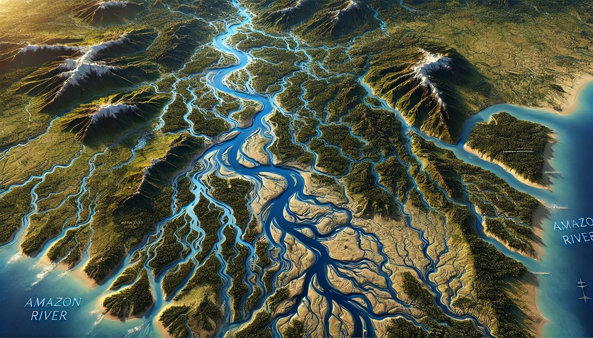
#1: The Amazon River Watershed, 2,720,000 Square Miles
The Amazon River Watershed is the largest watershed in the world, covering an enormous area of approximately 2,720,000 square miles. It is home to the Amazon River, the second longest river in the world, and drains an area that spans across nine countries in South America, including Brazil, Peru, Colombia, and others. The watershed is renowned for its biodiversity, as it hosts over 10% of the world’s known species, including countless unique flora and fauna. One interesting fact about the Amazon River is that it carries more water to the ocean than any other river, discharging nearly 20% of the world’s freshwater. The watershed is vital for regulating global climate patterns and is considered the “lungs of the Earth” due to its vast rainforests, which produce oxygen and absorb carbon dioxide. Anecdotal stories from local communities highlight the incredible reliance on the Amazon for water, food, and transportation, with the river being the lifeblood of millions of people who live along its banks. The Amazon has also been the focus of extensive research on deforestation, climate change, and sustainable resource management, making it one of the most critical watersheds in the world.
#2: The Congo River Watershed, 1,250,000 Square Miles
The Congo River Watershed spans about 1,250,000 square miles and is the second-largest watershed in the world by size. Located in Central Africa, the Congo River is the second-longest river in Africa, after the Nile. The Congo River and its tributaries drain a vast and diverse region, flowing through six countries: the Democratic Republic of the Congo, Republic of the Congo, Cameroon, Central African Republic, Angola, and Gabon. The watershed is a vital source of freshwater for the people living in this region, supporting agriculture, transportation, and electricity generation. One interesting aspect of the Congo River is that it has the world’s deepest river channel, reaching depths of more than 700 feet. The Congo River basin also contains some of the most biodiverse tropical rainforests on Earth, which are home to numerous species of primates, birds, and other wildlife. These forests play a key role in carbon sequestration and global climate regulation. Local stories and experiences from residents tell of how the river is essential for day-to-day life, providing water for drinking, fishing, and as a transportation route, especially in remote areas where roads are scarce.
#3: The Ganges-Brahmaputra-Meghna Watershed, 1,200,000 Square Miles
The Ganges-Brahmaputra-Meghna Watershed, covering 1,200,000 square miles, is one of the largest and most culturally significant watersheds in the world. This vast area drains water from the Himalayan mountain range and is home to three major river systems: the Ganges, Brahmaputra, and Meghna rivers. The watershed spans several countries, including India, Bangladesh, China, Nepal, and Bhutan, and is one of the most densely populated areas on Earth. It supports over 600 million people who rely on the rivers for water, agriculture, and transportation. The Ganges River, in particular, holds deep religious significance for Hindus, as it is considered a sacred river and is central to many spiritual practices. The watershed is also critical for the region’s economy, providing water for irrigation in one of the most productive agricultural regions in the world. However, the watershed faces significant challenges, including pollution, flooding, and the impacts of climate change on the Himalayan glaciers that feed the rivers. Local communities are actively involved in efforts to clean and protect the rivers, while researchers continue to study the impacts of human activity on the watershed’s health.
#4: The Mississippi-Missouri River Watershed, 1,150,000 Square Miles
The Mississippi-Missouri River Watershed spans approximately 1,150,000 square miles, draining a vast area across the United States. The Mississippi River is the longest river in North America, and it, along with the Missouri River, forms the backbone of one of the world’s largest river systems. The watershed covers parts of 31 U.S. states and two Canadian provinces, making it one of the most significant watersheds in the Americas. The region it covers is critical for agricultural production, especially in the Midwest, where the fertile soil is ideal for growing crops like corn, soybeans, and wheat. The watershed also plays a vital role in shipping and transportation, as the Mississippi River serves as an important waterway for goods traveling to and from ports in the Gulf of Mexico. The history of the watershed is steeped in the development of the United States, as early explorers, settlers, and traders navigated the river to expand the nation. The watershed is also home to rich ecosystems, including wetlands and floodplains that provide vital habitats for a wide range of wildlife. However, the Mississippi River system faces challenges from flooding, pollution, and habitat loss, prompting ongoing conservation and restoration efforts.
#5: The Yangtze River Watershed, 700,000 Square Miles
The Yangtze River Watershed covers approximately 700,000 square miles and is the largest river system in China. The Yangtze River, or Chang Jiang, is the longest river in Asia, and it flows from the Tibetan Plateau to the East China Sea. The watershed spans 11 provinces and is home to over 400 million people. It supports some of China’s most important cities, including Shanghai, Wuhan, and Chongqing, and is critical to the country’s economy. The Yangtze River has been central to China’s agricultural development, with its fertile basin being one of the world’s most productive farming regions. It also serves as an important transportation route for goods and people. One interesting fact about the Yangtze River is that it is home to the famous Three Gorges, a region known for its stunning landscapes and the Three Gorges Dam, one of the world’s largest hydroelectric power stations. The Yangtze has long been a symbol of Chinese civilization, and its history is deeply intertwined with the development of the nation. However, the river and its watershed face significant environmental pressures, including pollution, overfishing, and habitat destruction, prompting ongoing efforts to balance economic development with environmental conservation.
#6: The Mackenzie River Watershed, 450,000 Square Miles
The Mackenzie River Watershed spans 450,000 square miles in Canada and is the largest watershed in the country. The Mackenzie River flows from the Great Slave Lake in the Northwest Territories and eventually empties into the Arctic Ocean. This watershed is incredibly important for the local ecosystems, as it drains a significant portion of the northern boreal forest, which is home to a wide variety of wildlife, including caribou, moose, and many species of fish. The Mackenzie River also provides water to the Indigenous peoples of the region, who have lived along its banks for thousands of years. The watershed is rich in natural resources, including oil, gas, and minerals, but it also faces challenges from industrial development, climate change, and shifting ecosystems. Local stories often focus on the river’s importance to Indigenous communities and how they rely on the water for transportation, food, and cultural practices. The Mackenzie River Watershed is an area of great beauty and ecological significance, making its conservation crucial for the health of the region.
#7: The Yukon River Watershed, 330,000 Square Miles
The Yukon River Watershed covers 330,000 square miles, draining parts of Canada and Alaska. The Yukon River is one of the longest rivers in North America and has played a central role in the region’s history. During the Klondike Gold Rush in the late 19th century, the river served as the main route for miners and settlers hoping to strike it rich in the Yukon Territory. The watershed is still an important waterway for transportation and commerce, particularly in remote areas where roads are scarce. The Yukon River is known for its stunning landscapes, including forests, tundra, and mountains, as well as for its abundance of fish and wildlife. The watershed is also home to a number of Indigenous communities who have relied on the river for sustenance and cultural traditions for millennia. Local stories often recount how the river has shaped the way people live and interact with nature, and how it remains a lifeline for many people living in the region.
#8: The Indus River Watershed, 350,000 Square Miles
The Indus River Watershed, spanning 350,000 square miles, is one of the most important river systems in South Asia. The Indus River itself flows from Tibet through India and Pakistan, eventually emptying into the Arabian Sea. The watershed supports over 200 million people, many of whom depend on the river for agriculture, drinking water, and transportation. The Indus River Basin is known for its historical importance, as it was the cradle of one of the world’s earliest civilizations, the Indus Valley Civilization, which flourished more than 4,000 years ago. The river continues to be vital for modern-day Pakistan and parts of India, providing water for one of the most agriculturally productive regions in the world. However, the river and its watershed face significant challenges, including water scarcity, pollution, and the impacts of climate change, which have prompted efforts to improve water management and conservation.
#9: The Paraná River Watershed, 900,000 Square Miles
The Paraná River Watershed spans about 900,000 square miles across South America, primarily in Brazil, Argentina, and Paraguay. The Paraná River is the second-longest river in South America, and its watershed is a vital source of water for agriculture, hydroelectric power, and urban areas. The Paraná River Basin is home to some of the most fertile farmland in the region, including vast soybean and corn fields. The river is also crucial for transportation, as it provides access to ports on the Atlantic Ocean. One interesting fact about the Paraná River is that it is home to the massive Itaipu Dam, which is one of the largest hydroelectric plants in the world. The Paraná River also flows through the Iguaçu Falls, one of the world’s most stunning natural wonders. While the watershed is rich in resources, it also faces challenges from deforestation, pollution, and the effects of climate change.
#10: The Limpopo River Watershed, 300,000 Square Miles
The Limpopo River Watershed, covering 300,000 square miles, spans several countries in Southern Africa, including South Africa, Botswana, Zimbabwe, and Mozambique. The Limpopo River is an important water source for millions of people living in the region, and it supports a variety of agricultural activities, particularly in South Africa. The river also flows through several important ecological zones, including savannas and wetlands, making it a critical resource for wildlife. One interesting fact about the Limpopo River is its historical significance in the ancient trade routes of Southern Africa, as it served as a major route for the transport of goods. The watershed faces significant environmental challenges, including droughts, deforestation, and water pollution, which have impacted the local population’s access to clean water.
Watersheds are essential components of the Earth’s hydrological systems, and these top 10 largest watersheds play a significant role in maintaining ecological balance, supporting local communities, and providing vital resources. From the vast Amazon River Watershed to the intricate networks of the Limpopo River, each of these watersheds has a unique story to tell. Understanding and preserving these watersheds is crucial for ensuring the sustainability of our natural environment and the livelihoods of millions of people around the world.