Waterfalls are among nature’s most breathtaking phenomena, where rivers plunge over cliffs, creating cascades of roaring water and mist. They captivate the imagination with their immense power and beauty, symbolizing the sheer force of nature. Here, we explore the top 10 largest waterfalls in the world, diving into their incredible heights, stunning locations, and fascinating histories.
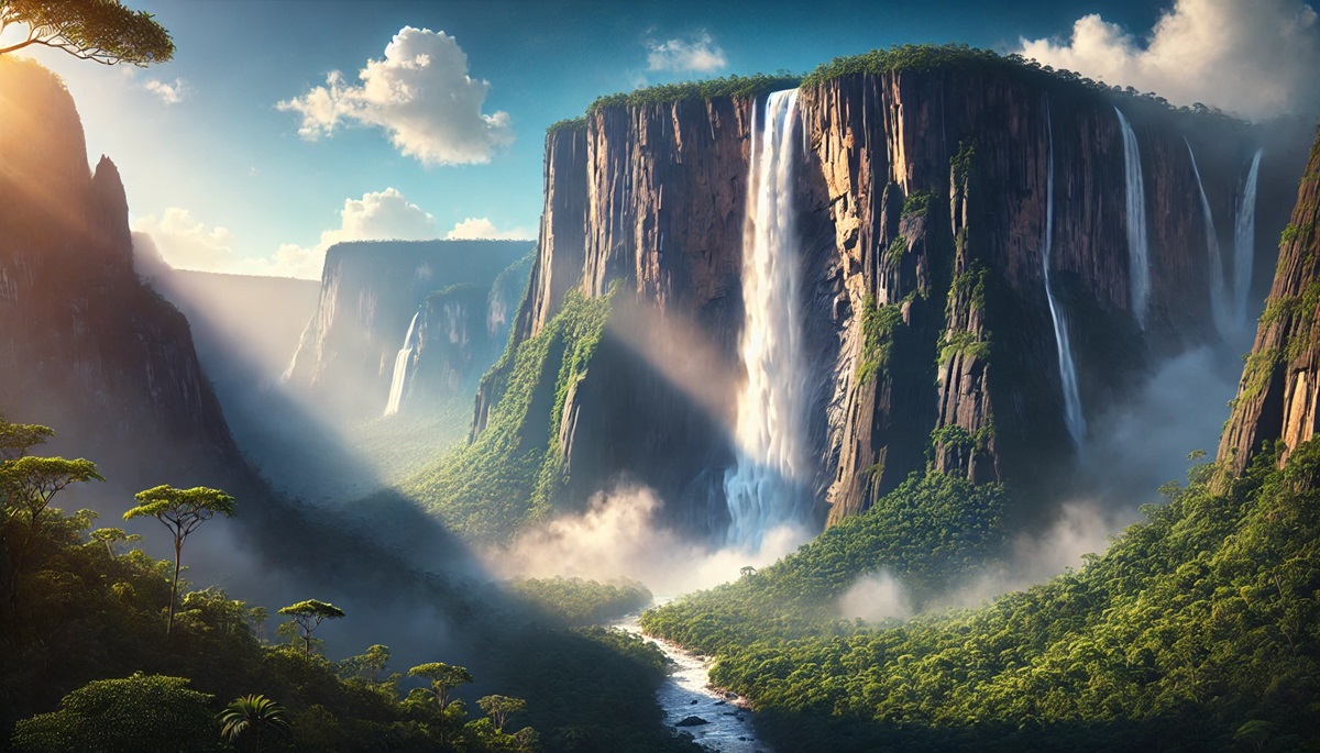
#1: Angel Falls – 3,212 feet
Angel Falls in Venezuela holds the title of the world’s tallest waterfall, plunging 3,212 feet from the Auyán-Tepui mountain. This awe-inspiring cascade drops uninterrupted for 2,648 feet, creating a veil of mist that often dissipates before reaching the ground. Located in Canaima National Park, a UNESCO World Heritage Site, Angel Falls is nestled within one of the planet’s most biodiverse rainforests.
Named after American aviator Jimmie Angel, who first flew over it in 1933, the waterfall has a mythical allure. Indigenous Pemon people call it “Kerepakupai Merú,” meaning “waterfall of the deepest place.” Visiting Angel Falls requires a journey by river and hike, adding to its mystique and sense of adventure.
#2: Tugela Falls – 3,110 feet
South Africa’s Tugela Falls is a series of cascading drops in the Drakensberg Mountains, with a combined height of 3,110 feet. The source of the Tugela River, this waterfall is one of nature’s most dramatic spectacles, with its water plunging from the Amphitheatre, a vast cliff face that is a highlight of Royal Natal National Park.
Legend has it that the Amphitheatre’s cliffs were once home to ancient spirits. The falls are particularly striking during the rainy season, when they swell with water, creating a roaring cascade visible from miles away. Adventurous hikers often trek to the top for panoramic views of this natural wonder.
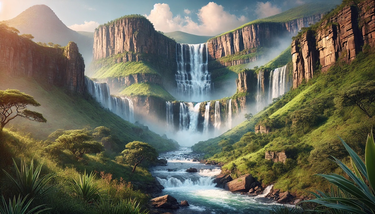
#3: Tres Hermanas Falls – 3,000 feet
Tres Hermanas Falls, or “Three Sisters Falls,” is located in Peru’s remote Otishi National Park. This three-tiered waterfall cascades 3,000 feet through lush rainforests, offering a mesmerizing spectacle of nature’s grandeur. Its inaccessibility adds to its enigmatic appeal, as it remains relatively untouched by tourism.
Surrounded by dense Amazonian jungle, the falls support a wide array of flora and fauna. Indigenous legends speak of the falls as a sacred site, adding layers of cultural and natural significance to this hidden gem.
#4: Olo’upena Falls – 2,953 feet
Olo’upena Falls in Hawaii is the fourth tallest waterfall globally, cascading 2,953 feet down the rugged cliffs of Molokai Island. Accessible only by air or sea, the waterfall flows seasonally, blending seamlessly into the surrounding verdant cliffs.
The falls are part of Molokai’s pristine landscape, offering unparalleled beauty and tranquility. Stories from local Hawaiians often recount the spiritual significance of these cliffs, considered sacred and powerful in Hawaiian culture.
#5: Yumbilla Falls – 2,938 feet
Yumbilla Falls in Peru drops an impressive 2,938 feet, making it one of the world’s tallest waterfalls. Hidden within the Amazon Rainforest, it was only officially measured and recognized in the early 2000s. Its four-tiered cascade flows through dense jungle, creating an ethereal atmosphere.
Yumbilla Falls is surrounded by rich biodiversity, including unique bird species and orchids. Its recent discovery has added a sense of wonder and excitement for adventurers and researchers alike.
#6: Vinnufossen – 2,822 feet
Located in Norway, Vinnufossen is Europe’s tallest waterfall, plunging 2,822 feet down a sheer cliff face into the Vinnufjorden valley. Fed by the Vinnu Glacier, the waterfall changes dramatically with the seasons, swelling with ice melt during the spring and summer months.
The picturesque surroundings of Vinnufossen, with its fjords and forests, make it a favorite destination for nature lovers. The cascading water against the backdrop of Norway’s rugged terrain creates a scene of timeless beauty.
#7: Balåifossen – 2,788 feet
Balåifossen, another Norwegian gem, is the second-tallest waterfall in Europe at 2,788 feet. Located in Hordaland County, it tumbles down steep cliffs into a serene valley, creating a striking contrast between its white spray and the dark rocks.
The falls are less accessible than some others, offering a sense of seclusion and wonder for those who make the journey. Its powerful flow and remote beauty have inspired poets and painters for centuries.
#8: Pu’uka’oku Falls – 2,756 feet
Pu’uka’oku Falls, also on Hawaii’s Molokai Island, drops 2,756 feet in a single, dramatic cascade. Set against the island’s sea cliffs, it is one of the tallest waterfalls in the United States.
The falls’ remote location and seasonal flow make them a hidden treasure, best appreciated from a boat or helicopter tour. They add to the rugged charm of Molokai, a place known for its untouched natural beauty.
#9: James Bruce Falls – 2,755 feet
James Bruce Falls in Canada’s British Columbia plunges 2,755 feet, making it the tallest waterfall in North America. Nestled in Princess Louisa Marine Provincial Park, it is fed by snowfields high above the fjords.
The remote park is accessible only by boat, enhancing the sense of adventure for visitors. The falls cascade down sheer cliffs, creating a breathtaking spectacle that perfectly complements the serene fjord landscape.
#10: Browne Falls – 2,744 feet
Browne Falls in New Zealand’s Fiordland National Park drops 2,744 feet from Lake Browne into Doubtful Sound. Surrounded by lush rainforests and dramatic cliffs, the waterfall is part of one of the most pristine ecosystems on Earth.
Fiordland’s beauty is legendary, and Browne Falls is a key feature of its landscape. It is a favorite spot for kayakers and eco-tourists exploring the untouched wilderness of Doubtful Sound.
The world’s largest waterfalls are more than just geological features; they are powerful symbols of nature’s force and beauty. From the towering Angel Falls to the remote Browne Falls, each waterfall offers a unique glimpse into Earth’s splendor and diversity. They remind us of the timeless processes that shape our planet, captivating the imagination and inspiring awe for generations to come.