Gorges, with their breathtaking depths and dramatic landscapes, are among nature’s most captivating formations. These colossal chasms carved by rivers over millions of years showcase the raw power of erosion and the beauty of Earth’s geological history. From towering cliffs to lush valleys, each gorge tells a story of time and transformation. Let’s explore the top 10 largest gorges in the world, diving into their heights, unique features, and fascinating histories.
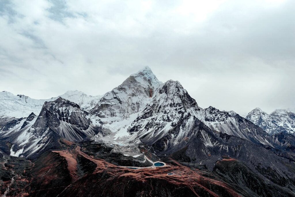
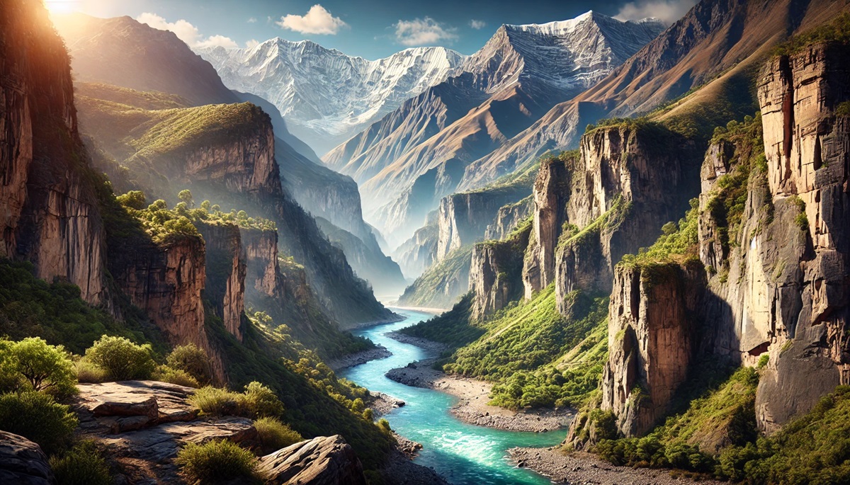
#1: Yarlung Tsangpo Gorge – 19,714 feet
The Yarlung Tsangpo Gorge in Tibet is the largest and deepest gorge in the world, plunging 19,714 feet at its deepest point. Stretching over 300 miles, it carves through the eastern Himalayas, winding around the towering Namcha Barwa peak. The gorge transitions from snowy Himalayan landscapes to tropical rainforests, making it one of the most biodiverse regions on the planet.
Often referred to as the “Grand Canyon of the East,” the Yarlung Tsangpo Gorge remains largely unexplored due to its remote and rugged terrain. Stories of adventurers braving its rapids highlight its reputation as one of the most challenging whitewater expeditions in the world.
#2: Kali Gandaki Gorge – 18,278 feet
Located in Nepal, the Kali Gandaki Gorge slices through the Himalayas between the Annapurna and Dhaulagiri ranges, with a depth of 18,278 feet. The gorge is carved by the Kali Gandaki River, one of the oldest rivers in the world, and is lined with fossils of ammonites, revered in Hinduism as sacred symbols.
Trekkers traversing the Annapurna Circuit often pass through this gorge, taking in its stunning views and cultural significance. Ancient villages and monasteries dot the landscape, blending natural beauty with rich heritage.
#3: Cotahuasi Canyon – 11,595 feet
Also in Peru, Cotahuasi Canyon reaches a depth of 11,595 feet, slightly deeper than Colca Canyon. Located in the Arequipa region, it is carved by the Cotahuasi River and surrounded by snow-capped peaks, including Mount Coropuna.
This remote canyon remains less visited than its famous neighbor, offering an untouched wilderness experience. Its rugged trails lead to hidden waterfalls and ancient ruins, making it a paradise for adventurous hikers.
#4: Colca Canyon – 10,730 feet
Peru’s Colca Canyon plunges to a depth of 10,730 feet, twice as deep as the Grand Canyon. The Colca River has sculpted this vast chasm over millions of years, creating one of the most spectacular landscapes in South America. Its slopes are adorned with pre-Incan agricultural terraces still in use today.
The canyon is also a sanctuary for the majestic Andean condor, which can often be seen gliding above its cliffs. Visitors flock to the Cruz del Condor viewpoint for breathtaking views of the canyon and its soaring inhabitants.
#5: Tiger Leaping Gorge – 9,842 feet
Tiger Leaping Gorge in China’s Yunnan Province plunges 9,842 feet between Jade Dragon Snow Mountain and Haba Snow Mountain. The Jinsha River roars through the narrow gorge, creating some of the world’s most dramatic whitewater rapids.
Legend has it that a tiger once leaped across the gorge at its narrowest point, giving it its name. The well-maintained hiking trails offer breathtaking views of the river and the surrounding mountains.
#6: Grand Canyon – 6,093 feet
The Grand Canyon in Arizona is one of the most iconic natural wonders in the world, with a depth of 6,093 feet. Carved by the Colorado River over millions of years, this immense gorge stretches 277 miles and showcases nearly two billion years of Earth’s history through its stratified rock layers.
Native American tribes, including the Hopi and Havasupai, hold the Grand Canyon sacred, adding cultural depth to its geological significance. Millions of visitors each year marvel at its vistas, making it one of the most popular tourist destinations on the planet.
#7: Fish River Canyon – 5,904 feet
Namibia’s Fish River Canyon, at 5,904 feet deep, is Africa’s largest canyon. The arid landscape is carved by the Fish River, creating dramatic views and steep, rugged walls. The Fish River Hiking Trail offers a challenging yet rewarding trek through this starkly beautiful terrain.
Its remote location and harsh environment have preserved much of its natural beauty, drawing adventurers seeking solitude and dramatic desert scenery.
#8: Tara River Canyon – 4,300 feet
The Tara River Canyon in Montenegro is Europe’s deepest canyon, plunging 4,300 feet into the rugged landscape of the Durmitor National Park. The Tara River’s crystal-clear waters flow through the canyon, creating rapids popular for whitewater rafting.
The canyon is a UNESCO World Heritage Site, celebrated for its biodiversity and unspoiled beauty. Its steep cliffs and emerald waters make it a must-visit for nature enthusiasts.
#9: Blyde River Canyon – 2,625 feet
South Africa’s Blyde River Canyon descends 2,625 feet and is one of the world’s greenest gorges. Its lush subtropical vegetation contrasts with the dramatic cliffs and rock formations that line the canyon.
God’s Window, a popular viewpoint, offers breathtaking vistas of the canyon and the surrounding landscape. Its beauty and accessibility make it a favorite destination for travelers and photographers.
#10: Verdon Gorge – 2,300 feet
The Verdon Gorge in southeastern France, at 2,300 feet, is often called the “Grand Canyon of Europe.” The turquoise Verdon River winds through the limestone cliffs, creating a picturesque and serene landscape.
The gorge is a haven for outdoor activities, including kayaking, rock climbing, and hiking. Its stunning beauty has inspired countless artists and continues to attract visitors from around the globe.
The world’s largest gorges are confirmations to the power of nature and the passage of time. From the towering cliffs of the Yarlung Tsangpo to the vibrant greenery of the Blyde River Canyon, each gorge offers unique landscapes and fascinating stories. Exploring these natural wonders reveals the beauty and grandeur of Earth’s diverse geology, inviting us to connect with the planet’s most awe-inspiring creations.