River deltas are dynamic and fertile landscapes where rivers meet the sea or large lakes, depositing sediment and creating vast, triangular landforms. These ecosystems are not only critical for biodiversity but also serve as cultural, historical, and economic hubs for the regions they occupy. Let’s explore the top 10 largest deltas in the world, their impressive features, and the stories that have unfolded across their landscapes.
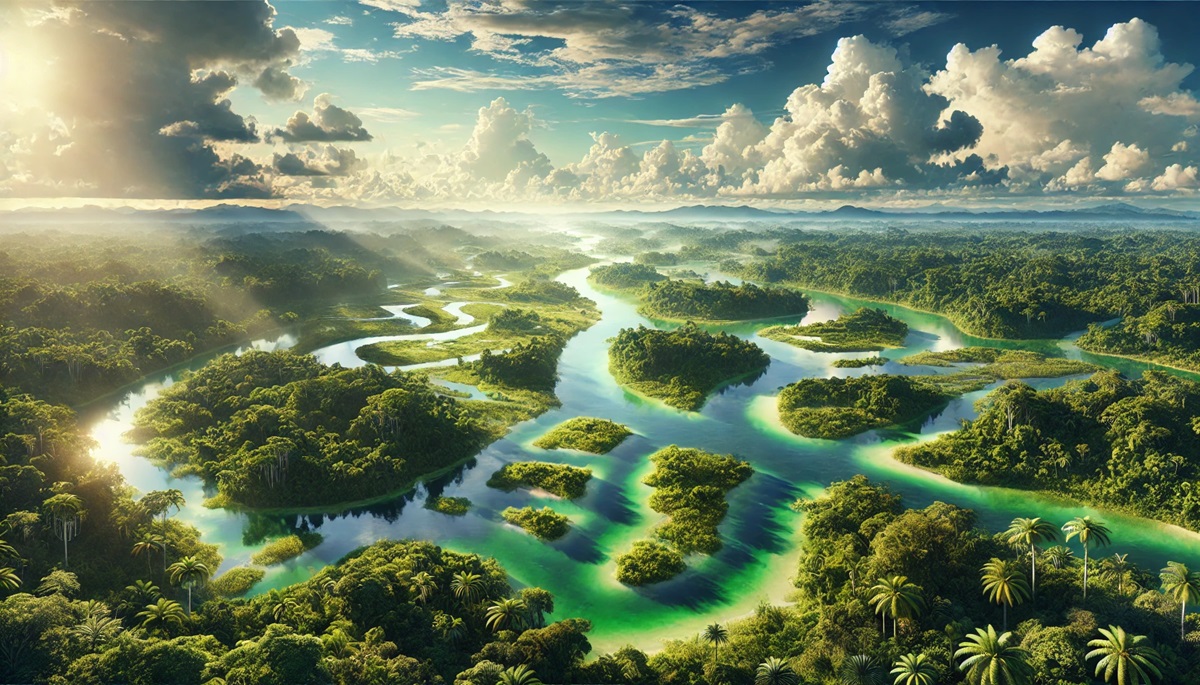
#1: Amazon River Delta – 62,000 feet
The Amazon River Delta, located in northern Brazil, is a sprawling network of channels, islands, and wetlands that spans 62,000 square miles. It is fed by the Amazon River, the world’s largest by discharge, and empties into the Atlantic Ocean. The delta’s immense size and complexity make it a vital component of the Amazon Basin’s ecosystem.
The delta is home to thousands of species, including pink river dolphins and piranhas. The Marajó Island, the world’s largest river island, lies within this delta, showcasing a mix of traditional indigenous cultures and diverse wildlife. Anecdotal stories from explorers describe the challenges of navigating its dense vegetation and unpredictable waterways.
#2: Ganges-Brahmaputra Delta – 40,000 feet
The Ganges-Brahmaputra Delta, also known as the Sundarbans Delta, is the largest delta in the world, covering over 40,000 square miles across India and Bangladesh. This fertile plain is created by the convergence of the Ganges, Brahmaputra, and Meghna rivers, which deposit billions of tons of sediment annually. With its elevation rarely exceeding 20 feet above sea level, the delta supports one of the most densely populated regions on Earth.
The Sundarbans, a UNESCO World Heritage Site within the delta, is home to the endangered Bengal tiger and countless other species. Its intricate network of waterways and mangroves creates a haven for biodiversity. Historically, the delta has been a cradle of civilization, with ancient settlements thriving here due to its rich soils and abundant water.
#3: Yangtze River Delta – 25,000 feet
The Yangtze River Delta in eastern China spans approximately 25,000 square miles and is one of the most economically significant regions in the world. Home to cities like Shanghai, this delta is a hub of commerce, industry, and culture.
The delta’s history is intertwined with China’s rise, serving as a focal point for trade and innovation. Its wetlands and estuaries support rich biodiversity, while its urban areas reflect the dynamic growth of modern China.
#4: Lena River Delta – 18,000 feet
The Lena River Delta in Siberia, Russia, is one of the largest Arctic deltas, spanning 18,000 square miles. This remote and pristine delta empties into the Laptev Sea, creating a unique landscape of tundra, wetlands, and islands.
The delta is a haven for Arctic wildlife, including polar bears and migratory birds. It also holds clues to Earth’s climatic past, with permafrost and ancient sediments revealing changes over millennia.
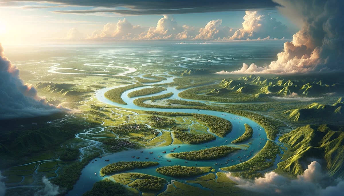
#5: Mekong Delta – 15,000 feet
The Mekong Delta in southern Vietnam spans 15,000 square miles and serves as a lifeline for millions of people. Known as the “Rice Bowl of Vietnam,” this delta produces more than half of the country’s rice, thanks to its fertile soil and abundant water supply. Its elevation rarely exceeds 10 feet, making it vulnerable to sea-level rise and climate change.
The delta is a labyrinth of rivers, canals, and swamps, teeming with life. Floating markets, like the Cai Rang market, are iconic symbols of the Mekong’s vibrant culture and commerce. Historically, the Mekong Delta has been a site of significant conflict and resilience, playing pivotal roles in Vietnam’s history.
#6: Mississippi River Delta – 14,500 feet
The Mississippi River Delta in Louisiana covers approximately 14,500 square miles and serves as the gateway to one of the largest river systems in North America. Created by the Mississippi River’s sediment deposits, the delta forms a rich mosaic of wetlands, marshes, and waterways.
The delta is crucial for the U.S. economy, supporting industries like fishing, shipping, and oil. However, it faces significant challenges from land loss and hurricanes. Stories of resilience and innovation, such as the restoration efforts after Hurricane Katrina, highlight the region’s importance and vulnerability.
#7: Ganges Delta – 10,000 feet
The Ganges Delta, stretching 10,000 square miles, is another arm of the Ganges-Brahmaputra system, emphasizing its immense scale. This delta supports dense populations and a vibrant agricultural system.
Its intricate waterways and mangroves, including the Sundarbans, make it a global ecological treasure. The delta’s history and cultural significance underscore its importance as a lifeline for millions.
#8: Orinoco Delta – 9,600 feet
The Orinoco Delta in Venezuela covers 9,600 square miles and is one of South America’s most unique ecosystems. Fed by the Orinoco River, the delta forms a sprawling network of waterways that flow into the Atlantic Ocean.
The delta is home to the Warao people, who have lived here for centuries, adapting to its challenging environment. The region’s abundant wildlife and cultural heritage make it a fascinating destination for ecotourism and anthropology.
#9: Volga Delta – 6,000 feet
The Volga Delta in Russia, spanning 6,000 square miles, is Europe’s largest delta. It forms as the Volga River empties into the Caspian Sea, creating a complex web of channels and wetlands.
The delta is renowned for its sturgeon population, which produces the world-famous caviar. Its unique landscape and biodiversity have made it a focal point for conservation efforts.
#10: Nile Delta – 100 feet
The Nile Delta in Egypt, covering over 9,650 square miles, has been a cradle of civilization for millennia. Fed by the Nile River as it flows into the Mediterranean Sea, the delta has supported agriculture and human settlements for over 5,000 years. With an average elevation of 100 feet, it is one of the most fertile regions in the world.
The delta’s history is steeped in ancient Egyptian lore, with its rich soils enabling the rise of the pharaohs. Today, it faces challenges from urbanization and climate change, yet it remains a vital agricultural and economic region.
The world’s largest deltas are more than geographical features; they are dynamic systems that sustain life, culture, and economies. From the Sundarbans’ tangled mangroves to the bustling cities of the Yangtze Delta, these deltas showcase the incredible interplay between rivers and seas. As climate change and human activity threaten their delicate balance, preserving these vital ecosystems becomes a global imperative, ensuring their stories continue for generations to come.