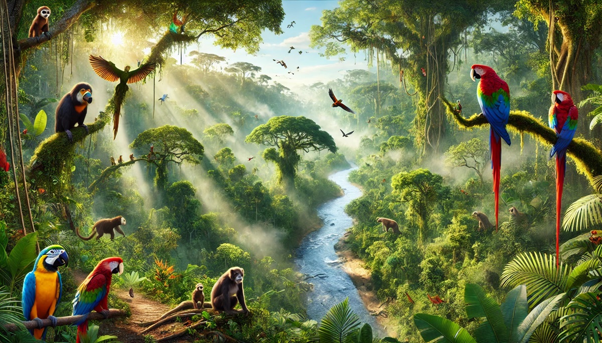
Rainforests are the lush, green lungs of our planet, teeming with life and mysteries. These vast ecosystems harbor towering trees, intricate canopies, and an extraordinary diversity of flora and fauna. Beyond their ecological importance, rainforests are also cultural treasures, holding deep significance for Indigenous peoples and a history intertwined with exploration, discovery, and conservation. From the expansive Amazon Rainforest to the remote Daintree, the world’s rainforests offer a glimpse into nature’s most vibrant and vital habitats. Here are the top 10 largest rainforests in the world, ranked by size.
#1: Amazon Rainforest – 2.3 Million Square Miles
The Amazon Rainforest is the largest rainforest in the world, sprawling across nine countries in South America, including Brazil, Peru, and Colombia. This vast ecosystem is home to 390 billion individual trees, some reaching heights of over 200 feet. The forest’s dense canopy creates a shadowy underworld where unique species thrive, including jaguars, harpy eagles, and pink river dolphins.
The Amazon is often called the “lungs of the Earth” because it produces 20% of the world’s oxygen. Its Indigenous tribes, like the Yanomami and Kayapo, have lived sustainably in this forest for thousands of years. Stories of explorers like Francisco de Orellana, the first European to navigate the Amazon River, add to the forest’s allure. However, deforestation and climate change pose significant threats, making the Amazon a critical area for global conservation efforts.
#2: Congo Rainforest – 780,000 Square Miles
The Congo Rainforest, stretching across central Africa, is the second-largest rainforest in the world. This sprawling forest covers parts of the Democratic Republic of the Congo, Cameroon, and Gabon, harboring ancient trees that tower over 150 feet tall. Its dense vegetation supports a diverse range of wildlife, including forest elephants, lowland gorillas, and okapis.
The Congo Basin is also home to numerous Indigenous communities whose cultures and traditions are deeply tied to the forest. Stories of early explorers braving its challenging terrain and accounts of the forest’s role in global carbon storage underscore its importance. Today, the Congo Rainforest is a key focus for climate change mitigation and biodiversity preservation.

#3: New Guinea Rainforest – 303,000 Square Miles
The New Guinea Rainforest, split between Papua New Guinea and Indonesia, is the third-largest rainforest, covering approximately 303,000 square miles. Known for its biodiversity, this forest supports species found nowhere else, such as tree kangaroos and birds of paradise.
The forest’s towering trees and dense undergrowth provide a habitat for rare flora and fauna. Local tribes maintain a deep connection to the land, using sustainable practices to coexist with nature. Anecdotes of researchers discovering new species within its depths highlight its ecological significance. The New Guinea Rainforest remains one of the last frontiers for scientific exploration.
#4: Valdivian Temperate Rainforest – 95,000 Square Miles
The Valdivian Temperate Rainforest, located in Chile and Argentina, is one of the largest temperate rainforests in the world, covering 95,000 square miles. It is characterized by ancient, towering trees such as the alerce, which can live for over 3,600 years, and lush understories of mosses and ferns.
The forest’s history is intertwined with the Indigenous Mapuche people, who have long revered its natural beauty. Stories of European settlers marveling at its dense canopy and unique species like the pudú, the world’s smallest deer, enrich its narrative. The Valdivian Rainforest is a reminder of the diverse forms that rainforests can take.
#5: Daintree Rainforest – 460 Square Miles
The Daintree Rainforest in Queensland, Australia, is the oldest rainforest in the world, dating back over 135 million years. Despite its smaller size of 460 square miles, it is incredibly diverse, with towering trees like the majestic kauri pine and exotic wildlife such as cassowaries and tree kangaroos.
The rainforest is sacred to the Kuku Yalanji people, whose stories and traditions are woven into its history. Anecdotes of early botanists uncovering ancient plant species add to its mystique. The Daintree’s unique blend of ancient plants and modern conservation challenges makes it a global treasure.
#6: Tongass National Forest – 26,560 Square Miles
The Tongass National Forest in Alaska is the largest temperate rainforest in the world, covering 26,560 square miles. Its towering Sitka spruce and western hemlock trees create a lush, green canopy that supports bears, eagles, and salmon.
The forest’s history includes stories of Indigenous Tlingit, Haida, and Tsimshian peoples living harmoniously with the land. Tales of early explorers and conservation battles add depth to its narrative. The Tongass is a critical habitat for wildlife and a key area for carbon sequestration, highlighting its global importance.
#7: Sundarbans – 3,861 Square Miles
The Sundarbans, spanning India and Bangladesh, is the largest mangrove forest in the world, covering 3,861 square miles. It is famous for its tidal waterways, lush mangroves, and elusive Bengal tigers.
The forest’s history includes tales of early settlers navigating its challenging terrain and stories of its role in protecting coastal communities from cyclones. The Sundarbans is a UNESCO World Heritage Site and a vital area for conservation.
#8: Sinharaja Forest Reserve – 34 Square Miles
The Sinharaja Forest Reserve in Sri Lanka may be smaller, at 34 square miles, but it is a UNESCO World Heritage Site and a biodiversity hotspot. Its dense vegetation includes towering dipterocarps and rare orchids.
The forest is steeped in local folklore, with stories of sacred groves and hidden treasures. It is a haven for endemic species, such as the Sri Lankan leopard and purple-faced langur, making it a jewel of the island nation.
#9: Atlantic Forest – 580,000 Square Miles
The Atlantic Forest of South America once spanned 580,000 square miles across Brazil, Paraguay, and Argentina. Although much of it has been lost to deforestation, it remains a biodiversity hotspot with towering trees and vibrant wildlife.
The forest is home to Indigenous communities and rare species, including golden lion tamarins and maned wolves. Efforts to restore the Atlantic Forest highlight the importance of preserving this unique ecosystem.
#10: Kinabalu National Park – 291 Square Miles
Kinabalu National Park in Malaysia covers 291 square miles and is home to Mount Kinabalu, one of Southeast Asia’s tallest peaks at 13,435 feet. The forest features towering dipterocarps and a variety of orchids.
The park’s history includes tales of Indigenous Dusun people and early explorers climbing its heights. It is a UNESCO World Heritage Site and a haven for biodiversity, offering a unique blend of rainforest and montane ecosystems.
The world’s largest rainforests are unparalleled in their beauty, biodiversity, and cultural significance. From the sprawling Amazon to the ancient Daintree, these ecosystems are vital to the planet’s health and a source of endless wonder. Their history, mysteries, and the life they sustain make them treasures worth protecting for generations to come.