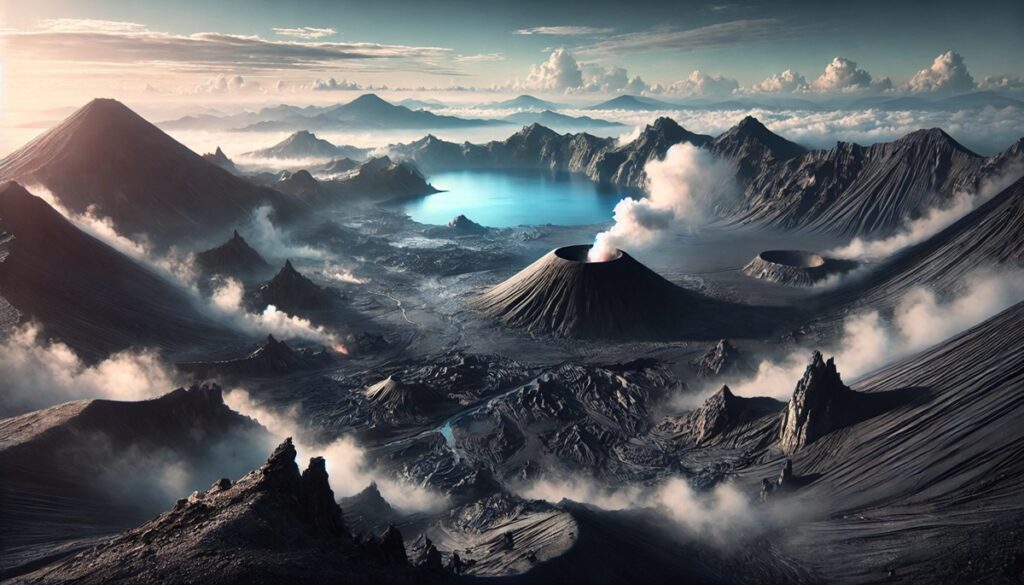
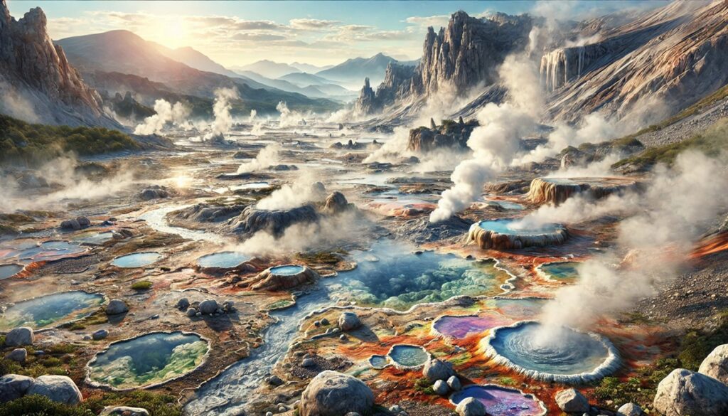
Geothermal areas are nature’s vivid map of the Earth’s fiery inner workings, painting the landscape with vibrant hot springs, hissing fumaroles, and bubbling mud pots. These hotspots are more than just geological wonders; they are living maps that guide us to the hidden power beneath the Earth’s crust. Picture a map etched not with roads and borders but with colorful mineral deposits, steam vents swirling like ghostly signals, and geysers marking key locations with dramatic eruptions. Explorers and scientists have long used these geothermal features as markers, charting the mysterious forces shaping our planet. From the sprawling Yellowstone Caldera to the compact and dynamic Norris Geyser Basin, each geothermal area tells a story of heat and pressure written in the language of boiling water and volcanic stone. Maps of these areas become treasures, blending topography with history, highlighting paths to ancient spiritual sites, renewable energy potential, and adventures that intertwine humanity with Earth’s raw energy. Geothermal areas remind us that beneath the calm surface of a map lies a world alive with movement, heat, and color.

The United States is a hotspot of geothermal activity, with areas scattered across the country showcasing incredible natural wonders formed by Earth’s internal heat. These geothermal regions are not only marvels of nature but also hold cultural, historical, and scientific significance. From geysers and hot springs to fumaroles and mud pots, the geothermal landscapes tell fascinating stories of the Earth’s inner workings. Here is a look at the top ten geothermal areas in the United States, ranked by size.
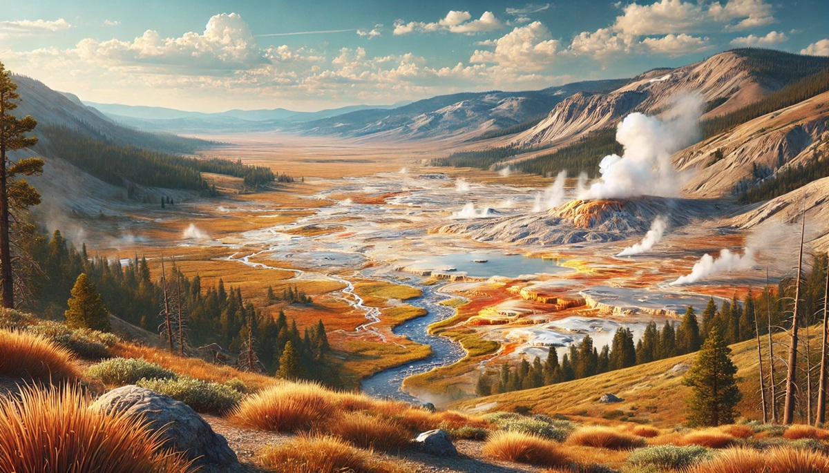
#1: Yellowstone National Park – 3,472 square miles
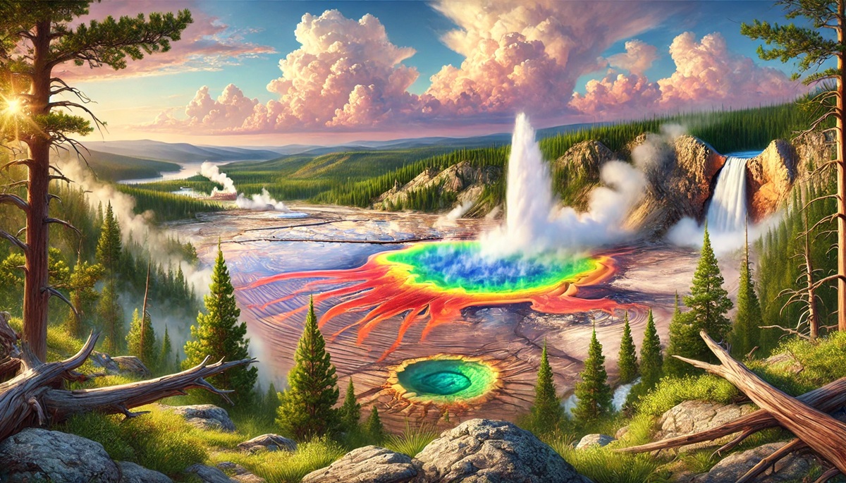
Yellowstone National Park, spanning over 3,400 square miles across Wyoming, Montana, and Idaho, is the largest geothermal area in the United States. It’s home to half of the world’s geysers, including the iconic Old Faithful, which erupts with remarkable regularity. The park’s geothermal features include over 10,000 hydrothermal sites, such as fumaroles, mud pots, and vibrant hot springs like the Grand Prismatic Spring. The Yellowstone Caldera, a massive volcanic crater, serves as the source of this geothermal activity.
The history of Yellowstone’s geothermal features dates back millions of years, when volcanic activity created the unique landscape. Native American tribes, such as the Shoshone, revered these thermal features, believing them to be spiritual sites. Early explorers in the 19th century marveled at the “boiling rivers” and “hissing fumaroles,” with some dismissing the stories as exaggerated. The park’s geothermal wonders ultimately played a pivotal role in its designation as the world’s first national park in 1872. Visitors today are captivated by anecdotes of early travelers boiling eggs in the hot springs or narrowly escaping the scalding waters while exploring the terrain.
#2: Long Valley Caldera – 200 square miles
Located in eastern California near Mammoth Lakes, the Long Valley Caldera spans approximately 200 square miles and is one of the country’s most active geothermal areas. This massive depression was formed 760,000 years ago after a catastrophic volcanic eruption. Today, it boasts numerous hot springs, fumaroles, and geothermal power plants, providing a significant source of renewable energy.
Long Valley’s geothermal features include the steaming Hot Creek Gorge, where boiling water bubbles up through fractures in the Earth’s crust. The area’s history is intertwined with local Native American tribes who utilized the hot springs for therapeutic and spiritual purposes. Modern visitors are drawn to tales of early settlers who discovered the springs’ healing properties and their subsequent use as early spas. Despite its tranquil appearance, Long Valley remains geologically active, with ongoing monitoring to detect potential volcanic activity.
#3: Geysers Geothermal Field – 45 square miles
Situated in northern California, the Geysers Geothermal Field spans about 45 square miles and is the largest geothermal power-producing field in the world. The area contains steam vents, hot springs, and geysers that contribute to its unique landscape. The steam generated from geothermal reservoirs is used to power over 20 geothermal plants, supplying electricity to hundreds of thousands of homes.
The Geysers were originally discovered by local Indigenous people, who utilized the area’s steam baths for ceremonial purposes. In the 19th century, entrepreneurs turned the hot springs into a tourist destination, with luxury resorts offering mineral baths and mud treatments. Anecdotes of early visitors marveling at the “earth’s kitchen” still entertain modern travelers. Although much of the natural geyser activity has been diminished due to industrial use, the area remains a crucial site for renewable energy and an intriguing study of human interaction with geothermal landscapes.
#4: Lassen Volcanic National Park – 166 square miles
Lassen Volcanic National Park in northern California covers 166 square miles and is a geothermal treasure trove. Its most famous feature is Bumpass Hell, a 16-acre hydrothermal area filled with fumaroles, bubbling mud pots, and boiling springs. The park also features steaming vents at Sulphur Works and the unique Cold Boiling Lake.
The park’s geothermal activity stems from the Lassen Peak volcano, which last erupted in 1917. Native Americans revered the site for its dynamic and sometimes dangerous landscape. Stories of early explorers such as Kendall Vanhook Bumpass, who severely burned his leg after stepping into a boiling mud pot, are a witness to the area’s raw power. Lassen’s geothermal features offer an up-close glimpse of volcanic forces at work, with vivid colors and sounds that leave a lasting impression on visitors.
#5: Valles Caldera National Preserve – 89 square miles
Nestled in northern New Mexico, the Valles Caldera National Preserve covers 89 square miles of scenic landscapes and geothermal features. The preserve’s hot springs, fumaroles, and geothermal wells are a result of volcanic activity that occurred over a million years ago. Among the most striking features are the Jemez Hot Springs and the warm waters of Sulphur Creek.
The area’s history includes extensive use by Native American tribes, Spanish settlers, and cattle ranchers. The caldera’s geothermal features were a source of fascination for early settlers who harnessed the springs for therapeutic baths. Visitors can enjoy tales of mysterious “ghost lights” attributed to geothermal gases and marvel at the scientific efforts to study the area’s volcanic history. Today, Valles Caldera is a haven for geologists and nature enthusiasts alike.
#6: Kilauea Volcano – 14 square miles
Hawaii’s Kilauea Volcano, encompassing 14 square miles of geothermal activity, is one of the world’s most active volcanoes. Located on the Big Island, the volcano’s geothermal features include steaming vents, sulfur banks, and the breathtaking Halema‘uma‘u Crater. Lava flows from Kilauea have shaped much of Hawaii’s landscape, creating new land and black sand beaches.
The volcano holds deep cultural significance for Native Hawaiians, who regard it as the home of Pele, the goddess of fire and volcanoes. Stories of Pele’s wrath and blessings are intertwined with the region’s history. Modern anecdotes include daring lava tours and scientists studying the unique ecosystems thriving in geothermal areas. Kilauea’s geothermal features provide an awe-inspiring glimpse into the raw power of the Earth.
#7: Craters of the Moon – 750,000 acres
Craters of the Moon National Monument in Idaho covers an expansive 750,000 acres of volcanic terrain, including lava fields, cinder cones, and geothermal features. Although not as visibly active as other geothermal areas, the monument showcases evidence of ancient eruptions and unique geological formations like tree molds and lava tubes.
Native Americans used the area’s caves and geothermal warmth for shelter during harsh winters. Early pioneers navigating the Oregon Trail described the landscape as “lunar,” inspiring its name. Visitors can explore lava tubes and learn about the region’s volcanic history, experiencing an otherworldly environment shaped by geothermal forces.
#8: Hot Springs National Park – 5,550 acres
Located in Arkansas, Hot Springs National Park spans 5,550 acres and is renowned for its 47 thermal springs. These springs emerge at a consistent temperature of about 143°F and have been used for centuries by Native Americans and European settlers for their purported healing properties.
The park’s history includes tales of bathhouses that flourished in the 19th century, attracting visitors seeking therapeutic treatments. Anecdotes of famous figures, such as Al Capone, visiting the springs add a layer of intrigue. Modern visitors can still experience the soothing waters at preserved bathhouses, making Hot Springs a unique blend of history and natural wonder.
#9: Mount Rainier’s Hot Springs – 5 square miles
Mount Rainier in Washington state features geothermal activity on a smaller scale, with hot springs, fumaroles, and steam vents concentrated in a 5-square-mile area. The most accessible sites include the Ohanapecosh Hot Springs and steaming vents near the mountain’s summit.
The geothermal features of Mount Rainier have a long history of use by Native American tribes for ceremonial purposes. Anecdotes of mountaineers finding refuge in steam caves during treacherous climbs highlight the springs’ practical and symbolic significance. Today, Mount Rainier’s geothermal areas are valued for their ecological importance and serene beauty.
#10: Norris Geyser Basin – 2 square miles
Norris Geyser Basin in Yellowstone National Park spans 2 square miles and is one of the park’s most dynamic geothermal areas. It is home to Steamboat Geyser, the world’s tallest active geyser, capable of reaching heights of 300 feet. The basin’s acidic hot springs and vibrant microbial mats create a visually striking environment.
The history of Norris includes stories of early explorers who named the area for its “noisy” geothermal activity. Visitors today are captivated by the unpredictable eruptions of Steamboat Geyser and the basin’s vivid colors. As one of Yellowstone’s hottest and most acidic geothermal areas, Norris Geyser Basin is a confirmation to the diversity of geothermal phenomena.
The geothermal areas of the United States are a remarkable confirmation to the Earth’s dynamic forces. Each site offers a unique window into the power and beauty of geothermal activity, from towering geysers to soothing hot springs. These natural wonders not only inspire awe but also serve as vital resources for energy, recreation, and scientific discovery, making them an integral part of the nation’s natural heritage.