Learn more about Maps

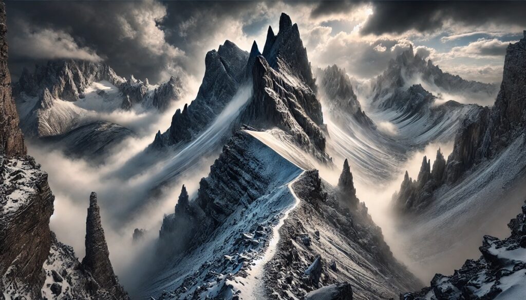
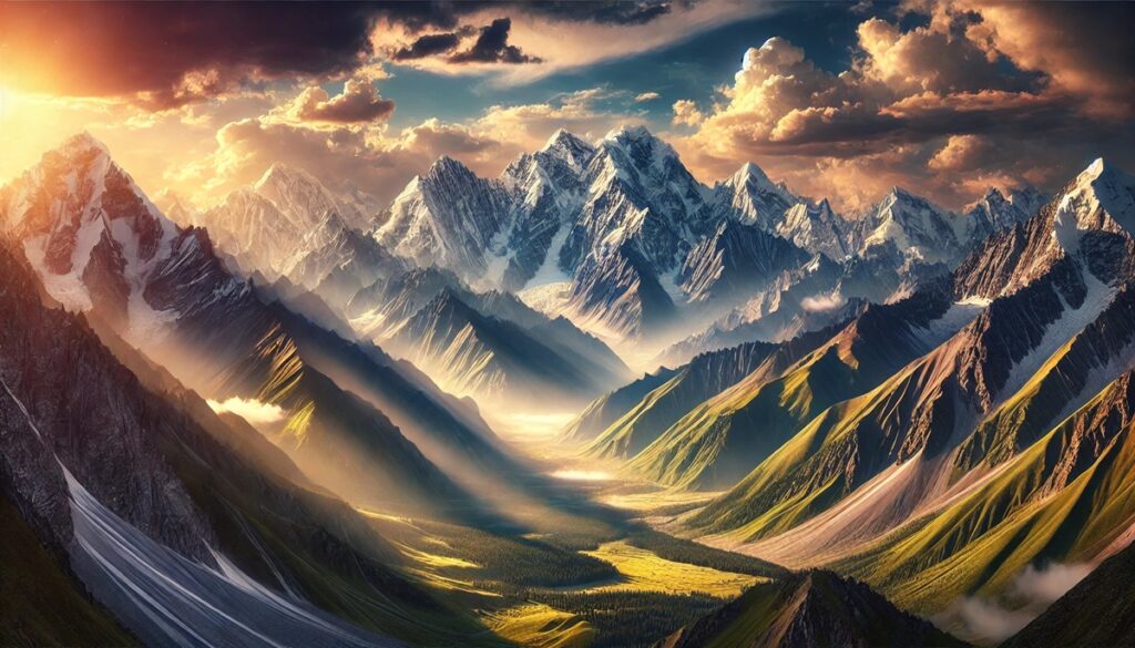
Europe is home to some of the most majestic mountain ranges in the world, each with its unique allure, historical significance, and breathtaking beauty. From the towering peaks of the Alps to the mystical landscapes of Scandinavia, these mountains have inspired adventurers, artists, and travelers for centuries. This list highlights the top ten European mountains worth visiting, offering insights into their size, location, history, and unique charm.
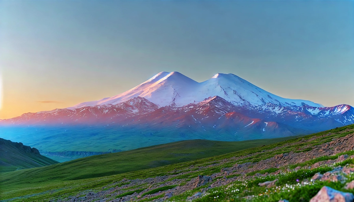
#1: Mount Elbrus – 18,510 ft
Mount Elbrus, the highest peak in Europe, is a dormant volcano nestled in the Caucasus mountain range in southern Russia. Known for its iconic twin summits, Elbrus has long been a beacon for mountaineers and adventurers worldwide. Its height and relative accessibility make it a popular choice for those attempting their first major ascent. The mountain is blanketed in snow year-round, and its glaciated slopes give it a serene yet formidable appearance. According to local legends, the mountain is named after the god Elbrus, believed to guard the region. Historically, it served as a boundary marker between Europe and Asia, symbolizing the blend of cultures in the region. Climbing Mount Elbrus can be challenging due to its unpredictable weather and high altitude, but it rewards those who reach its summit with sweeping views of the surrounding ranges.
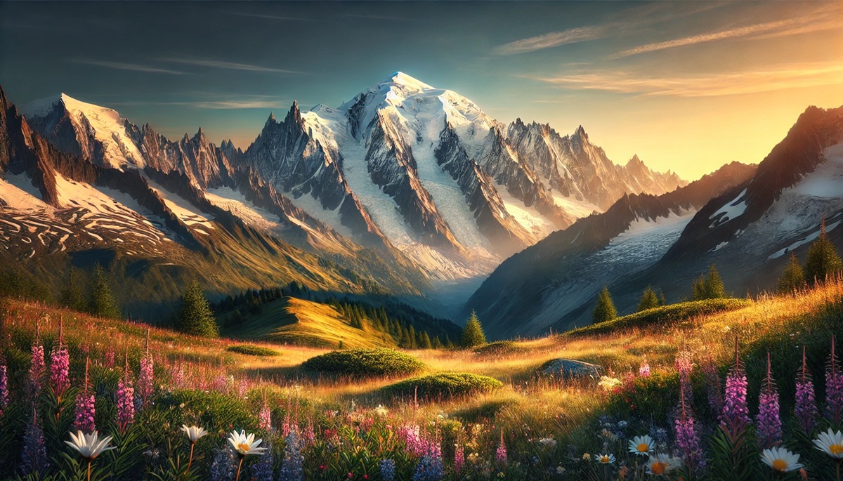
#2: Mont Blanc – 15,774 ft
Mont Blanc, meaning “White Mountain,” is the highest peak in the Alps and Western Europe. Spanning the borders of France, Italy, and Switzerland, this snow-capped giant has been an icon of alpinism for centuries. The first recorded ascent was in 1786, marking the birth of modern mountaineering. Its massif is home to some of the most picturesque towns, including Chamonix, Courmayeur, and Aosta. A notable feature is the Mont Blanc Tunnel, a marvel of engineering connecting France and Italy. An interesting anecdote involves Jacques Balmat, one of the first climbers to summit the mountain, who reportedly dreamed of the peak for years before his successful ascent. The area also holds a somber history, with plane crashes and avalanches reminding visitors of its power and unpredictability.
#3: Dufourspitze (Monte Rosa) – 15,203 ft
Part of the Pennine Alps, Dufourspitze is the highest peak in Switzerland and the second-highest in the Alps. Named after Swiss General Guillaume-Henri Dufour, the mountain is celebrated for its glaciers and rugged beauty. The Monte Rosa massif features dramatic cliffs and shimmering ice fields, attracting climbers and photographers alike. Historically, it was first climbed in 1855 by an English expedition, marking the beginning of its popularity among Victorian mountaineers. Local folklore includes tales of ghostly figures seen wandering the glaciers, believed to be lost souls trapped in the ice. Today, the Monte Rosa Hut, an eco-friendly base camp, serves as a witness to Switzerland’s commitment to sustainable tourism.
#4: Matterhorn – 14,692 ft
The Matterhorn, with its iconic pyramid shape, is one of the most recognizable peaks in the world. Located on the border between Switzerland and Italy, it is a symbol of the Alps and has a fascinating history. The first ascent in 1865 ended in tragedy when four climbers fell to their deaths during the descent, adding a layer of mystique to the mountain. The town of Zermatt at its base is a haven for mountaineers and skiers. Interestingly, the Matterhorn is featured on the packaging of Toblerone chocolate, paying homage to its unique silhouette. Stories of daring rescues and near-misses on its slopes continue to captivate adventurers.
#5: Grossglockner – 12,461 ft
Austria’s highest mountain, the Grossglockner, towers over the Hohe Tauern National Park. Its name translates to “Big Bell,” referencing its bell-shaped peak. The mountain has been a spiritual site for centuries, with early climbers often leaving offerings at its summit. The first successful ascent in 1800 marked a turning point in Alpine exploration. The Grossglockner High Alpine Road, a winding route offering panoramic views, is a popular attraction. Anecdotes from locals often highlight encounters with the elusive ibex, which thrives in the region’s rugged terrain. The mountain’s glaciers are now closely monitored as symbols of climate change.
#6: Mount Etna – 11,014 ft
Mount Etna, Europe’s highest and most active volcano, dominates the skyline of Sicily, Italy. Known as the “Mountain of Fire,” it has erupted for thousands of years, shaping the island’s culture and landscape. Ancient Greeks believed it was the forge of Hephaestus, their god of fire. Today, its fertile slopes support vineyards and orchards, showcasing its dual role as both a destroyer and life-giver. Tales abound of villagers fleeing its lava flows, only to return to rebuild their homes. Hikers often find themselves awed by the surreal landscapes, from black volcanic craters to verdant forests.
#7: Ben Nevis – 4,413 ft
The highest mountain in the British Isles, Ben Nevis is located in Scotland’s Grampian range. Though modest in height compared to Alpine giants, it boasts a dramatic presence due to its steep cliffs and frequent mists. Its name, derived from Gaelic, means “Venomous Mountain,” a nod to its unpredictable weather. The ruins of an observatory at the summit, operational in the late 19th century, stand as a confirmation to early scientific exploration. Ben Nevis attracts thousands of climbers annually, drawn by its rugged beauty and historical significance. Local tales recount climbers who faced perilous conditions but were saved by their quick thinking.
#8: Snowdon – 3,560 ft
Snowdon, Wales’ highest peak, is a favorite among hikers and nature lovers. Its summit can be reached via several trails or the historic Snowdon Mountain Railway. The mountain holds a special place in Welsh mythology, said to be the burial site of the giant Rhitta Gawr. Its diverse landscape, from rocky crags to tranquil lakes, has inspired poets and artists for generations. An interesting anecdote involves Edmund Hillary training here before his Everest expedition, cementing its reputation as a mountaineering hub.
#9: Sognefjell – 3,300 ft
Nestled in Norway’s Jotunheimen National Park, Sognefjell is a gateway to some of Scandinavia’s most dramatic landscapes. The Sognefjellsvegen, Northern Europe’s highest mountain pass, offers stunning views of this rugged terrain. The area is rich in Norse mythology, with tales of trolls and giants said to inhabit its valleys. The region’s glaciers, though retreating, remain a draw for adventurers. Stories from the Viking era suggest these mountains were used as navigational landmarks during long voyages.
#10: Mt. Vesuvius – 4,203 ft
Mount Vesuvius, overlooking the Bay of Naples in Italy, is infamous for its catastrophic eruption in 79 AD that buried Pompeii and Herculaneum. Despite its destructive history, it is a popular tourist destination, offering stunning views and a glimpse into its volcanic crater. Local anecdotes tell of vineyards producing wine with soil enriched by Vesuvius’ ash, a tradition dating back to Roman times. The mountain’s dual identity as a destroyer and provider makes it a fascinating study in nature’s power.
These ten mountains, each unique in their grandeur, history, and cultural significance, represent the incredible diversity of Europe’s landscapes. Whether you’re an experienced climber, a history enthusiast, or simply someone who loves stunning scenery, these peaks offer something for everyone. From the majestic heights of Mount Elbrus to the fiery heart of Mount Etna, exploring these mountains is a journey through Europe’s natural and cultural heritage. So pack your gear and set off on an adventure to discover the breathtaking beauty of these towering marvels.