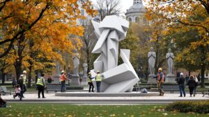
How to Make Statues Portable for Events
Portable statues are transforming festivals, brand activations, and immersive events. Discover how artists and fabricators design lightweight, modular sculptures that travel safely, assemble fast, and look monumental. From hidden frames to modern materials, this guide reveals how today’s mobile statues are built, transported, and displayed—turning any venue into a temporary outdoor gallery that moves with the crowd.