Waterfalls are among nature’s most breathtaking spectacles, where water cascades from dramatic heights, creating mesmerizing displays of beauty and power. The United States is home to some of the tallest waterfalls in the world, scattered across diverse landscapes from remote wilderness areas to iconic national parks. These towering waterfalls are not only geological wonders but also hold cultural, historical, and ecological significance. Here, we explore the top 10 tallest waterfalls in the U.S., uncovering their immense heights, unique characteristics, and the stories that surround them.
#1: Olo’upena Falls – 2,953 Feet
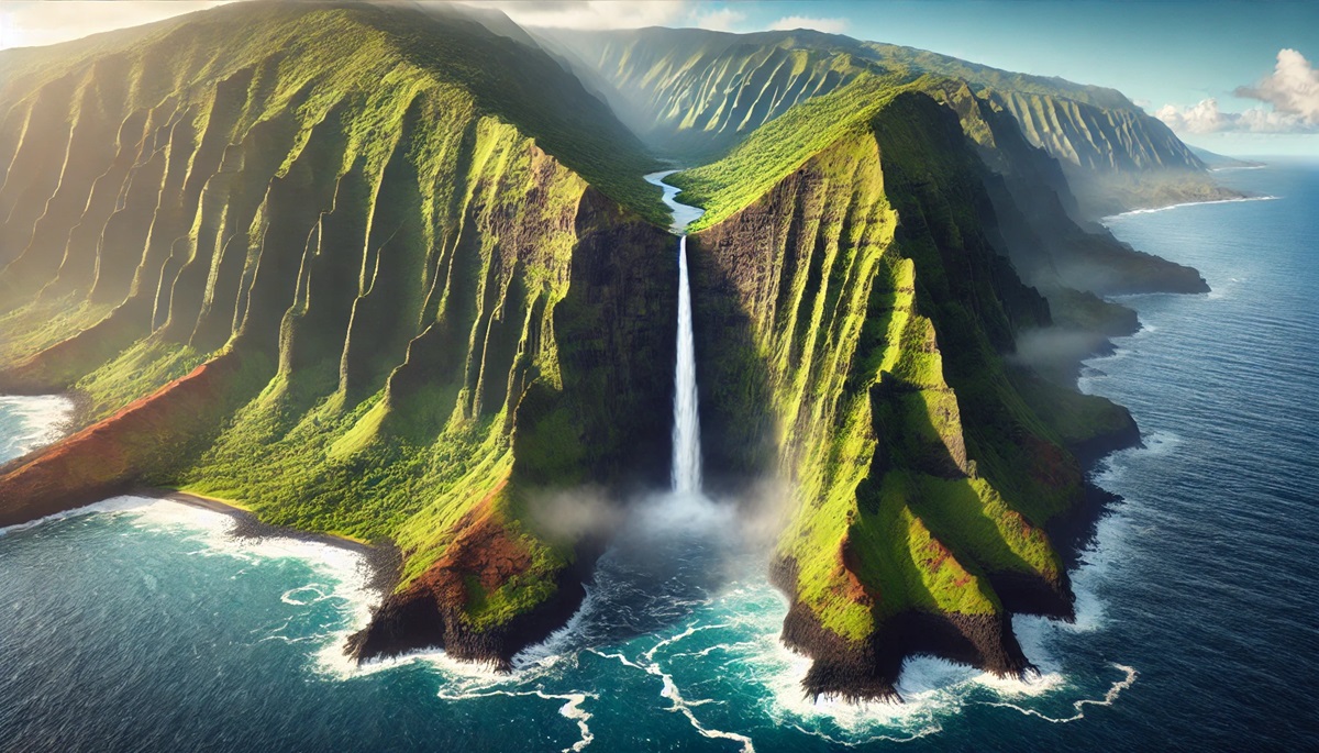
Located on the Hawaiian island of Molokai, Olo’upena Falls is the tallest waterfall in the United States, plunging 2,953 feet down the island’s steep sea cliffs. Accessible only by air or sea, the waterfall appears as a delicate ribbon of water slicing through lush greenery and rugged cliffs. Its remote location ensures a pristine environment, with little human interference. Anecdotes of early explorers marveling at its sheer height highlight its significance as a natural wonder. The falls are particularly spectacular during the rainy season when water flow increases dramatically.
#2: Pu’uka’oku Falls – 2,756 Feet
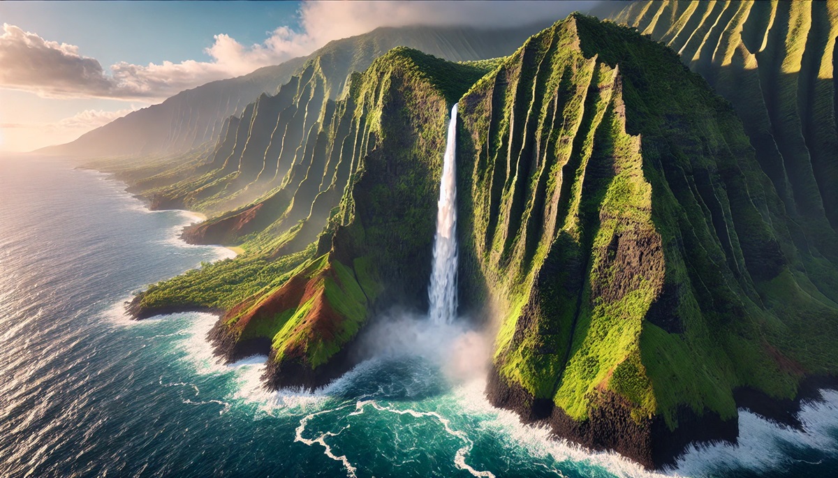
Also located on Molokai, Pu’uka’oku Falls is another extraordinary Hawaiian waterfall, cascading 2,756 feet down the same dramatic sea cliffs as Olo’upena Falls. Its proximity to the Pacific Ocean adds to its beauty, as the surrounding cliffs and mist create a surreal atmosphere. The falls are best viewed from a helicopter tour, offering a bird’s-eye view of this natural masterpiece. Its location in one of the most rugged and remote parts of Hawaii adds to its mystique.
#3: Waihilau Falls – 2,600 Feet
Waihilau Falls in Hawaii’s Waimanu Valley is a breathtaking 2,600-foot plunge that captivates visitors with its sheer magnitude. Surrounded by dense rainforest, the falls drop into a secluded pool, creating an idyllic setting that feels like stepping into a hidden paradise. Accessible by a challenging hike, Waihilau Falls rewards adventurers with one of the most stunning sights in the Hawaiian Islands. Local legends tell of the valley’s sacred nature, adding a spiritual dimension to its allure.
#4: Colonial Creek Falls – 2,568 Feet
Located in Washington’s North Cascades National Park, Colonial Creek Falls drops 2,568 feet in a segmented flow that weaves through rugged cliffs and dense forests. This remote and serene waterfall is part of the park’s dramatic alpine landscape, offering tranquility and natural beauty to hikers who venture to its base. The area’s glacial history has shaped the landscape, leaving behind this awe-inspiring cascade.
#5: Yosemite Falls – 2,425 Feet
Yosemite Falls in California’s Yosemite National Park is one of the most iconic waterfalls in the United States, with a total drop of 2,425 feet. This three-tiered waterfall is a centerpiece of the park’s stunning granite cliffs. The upper cascade alone plunges 1,430 feet, while the middle cascades and lower falls complete the picture. Yosemite Falls is particularly powerful in spring when snowmelt feeds its flow, attracting visitors from around the world.
#6: Cataract Falls – 2,170 Feet
Cataract Falls in Alaska’s Glacier Bay National Park plunges 2,170 feet into a pristine fjord surrounded by snow-capped peaks and ancient glaciers. This remote waterfall is a confirmation to the rugged beauty of Alaska’s wilderness. The falls are fed by glacial melt, making them especially dynamic during warmer months. Stories of early explorers discovering these cascading waters emphasize the untamed nature of the region.
#7: South Clear Creek Falls – 1,819 Feet
Located in Colorado’s San Juan National Forest, South Clear Creek Falls drops 1,819 feet in a striking display of power and grace. Surrounded by pine forests and rugged cliffs, the waterfall is a popular destination for hikers and nature enthusiasts. Its cascading tiers create a dramatic backdrop, and its remote location offers a sense of serenity.
#8: Ribbon Falls – 1,612 Feet
Ribbon Falls in Yosemite National Park is the tallest single-drop waterfall in North America, plunging 1,612 feet down a sheer granite wall. Often overshadowed by Yosemite Falls, Ribbon Falls is a hidden gem best viewed in spring when snowmelt feeds its flow. The waterfall’s ephemeral nature adds to its charm, making it a favorite among photographers and adventurers seeking solitude.
#9: Lower Falls of the Yellowstone River – 308 Feet
While not the tallest, the Lower Falls of the Yellowstone River is among the most iconic waterfalls in the United States. At 308 feet, it plunges into the Grand Canyon of the Yellowstone, creating a breathtaking scene. The vibrant hues of the canyon walls and the roaring waters make it a symbol of Yellowstone National Park. The falls have inspired countless artists and conservationists.
#10: Multnomah Falls – 620 Feet
Multnomah Falls in Oregon’s Columbia River Gorge is one of the most photographed waterfalls in the United States. Its two-tiered cascade spans 620 feet, surrounded by lush greenery and basalt cliffs. Visitors can enjoy a close-up view from Benson Bridge, adding to the charm of this easily accessible waterfall. The falls are steeped in local legends, including tales of its creation by the Multnomah people.
The tallest waterfalls in the United States are not just geological wonders but also sources of inspiration, adventure, and cultural significance. From the towering heights of Olo’upena Falls to the iconic beauty of Yosemite Falls, each waterfall offers a unique glimpse into the power and beauty of nature. These breathtaking cascades remind us of the importance of preserving our natural treasures for future generations to admire and enjoy.