The Bible, a collection of stories spanning millennia, is deeply intertwined with the geography of its time. Maps of the biblical world offer an intricate visual guide to the places where these profound events unfolded. From the Exodus across the Red Sea to the travels of the Apostle Paul, each map helps bring the ancient texts to life, offering context and perspective to stories that have shaped the faith of billions. Maps of the Bible are not just geographical tools—they serve as windows into the past, connecting modern readers with the physical places of ancient history. They allow us to trace the journeys of iconic figures like Abraham, Moses, Jesus, and the apostles, seeing how the landscape itself influenced the course of their actions and decisions. The maps themselves are rich in history, many based on centuries-old scrolls, combining the ancient with the modern through archaeological findings and historical studies. What’s more, they offer a deeper understanding of the cultures, peoples, and environments that influenced the stories. The deserts of Sinai, the mountains of Judea, the waters of the Jordan River—all are more than mere locations; they are symbols of the struggles, triumphs, and divine moments that define the Bible’s narratives. In a way, each map becomes a spiritual pilgrimage, helping us visualize not just the physical world of the Bible, but the emotional and spiritual journeys that define the human experience. The roads are not merely pathways, but they echo the steps of faith, the battles, and the miracles that continue to resonate through time.

Bible maps are invaluable resources that provide geographical context to the events, locations, and people described in the scriptures. These maps bring the ancient world to life, allowing readers to trace the journeys of biblical figures, understand the historical and political landscapes, and explore the places where significant events took place. From the Exodus in Egypt to the ministry of Jesus in Israel, Bible maps give depth to the narratives and make the world of the Bible more accessible to modern readers. Below is a list of the top 10 Bible maps, ranked by their size and historical importance, offering a window into the ancient world and its significance in biblical history.
#1: The Exodus and the Journey to the Promised Land, 1,200,000 Square Miles
The map depicting the Exodus and the journey of the Israelites from Egypt to the Promised Land is one of the most significant in the Bible. This map spans approximately 1,200,000 square miles, covering the vast distances traveled by Moses and the Israelites over 40 years. The journey began with the miraculous crossing of the Red Sea and led through the wilderness of Sinai, where the Israelites wandered before reaching the land of Canaan. The map details key locations such as Mount Sinai, the area where the Ten Commandments were given, and the plains of Moab, where Moses viewed the Promised Land before his death. An interesting fact about this map is that it often sparks debates among scholars about the exact route the Israelites took, with different theories about the locations of key places like the Red Sea and Mount Sinai. Anecdotal stories from travelers who have journeyed through these areas often reference the historical impact of the biblical narrative on their experiences. The map’s historical significance is immense, as it offers a tangible connection to the foundational event of the Jewish faith and one of the most important stories in the Bible.

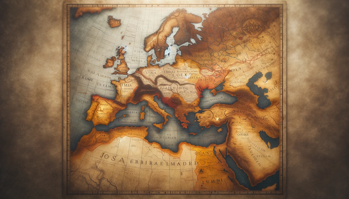
#2: The Roman Empire at the Time of Christ, 1,000,000 Square Miles
The map of the Roman Empire during the time of Christ covers approximately 1,000,000 square miles, depicting the vast territories controlled by the Romans in the 1st century. This map is crucial for understanding the political and social context in which Jesus lived, as the Roman Empire dominated much of the Mediterranean world. The map highlights key regions such as Judea, Galilee, and Samaria—areas central to Jesus’ ministry. It also shows the major roads, cities, and provinces of the Roman Empire, illustrating the empire’s impressive infrastructure, which facilitated the spread of Christianity after Christ’s death and resurrection. An interesting aspect of this map is that it also includes locations that would later play significant roles in early Christian history, such as Antioch, Ephesus, and Rome. The story of the Apostle Paul’s missionary journeys can be traced on this map, emphasizing the importance of travel and communication in the early spread of Christianity. Anecdotal stories from historians often recount the impressive scale of the Roman Empire and the challenges it posed for early Christians in their quest for religious freedom.
#3: Ancient Israel and Its Kingdoms, 700,000 Square Miles
The map of ancient Israel and its kingdoms covers around 700,000 square miles and provides insight into the geographic and political layout of the region during the time of the united monarchy under King David and King Solomon. This map highlights the division of the land into the northern kingdom of Israel and the southern kingdom of Judah after the death of Solomon. The map includes key cities such as Jerusalem, Bethlehem, and Hebron, all of which played crucial roles in biblical history. It also shows the strategic locations of fortified cities, military campaigns, and trade routes that were central to the kingdom’s economy. One interesting fact about this map is that it reflects the geographical challenges faced by the Israelites as they navigated the rugged terrain of their land, with mountains, valleys, and rivers shaping the course of their history. Anecdotal stories about this map often focus on the historical and spiritual significance of places like Mount Zion and the Temple Mount, which remain central to Jewish, Christian, and Muslim faiths.
#4: The Holy Land in the Time of Jesus, 500,000 Square Miles
The map of the Holy Land during the time of Jesus covers around 500,000 square miles, focusing on the region where Jesus conducted his ministry. This map highlights key locations such as Jerusalem, Nazareth, and the Sea of Galilee, offering a detailed view of the physical geography that influenced the life of Christ. The map also marks significant sites like the Jordan River, where Jesus was baptized, and the Mount of Olives, where he prayed before his arrest. The map is essential for understanding the cultural and religious dynamics of the time, as it shows the divisions between the Jewish, Roman, and Gentile populations in the region. An interesting fact about this map is its depiction of the social and political context of Jesus’ ministry, illustrating the tension between the Jewish leaders and the Roman authorities. Anecdotal stories from pilgrims to these holy sites often reflect the profound spiritual impact of visiting the locations associated with the life of Jesus.
#5: The Apostolic Journeys of Paul, 450,000 Square Miles
The map of the Apostolic Journeys of Paul covers approximately 450,000 square miles, tracing the missionary travels of the Apostle Paul as he spread the message of Christianity throughout the Roman Empire. The map shows the various cities and regions where Paul preached, including key locations such as Corinth, Ephesus, Philippi, and Rome. The map is an invaluable tool for understanding the early spread of Christianity, as Paul’s letters to various churches formed a foundational part of the New Testament. One interesting aspect of this map is its depiction of the vast distances traveled by Paul, often by foot or on a small boat, illustrating the missionary’s commitment to spreading the Gospel. Anecdotal stories often describe the hardships Paul faced during his journeys, including shipwrecks, imprisonment, and persecution, yet his determination to spread Christianity remained unshaken. This map is essential for understanding the geography of early Christianity and the global reach of Paul’s missions.
#6: The Exodus Route and the Promised Land, 400,000 Square Miles
The map of the Exodus Route and the Promised Land covers approximately 400,000 square miles, detailing the route taken by Moses and the Israelites from Egypt to the land of Canaan. This map is crucial for understanding the biblical narrative of the Israelites’ escape from slavery and their 40 years of wandering in the desert. The map marks important locations such as the Red Sea, Mount Sinai, and the Plains of Moab, where Moses viewed the Promised Land before his death. One interesting aspect of this map is that it has been the subject of much debate among scholars and theologians, as the exact route of the Exodus is not definitively known. Anecdotal stories often recount the symbolic significance of the journey, which represents faith, perseverance, and divine providence. This map provides a tangible connection to the biblical narrative, making the story of the Exodus more accessible and relatable.
#7: The City of Jerusalem in the Time of Jesus, 350,000 Square Miles
The map of Jerusalem in the time of Jesus covers approximately 350,000 square miles, providing a detailed look at the city as it existed during the 1st century. The map shows the key structures in Jerusalem, including the Second Temple, the Antonia Fortress, and the various gates through which Jesus would have entered the city. The map is important for understanding the social and religious divisions within Jerusalem during this period, as the city was a focal point for Jewish religious life, Roman military presence, and the early Christian movement. One interesting fact about this map is its depiction of the Temple Mount, which remains one of the most contested religious sites in the world. Anecdotal stories from pilgrims often highlight the profound spiritual significance of walking through the streets that Jesus would have known and traveled.
#8: The Kingdom of David and Solomon, 300,000 Square Miles
The map of the Kingdom of David and Solomon covers approximately 300,000 square miles and offers a glimpse into the geographical extent of the united kingdom of Israel during its height under King David and his son Solomon. The map highlights key cities such as Jerusalem, Gibeon, and Hebron, which were central to the administration and military operations of the kingdom. It also shows the borders of the kingdom, which stretched from the Mediterranean Sea in the west to the Euphrates River in the north. One interesting aspect of this map is its portrayal of the trade routes that helped Israel thrive during this period, as Solomon’s kingdom was known for its wealth and international influence. Anecdotal stories often reflect the grandeur of the kingdom during this time, with the building of Solomon’s Temple being a focal point in Jewish history.
#9: The Ancient Near East, 250,000 Square Miles
The map of the Ancient Near East covers approximately 250,000 square miles, depicting the regions that formed the backdrop for much of the Bible’s Old Testament. This map shows the ancient civilizations of Egypt, Mesopotamia, and Israel, as well as the locations of significant biblical events such as the exile of the Israelites and the destruction of the temple. The map also shows the trade routes and the interactions between various ancient peoples. One interesting aspect of this map is its depiction of the political and military struggles that took place between powerful nations like Egypt, Assyria, and Babylon, which were often mentioned in the Bible. Anecdotal stories often reflect how these ancient kingdoms influenced the events of biblical history, from the conquest of Jerusalem to the exile of the Jewish people.
#10: The Biblical World in the Time of Abraham, 200,000 Square Miles
The map of the Biblical World in the time of Abraham covers approximately 200,000 square miles and shows the lands that were central to the story of Abraham, the patriarch of Israel. This map includes key locations such as Ur of the Chaldeans, Haran, and Canaan, all of which were significant in the early life of Abraham. One interesting fact about this map is that it shows the migration routes taken by Abraham and his family as they traveled from Mesopotamia to the land promised by God. Anecdotal stories often highlight the significance of Abraham’s journey, which symbolizes faith and obedience. This map is essential for understanding the early biblical narrative and the origins of the Jewish people.
Bible maps are more than just geographical depictions—they are historical and spiritual documents that help us understand the context of the Bible’s stories. From the Exodus to the travels of Paul, these maps provide a visual representation of the journey of faith and wisdom.